Land at Mowhay, Mawgan Porth, TR8
Key Features
- Located in a Sought After area of Desirable Mawgan Porth
- Minutes from the Glorious Sand & Surf Below
- Outline Planning Permission for Two Substantial Detached Dwellings
- Two Generously Spaced Individually Accessed Plots
- Private Gardens & Patios Indicated for Both Homes
- Detached Garages & Driveway Parking
- Planning Number PA25/01566
Description
A rare and exciting opportunity to acquire an attractive residential development site in Trenance, on the northern side of the highly sought-after coastal village of Mawgan Porth. Outline planning permission has been granted under application number PA25/01566 for the construction of two detached dwellings, utilising the existing access arrangements together with enhanced landscaping and planting.
The site occupies an established position between Halwyn to the north and the converted barns of Trehelles Barn to the south. Predominantly level and currently laid to well-maintained grass, the land gently rises towards its eastern boundary and has a pleasant, domestic character. Its position between existing residential properties allows the proposed development to sit naturally within the established form of Trenance while enjoying an appealing outlook towards the adjoining countryside to the east and coastal views to the west.
The indicative layout illustrates two generously spaced and individually accessed homes, each combining two-storey and single-storey elements. Both properties are shown with their own private garden, patio, driveway, parking and turning area, together with a detached single-storey garage. The garages are illustrated with sedum roofs, helping these ancillary buildings sit discreetly within the proposed landscaped setting.
Plot 1 occupies the northern portion of the development site, adjoining Halwyn, and is intended to be set slightly lower within the site's natural topography. Plot 2 is positioned to the south, adjoining the converted former barns, and incorporates a single-storey section closest to this boundary. The proposed arrangement creates a generous separation between the two new homes and carefully considers the privacy and amenity of both existing and future occupiers.
Although the detailed appearance remains subject to reserved matters approval, the illustrative proposals show traditionally proportioned dwellings with simple pitched roofs designed to complement the character and ridge heights of surrounding properties. Suggested materials include natural stone, smooth render, vertical timber boarding and natural slate, offering the potential to create two high-quality homes combining traditional Cornish influences with contemporary detailing.
Landscaping forms an important part of the indicative scheme. Existing frontage features, including the grass verge and Cornish bank, are intended to be retained and enhanced, while a Cornish dry-stone wall and planted bank would create an attractive division between the two entrances. Further native planting, landscaped boundaries and a new Cornish hedge bank along the eastern edge would provide privacy, strengthen the development's relationship with its setting and create a clearly defined boundary with the adjoining countryside.
The indicative proposals also incorporate a number of environmentally conscious features. Permeable driveway finishes and individual surface-water soakaways are shown, while the planning statement anticipates air-source heat pumps, provision for solar or photovoltaic panels and electric-vehicle charging points. Further ecological enhancements could include bee bricks, bat access points, nesting provision and additional native planting.
Vehicular access is taken directly from the adjoining highway, which is shown as being subject to a 30mph speed limit. The submitted plans demonstrate that suitable visibility, off-road parking and turning can be provided for both proposed dwellings. Foul drainage may be capable of connection to the South West Water sewer situated within the highway, subject to the necessary technical approval and agreement with the relevant provider. Planning permission has been granted in outline, and the submitted layout, elevations, garages, landscaping and architectural treatments are indicative. The final scale, appearance, layout and landscaping of the dwellings will be determined through the submission and approval of the relevant reserved matters, allowing the purchaser to create their own grand design to their individual specification. Prospective purchasers should review the formal decision notice, approved documentation and associated planning conditions under application PA25/01566. Alternatively the purchaser could utilise the site for one large dwelling subject to the necessary planning consent.
Mawgan Porth is one of North Cornwall’s most desirable coastal locations, celebrated for its magnificent sandy beach and vibrant water sports scene, attracting both surfers and bathers. Stunning cliff and coastline walks offer breathtaking views, including routes along the South West Coastal Path to nearby Watergate Bay and Bedruthan Steps. The area boasts excellent dining and leisure options. Guests can enjoy fine dining at the award-winning Scarlet Hotel, as well as first-class spa and recreational facilities at The Scarlet and Bedruthan Hotel. Local cafes, eateries, and The Merrymoor pub provide a charming, community-focused atmosphere, while surf schools and gift shops add to the beachside lifestyle. For food enthusiasts, renowned restaurants are just a short drive away in Padstow, including Rick Stein’s Seafood Restaurant, Paul Ainsworth’s Michelin-starred No.6 and the stylish seafood bar Prawn on the Lawn. Mawgan Porth is well-connected and easily accessible. The village is less than 20 minutes from the main A30, approximately 2.4 miles from Newquay Airport with domestic and international flights, and around 30 minutes from Bodmin Parkway train station, providing routes into London Paddington.
To find the Land at Mowhay, head towards Newquay from Padstow along the coast road, passing through St Merryn and Porthcothan along the way. Upon entering the Trenance side of Mawgan Porth, the entrance to the land can be found on the left-hand side. The postcode for satellite navigation is TR8 4BY. What3words: visual.shopper.alienated
Map Location
Property details
- Tenure
- Freehold
- Council Tax Band
- Ask Agent
- Date Posted
- 2026-09-10
Utilities & Restrictions
Utilities
- Electricity
- Mains
- Water
- Mains
- Heating
- Air Source Heat Pump
- Broadband
- Full Fibre (FTTP)
- Sewerage
- Ask Agent
Rights & Restrictions
- Public Rights of Way
- Ask Agent
- Private Rights of Way
- Ask Agent
- Listed Property
- Ask Agent
- Restrictions
- Ask Agent
Listed status, conservation areas and planning constraints for this location are in the full report.
Property Features
- Accessibility
- Level Access
- Parking
- Garage, Driveway, Off-Street Parking, Private Parking
- Garden
- Private Garden
Beyond the particulars: planning activity, flood history, heritage and ground risks, checked for this exact spot.
Connectivity
Broadband
Fastest speed available at this postcode
80 Mbps
Superfast
Suitable for
- HD streaming
- Video calls
- Web & social
Mobile signal
Outdoor predictions; indoor signal depends on building materials.
Ofcom Connected Nations postcode-level predictions. Speeds and signal are modelled, not measured, and vary between addresses and providers.
Signal is the easy part. Planning activity, flood history and protected designations here are in the full report.
Nearest Schools
Primary
- Mawgan-In-Pydar Primary School1.9 milesOfsted: Good
- Ages
- 4 to 11
- Pupils
- 102
- Type
- Academy converter
- Trevisker Primary School2.2 milesNo Ofsted rating
- Ages
- 4 to 11
- Pupils
- 129
- Type
- Academy converter
- St Merryn School3.7 milesNo Ofsted rating
- Ages
- 3 to 11
- Pupils
- 115
- Type
- Academy converter
- St Columb Minor Academy3.9 milesOfsted: Good *
- Ages
- 4 to 11
- Pupils
- 393
- Type
- Academy converter
- Nansledan School4.3 milesOfsted: Good
- Ages
- 4 to 11
- Pupils
- 386
- Type
- Free schools
Secondary
- Treviglas Academy3.8 milesOfsted: Good *
- Ages
- 11 to 18
- Pupils
- 872
- Type
- Academy sponsor led
- Newquay Tretherras4.1 milesNo Ofsted rating
- Ages
- 11 to 18
- Pupils
- 1,614
- Type
- Academy converter
- Wadebridge School9.4 milesOfsted: Good
- Ages
- 11 to 16
- Pupils
- 1,018
- Type
- Academy converter
- Brannel School11 milesOfsted: Good
- Ages
- 11 to 16
- Pupils
- 888
- Type
- Academy sponsor led
- Poltair School14 milesOfsted: Good
- Ages
- 11 to 16
- Pupils
- 882
- Type
- Academy sponsor led
* Latest graded judgement covers quality of education only; no overall grade was issued under the 2024-25 inspection framework.
Distances are straight-line from the advertised location. Source: the national school registers (DfE, Welsh Government, Scottish Government) and Ofsted.
Schools are just the start: sold prices nearby, planning activity and any flood history are in the full report.
Amenities
Supermarket
GP surgery
Pharmacy
Hospital
Walking trail
Straight-line distances from the advertised location. Sources: NHS records, Geolytix supermarket locations, OS Open Greenspace and the national trails registers.
The area stacks up? Now check the location itself: planning nearby, protected designations and past flooding.
Getting Around
Nearest station
Nearest bus stop
Typical drive times
Straight-line distances from the advertised location; drive times are typical free-flow times over OpenStreetMap road data, so allow more at peak. Public transport locations from DfT NaPTAN.
Easy to reach matters. So do planning activity, flood history and ground risks: all in the full report.
Flood Risk
From Environment Agency flood map open data, checked around the advertised map pin and allowing for the listed acreage where known. This summary comes from LandSale, the advertising platform, not from the listing agent, and is not part of the agent's particulars. Risk can vary across a single holding, so verify anything critical through your own searches before committing.
Rivers and the sea
Surface water
The detail behind these bandings
The full report pinpoints where this location sits on the flood maps, and runs the deeper checks that usually only surface after an offer.
- Exact flood zones & annual chances (included in the full report)
- Any recorded past flooding (included in the full report)
- Planning activity nearby (included in the full report)
- Heritage & conservation (included in the full report)
- Protected nature designations (included in the full report)
- Ground risks (included in the full report)
- Sold prices nearby (included in the full report)
£14.99 · one-off purchase
By LandSale, the platform. Not provided by the listing agent. Ready in about a minute.
Important notice: Information, maps and tags on this page are drawn from the advertising agent's marketing materials or generated automatically. LandSale has not verified them. Relying on these details is at your own risk, always carry out independent checks before committing to a purchase.
LandSale full disclaimer
Marketing information only - not formal particulars. The details on this website are provided for general guidance and do not constitute an offer or contract. Neither LandSale nor the advertising estate/land agent accepts responsibility for any inaccuracy.
1. Source of information
- Listing content: Core description, asking price, tenure, measurements, photographs and planning history originate from the marketing materials of the advertising estate or land agent. LandSale does not author this content and cannot guarantee its accuracy.
- Automated tags & categorisation: Property type, land-use class, acreage bands and similar labels may be applied by machine-learning models. They are intended as a helpful guide only and may not reflect the property's legal status or permitted use.
- Third-party & enriched data layers: Maps, boundary outlines, planning designations, soil reports, broadband coverage and other environmental or location-based insights are licensed from external suppliers. Such data are supplied “as is", may be incomplete or out of date and are subject to change without notice.
2. Verification required
Prospective purchasers must verify critical matters, including but not limited to planning permission, title boundaries, public rights of way, environmental constraints, acreage, services, access and VAT status, through their own inspections, specialist surveys, legal advisers and the selling agent before relying on the information or entering into any contract.
3. No warranty or liability
LandSale gives no warranty, express or implied, as to the accuracy, completeness or fitness for any particular purpose of the information displayed. LandSale shall not be liable for any loss, damage, cost or expense arising directly or indirectly from any use of or reliance on such information, save where liability may not be excluded by law.
4. Updates & feedback
If you believe any detail on this listing is inaccurate, please let us know. We will investigate and, where appropriate, update the listing or notify the agent.
© LandSale | Version 1.3 - August 2026
Listing agent
Jackie Stanley, Padstow
1 North Quay, Padstow, Cornwall, PL28 8AF
Similar properties for sale
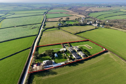
- Price
- £1,500,000
- Size
- 2.25 acres
Added on 14/03/2026Camping Land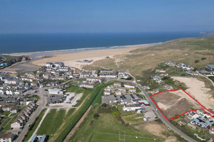
- Price
- Guide Price£1,000,000
- Size
- 1.25 acres
Added on 29/01/2026Development Land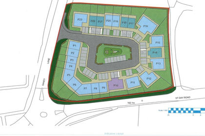 Added on 29/01/2026Development Land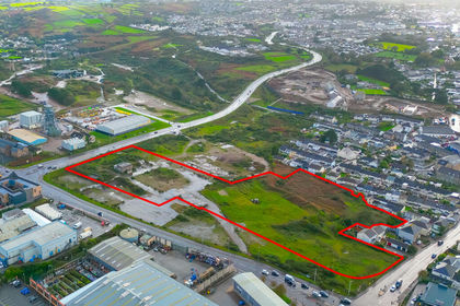
- Price
- Offers in Excess of£1,250,000
- Size
- 5.19 acres
Added on 29/01/2026Redevelopment Land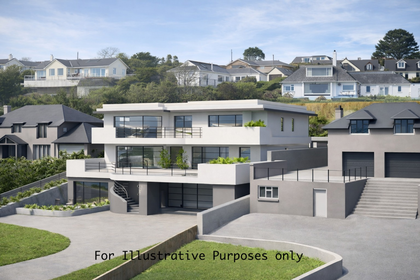
- Price
- Offers in Excess of£1,250,000
- Size
- 0.54 acres
Added on 05/04/2026Building Plot