Modbury, Ivybridge, PL21
- Bedrooms
- 1
- Bathrooms
- 9
Key Features
- Unit 5: A five bedroom detached barn with Class Q A & B conversion.
- Unit 4: A two bedroom detached stone barn.
- A collection of Grade II listed Stone Barns with detailed planning consent to convert.
- Unit 2: A three bedroom residential property arranged over three floors
- Unit 1: A four bedroom residential property arranged over two floors.
- Unit 3: A one bedroom holiday let that is provided over two floors.
Description
A collection of Grade II listed Stone Barns with detailed planning consent to convert into four units consisting of a 4 bedroom, a 3 bedroom and a 2 bedroom, full residential units and a 1 bedroom holiday use unit, PLUS a 5 bedroom Class Q Barn with land.
Situation
Babland Barns are situated in a quiet location approximately 3 miles from the market town of Modbury which boasts a good range of independent shops and eateries as well as the useful amenities of a primary school, doctors, dentist and vets. It is around 8 miles to the very popular surfing beaches of Bantham and Challaborough and Plymouth is about 12 miles to the west. Totnes Train Station is about 12.5 miles away giving direct links to London Paddington. Access onto to A38 Devon Expressway is just over 5 miles to the north.
Description:
A range of Grade II Listed Stone Barns offering a unique development planning reference 4007/21/FUL and 4008/21/LBC providing 3 residential dwellings and one holiday/ancillary residence. Plus a Class Q Barn with detailed planning permission for a 5 bedroom dwelling with extensive curtilage and paddock. All in the heart of the South Hams with great access from the A38 to Modbury, Bigbury and Kingsbridge
Unit 1:
A four bedroom residential property arranged over two floors that is situated within the middle of the development with a back garden. This consists of a kitchen, downstairs WC and utility, a walk-in larder, dining area with adjoining snug and a sitting room. Leading from this, there is a downstairs bedroom with ensuite and a large storage cupboard. Upstairs there are a further 3 bedrooms—two with ensuites—and a family bathroom.
Unit 2:
A three bedroom residential property arranged over three floors that is situated at the southern end of the range of stone barns. There will be be a large rear garden. Within this sits an open-plan dining area and sitting room with adjoining kitchen. There is a down stairs bedroom and bathroom along with a large storage cupboard. Upstairs there are a further two bedrooms and family bathroom. There is also an airing cupboard.
Unit 3:
A one bedroom holiday let that is provided over two floors at the northern end of the main range of barns comprising of an open-plan kitchen/living area with downstairs bath room and a bedroom above.
Outside:
Access to the front of the barns will be by foot only with parking areas garages and bin storage to the north and east and a large area to the rear to create private gardens. Currently there is a redundant slurry store that is being removed and the sheep shed to the rear that shall be vacated by the 31st March 2024 and can be removed if required. If any of the agricultural buildings remain they are permitted to be utilised for storage only and will be required to be removed once the building work is completed.
Services:
Currently there is a shared electrical and water supply to each building. All rights will be reserved for the benefit of access and services.
Unit 4:
A two bedroom detached stone barn surrounded by a stone wall to provide a lovely self-contained dwelling. Ideal as a holiday home, with views across the field to the south.
Outside
Access down past the front of the barns with parking and a concrete area to the rear for a private garden, with further space below where there is currently a redundant barn to be removed by the 31st March 2024, thus allowing views across the fields to the south.
Services:
Currently there is a shared electrical and water supply to each building. All rights will be reserved for the benefit of access and services.
Unit 5
A five bedroom detached barn with Class Q A & B conversion granted on the 7th July 2021. Planning reference 1478/21/PDM
Outside
Access would be from the track around the stone barns to the north. The barn will have an area to the west of the barn for parking while to the east there will be a large garden, paddock area.
Services:
Currently there is a shared electrical and water supply to each building. All rights will be reserved for the benefit of access and services.
Local and Planning Authority:
South Hams District Council, Follaton House, Plymouth Road, Totnes, TQ9 5NE
Council Tax:
Council tax band E rate 2021/22 £2,634 per annum.
Tenure:
The property is freehold with vacant possession.
Wayleaves, Rights & Easements:
The property is sold subject to any wayleaves, public or private rights of ways, easements and covenants and all outgoings, whether mentioned in the sales particulars or not.
Boundaries, Roads & Fencing:
The Purchaser shall be deemed to have full knowledge of the boundaries, and neither the Vendor, nor their Agent will be responsible for defining the ownership of the boundary fencing and hedges.
Plan:
The sales plan identifies the full extent of the property as a whole being sold outlined in red. The right of access for all purposes, all vehicles and on foot at all times is over the area hatched blue. Maintenance will be shared subject to usage.
Viewings :
Strictly by appointment only through Rendells Estate Agents, Tel:
Directions:
Driving along the A379 heading from Kingsbridge to Modbury, take a right turn at Harraton Cross and Babland Farm will be the first turning on your right.
what3words
thankful.dragonfly.giggled
Sellers Agents:
Rendells, 13 Market Street, Newton Abbot TQ12 2RL Tel: Email: Ref: JJB/AMC
Map Location
Property details
- Tenure
- Freehold
- Council Tax Band
- Ask Agent
- Date Posted
- 2026-11-03
Utilities & Restrictions
Utilities
- Electricity
- Mains
- Water
- Mains
- Heating
- Ask Agent
- Broadband
- Ask Agent
- Sewerage
- Ask Agent
Rights & Restrictions
- Public Rights of Way
- Ask Agent
- Private Rights of Way
- Ask Agent
- Listed Property
- Yes
- Restrictions
- Ask Agent
Listed status, conservation areas and planning constraints for this location are in the full report.
Property Features
- Accessibility
- Ask Agent
- Parking
- Parking Available
- Garden
- Garden
Beyond the particulars: planning activity, flood history, heritage and ground risks, checked for this exact spot.
Connectivity
Broadband
Fastest speed available at this postcode
25 Mbps
Standard (10-30 Mbps)
Suitable for
- Web & social
- Music streaming
- Standard video calls
Fixed wireless access may also be an option here.
Mobile signal
Predicted 4G and 5G signal; indoor signal depends on building materials.
Ofcom Connected Nations postcode-level predictions. Speeds and signal are modelled, not measured, and vary between addresses and providers.
Signal is the easy part. Planning activity, flood history and protected designations here are in the full report.
Nearest Schools
Primary
- Modbury Primary School1.4 milesOfsted: Good
- Ages
- 4 to 11
- Pupils
- 152
- Type
- Community school
- Aveton Gifford CofE Primary School2.4 milesOfsted report card · Jan 2026
- Ages
- 4 to 11
- Pupils
- 97
- Type
- Academy converter
- Faith
- Church of England
- Ermington Primary School2.8 milesOfsted: Good
- Ages
- 4 to 11
- Pupils
- 85
- Type
- Academy converter
- Ugborough Primary School2.9 milesNo Ofsted rating
- Ages
- 4 to 11
- Pupils
- 114
- Type
- Academy converter
- Loddiswell Primary School3 milesNo Ofsted rating
- Ages
- 4 to 11
- Pupils
- 118
- Type
- Community school
Secondary
- Ivybridge Community College4.1 milesOfsted: Good
- Ages
- 11 to 18
- Pupils
- 2,262
- Type
- Academy converter
- Kingsbridge Academy5.6 milesOfsted: Good
- Ages
- 11 to 18
- Pupils
- 1,199
- Type
- Academy converter
- Plympton Academy9 milesOfsted: Requires improvement
- Ages
- 11 to 18
- Pupils
- 984
- Type
- Academy converter
- King Edward VI Community College9.6 milesNo Ofsted rating
- Ages
- 11 to 18
- Pupils
- 940
- Type
- Academy converter
- Hele's School9.7 milesNo Ofsted rating
- Ages
- 11 to 18
- Pupils
- 1,378
- Type
- Academy converter
Distances are straight-line from the advertised location. Source: the national school registers (DfE, Welsh Government, Scottish Government) and Ofsted.
Schools are just the start: sold prices nearby, planning activity and any flood history are in the full report.
Amenities
Supermarket
GP surgery
Pharmacy
Hospital
Straight-line distances from the advertised location. Sources: NHS records, Geolytix supermarket locations, OS Open Greenspace and the national trails registers.
The area stacks up? Now check the location itself: planning nearby, protected designations and past flooding.
Getting Around
Nearest station
Nearest bus stop
Typical drive times
Straight-line distances from the advertised location; drive times are typical free-flow times over OpenStreetMap road data, so allow more at peak. Public transport locations from DfT NaPTAN.
Easy to reach matters. So do planning activity, flood history and ground risks: all in the full report.
Flood Risk
Environment Agency open data, checked around the advertised map pin for the listed acreage. Long-term risk counts flood defences; the planning map's flood zones do not. Provided by LandSale, not the listing agent, and not part of the agent's particulars. Risk varies across a holding, so verify before committing.
Rivers and the sea
Planning map: Flood Zone 1.
Surface water
These bandings are the summary. Where this location sits on the flood maps, plus planning activity, heritage and ground risks, is in the full report.
Important notice: Information, maps and tags on this page are drawn from the advertising agent's marketing materials or generated automatically. LandSale has not verified them. Relying on these details is at your own risk, always carry out independent checks before committing to a purchase.
LandSale full disclaimer
Marketing information only - not formal particulars. The details on this website are provided for general guidance and do not constitute an offer or contract. Neither LandSale nor the advertising estate/land agent accepts responsibility for any inaccuracy.
1. Source of information
- Listing content: Core description, asking price, tenure, measurements, photographs and planning history originate from the marketing materials of the advertising estate or land agent. LandSale does not author this content and cannot guarantee its accuracy.
- Automated tags & categorisation: Property type, land-use class, acreage bands and similar labels may be applied by machine-learning models. They are intended as a helpful guide only and may not reflect the property's legal status or permitted use.
- Third-party & enriched data layers: Maps, boundary outlines, planning designations, soil reports, broadband coverage and other environmental or location-based insights are licensed from external suppliers. Such data are supplied “as is", may be incomplete or out of date and are subject to change without notice.
2. Verification required
Prospective purchasers must verify critical matters, including but not limited to planning permission, title boundaries, public rights of way, environmental constraints, acreage, services, access and VAT status, through their own inspections, specialist surveys, legal advisers and the selling agent before relying on the information or entering into any contract.
3. No warranty or liability
LandSale gives no warranty, express or implied, as to the accuracy, completeness or fitness for any particular purpose of the information displayed. LandSale shall not be liable for any loss, damage, cost or expense arising directly or indirectly from any use of or reliance on such information, save where liability may not be excluded by law.
4. Updates & feedback
If you believe any detail on this listing is inaccurate, please let us know. We will investigate and, where appropriate, update the listing or notify the agent.
© LandSale | Version 1.3 - August 2026
Similar properties for sale
- Price
- Guide Price£1,100,000
- Size
- 5 acres
Added on 17/08/2026Development Land
- Price
- Offers in Excess of£1,000,000
Added on 22/05/2026Development Land
- Price
- Offers in Excess of£900,000
- Size
- 3.25 acres
St Judes, Plymouth, Plymouth Sutton and Devonport, Plymouth PL4 England
Added on 18/03/2026Building Plot
- Price
- £1,000,000
- Size
- 0.5 acres
Added on 17/07/2026Development Land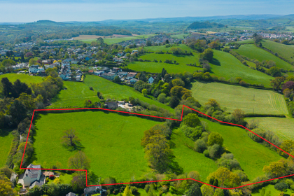
- Price
- Offers in Region of£900,000
- Size
- 7.63 acres
Site North Of Whitehill Road, Highweek, Nr. Newton Abbot, TQ12, Nr. Newton Abbot, Devon TQ12 England
Added on 12/06/2026Development Land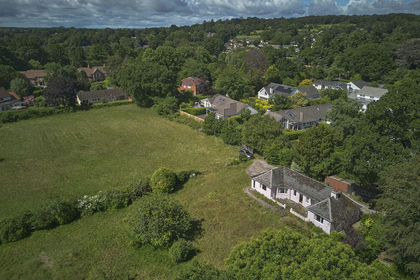
- Price
- Guide Price£1,000,000
- Size
- 1.8 acres
West Hill Road, Ottery St. Mary, West Hill, Devon EX11 England
Added on 29/01/2026Redevelopment Land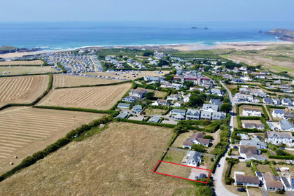
- Price
- Guide Price£780,000
- Size
- 0.135 acres
Constantine Bay, Padstow, PL28, St. Merryn, Cornwall PL28 England
Added on 18/06/2026Building Plot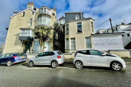
- Price
- Offers in Region of£899,950
Added on 17/07/2026Commercial Land
- Price
- Guide Price£1,000,000
- Size
- 1.25 acres
Added on 29/01/2026Development Land Added on 27/10/2026Development Land