Church Street, Weston-Subedge, Gloucestershire, GL55
- Bedrooms
- 4
- Bathrooms
- 2
Key Features
- Charming period features
- Extended and modernised kitchen
- Self-contained annexe
- Pretty, westerly-facing gardens
- Versatile layout across two storeys
- Views over neighbouring fields
Description
Popfosters is a handsome Grade II listed period home believed to incorporate parts dating back to the 16th century, benefitting from a modern layout and ancillary accommodation
Formerly the village post office and shop, the property has a fascinating history and an abundance of period character, with a traditional timbered cottage frontage and a Cotswold stone rear elevation incorporating the former hay barn. The accommodation combines original features with thoughtful modern additions and is complemented by a converted barn, currently operating successfully as a holiday let.
The main house is approached via an entrance hall with flagstone flooring, leading into the principal reception rooms. The triple-aspect sitting room enjoys views over the surrounding fields and features an impressive inglenook fireplace housing a dual-fuel stove. The dual-aspect dining room has a further inglenook fireplace with open fire, stone mullion windows, exposed character and window seats. The kitchen/breakfast room is fitted with Barn and Brook solid oak joinery, a Mercury range cooker and a range of integrated appliances, with flagstone flooring and a breakfast bar. A 2015 extension created an additional dining area with a ceiling lantern and double doors opening onto the outdoor dining courtyard. Underfloor heating extends through this area, while a useful utility space with sink and provision for white goods is concealed behind bifold doors.
The principal bedroom is home to an impressive stone fireplace, dual-aspect windows overlooking the fields, fitted wardrobes and a storage cupboard, together with access to bedroom three. This versatile room could be used as an office, dressing room or nursery, or as a third bedroom, with a separate staircase leading from the sitting room. Bedroom two has exposed beams, a feature fireplace and views over the surrounding countryside. The main bathroom is fitted with a Matki double walk-in shower, freestanding resin bath, vanity unit and WC, together with underfloor heating.
OUTSIDE
The former cattle barn has been sympathetically converted to provide an exceptionally useful additional space. The smaller section is currently arranged as a home office/gym with a mezzanine providing further storage or workspace. The larger section forms a self-contained annexe, comprising open-plan living accommodation with kitchenette, sitting and dining areas, a first-floor bedroom and shower room, together with a further ground-floor bedroom with mezzanine area. The annexe is currently used as a successful holiday let, offering an attractive opportunity for supplementary income or flexible accommodation for family and guests.
The outside space includes a Cotswold stone-walled courtyard garden, incorporating a millstone discovered at the property, together with a useful storage area and gravel driveway providing parking for several vehicles. Beyond the barn lies a delightful south-facing garden, with a broad lawn, beautifully established flower beds, mature trees and a garden shed. The garden enjoys a wonderful sense of space and privacy, adding to the property's appeal.
Weston Subedge is a charming North Cotswold village, set amidst beautiful rolling countryside on the edge of the Cotswolds. The village is known for its attractive period homes and rural surroundings, while also benefitting from a strong sense of community and a well-regarded village pub - The Seagrave Arms - as well as the popular village club.
The neighbouring village of Chipping Campden, approximately two miles away, offers an excellent range of everyday amenities, including independent shops, cafés, restaurants, pubs and a variety of local services. The larger market towns of Moreton-in-Marsh, Evesham and Stratford-upon-Avon are also within convenient reach, providing further shopping, leisure and transport facilities.
The surrounding countryside offers an abundance of walking and riding opportunities, with the Cotswold Way and numerous footpaths accessible nearby. For commuters, there are mainline railway stations at Moreton-in-Marsh and Honeybourne, providing services towards London, while the wider road network gives access to Cheltenham, Stratford-upon-Avon, Oxford and beyond.
Map Location
Property details
- Tenure
- Freehold
- Council Tax Band
- F
- Date Posted
- 2026-09-10
Utilities & Restrictions
Utilities
- Electricity
- Mains
- Water
- Mains
- Heating
- Gas Central Heating
- Broadband
- Ask Agent
- Sewerage
- Mains
Rights & Restrictions
- Public Rights of Way
- Ask Agent
- Private Rights of Way
- Ask Agent
- Listed Property
- Yes
- Restrictions
- Ask Agent
Listed status, conservation areas and planning constraints for this location are in the full report.
Property Features
- Accessibility
- No Wheelchair Access
- Parking
- Driveway
- Garden
- Garden
Beyond the particulars: planning activity, flood history, heritage and ground risks, checked for this exact spot.
Connectivity
Broadband
Fastest speed available at this postcode
1 Gbps
Gigabit full fibre
Suitable for
- 4K streaming on every screen
- Full-time home working
- Online gaming & big downloads
Mobile signal
Outdoor predictions; indoor signal depends on building materials.
Ofcom Connected Nations postcode-level predictions. Speeds and signal are modelled, not measured, and vary between addresses and providers.
Signal is the easy part. Planning activity, flood history and protected designations here are in the full report.
Nearest Schools
Primary
- Willersey Church of England Primary School1.5 milesNo Ofsted rating
- Ages
- 5 to 11
- Pupils
- 45
- Type
- Voluntary controlled school
- Faith
- Church of England
- St Catharine's Catholic Primary School1.8 milesOfsted: Good
- Ages
- 5 to 11
- Pupils
- 114
- Type
- Academy converter
- Faith
- Roman Catholic
- St James and Ebrington Church of England Primary School2 milesOfsted report card · Mar 2026
- Ages
- 2 to 11
- Pupils
- 149
- Type
- Academy converter
- Faith
- Church of England
- Honeybourne Primary Academy2 milesOfsted: Good *
- Ages
- 2 to 11
- Pupils
- 232
- Type
- Academy converter
- Broadway First School2.4 milesNo Ofsted rating
- Ages
- 5 to 10
- Pupils
- 73
- Type
- Community school
Secondary
- Chipping Campden School1.8 milesOfsted: Good *
- Ages
- 11 to 18
- Pupils
- 1,465
- Type
- Academy converter
- Blackminster Middle School4.4 milesOfsted: Requires improvement
- Ages
- 10 to 13
- Pupils
- 217
- Type
- Community school
- The De Montfort School5.4 milesOfsted: Good
- Ages
- 10 to 18
- Pupils
- 915
- Type
- Academy sponsor led
- Prince Henry's High School5.8 milesOfsted: Outstanding
- Ages
- 13 to 18
- Pupils
- 1,282
- Type
- Academy converter
- St Egwin's CofE Middle School6.1 milesOfsted: Good *
- Ages
- 10 to 13
- Pupils
- 438
- Type
- Voluntary controlled school
- Faith
- Church of England
* Latest graded judgement covers quality of education only; no overall grade was issued under the 2024-25 inspection framework.
Distances are straight-line from the advertised location. Source: the national school registers (DfE, Welsh Government, Scottish Government) and Ofsted.
Schools are just the start: sold prices nearby, planning activity and any flood history are in the full report.
Amenities
Supermarket
GP surgery
Pharmacy
Hospital
Green space
Walking trail
Straight-line distances from the advertised location. Sources: NHS records, Geolytix supermarket locations, OS Open Greenspace and the national trails registers.
The area stacks up? Now check the location itself: planning nearby, protected designations and past flooding.
Getting Around
Nearest station
Nearest bus stop
Typical drive times
Straight-line distances from the advertised location; drive times are typical free-flow times over OpenStreetMap road data, so allow more at peak. Public transport locations from DfT NaPTAN.
Easy to reach matters. So do planning activity, flood history and ground risks: all in the full report.
Flood Risk
From Environment Agency flood map open data, checked around the advertised map pin and allowing for the listed acreage where known. This summary comes from LandSale, the advertising platform, not from the listing agent, and is not part of the agent's particulars. Risk can vary across a single holding, so verify anything critical through your own searches before committing.
Rivers and the sea
Surface water
The detail behind these bandings
The full report pinpoints where this location sits on the flood maps, and runs the deeper checks that usually only surface after an offer.
- Exact flood zones & annual chances (included in the full report)
- Any recorded past flooding (included in the full report)
- Planning activity nearby (included in the full report)
- Heritage & conservation (included in the full report)
- Protected nature designations (included in the full report)
- Ground risks (included in the full report)
- Sold prices nearby (included in the full report)
£14.99 · one-off purchase
By LandSale, the platform. Not provided by the listing agent. Ready in about a minute.
Important notice: Information, maps and tags on this page are drawn from the advertising agent's marketing materials or generated automatically. LandSale has not verified them. Relying on these details is at your own risk, always carry out independent checks before committing to a purchase.
LandSale full disclaimer
Marketing information only - not formal particulars. The details on this website are provided for general guidance and do not constitute an offer or contract. Neither LandSale nor the advertising estate/land agent accepts responsibility for any inaccuracy.
1. Source of information
- Listing content: Core description, asking price, tenure, measurements, photographs and planning history originate from the marketing materials of the advertising estate or land agent. LandSale does not author this content and cannot guarantee its accuracy.
- Automated tags & categorisation: Property type, land-use class, acreage bands and similar labels may be applied by machine-learning models. They are intended as a helpful guide only and may not reflect the property's legal status or permitted use.
- Third-party & enriched data layers: Maps, boundary outlines, planning designations, soil reports, broadband coverage and other environmental or location-based insights are licensed from external suppliers. Such data are supplied “as is", may be incomplete or out of date and are subject to change without notice.
2. Verification required
Prospective purchasers must verify critical matters, including but not limited to planning permission, title boundaries, public rights of way, environmental constraints, acreage, services, access and VAT status, through their own inspections, specialist surveys, legal advisers and the selling agent before relying on the information or entering into any contract.
3. No warranty or liability
LandSale gives no warranty, express or implied, as to the accuracy, completeness or fitness for any particular purpose of the information displayed. LandSale shall not be liable for any loss, damage, cost or expense arising directly or indirectly from any use of or reliance on such information, save where liability may not be excluded by law.
4. Updates & feedback
If you believe any detail on this listing is inaccurate, please let us know. We will investigate and, where appropriate, update the listing or notify the agent.
© LandSale | Version 1.3 - August 2026
Listing agent
Hayman-Joyce Broadway, Broadway
28 High Street, Broadway, WR12 7DT
Similar properties for sale
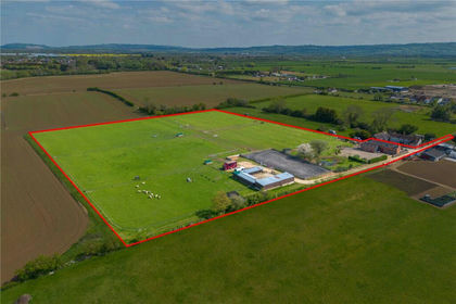
- Price
- Guide Price£850,000
- Size
- 7 acres
Bretforton Road, Badsey, Evesham, Worcestershire, WR11, Badsey, Worcestershire WR11 England
Added on 13/05/2026Equestrian property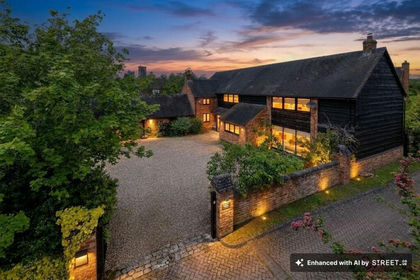
- Price
- Guide Price£1,175,000
- Size
- 0.2 acres
Wyre Lane, Long Marston, CV37, Long Marston, Warwickshire CV37 England
Added on 29/05/2026Barn Conversion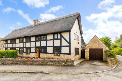
- Price
- Guide Price£850,000
Stanway Road, Stanton, Gloucestershire, WR12, Stanton, Gloucestershire WR12 England
Added on 24/08/2026Barn Conversion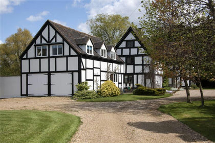
- Price
- £975,000
- Size
- 2.4 acres
Dorsington, Stratford Upon Avon, Warwickshire, CV37, Dorsington, Warwickshire CV37 England
Added on 29/01/2026House with Land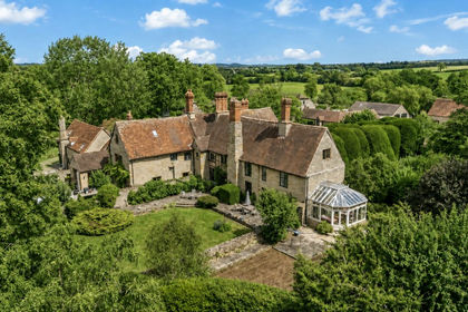
- Price
- £1,000,000
- Size
- 2.16 acres
Manor House, Cleeve Prior Manor, WR11, Cleeve Prior, Worcestershire WR11 England
Added on 24/08/2026House with Land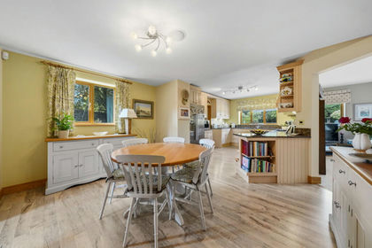
- Price
- Guide Price£1,000,000
- Size
- 0.5 acres
Cleeve Barn, Froglands Lane, Cleeve Prior, WR11, Cleeve Prior, Worcestershire WR11 England
Added on 28/07/2026Barn Conversion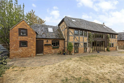
- Price
- Guide Price£800,000
- Size
- 0.43 acres
Main Street, Sedgeberrow, Worcestershire, WR11, Sedgeberrow, Worcestershire WR11 England
Added on 09/09/2026Barn Conversion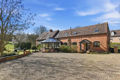
- Price
- Offers in Region of£995,000
- Size
- 0.5 acres
Crimscote, Stratford-upon-Avon, Whitchurch, Warwickshire CV37 England
Added on 22/06/2026Barn Conversion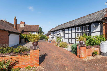
- Price
- Guide Price£975,000
- Size
- 0.33 acres
The Brew House, Mill Lane, Broom B50, Bidford-on-Avon, Warwickshire B50 England
Added on 10/09/2026Barn Conversion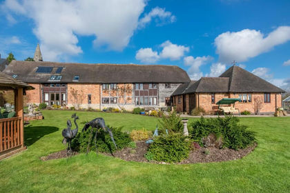
- Price
- Offers Over£1,150,000
- Size
- 10.19 acres
Temple Grafton Alcester, Temple Grafton, Warwickshire B49 England
Added on 15/05/2026Barn Conversion