Brotherlee, Westgate, Weardale, DL13
- Land size
- 5 acres
- Bedrooms
- 4
- Bathrooms
- 2
Key Features
- Truly remarkable Grade II listed country home
- Idyllic position within the desirable rural hamlet of Brotherlee, Westgate
- Large gardens and attached piece of land approximately 5 acres
- Abundance of period features befitting a home of its age and stature
- Exposed timber beams, open fireplaces and sash windows
- Scandinavian-style BBQ cabin within the gardens
- Three generous sized reception rooms
- Boot room - an essential for this country home
- Surrounded by unspoilt countryside and enjoying far-reaching rural views
- Ample off road car parking
Description
Robinsons are delighted to offer to the sales market this truly remarkable Grade II listed, four-bedroom stone-built country home, occupying an idyllic position within the desirable rural hamlet of Brotherlee, Westgate. Surrounded by unspoilt countryside and enjoying far-reaching rural views, this exceptional property offers a rare combination of historic charm, generous gardens and approximately five acres of adjoining land, making it an ideal home for those seeking a peaceful country lifestyle.
The property retains an abundance of period features befitting a home of its age and stature, including exposed timber beams, open fireplaces and sash windows, complemented by spacious and versatile accommodation. A particularly appealing feature is the boot room, perfectly suited to rural living, while the established gardens and Scandinavian-style BBQ cabin provide wonderful spaces for outdoor entertaining and relaxation.
The accommodation briefly comprises an entrance area leading to three generous reception rooms, each offering considerable versatility and lending themselves equally well to formal dining, comfortable sitting rooms or cosy snugs. The well-appointed kitchen features a range of wall, base and drawer units, with space for a Rayburn cooker and a dining table. An inner hallway provides access to the staircase and further accommodation, together with a shower room fitted with a three-piece suite.
To the first floor are four bedrooms, comprising three generous double bedrooms and a smaller single bedroom. The spacious landing provides an additional versatile area, ideal for a reading nook or home study. The family bathroom is fitted with a traditional three-piece suite, including a bath with shower over, wash hand basin and WC.
Outside - Outside, the property is approached via a shared gravelled driveway, which continues to the house and provides off-road parking within a carport. The beautifully established gardens are a particular delight, offering a wealth of mature planting and lawns, together with a charming stream meandering through the garden, creating a tranquil and picturesque setting.
A further garden area houses the impressive Scandinavian BBQ cabin, providing an exceptional space for entertaining guests throughout the seasons. Beyond the principal gardens lies approximately five acres of additional land, offering considerable appeal to equestrian buyers or those wishing to keep livestock and other animals, subject to any necessary consents.
Location - Brotherlee, Westgate enjoys an enviable position within an area renowned for its outstanding natural beauty, with an abundance of countryside, scenic walking routes and picturesque landscapes on the doorstep. Despite its peaceful and secluded setting, the property remains within convenient reach of the surrounding towns, including Stanhope, Consett and Bishop Auckland, which offer a range of everyday amenities, independent shops, schools and leisure facilities.
A property of considerable character and distinction, this unique home represents a rare opportunity to acquire a substantial period residence in an exceptionally beautiful rural setting, with the added benefit of extensive gardens and approximately five acres of land.
Agent Notes - Council Tax: Durham County Council, Band D - Approx. £2,622 p.a
Tenure: Freehold
Property Construction – Standard
Number & Types of Rooms – Please refer to the details and floorplan, all measurements are for guidance only
Gas Supply - none
Electricity supply – Mains
Water Supply – Mains
Sewerage – Mains
Heating – Oil central heating
Estimated Mobile phone coverage – Please refer to the Ofcom Website -
Estimated Broadband Download speeds – please refer to the Ofcom Website –
Building Safety – The Vendor is not aware of any Building Safety issues. However, we would recommend that the purchaser engages the services of a chartered surveyor to confirm.
Restrictions – covenants which affect the property are within the Land Registry Title Register which is available for inspection.
Selective licencing area – no
Probate – NA
Rights & Easements – Neighbouring propeties have pedestrian and vehicle access over some areas of land owned by subject property.
Flood risk – refer to the Gov website -
Coastal Erosion – refer to the Gov website -
Protected Trees – Yes
Planning Permission – Check with seller.
Accessibility/Adaptations – No
Mining Area – Coal Mining Reporting Area, further searches may be required by your legal representative.
Disclaimer: Our details have been compiled in good faith using publicly available sources and information obtained from the vendor prior to marketing. Verification and clarification of this information, along with any further details concerning Material Information parts A, B & C, should be sought from a legal representative or appropriate authorities before making any financial commitments. Robinsons cannot accept liability for any information provided subsequent amendments or unintentional errors or omissions.
HMRC Compliance requires all estate agents to carry out identity checks on their customers, including buyers once their offer has been accepted. These checks must be completed for each purchaser who will become a legal owner of the property. An administration fee of £42 (inc. VAT) per individual purchaser applies for carrying out these checks.
Map Location
Property details
- Tenure
- Freehold
- Council Tax Band
- D
- Date Posted
- 2026-09-10
Market Value Analysis
Compared with 72 Homes with Land listings in North East England (5+ acres).
Utilities & Restrictions
Utilities
- Electricity
- Mains
- Water
- Mains
- Heating
- Oil Heating
- Broadband
- Ask Agent
- Sewerage
- Mains
Rights & Restrictions
- Public Rights of Way
- Ask Agent
- Private Rights of Way
- Ask Agent
- Listed Property
- Ask Agent
- Restrictions
- Ask Agent
Listed status, conservation areas and planning constraints for this location are in the full report.
Property Features
- Accessibility
- Ask Agent
- Parking
- Parking Available
- Garden
- Garden
Beyond the particulars: planning activity, flood history, heritage and ground risks, checked for this exact spot.
Connectivity
Broadband
Fastest speed available at this postcode
19 Mbps
Standard (10-30 Mbps)
Suitable for
- Web & social
- Music streaming
- Standard video calls
Mobile signal
Outdoor predictions; indoor signal depends on building materials.
Ofcom Connected Nations postcode-level predictions. Speeds and signal are modelled, not measured, and vary between addresses and providers.
Signal is the easy part. Planning activity, flood history and protected designations here are in the full report.
Nearest Schools
Primary
- St John's Chapel Primary School2.5 milesNo Ofsted rating
- Ages
- 2 to 11
- Pupils
- 24
- Type
- Community school
- Stanhope Barrington CofE Primary School4.3 milesOfsted: Good *
- Ages
- 2 to 11
- Pupils
- 123
- Type
- Academy converter
- Faith
- Church of England
- Wearhead Primary School4.4 milesNo Ofsted rating
- Ages
- 2 to 11
- Pupils
- 11
- Type
- Community school
- Frosterley Primary School6.1 milesOfsted: Good
- Ages
- 3 to 11
- Pupils
- 32
- Type
- Community school
- Middleton-In-Teesdale Academy8 milesOfsted: Inadequate
- Ages
- 3 to 11
- Pupils
- 73
- Type
- Academy sponsor led
Secondary
- Wolsingham School9 milesNo Ofsted rating
- Ages
- 11 to 16
- Pupils
- 774
- Type
- Academy converter
- Samuel King's School14 milesNo Ofsted rating
- Ages
- 11 to 16
- Pupils
- 113
- Type
- Foundation school
- Consett Academy14 milesOfsted: Good
- Ages
- 11 to 18
- Pupils
- 1,493
- Type
- Academy sponsor led
- Teesdale School and Sixth Form15 milesNo Ofsted rating
- Ages
- 11 to 18
- Pupils
- 684
- Type
- Academy sponsor led
- St Joseph's Catholic Middle School, Hexham16 milesNo Ofsted rating
- Ages
- 9 to 13
- Pupils
- 168
- Type
- Academy converter
- Faith
- Roman Catholic
* Latest graded judgement covers quality of education only; no overall grade was issued under the 2024-25 inspection framework.
Distances are straight-line from the advertised location. Source: the national school registers (DfE, Welsh Government, Scottish Government) and Ofsted.
Schools are just the start: sold prices nearby, planning activity and any flood history are in the full report.
Amenities
Supermarket
GP surgery
Pharmacy
Hospital
Straight-line distances from the advertised location. Sources: NHS records, Geolytix supermarket locations, OS Open Greenspace and the national trails registers.
The area stacks up? Now check the location itself: planning nearby, protected designations and past flooding.
Getting Around
Nearest station
Nearest bus stop
Typical drive times
Straight-line distances from the advertised location; drive times are typical free-flow times over OpenStreetMap road data, so allow more at peak. Public transport locations from DfT NaPTAN.
Easy to reach matters. So do planning activity, flood history and ground risks: all in the full report.
Flood Risk
From Environment Agency flood map open data, checked around the advertised map pin and allowing for the listed acreage where known. This summary comes from LandSale, the advertising platform, not from the listing agent, and is not part of the agent's particulars. Risk can vary across a single holding, so verify anything critical through your own searches before committing.
Rivers and the sea
Surface water
Mapped within the area searched, not at the advertised map pin itself.
The detail behind these bandings
The full report pinpoints where this location sits on the flood maps, and runs the deeper checks that usually only surface after an offer.
- Exact flood zones & annual chances (included in the full report)
- Any recorded past flooding (included in the full report)
- Planning activity nearby (included in the full report)
- Heritage & conservation (included in the full report)
- Protected nature designations (included in the full report)
- Ground risks (included in the full report)
- Sold prices nearby (included in the full report)
£14.99 · one-off purchase
By LandSale, the platform. Not provided by the listing agent. Ready in about a minute.
Important notice: Information, maps and tags on this page are drawn from the advertising agent's marketing materials or generated automatically. LandSale has not verified them. Relying on these details is at your own risk, always carry out independent checks before committing to a purchase.
LandSale full disclaimer
Marketing information only - not formal particulars. The details on this website are provided for general guidance and do not constitute an offer or contract. Neither LandSale nor the advertising estate/land agent accepts responsibility for any inaccuracy.
1. Source of information
- Listing content: Core description, asking price, tenure, measurements, photographs and planning history originate from the marketing materials of the advertising estate or land agent. LandSale does not author this content and cannot guarantee its accuracy.
- Automated tags & categorisation: Property type, land-use class, acreage bands and similar labels may be applied by machine-learning models. They are intended as a helpful guide only and may not reflect the property's legal status or permitted use.
- Third-party & enriched data layers: Maps, boundary outlines, planning designations, soil reports, broadband coverage and other environmental or location-based insights are licensed from external suppliers. Such data are supplied “as is", may be incomplete or out of date and are subject to change without notice.
2. Verification required
Prospective purchasers must verify critical matters, including but not limited to planning permission, title boundaries, public rights of way, environmental constraints, acreage, services, access and VAT status, through their own inspections, specialist surveys, legal advisers and the selling agent before relying on the information or entering into any contract.
3. No warranty or liability
LandSale gives no warranty, express or implied, as to the accuracy, completeness or fitness for any particular purpose of the information displayed. LandSale shall not be liable for any loss, damage, cost or expense arising directly or indirectly from any use of or reliance on such information, save where liability may not be excluded by law.
4. Updates & feedback
If you believe any detail on this listing is inaccurate, please let us know. We will investigate and, where appropriate, update the listing or notify the agent.
© LandSale | Version 1.3 - August 2026
Listing agent
Robinsons, Crook
Royal Corner Crook DL15 9UA
Similar properties for sale
- Price
- Guide Price£750,000
- Size
- 1.8 acres
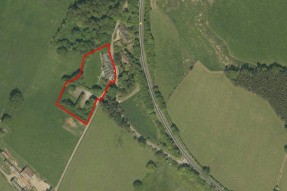
Land At Helme Park Hotel, Tow Law, Bishop Auckland, DL13, Wolsingham, County Durham DL13 England
Added on 29/01/2026Redevelopment Land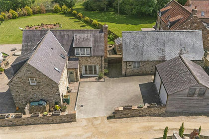
- Price
- Guide Price£799,995
- Size
- 2.5 acres
Lodge Farm, Durham, DH7, Bearpark, County Durham DH7 England
Added on 26/02/2026Country Home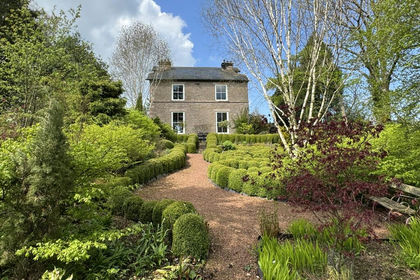
- Price
- £825,000
- Size
- 1 acres
Old Vicarage Kirkby Stephen, Soulby, CA17, Soulby, Westmorland and Furness CA17 England
Added on 19/08/2026House with Land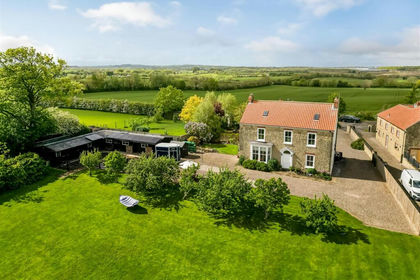
- Price
- £750,000
- Size
- 7 acres
Coatham Mundeville, Darlington, Coatham Mundeville, Darlington DL1 England
Added on 22/05/2026Equestrian property
- Price
- Guide Price£800,000
- Size
- 5 acres
Mordon, Stockton-On-Tees, TS21, Mordon, County Durham TS21 England
Added on 23/04/2026Country Home
- Price
- £750,000
- Size
- 1 acres
Carr House Great Bavington, Newcastle Upon Tyne NE19, Bavington, Northumberland NE19 England
Added on 28/04/2026Country Home
- Price
- Offers Over£595,000
- Size
- 1.67 acres
Added on 14/03/2026Country Home
- Price
- Guide Price£750,000
- Size
- 1.9 acres
Added on 08/07/2026Country Home Added on 16/07/2026Cottage
- Price
- £800,000
- Size
- 1 acres
Added on 29/01/2026Country Home