Manse Road, Colmonell, Girvan, South Ayrshire
- Land size
- 4 acres
- Bedrooms
- 7
- Bathrooms
- 5
Description
Occupying an enviable position on the edge of the historic village of Colmonell, The Manse is an exceptional Category C listed country house, dating from 1822 with river frontage, extensive grounds and exceptional flexibility.
Set within approximately four acres of grounds and overlooking the River Stinchar and with views of the ruins of Craigneil Castle, the property combines architectural character, privacy and an extraordinary degree of flexibility.
Painstakingly restored by the present owners, the house retains a wealth of original features while benefiting from extensive improvements to its heating, plumbing, kitchens and bathrooms. The result is a substantial and highly individual family home which is equally suited to entertaining, multigenerational living, working from home or accommodating guests.
Approached by a gated driveway, The Manse occupies an elevated, commanding position overlooking one of the most attractive stretches of the River Stinchar.
The house is immediately distinguished by its handsome proportions and traditional stone construction. Its elevated position allows the principal rooms and gardens to enjoy an attractive outlook across the surrounding countryside, with Craigneil Castle forming a particularly evocative focal point.
Built in 1822 as the residence of the local minister, the house was enlarged in the early twentieth century and is consequently a property with a strong sense of history and architectural identity. The current owners acquired The Manse in 2009 and have undertaken a comprehensive programme of restoration, approaching the property as custodians of an important local building. Original detailing has been carefully retained wherever possible, including panelled timber doors, decorative cornicing, a Greek Key ceiling detail and the characterful entrance arrangement.
The accommodation extends over four levels and offers considerable flexibility for modern family life.
Ground Floor
A traditional vestibule opens into an impressive reception hall, from which the principal accommodation flows naturally.
The sitting room is a particularly attractive room with a bay window and views towards the surrounding countryside.
A separate formal dining room/music room provides an elegant setting for entertaining, while the superb open-plan kitchen forms the natural heart of the house. A substantial central island and Rayburn range cooker combine the character expected of a country house with the practicality required for contemporary living.
A store, inner hall and cloakroom/WC complete this level.
Lower Ground Floor
One of the property's most notable features is a self-contained one-bedroom apartment, offering an excellent opportunity for extended family, guests, independent living or ancillary accommodation.
The apartment comprises sitting room, dining kitchen, double bedroom and shower room. Also on this level is a utility room, wine store and hallway with direct access to the garden.
First Floor
The principal bedroom accommodation is arranged around a spacious landing with fitted storage.
There are four generous bedrooms, together with two bathrooms and a shower room.
The rooms benefit from attractive views and the sense of space characteristic of a substantial period house.
Second Floor
Two bedrooms and a useful store occupy the upper level.
Gardens, grounds and outbuildings
The Manse sits within approximately four acres, combining formal garden, lawn, paddock and river frontage.
The approach leads through the grounds to a generous turning area in front of the house, with extensive parking available to both the front and rear.
The gardens have an informal country character, providing an attractive setting for the house while preserving the magnificent views towards the River Stinchar and the surrounding landscape. Of particular note is the property's relationship with the river. The grounds extend to the middle of the River Stinchar and include part of the historic Minister Pool. This provides an exceptional amenity for those with an interest in fishing, with trout fishing available and opportunities to join the local fishing club for salmon fishing.
A greenhouse and summerhouse sit within the grounds, while the paddock offers further versatility. There is a vegetable garden and orchard to the rear of the property.
There are a collection of traditional ancillary buildings which form an important part of the property. These include a cart lodge, carriage shed, stables, laundry/tool shed together with a log store. The buildings provide useful storage, garaging and workshop space and, subject to the necessary consents, may offer scope for further adaptation.
Their traditional construction and relationship with the principal house contribute significantly to the character of the overall property.
Summary of Accommodation
Approximately 4 acres of grounds
Direct outlook over the River Stinchar
Views towards the ruins of Craigneil Castle
Self-contained lower-ground apartment
Air source heat pump and oil-fired central heating
Extensive range of traditional ancillary buildings
River frontage and fishing opportunities
Location
Life at The Manse is defined by its extraordinary setting. Mornings begin overlooking the River Stinchar, while the surrounding countryside provides a constantly changing backdrop of woodland, pasture and open skies.
The gardens provide space for children to explore, dogs to roam and family and friends to gather. The river brings another dimension to the property, with fishing and the simple pleasure of having water and wildlife immediately beyond the garden.
There is space here for long summer lunches, informal gatherings, gardening, outdoor games and quiet afternoons beneath the trees.
Despite its rural setting, The Manse is not isolated. Colmonell provides a strong sense of community and an attractive village setting, while Girvan offers everyday amenities and services.
The wider South Ayrshire landscape provides an exceptional range of opportunities for an active family lifestyle, from walking and cycling to fishing, riding, sailing and golf.
The coast is readily accessible, while Turnberry provides world-class golf and hospitality nearby.
Glasgow and the Central Belt are also within straightforward travelling distance, making it possible to enjoy the benefits of country living without becoming disconnected from work, education, culture or family further afield.
EPC E
Council tax G
Freehold
EPC Rating: E
Council Tax Band: G
Map Location
Property details
- Tenure
- Ask Agent
- Council Tax Band
- G
- Date Posted
- 2026-09-07
Market Value Analysis
Compared with 438 Homes with Land listings in Scotland (1+ acres).
Energy Performance Certificate
Energy Efficiency Rating
Based on UK Energy Performance Certificate standards (EU Directive 2002/91/EC)
Running costs are one side. Planning activity, flood history and ground risks for this location are in the full report.
Utilities & Restrictions
Utilities
- Electricity
- Ask Agent
- Water
- Ask Agent
- Heating
- Ask Agent
- Broadband
- Ask Agent
- Sewerage
- Ask Agent
Rights & Restrictions
- Public Rights of Way
- Ask Agent
- Private Rights of Way
- Ask Agent
- Listed Property
- Ask Agent
- Restrictions
- Ask Agent
Listed status, conservation areas and planning constraints for this location are in the full report.
Property Features
- Accessibility
- Ask Agent
- Parking
- Parking Available
- Garden
- Garden
Beyond the particulars: planning activity, flood history, heritage and ground risks, checked for this exact spot.
Connectivity
Broadband
Fastest speed available at this postcode
80 Mbps
Superfast
Suitable for
- HD streaming
- Video calls
- Web & social
Mobile signal
Outdoor predictions; indoor signal depends on building materials.
Ofcom Connected Nations postcode-level predictions. Speeds and signal are modelled, not measured, and vary between addresses and providers.
Signal is the easy part. Planning activity, flood history and protected designations here are in the full report.
Nearest Schools
Primary
- Colmonell Primary School606 metres
- Pupils
- 38
- Type
- Non-denominational
- Ballantrae Primary School4.3 miles
- Pupils
- 44
- Type
- Non-denominational
- Barrhill Primary School5.8 miles
- Pupils
- 20
- Type
- Non-denominational
- Girvan Primary School7.8 miles
- Pupils
- 305
- Type
- Non-denominational
- Sacred Heart Primary School7.9 miles
- Pupils
- 120
- Type
- Roman Catholic
Secondary
- Girvan Academy7.9 miles
- Pupils
- 542
- Type
- Non-denominational
- Stranraer Academy16 miles
- Pupils
- 991
- Type
- Non-denominational
- Carrick Academy17 miles
- Pupils
- 391
- Type
- Non-denominational
- Douglas Ewart High School21 miles
- Pupils
- 584
- Type
- Non-denominational
- Doon Academy24 miles
- Pupils
- 240
- Type
- Non-denominational
Distances are straight-line from the advertised location. Source: the national school registers (DfE, Welsh Government, Scottish Government) and Ofsted.
Schools are just the start: planning activity, heritage and any flood history here are in the full report.
Amenities
Supermarket
GP surgery
Pharmacy
Green space
Straight-line distances from the advertised location. Sources: NHS records, Geolytix supermarket locations, OS Open Greenspace and the national trails registers.
The area stacks up? Now check the location itself: planning nearby, protected designations and past flooding.
Getting Around
Nearest station
Nearest bus stop
Typical drive times
Straight-line distances from the advertised location; drive times are typical free-flow times over OpenStreetMap road data, so allow more at peak. Public transport locations from DfT NaPTAN.
Easy to reach matters. So do planning activity, flood history and ground risks: all in the full report.
Flood Risk
From SEPA flood map open data, checked around the advertised map pin and allowing for the listed acreage where known. This summary comes from LandSale, the advertising platform, not from the listing agent, and is not part of the agent's particulars. Risk can vary across a single holding, so verify anything critical through your own searches before committing.
Rivers and the sea
Surface water
The detail behind these bandings
The full report pinpoints where this location sits on the flood maps, and runs the deeper checks that usually only surface after an offer.
- Exact flood zones & annual chances (included in the full report)
- Any recorded past flooding (included in the full report)
- Planning activity nearby (included in the full report)
- Heritage & conservation (included in the full report)
- Protected nature designations (included in the full report)
- Ground risks (included in the full report)
£14.99 · one-off purchase
By LandSale, the platform. Not provided by the listing agent. Ready in about a minute.
Important notice: Information, maps and tags on this page are drawn from the advertising agent's marketing materials or generated automatically. LandSale has not verified them. Relying on these details is at your own risk, always carry out independent checks before committing to a purchase.
LandSale full disclaimer
Marketing information only - not formal particulars. The details on this website are provided for general guidance and do not constitute an offer or contract. Neither LandSale nor the advertising estate/land agent accepts responsibility for any inaccuracy.
1. Source of information
- Listing content: Core description, asking price, tenure, measurements, photographs and planning history originate from the marketing materials of the advertising estate or land agent. LandSale does not author this content and cannot guarantee its accuracy.
- Automated tags & categorisation: Property type, land-use class, acreage bands and similar labels may be applied by machine-learning models. They are intended as a helpful guide only and may not reflect the property's legal status or permitted use.
- Third-party & enriched data layers: Maps, boundary outlines, planning designations, soil reports, broadband coverage and other environmental or location-based insights are licensed from external suppliers. Such data are supplied “as is", may be incomplete or out of date and are subject to change without notice.
2. Verification required
Prospective purchasers must verify critical matters, including but not limited to planning permission, title boundaries, public rights of way, environmental constraints, acreage, services, access and VAT status, through their own inspections, specialist surveys, legal advisers and the selling agent before relying on the information or entering into any contract.
3. No warranty or liability
LandSale gives no warranty, express or implied, as to the accuracy, completeness or fitness for any particular purpose of the information displayed. LandSale shall not be liable for any loss, damage, cost or expense arising directly or indirectly from any use of or reliance on such information, save where liability may not be excluded by law.
4. Updates & feedback
If you believe any detail on this listing is inaccurate, please let us know. We will investigate and, where appropriate, update the listing or notify the agent.
© LandSale | Version 1.3 - August 2026
Listing agent
Rettie, Town & Country
11 Wemyss Place, Edinburgh, EH6 7HT
Similar properties for sale
- Price
- Offers Over£480,000
- Size
- 2.6 acres
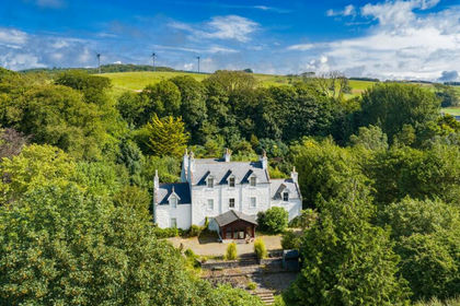
Portpatrick, Stranraer, DG9, Dumfries and Galloway, Dumfries and Galloway DG9 Scotland
Added on 26/08/2026Country Home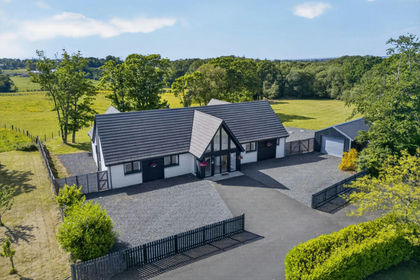
- Price
- Offers Over£595,000
- Size
- 3 acres
Colden Heights, Barquhey Farm, Sundrum, KA6, Ayr, Carrick and Cumnock, South Ayrshire KA6 Scotland
Added on 31/05/2026Country Home
- Price
- Offers Over£695,000
- Size
- 1.75 acres
Fairways, 3 Southwood Road, Troon, KA10, Central Ayrshire, South Ayrshire KA10 Scotland
Added on 01/09/2026House with Land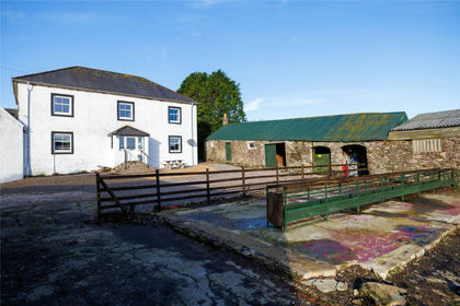
- Price
- Offers Over£495,000
- Size
- 20 acres
Homeston Farm, Campbeltown, PA28, Argyll, Bute and South Lochaber, Argyll and Bute PA28 Scotland
Added on 04/06/2026House with Land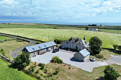
- Price
- Offers Over£630,000
- Size
- 6.67 acres
Added on 08/08/2026House with Land
- Price
- Offers Over£630,000
- Size
- 14.58 acres
Mains of Twynholm, Twynholm, DG6, Dumfries and Galloway, Dumfries and Galloway DG6 Scotland
Added on 02/05/2026Smallholding
- Price
- Offers Over£700,000
- Size
- 16.81 acres
Borgue House, Borgue, Kirkcudbright, DG6, Dumfries and Galloway, Dumfries and Galloway DG6 Scotland
Added on 08/03/2026Country Home
- Price
- Offers Over£595,000
- Size
- 4.3 acres
Nabny, Dundrennan, Kirkcudbright, Dumfries and Galloway, Dumfries and Galloway DG6 Scotland
Added on 29/01/2026House with Land
- Price
- Offers in Excess of£595,000
- Size
- 16.61 acres
Nunland, Lochfoot, Dumfries, DG2, Dumfries and Galloway, Dumfries and Galloway DG2 Scotland
Added on 29/01/2026Cottage
- Price
- Offers Over£599,000
- Size
- 3.2 acres
Added on 11/06/2026House with Land