
Llangynin, St Clears, SA33
- Land size
- 74.3 acres
- Bedrooms
- 4
- Bathrooms
- 3
Key Features
- Secluded and private position surrounded by its own land with no immediate adjoining neighbours
- Residential holding of significant appeal extending to 74.30 acres
- Well presented 3/4 reception room and 4 bedroom residence
- Viewing highly recommended to appreciate setting
- A useful range of outbuildings, suitable for a range of uses
- Wildlife and natural water ponds containing variety of fish
- Air source heating system and solar panels
- 4 miles from St Clears and A40 dual carriageway
Description
A private residential holding extending to approx. 74.30 acres positioned in a quiet and peaceful river valley setting with no immediate neighbours in the heart of the Carmarthenshire countryside.
Overview
Penlan Farm is a private and rural, yet not remote, residential holding extending to approx. 74.30 acres positioned in a quiet and peaceful river valley setting with no immediate neighbours in the heart of the Carmarthenshire countryside.
The property is approached via a meandering private driveway leading to the homestead with a large principal residence. The home has been extended and modernised in recent year and offers flexible living accommodation by means of 3/4-reception rooms on the ground floor, 4-bedrooms, an attic room used as a hobby / craft room on the upper floors, plus a large first floor sun terrace with commanding views over the grounds and beyond.
A detached sunroom / conservatory overlooks the grounds and spring-fed lake, offering excellent amenity and socialising space, plus a residential caravan. A range of useful modern general-purpose outbuildings provide useful car port / garage, workshop, storage and stabling, and suitable for a range of other uses, subject to obtaining the necessary planning consents.
The homestead is set in a central position with the land being ringfenced being a mixture of pastureland, meadows and wildlife and natural ponds containing a variety of fish to include goldfish, koi carp and tench, and amenity woodland, being a swarm for local wildlife and nesting birds, with a further coniferous woodland plantation.
The land comprises a mixture of clean agricultural land suitable for both grazing and cutting, and varies from gently sloping to sloping in nature, extending to approx. 42 acres, with approx. 30 acres of mixed broadleaf woodland being a swarm to local wildlife and nesting birds. The remaining 3 acres of the land incorporates the homestead and tracks.
Situation
The property lies in a quiet rural area affording privacy and seclusion, surrounded by rolling countryside, farmland and woodland, accessed directly off an unclassified highway, some 4 miles north of the small town of St Clears, being home to a range of local amenities and services to include independent stores, eateries, takeaway outlets, convenient stores, doctor's surgery, and primary school. The market town and administrative centre of Carmarthen, is within easy reach, 20 minutes to the south - east, being home to an excellent range of services and amenities, to include high street and independent shops, eateries, national retailers, supermarkets. The A48 / M4 link road can also be reached at Carmarthen, providing excellent links along the M4 corridor and the A40 west towards west Carmarthenshire and Pembrokeshire.
Entrance Conservatory
3.8m x 3.89m (12' 6" x 12' 9")
Entrance door leading into a welcoming entrance conservatory with triple aspect windows and skylight above. Door leading into Entrance Hallway.
Entrance Hallway
2.13m x 4.29m (7' 0" x 14' 1")
Internal hall with staircase leading to the First Floor. Tiled floors. Door leading into the Open Plan Living - Sun Room and Kitchen.
Open Plan Living - Sun Room
Large, extended reception room with solid oak flooring, comprising a cosy lounge area centred around a fireplace with log burner and a separate TV area. A triple-aspect sun room leads off the reception room, enjoying commanding views over the grounds and surrounding countryside and providing an additional seating and dining area.
Lounge Area: 2.95m x 3.90m (9' 8" x 12' 10")
TV Area: 4.45m x 3.64m (14' 7" x 11' 11")
Sun Room: 4.04m x 8.41m (13' 3" x 27' 7")
Kitchen - Breakfast Room
3.92m x 5.45m (12' 10" x 17' 11")
A fitted range of base and wall units with undercounter lights with corian work surfaces comprising a range of integrated appliances to include an NEFF induction hob & oven, a stone fireplace with Stanley oil-fired cooker, corian sink and drainer and pantry cupboard. Tiled flooring.
Rear Kitchen
2.84m x 2.62m (9' 4" x 8' 7")
A further range of base and wall units with work surfaces comprising integrated 5-ring gas hob, with extractor hood above, a stainless steel sink with drainer, dishwasher and pantry pull-out drawers. Tiled flooring and consumer unit.
Rear Hallway
2.73m x 0.80m (8' 11" x 2' 7")
Tiled flooring. Door leading into Utility Room and Wet Room / Cloakroom.
Utility Room
2.70m x 1.83m (8' 10" x 6' 0")
Plumbing for washing machine and room for tumble dryer. Tiled flooring.
Wet Room / Cloakroom
Wet Room: 2.63m x 2.56m (8' 8" x 8' 5")
Wet room style shower
Cloakroom: 2.87m x 0.98m (9' 5" x 3' 3")
WC. Wash Hand Basin.
Fully tiled walls and flooring.
First Floor Landing
1.38m x 2.42m (4' 6" x 7' 11") + 3.38m x 0.98m (11' 1" x 3' 3")
Family Bathroom
2.11m x 1.67m (6' 11" x 5' 6")
Jacuzzi bathtub (corner tub) with overhead shower. Wash hand basin.
Bedroom 1
3.90m x 3.08m (12' 10" x 10' 1")
Patio door leading out to Sun Terrace. Currently used as a reception room. Laminate flooring.
Bedroom 2
3.65m x 3.80m (12' 0" x 12' 6")
Large picture with built in storage cupboards and carpet flooring.
Bedroom 3
3.56m x 2.74m (11' 8" x 9' 0")
Carpet flooring.
Bedroom 4
2.30m x 3.97m (7' 7" x 13' 0")
Carpet flooring. Built-in storage cupboards.
Family Bathroom
Large family bathroom with triple aspect windows housing WC. wash hand basin, bidet, Jacuzzi bathtub and towel rail. Tiled flooring and walls.
Bathroom: 2.83m x 3.75m (9' 3" x 12' 4")
Corridor: 2.06m x 0.75m (6' 9" x 2' 6")
Attic Room
4.31m x 3.65m (14' 2" x 12' 0")
Former window to front.
Skylight.
Garden and Grounds
The property is approached via a meandering private driveway from the highway leading to the homestead with range of buildings, static caravan and access to the land, before reaching the principal farmhouse, with ample parking for multiple vehicles to the rear and side. The grounds include lawns, borders, shrubs, bushes and vegetation, along with several seating / patio areas to sit and enjoy overlooking the grounds, farmland and far reaching views.
Gym
Built of brick and block construction with uPVC windows and doors throughout extending to 4.28m x 6.38m (14' 1" x 20' 11") currently utilised as a gym. Electricity connection.
Sunroom
4.38m x 2.85m (14' 4" x 9' 4")
Built of brick and block construction with uPVC windows and doors throughout extending to4.38m x 2.85m (14' 4" x 9' 4") currently utilised as a sun room. Plumbing for sink and electricity connection.
General Purpose Outbuilding & Workshop
Built of timber construction under a pitched corrugated sheeted roof with felt and batten, along with timber cladding on external elevations and open front elevations, benefitting from concrete flooring and extending to 6.07m x 13.39m (19' 11" x 43' 11"). Benefitting from solar panels on the roof and electricity connection. Adjoining Workshop building extending to 5.84m x 6.04m (19' 2" x 19' 10") with separate uPVC entrance door.
Adjoining Log Store
5.19m x 2.55m (17' 0" x 8' 4")
Built of timber construction under a mono-pitched corrugated sheeted roof with open front and sides with covered plastic sheets.
Tractor / Implement Shed & Rear Stable
Built of timber construction under a pitched corrugated sheeted roof with timber doors with concrete flooring, extending to 4.51m x 9.09m (14' 10" x 29' 10"). A rear loose box stable extending to 3.05m x 4.51m (10' 0" x 14' 10") used as wood store.
Static Caravan
Kitchen - living Room: 3.57m x 5.53m (11' 9" x 18' 2")
Shower Room: 1.04m x 2.21m (3' 5" x 7' 3")
Bed 1: 2.39m x 1.53m (7' 10" x 5' 0")
Bed 2: 3.21m x 2m (10' 6" x 6' 7")
Bed 3: 2.23m x 1.53m (7' 4" x 5' 0")
Farmland and Woodland
Penlan extends to 74.3 acres in total, with the homestead being set in to the Northern edge of the land, being ringfenced, being a mixture of pastureland and sheltered amenity woodland, accessed tracked system which runs through the property.
The grazing land is contained in several paddocks/enclosures, being gently sloping to sloping in nature benefitting from stockproof fencing, whilst the remaining amenity land is a swarm for local wildlife and nesting birds, with parcels of mixed amenity broadleaf woodland parcels.
On the farm's south-eastern boundary lies Pen Y Gaer Fawr, the site of an ancient Iron Age contour fort, characterised by defensive earthworks that follow the natural slope of the hill, this historic location holds significant appeal for archaeology enthusiasts.
Tenure
We understand that the property is held on a Freehold basis, with vacant possession upon completion.
Services
We are advised the property benefits from mains electricity, mains water, newly installed air sourced central heating system and solar panels. None of the services have been tested.
Council Tax Band
Band E Carmarthenshire County Council approx. £2,873.69 for 2026/2027.
Energy Performance Certificate
EPC Rating D (63)
Wayleaves, Easements and Rights of Way
The property is sold subject to and with the benefit of all rights, including rights of way, whether public or private, light, support, drainage, water, and electricity supplies and any other rights and obligations, easements and proposed wayleaves for masts, pylons, stays, cables, drains and water, gas and other pipes, whether referenced or not.
We are advised that there is a public footpath transverses the property.
Plans
A copy of the plan is attached for identification purposes only. The purchasers shall be deemed to have satisfied themselves as to the description of the property. Any error or mis-statement shall not annul a sale or entitle any party to compensation in respect thereof.
Planning
All planning related enquiries to Carmarthenshire County Council Planning Department.
Planning Services, Civic Offices, Crescent Road, Llandeilo, Carmarthenshire SA19 6HW
Tel: 01267 234567
Local Authority
Carmarthenshire County Council, County Hall, Castle Hill, Carmarthen, SA31 1JP.
Tel: 01267 234567
Postcode
Postcode: SA33 4LD
Viewing
Strictly by appointment with sole selling agents Rees Richards & Partners.
Please contact Carmarthen office for further information - 12 Spilman Street, Carmarthen SA31 1LQ.
Tel: 01267 612021
Email: [email protected]
Map Location
Property details
- Tenure
- Freehold
- Council Tax Band
- Ask Agent
- Date Posted
- 2026-09-05
Market Value Analysis
Compared with 81 Farms & Smallholdings listings in Wales (50+ acres).
Energy Performance Certificate
Energy Efficiency Rating
Based on UK Energy Performance Certificate standards (EU Directive 2002/91/EC)
Running costs are one side. Planning activity, flood history and ground risks for this location are in the full report.
Property Brochure
Seen the details? The full report adds the independent checks: planning activity, flood history, heritage and ground.
Utilities & Restrictions
Utilities
- Electricity
- Mains Supply
- Water
- Mains Supply
- Heating
- Air Source Heat Pump
- Broadband
- Ask Agent
- Sewerage
- Private Supply
Rights & Restrictions
- Public Rights of Way
- Ask Agent
- Private Rights of Way
- Ask Agent
- Listed Property
- Ask Agent
- Restrictions
- Ask Agent
Listed status, conservation areas and planning constraints for this location are in the full report.
Property Features
- Accessibility
- Ask Agent
- Parking
- Ask Agent
- Garden
- Ask Agent
Beyond the particulars: planning activity, flood history, heritage and ground risks, checked for this exact spot.
Connectivity
Broadband
Fastest speed available at this postcode
14 Mbps
Standard (10-30 Mbps)
Suitable for
- Web & social
- Music streaming
- Standard video calls
Mobile signal
Predicted 4G and 5G signal; indoor signal depends on building materials.
Ofcom Connected Nations postcode-level predictions. Speeds and signal are modelled, not measured, and vary between addresses and providers.
Signal is the easy part. Planning activity, flood history and protected designations here are in the full report.
Nearest Schools
Primary
- Meidrim2.3 miles
- Pupils
- 31
- Type
- Infants & Juniors
- Language
- Welsh medium school / provision (including transitional)
- Bro Brynach2.9 miles
- Pupils
- 90
- Type
- Nursery, Infants & Juniors
- Language
- Welsh medium school / provision (including transitional)
- Griffith Jones3.3 miles
- Pupils
- 297
- Type
- Nursery, Infants & Juniors
- Language
- Dual language school / provision (Welsh and English) (including transitional)
- Llys Hywel4.5 miles
- Pupils
- 135
- Type
- Infants & Juniors
- Language
- Dual language school / provision (Welsh and English) (including transitional)
- Bancyfelin4.6 miles
- Pupils
- 65
- Type
- Nursery, Infants & Juniors
- Language
- Welsh medium school / provision (including transitional)
Secondary
- Dyffryn Taf4.6 miles
- Pupils
- 890
- Type
- Secondary (ages 11-19)
- Language
- Dual language school / provision (Welsh and English) (including transitional)
- Ysgol Bro Preseli8.9 miles
- Pupils
- 932
- Type
- Middle (ages 3-19)
- Language
- Welsh medium school / provision (including transitional)
- Queen Elizabeth High School9.1 miles
- Pupils
- 1,289
- Type
- Secondary (ages 11-19)
- Language
- English medium school / provision
- Ysgol Gyfun Gymraeg Bro Myrddin9.8 miles
- Pupils
- 929
- Type
- Secondary (ages 11-19)
- Language
- Welsh medium school / provision (including transitional)
- Ysgol Gyfun Emlyn12 miles
- Pupils
- 502
- Type
- Secondary (ages 11-19)
- Language
- Dual language school / provision (Welsh and English) (including transitional)
Distances are straight-line from the advertised location. Source: the national school registers (DfE, Welsh Government, Scottish Government) and Ofsted.
Schools are just the start: sold prices nearby, planning activity and any flood history are in the full report.
Amenities
Supermarket
GP surgery
Pharmacy
Straight-line distances from the advertised location. Sources: NHS records, Geolytix supermarket locations, OS Open Greenspace and the national trails registers.
The area stacks up? Now check the location itself: planning nearby, protected designations and past flooding.
Getting Around
Nearest station
Nearest bus stop
Typical drive times
Straight-line distances from the advertised location; drive times are typical free-flow times over OpenStreetMap road data, so allow more at peak. Public transport locations from DfT NaPTAN.
Easy to reach matters. So do planning activity, flood history and ground risks: all in the full report.
Flood Risk
Natural Resources Wales open data, checked around the advertised map pin for the listed acreage. Long-term risk counts flood defences; the planning map's flood zones do not. Provided by LandSale, not the listing agent, and not part of the agent's particulars. Risk varies across a holding, so verify before committing.
Rivers and the sea
Planning map: Flood Zone 1.
Surface water
Not at the pin: mapped about 40 metres away.
These bandings are the summary. Where this location sits on the flood maps, plus planning activity, heritage and ground risks, is in the full report.
Important notice: Information, maps and tags on this page are drawn from the advertising agent's marketing materials or generated automatically. LandSale has not verified them. Relying on these details is at your own risk, always carry out independent checks before committing to a purchase.
LandSale full disclaimer
Marketing information only - not formal particulars. The details on this website are provided for general guidance and do not constitute an offer or contract. Neither LandSale nor the advertising estate/land agent accepts responsibility for any inaccuracy.
1. Source of information
- Listing content: Core description, asking price, tenure, measurements, photographs and planning history originate from the marketing materials of the advertising estate or land agent. LandSale does not author this content and cannot guarantee its accuracy.
- Automated tags & categorisation: Property type, land-use class, acreage bands and similar labels may be applied by machine-learning models. They are intended as a helpful guide only and may not reflect the property's legal status or permitted use.
- Third-party & enriched data layers: Maps, boundary outlines, planning designations, soil reports, broadband coverage and other environmental or location-based insights are licensed from external suppliers. Such data are supplied “as is", may be incomplete or out of date and are subject to change without notice.
2. Verification required
Prospective purchasers must verify critical matters, including but not limited to planning permission, title boundaries, public rights of way, environmental constraints, acreage, services, access and VAT status, through their own inspections, specialist surveys, legal advisers and the selling agent before relying on the information or entering into any contract.
3. No warranty or liability
LandSale gives no warranty, express or implied, as to the accuracy, completeness or fitness for any particular purpose of the information displayed. LandSale shall not be liable for any loss, damage, cost or expense arising directly or indirectly from any use of or reliance on such information, save where liability may not be excluded by law.
4. Updates & feedback
If you believe any detail on this listing is inaccurate, please let us know. We will investigate and, where appropriate, update the listing or notify the agent.
© LandSale | Version 1.3 - August 2026
Similar properties for sale
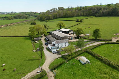
- Price
- Guide Price£1,295,000
- Size
- 114 acres
Trevaughan, Whitland, SA34, Whitland, Carmarthenshire SA34 Wales
Added on 20/05/2026Livestock Farm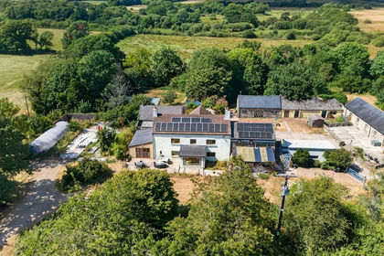
- Price
- Offers in Region of£900,000
- Size
- 48 acres
Added on 04/08/2026Smallholding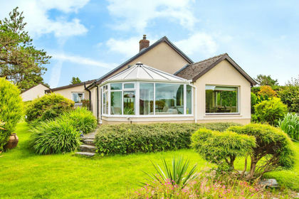
- Price
- Offers in Region of£900,000
- Size
- 47 acres
Tegryn, Llanfyrnach CARDIGAN SA35, Clydau, Pembrokeshire SA35 Wales
Added on 29/01/2026Smallholding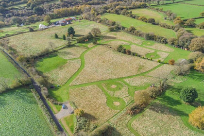
- Price
- £1,295,000
- Size
- 49 acres
Saron, Llandysul, SA44, Llangeler, Carmarthenshire SA44 Wales
Added on 29/01/2026Multiple Dwelling Property
- Price
- £1,000,000
- Size
- 50 acres
Eglwyswrw, Crymych, SA41, Eglwyswrw, Pembrokeshire SA41 Wales
Added on 30/05/2026Farm
- Price
- £1,495,000
- Size
- 173 acres
Bancyffordd, Llandysul, SA44, Llandysul, Carmarthenshire SA44 Wales
Added on 29/01/2026Farm
- Price
- £1,500,000
- Size
- 52.83 acres
Nantgaredig, Carmarthen, SA32, Llanegwad, Carmarthenshire SA32 Wales
Added on 08/08/2026Smallholding
- Price
- £1,295,000
- Size
- 80 acres
Caerwedros, Llandysul, SA44, Llandysul, Ceredigion SA44 Wales
Added on 29/07/2026Smallholding
- Price
- £995,000
- Size
- 37 acres
Cross Inn, New Quay, SA44, Llanllwchaiarn, Ceredigion SA44 Wales
Added on 02/07/2026Smallholding
- Price
- Guide Price£1,250,000
- Size
- 210 acres
Added on 29/01/2026Farm