Hillcrest House, Thorpe
- Land size
- 3.5 acres
- Bedrooms
- 10
- Bathrooms
- 10
Key Features
- Detached House
- Ten Bedrooms
- Completely Renovated
- Run as a Large Holiday Property
- Ample Off Road Parking
- 3.5 Acres
- Stunning Views
- All Enquiries to Ashbourne Office
Description
A opportunity to purchase an impressive ten bedroom property which has undergone renovation and is currently run as a large holiday property with ample off road parking and approximately 3.5 acres
Description - A superb opportunity to purchase an impressive ten bedroom property which has undergone complete renovation over recent years and is currently run as a large holiday property with two hot tubs and a sauna with ample off road parking and pastureland land extending to 3.5acres.
Idyllically situated at the foot of Thorpe Cloud in the heart of the beautiful Peak District National Park close to the popular Dovedale valley which has the iconic Stepping Stones.
Thorpe is just three miles from the historic market town of Ashbourne which has a good range of local amenities which appeal to tourists and local occupants alike. Thorpe itself has a well considered village public house, ‘The Old Dog’ which is close to the Tissington Trail which leads from Ashbourne to Hartington and is popular with cyclists.
Viewings essential to appreciate the extent of the accommodation and truly stunning location.
The picturesque village of Brassington is well provided for with a primary school, playing field, church and two public houses with the popular Carsington Water within 3miles.
The land ascends along the hillside from the property to the North West and is accessed from the yard.
An additional 2.88 acres with separate gated access is available by separate negotiation.
Viewing is essential to appreciate the location and full extent of the holding on offer
Reception Areas - The property is blessed with many versatile rooms all of which have been completely renovated. The Main Entrance Hall has stairs leading off to the main staircase leading to the first floor. Internal access door leads to the Spacious Dining Area which provides seating for 22 being open plan to the Sitting Room currently used a and further versatile reception room Second Sitting Room with built in storage and views across the lane towards Thorpe Cloud. Internal door leads through to refitted Breakfast Kitchen having a comprehensive range of recently fitted wall, drawer and base units and separate central island with Breakfast Bar and double doors opening out onto the patio.
An internal door leads off into the West wing which was previously a separate annex with independent access but is now an integral part of the property although the independent external access into the West wing remain. The Side Hall provides access to a further versatile reception room currently used as a Snug. Stairs lead from the Side Hall to the first floor.
Accessed from the Side Hall is a convenient Shower Room ideally located for use in conjunction with the hot tubs and Sauna being situated next to the rear door which provides access to the covered hot tub and sauna complex.
Bedrooms - The bedrooms are located in different locations throughout the house and most have recently refitted ensuite shower rooms. Adjacent to the main Entrance Hall is an accessibility suite which has a separate sitting area and ensuite shower room.
The West wing has bedrooms to the ground floor and two to the first floor with a refitted bathroom serving both these bedrooms.
On the first floor of the main house accessed from the main stairs are three further double bedrooms, all with refitted fully tiled ensuite shower rooms and enjoying stunning views in every direction.
The stairs lead up from the first floor landing to the second floor where there is a split level landing accessing three further double bedrooms two with ensuite shower rooms and one bedroom serviced by a separate shower room.
Hot Tubs And Sauna Building - A delightfully situated purpose built covered Hot Tub and sauna is situated in the garden and enjoys stunning views over the flattened peak of Thorpe Cloud. The hot tubs are set next to each other within a raised decked platform. within the complex is a changing area behind glazed double doors which provides useful changing and storage space whilst using the facilities. this room also provides access to the enclosed sauna with seating.
This is a truly stunning setting for a property of this type and will be hard placed to be more idyllically situated.
Externally - Gardens And Land - The property is accessed from the land through a gated driveway leading to the hardstanding providing vast amounts of parking for a number of vehicles. There is gated access from the hardstanding leading to the fields or alternatively a separate gated access for agricultural use.
The gardens are predominantly to the west of the property and enjoy a southern aspect with a paved seating area immediately outside the property with good sized lawned garden enclosed by hedging and fencing.
The pastureland is situated to the south of the property and extends to about 3 acres. It provides fairly level pasture which would be suitable for grazing and mowing alike. The paddock is enclosed by drystone walling and fencing and also enjoys the views across the valley or up at the flattened peak of Thorpe Cloud.
General Information -
Services - Mains water, drainage and electricity. Oil fired central heating.
Tenure And Possession - The property is sold Freehold with vacant possession.
Rights Of Way, Wayleaves And Easements - The property is sold subject to and with the benefit of all rights of way, easements and wayleaves whether or not defined in these particulars.
Fixtures And Fittings - Only those fixtures and fittings referred to in the sale particulars are included in the purchase price. Bagshaws have not tested any equipment, fixtures, fittings or services and no guarantee is given that they are in good working order.
Local Authority - Derbyshire Dales District Council
Directions - What3words:: ///fitting.brightens.rally
Viewings - Strictly by appointment through the Ashbourne Office of Bagshaw's as sole agents on or e-mail: .
Broadband Connectivity - It is understood that the property currently benefits from excellent broadband connectivity. However, please note that connection speeds may vary. For an estimated broadband coverage, prospective purchasers are advised to consult
Mobile Network Coverage - The property is well-situated for mobile signal coverage and is expected to be served by a broad range of providers. Prospective purchasers are encouraged to consult the Ofcom website ( to obtain an estimate of the signal strength for this specific location.
Agents Notes - Bagshaws LLP have made every reasonable effort to ensure these details offer an accurate and fair description of the property. The particulars are produced in good faith, for guidance only and do not constitute or form an offer or part of the contract for sale. Bagshaws LLP and their employees are not authorised to give any warranties or representations in relation to the sale and give notice that all plans, measurements, distances, areas and any other details referred to are approximate and based on information available at the time of printing.
Map Location
Property details
- Tenure
- Freehold
- Council Tax Band
- H
- Date Posted
- 2026-09-04
Market Value Analysis
Compared with 697 Homes with Land listings in East Midlands (1+ acres).
Utilities & Restrictions
Utilities
- Electricity
- Ask Agent
- Water
- Ask Agent
- Heating
- Ask Agent
- Broadband
- Ask Agent
- Sewerage
- Ask Agent
Rights & Restrictions
- Public Rights of Way
- Ask Agent
- Private Rights of Way
- Ask Agent
- Listed Property
- Ask Agent
- Restrictions
- Ask Agent
Listed status, conservation areas and planning constraints for this location are in the full report.
Property Features
- Accessibility
- Ask Agent
- Parking
- Parking Available
- Garden
- Garden
Beyond the particulars: planning activity, flood history, heritage and ground risks, checked for this exact spot.
Connectivity
Broadband
Fastest speed available at this postcode
61 Mbps
Superfast
Suitable for
- HD streaming
- Video calls
- Web & social
Mobile signal
Predicted 4G and 5G signal; indoor signal depends on building materials.
Ofcom Connected Nations postcode-level predictions. Speeds and signal are modelled, not measured, and vary between addresses and providers.
Signal is the easy part. Planning activity, flood history and protected designations here are in the full report.
Nearest Schools
Primary
- Ilam Church of England Primary School1.2 milesOfsted: Good
- Ages
- 3 to 11
- Pupils
- 40
- Type
- Academy converter
- Faith
- Church of England
- Fitzherbert CofE (Aided) Primary School1.4 milesNo Ofsted rating
- Ages
- 5 to 11
- Pupils
- 48
- Type
- Voluntary aided school
- Faith
- Church of England
- St Oswald's CofE Primary School2.9 milesNo Ofsted rating
- Ages
- 5 to 11
- Pupils
- 204
- Type
- Voluntary controlled school
- Faith
- Church of England
- Ashbourne Primary School3 milesOfsted: Good
- Ages
- 3 to 11
- Pupils
- 202
- Type
- Academy converter
- Parwich Primary School3.2 milesOfsted report card · Jun 2026
- Ages
- 4 to 11
- Pupils
- 25
- Type
- Community school
Secondary
- Queen Elizabeth's Grammar School2.8 milesNo Ofsted rating
- Ages
- 11 to 18
- Pupils
- 1,276
- Type
- Academy converter
- Faith
- Christian
- Ryecroft CofE Middle School7.2 milesNo Ofsted rating
- Ages
- 9 to 13
- Pupils
- 201
- Type
- Academy converter
- Faith
- Church of England
- The JCB Academy7.5 milesOfsted: Good
- Ages
- 13 to 19
- Pupils
- 781
- Type
- University technical college
- Anthony Gell School8.6 milesNo Ofsted rating
- Ages
- 11 to 18
- Pupils
- 776
- Type
- Academy converter
- Painsley Catholic College10 milesOfsted: Good
- Ages
- 11 to 18
- Pupils
- 1,340
- Type
- Academy converter
- Faith
- Roman Catholic
Distances are straight-line from the advertised location. Source: the national school registers (DfE, Welsh Government, Scottish Government) and Ofsted.
Schools are just the start: sold prices nearby, planning activity and any flood history are in the full report.
Amenities
Supermarket
GP surgery
Pharmacy
Hospital
Straight-line distances from the advertised location. Sources: NHS records, Geolytix supermarket locations, OS Open Greenspace and the national trails registers.
The area stacks up? Now check the location itself: planning nearby, protected designations and past flooding.
Getting Around
Nearest station
Nearest bus stop
Typical drive times
Straight-line distances from the advertised location; drive times are typical free-flow times over OpenStreetMap road data, so allow more at peak. Public transport locations from DfT NaPTAN.
Easy to reach matters. So do planning activity, flood history and ground risks: all in the full report.
Flood Risk
Environment Agency open data, checked around the advertised map pin for the listed acreage. Long-term risk counts flood defences; the planning map's flood zones do not. Provided by LandSale, not the listing agent, and not part of the agent's particulars. Risk varies across a holding, so verify before committing.
Rivers and the sea
Planning map: Flood Zone 1.
Surface water
These bandings are the summary. Where this location sits on the flood maps, plus planning activity, heritage and ground risks, is in the full report.
Important notice: Information, maps and tags on this page are drawn from the advertising agent's marketing materials or generated automatically. LandSale has not verified them. Relying on these details is at your own risk, always carry out independent checks before committing to a purchase.
LandSale full disclaimer
Marketing information only - not formal particulars. The details on this website are provided for general guidance and do not constitute an offer or contract. Neither LandSale nor the advertising estate/land agent accepts responsibility for any inaccuracy.
1. Source of information
- Listing content: Core description, asking price, tenure, measurements, photographs and planning history originate from the marketing materials of the advertising estate or land agent. LandSale does not author this content and cannot guarantee its accuracy.
- Automated tags & categorisation: Property type, land-use class, acreage bands and similar labels may be applied by machine-learning models. They are intended as a helpful guide only and may not reflect the property's legal status or permitted use.
- Third-party & enriched data layers: Maps, boundary outlines, planning designations, soil reports, broadband coverage and other environmental or location-based insights are licensed from external suppliers. Such data are supplied “as is", may be incomplete or out of date and are subject to change without notice.
2. Verification required
Prospective purchasers must verify critical matters, including but not limited to planning permission, title boundaries, public rights of way, environmental constraints, acreage, services, access and VAT status, through their own inspections, specialist surveys, legal advisers and the selling agent before relying on the information or entering into any contract.
3. No warranty or liability
LandSale gives no warranty, express or implied, as to the accuracy, completeness or fitness for any particular purpose of the information displayed. LandSale shall not be liable for any loss, damage, cost or expense arising directly or indirectly from any use of or reliance on such information, save where liability may not be excluded by law.
4. Updates & feedback
If you believe any detail on this listing is inaccurate, please let us know. We will investigate and, where appropriate, update the listing or notify the agent.
© LandSale | Version 1.3 - August 2026
Similar properties for sale
- Price
- £1,350,000
- Size
- 1.75 acres
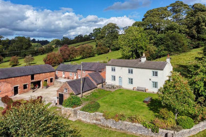
Callow End Farm, Mappleton, Mapleton, Derbyshire DE6 England
Added on 29/01/2026House with Land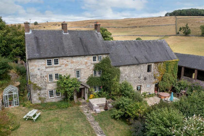
- Price
- Guide Price£1,500,000
- Size
- 9.14 acres
Roystone Grange Farm, Pikehall, Matlock, Ballidon, Derbyshire DE4 England
Added on 17/08/2026House with Land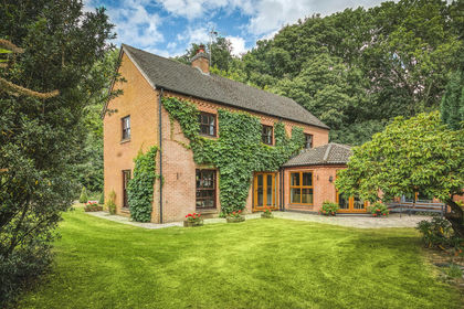
- Price
- £1,250,000
- Size
- 7.3 acres
Added on 29/01/2026House with Land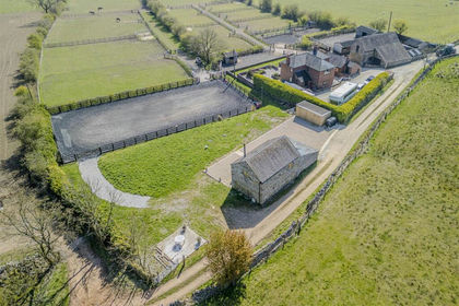
- Price
- Offers in Excess of£1,250,000
- Size
- 8.37 acres
Butterton, Leek, ST13, Butterton, Staffordshire ST13 England
Added on 12/10/2026Smallholding
- Price
- Offers in Region of£1,300,000
- Size
- 1.79 acres
Jeffrey Meadows Farm, Nabb Lane, Alton, Alton, Staffordshire ST10 England
Added on 18/08/2026Development Land
- Price
- Offers in Excess of£1,300,000
- Size
- 9.5 acres
Old Furnace Farm, Oakamoor, Stoke-On-Trent, Oakamoor, Staffordshire ST10 England
Added on 10/05/2026House with Land
- Price
- £1,100,000
- Size
- 2.5 acres
Waldley, Nr Ashbourne, Derbyshire, Doveridge, Derbyshire DE6 England
Added on 29/01/2026Barn Conversion
- Price
- Offers in Region of£1,400,000
- Size
- 7.5 acres
Alton Road, Threapwood, Staffordshire, Alton, Staffordshire ST10 England
Added on 25/04/2026House with Land
- Price
- Guide Price£1,250,000
- Size
- 3.56 acres
Sandiways, Ashbourne, Derbyshire, Mercaston, Derbyshire DE6 England
Added on 22/04/2026House with Land
- Price
- Guide Price£1,650,000
- Size
- 5.75 acres
Shawfields Farm, Reapsmoor, Longnor, Longnor, Staffordshire SK17 England
Added on 14/08/2026House with Land