Dallinghoo, Woodbridge, Suffolk, IP13
- Land size
- 1 acres
- Bedrooms
- 4
- Bathrooms
- 3
Key Features
- Rural edge of village setting just 3½ miles from Woodbridge
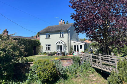
- Picturesque Grade II Listed farmhouse amidst mature gardens & grounds
- 2.737 sq ft with 2 principal reception rooms & study
- Impressive bespoke conservatory
- Kitchen/breakfast room & utility room
- 4 bedrooms with the potential for a 5th plus 2 bathrooms (1 en suite)
- Flexible use, self-contained annexe/at home office with sitting room, kitchenette, shower room & bedroom (income providing potential)
- Double cart lodge & log store, range of timber potting sheds, stores & 50ft glass house with raised beds
- Mature & colourful landscaped gardens with a large pond & numerous oak, cherry & lime trees
- In all about 1 acre
Description
A picturesque farmhouse, complete with guest annexe, sitting amidst mature gardens in an edge of village setting close to Woodbridge.
Pound Corner House is Listed Grade II and understood to date from the 17th Century. Well-presented throughout, the property displays great character and ambience with a wealth of exposed timbers.
The accommodation, which is arranged on three floors, benefits from an oil-fired central heating and security systems.
An atmospheric sitting room with a brick fireplace and wood burning stove, has double doors linking to a panelled study, as well as an impressive bespoke conservatory, which enjoys views across the gardens. The well-proportioned living/dining room enjoys views across the front garden, has a brick fireplace and is open plan into the kitchen/breakfast room. The fully equipped bespoke kitchen by Ashford and Brooks, features oak units, granite surfaces, a pantry cupboard and an AGA, whilst the utility room, which sits beyond, has further built-in units and work surfaces, together with an external door.
From the reception hall a winder staircase accesses the three first floor double bedrooms, all of which enjoy views across the gardens, together with both family and en suite bathrooms. The second floor, open to the roof apex, presents an open plan fourth bedroom, together with the opportunity to sub-divide to create further bedroom.
OUTSIDE
ANNEXE BARN/AT HOME OFFICE
Electronically controlled wrought iron gates on brick piers access a wide shingled driveway fronting onto which, on one side, is a self-contained barn annexe/at home office which has an open plan living room, kitchenette, separate shower room and bedroom. Adjacent is a timbered garden store/equipment shed, whilst on the other side of the driveway is a two-bay cart lodge garage and lean-to log store.
GARDENS & GROUNDS
Pound Corner House sits well amidst, picturesque and colourful gardens. Enclosed by natural hedgerow and bordered by a series of fine oak trees, they include lawns which are bordered by well-stocked herbaceous and shrub borders. A footbridge crosses a small stream which runs through to a large pond which is overhung by further mature trees and from where there are fine views over the surrounding countryside. There are storage, potting and tool sheds, together with a long glasshouse. To the rear of the house is a wide terrace, with pathways around to the front, where the lawned gardens and a delightful wildflower meadow are enclosed by natural hedgerow and include further oak and cherry trees. In all the property extends to 1 acre.
LOCATION
Pound Corner House enjoys a rural setting within the parish of Dallinghoo, between the village and neighbouring Bredfield, both of which have active local communities. The property is conveniently located for easy access to the popular riverside town of Woodbridge (3½ miles) which together with the county town of Ipswich (12 miles to the west) provides a full range of local shopping and commercial facilities. Educationally there is a choice of top performing schools in both the state and private sectors and recreationally a wide choice of sports and social clubs including tennis, football and rugby, as well as a variety of golf courses on the edge of each town, whilst the east coast estuaries provide varied water sport opportunities.
There are regular school bus services running to Woodbridge and rail services run from both towns to London’s Liverpool Street Station, whilst the A12, which bypasses Woodbridge is accessible just beyond Bredfield and connects through to London’s M25 as well as both Cambridge and The Midlands (via the A14).
DISTANCES
Woodbridge - 3½ miles
Ipswich - 12 miles (London Liverpool Street Station 70 mins approx)
DIRECTIONS (IP13 0LL)
From the A12 as it bypasses Woodbridge, continue beyond the Melton road roundabout on the single carriageway stretch, turning off to the left where signed to Bredfield. Proceed into the village and turn right at the wrought iron sign. Continue beyond the village church and out into open countryside. After passing through a 90-degree left-hand bend, proceed for a further 500 yards, where the entrance to Pound Corner House will be found on the right-hand side immediately before a 90 degree right-hand bend.
What3words: technical.afraid.credible
AGENT'S NOTE
Storm Babet 2023: Please speak to selling agents prior to booking a viewing.
PROPERTY INFORMATION
Services: Mains electricity and water are connected to the property. Private drainage system.
Broadband: Ofcom reports ultrafast broadband is available at the property.
Mobile: Ofcom reports mobile signal is likely at the property.
Council Tax: Band F. East Suffolk Council.
Fixtures and Fittings: Items regarded as fixtures and fittings, including carpets and curtains, are initially excluded from the sale, although certain items may be available by separate negotiation.
Viewings: By appointment with Jackson-Stops
Map Location
Property details
- Tenure
- Freehold
- Council Tax Band
- F
- Date Posted
- 2026-09-01
Market Value Analysis
Compared with 1,142 Homes with Land listings in East Anglia (1+ acres).
Utilities & Restrictions
Utilities
- Electricity
- Mains
- Water
- Mains
- Heating
- Electric Heating, Oil Heating
- Broadband
- Full Fibre (FTTP)
- Sewerage
- Septic Tank / Private
Rights & Restrictions
- Public Rights of Way
- Ask Agent
- Private Rights of Way
- Ask Agent
- Listed Property
- Yes
- Restrictions
- Ask Agent
Listed status, conservation areas and planning constraints for this location are in the full report.
Property Features
- Accessibility
- Ask Agent
- Parking
- Parking Available
- Garden
- Garden
Beyond the particulars: planning activity, flood history, heritage and ground risks, checked for this exact spot.
Connectivity
Broadband
Fastest speed available at this postcode
1.8 Gbps
Gigabit full fibre
Suitable for
- 4K streaming on every screen
- Full-time home working
- Online gaming & big downloads
Mobile signal
Predicted 4G and 5G signal; indoor signal depends on building materials.
Ofcom Connected Nations postcode-level predictions. Speeds and signal are modelled, not measured, and vary between addresses and providers.
Signal is the easy part. Planning activity, flood history and protected designations here are in the full report.
Nearest Schools
Primary
- Charsfield Church of England Primary School1.7 milesNo Ofsted rating
- Ages
- 4 to 11
- Pupils
- 34
- Type
- Academy converter
- Faith
- Church of England
- Wickham Market Primary School2.1 milesNo Ofsted rating
- Ages
- 3 to 11
- Pupils
- 163
- Type
- Academy converter
- Melton Primary School2.6 milesOfsted report card · Jan 2026
- Ages
- 3 to 11
- Pupils
- 163
- Type
- Community school
- Easton Primary School2.8 milesNo Ofsted rating
- Ages
- 5 to 11
- Pupils
- 73
- Type
- Academy converter
- Woodbridge Primary School2.9 milesOfsted: Good *
- Ages
- 3 to 11
- Pupils
- 209
- Type
- Community school
Secondary
- Farlingaye High School2.8 milesOfsted report card · May 2026
- Ages
- 11 to 18
- Pupils
- 1,861
- Type
- Academy converter
- Kesgrave High School5.9 milesOfsted: Good
- Ages
- 11 to 18
- Pupils
- 1,875
- Type
- Academy converter
- Thomas Mills High School & Sixth Form6.1 milesOfsted: Good
- Ages
- 11 to 18
- Pupils
- 1,056
- Type
- Academy converter
- St Alban's Catholic High School7.2 milesOfsted: Good
- Ages
- 11 to 18
- Pupils
- 967
- Type
- Academy converter
- Faith
- Roman Catholic
- Northgate High School7.4 milesOfsted: Good *
- Ages
- 11 to 18
- Pupils
- 1,750
- Type
- Community school
* Latest graded judgement covers quality of education only; no overall grade was issued under the 2024-25 inspection framework.
Distances are straight-line from the advertised location. Source: the national school registers (DfE, Welsh Government, Scottish Government) and Ofsted.
Schools are just the start: sold prices nearby, planning activity and any flood history are in the full report.
Amenities
Supermarket
GP surgery
Pharmacy
Hospital
Straight-line distances from the advertised location. Sources: NHS records, Geolytix supermarket locations, OS Open Greenspace and the national trails registers.
The area stacks up? Now check the location itself: planning nearby, protected designations and past flooding.
Getting Around
Nearest station
Nearest bus stop
Typical drive times
Straight-line distances from the advertised location; drive times are typical free-flow times over OpenStreetMap road data, so allow more at peak. Public transport locations from DfT NaPTAN.
Easy to reach matters. So do planning activity, flood history and ground risks: all in the full report.
Flood Risk
Environment Agency open data, checked around the advertised map pin for the listed acreage. Long-term risk counts flood defences; the planning map's flood zones do not. Provided by LandSale, not the listing agent, and not part of the agent's particulars. Risk varies across a holding, so verify before committing.
Rivers and the sea
Planning map: Flood Zone 1.
Surface water
Not at the pin: mapped about 10 metres away.
These bandings are the summary. Where this location sits on the flood maps, plus planning activity, heritage and ground risks, is in the full report.
Important notice: Information, maps and tags on this page are drawn from the advertising agent's marketing materials or generated automatically. LandSale has not verified them. Relying on these details is at your own risk, always carry out independent checks before committing to a purchase.
LandSale full disclaimer
Marketing information only - not formal particulars. The details on this website are provided for general guidance and do not constitute an offer or contract. Neither LandSale nor the advertising estate/land agent accepts responsibility for any inaccuracy.
1. Source of information
- Listing content: Core description, asking price, tenure, measurements, photographs and planning history originate from the marketing materials of the advertising estate or land agent. LandSale does not author this content and cannot guarantee its accuracy.
- Automated tags & categorisation: Property type, land-use class, acreage bands and similar labels may be applied by machine-learning models. They are intended as a helpful guide only and may not reflect the property's legal status or permitted use.
- Third-party & enriched data layers: Maps, boundary outlines, planning designations, soil reports, broadband coverage and other environmental or location-based insights are licensed from external suppliers. Such data are supplied “as is", may be incomplete or out of date and are subject to change without notice.
2. Verification required
Prospective purchasers must verify critical matters, including but not limited to planning permission, title boundaries, public rights of way, environmental constraints, acreage, services, access and VAT status, through their own inspections, specialist surveys, legal advisers and the selling agent before relying on the information or entering into any contract.
3. No warranty or liability
LandSale gives no warranty, express or implied, as to the accuracy, completeness or fitness for any particular purpose of the information displayed. LandSale shall not be liable for any loss, damage, cost or expense arising directly or indirectly from any use of or reliance on such information, save where liability may not be excluded by law.
4. Updates & feedback
If you believe any detail on this listing is inaccurate, please let us know. We will investigate and, where appropriate, update the listing or notify the agent.
© LandSale | Version 1.3 - August 2026
Listing agent
Jackson-Stops, Ipswich
15 Tower Street, Ipswich, IP1 3BE
Similar properties for sale
- Price
- Offers Over£600,000
- Size
- 3 acres
Added on 18/04/2026House with Land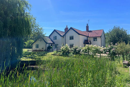
- Price
- Guide Price£975,000
- Size
- 2.2 acres
Added on 26/04/2026House with Land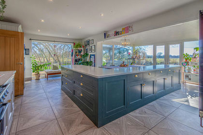
- Price
- Guide Price£850,000
- Size
- 2 acres
High Street, Wickham Market, IP13, Wickham Market, Suffolk IP13 England
Added on 12/04/2026House with Land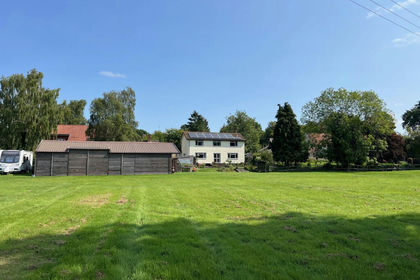
- Price
- Guide Price£650,000
- Size
- 6.5 acres
Easton, Near Framlingham, Suffolk, Easton, Suffolk IP13 England
Added on 29/01/2026House with Land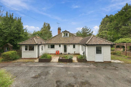
- Price
- Guide Price£685,000
- Size
- 1.5 acres
Sheepdrift Road, Bromeswell, IP12, Bromeswell, Suffolk IP12 England
Added on 18/09/2026House with Land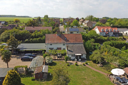
- Price
- Guide Price£715,000
- Size
- 3.14 acres
Parham, Nr Framlingham, Suffolk, Parham, Suffolk IP13 England
Added on 31/05/2026House with Land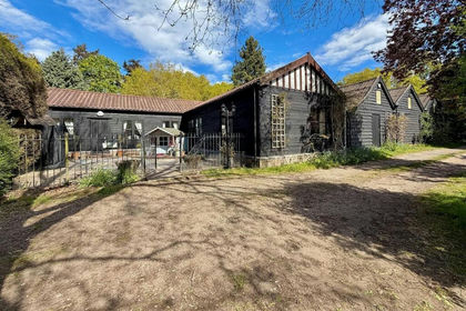 Added on 03/10/2026Barn Conversion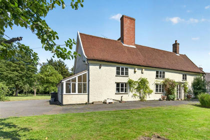
- Price
- Guide Price£695,000
- Size
- 1.25 acres
Framlingham, Woodbridge, Suffolk, IP13, Framlingham, Suffolk IP13 England
Added on 10/09/2026House with Land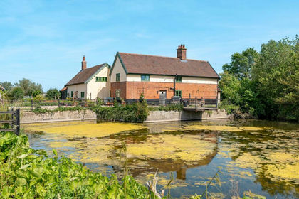
- Price
- Offers Over£900,000
- Size
- 3 acres
Added on 07/06/2026Farmhouse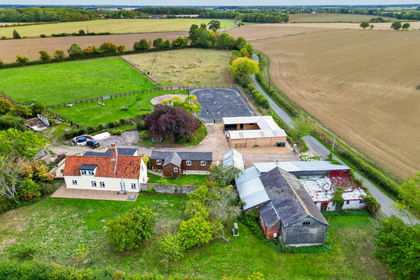
- Price
- Guide Price£945,000
- Size
- 6.9 acres
Parham, Woodbridge, Suffolk, IP13, Parham, Suffolk IP13 England
Added on 02/10/2026House with Land