Gladestry, Kington
- Bedrooms
- 6
- Bathrooms
- 4
Key Features
- Three bedrooms in each barn
- Separate home office / workshop
- Excellent income potential
- Internal lift in Brookside Barn
- Viewing recommended
Description
In the centre of the village, two individual barn conversions which are ideal for multi-generational living or income generation, both offering comfortable and adaptable living space.
Situation and Description
The rural village of Gladestry, lies close to Offas Dyke Path which is very popular with walkers from around the world and roughly follows the border between England and Wales. The village is a mixture of individual houses and cottages, which, cluster below a pretty village church, along with a highly regarded primary school and a popular village pub. Shopping facilities are then available at the bustling mark.et town of Kington, which lies just under 6 miles away and offers a supermarket, shops, cafes and restaurants, a schools and a modern medical centre, to name but a few.
The Courtyard Barns comprise of two individual stone barns which each offer comfortable and energy-improved living space which would be suitable for multi-generational living, or for producing an income. Both barns offer three bedrooms and two shower rooms and have good-sized living areas on the ground floor. Other features include double-glazing, electric heating and the benefit from three solar arrays, which we understand produced an income of around £5,500 last year. The feed in tariff is also index linked and runs until 2034. One of the barns also has a lift connecting the ground and first floor which is ideal for someone with mobility issues.
On arrival, a double carport offers covered parking with power and lighting and has a fast EV charging point. A pathway then leads to a walk-through garden room which has Bi-fold doors to either end and a fitted solid fuel Nordica range cooker for those colder evenings. A double-glazed door then opens into Brookside Barn and a kitchen/breakfast which offers plenty of work and cupboard space and includes a number of fitted appliances. At one end the kitchen continues into an impressive living area with large, glazed windows overlooking the rear courtyard, windows and doors to the front, decorative fireplace, Stiltz lift to first floor and attractive spiral staircase. The ground floor space is then supported by a useful utility room/cloakroom with WC, sink and fitted Elecktra boiler.
On the first floor there are three individual bedrooms, all with vaulted ceilings as well as an en-suite shower room to the main bedroom and a family shower room.
From the garden room, Bi-fold doors lead to the inner courtyard garden with a Gazebo and very useful studio or workshop, which is insulated and could also be used as a home office. A pathway then leads to The Courtyard Barn which can also be accessed by a pedestrian gate from the village road.
Also offering three double bedrooms, along with an en-suite and a family shower room, this barn is slightly smaller but still offers very comfortable living space, which would be ideal for extended family, teenagers to have their own space, or as an Air B&B.
It has a good-sized living area, dining room and fitted kitchen and again the property is double glazed and has electric heating.
Outside
The central courtyard between the two barns is very well enclosed and secure on all sides and a lovely space for family barbecues. At the front of Brookside Barn there is a south facing sun terrace and again stone walling on either side, ample parking and a lawned area.
Services and Considerations
Tenure Freehold
Mains electricity and water are connected.
Heating is via an electric combination boiler in Brookside Barn and electric heaters in The Courtyard Barn. There is an air-to-air heat pump in Brookside Barn and the Studio/Workshop.
Fast EV charger
Private drainage to a Biodisc treatment plant
Council Tax Band The Courtyard Barn C
Council Tax Band Brookside Barn E
EPC Rating The Courtyard Barn D 61/85
EPC Rating Brookside Barn E 53/54
Broadband
Mobile Phone Coverage
It is not our company policy to test services and domestic appliances, so we cannot verify that they are in working order. These and any matters relating to Rights of Way should be checked with your Solicitor or Surveyor.
Money Laundering Regulations Prospective purchasers will be asked to produce identification, address verification and proof of funds at the time of making an offer.
If you need help with or are unsure about any of the information contained in these details, please let us know.
Directions
What3Words ///stuff.race.hopefully.
On entering the village from Kington, proceed past the primary school on the right-hand side and then the village pub on the left, and as the road bears around to the left the driveway is on the left-hand side just before the bridge. Follow the drive to the end where it sweeps up to the property.
Map Location
Property details
- Tenure
- Freehold
- Council Tax Band
- Ask Agent
- Date Posted
- 2026-08-28
Utilities & Restrictions
Utilities
- Electricity
- Mains
- Water
- Mains
- Heating
- Ask Agent
- Broadband
- Ask Agent
- Sewerage
- Ask Agent
Rights & Restrictions
- Public Rights of Way
- Ask Agent
- Private Rights of Way
- Ask Agent
- Listed Property
- Ask Agent
- Restrictions
- Ask Agent
Listed status, conservation areas and planning constraints for this location are in the full report.
Property Features
- Accessibility
- Ask Agent
- Parking
- Parking Available
- Garden
- Garden
Beyond the particulars: planning activity, flood history, heritage and ground risks, checked for this exact spot.
Connectivity
Broadband
Fastest speed available at this postcode
1.8 Gbps
Gigabit full fibre · available to 43% of premises
Suitable for
- 4K streaming on every screen
- Full-time home working
- Online gaming & big downloads
Mobile signal
Predicted 4G and 5G signal; indoor signal depends on building materials.
Ofcom Connected Nations postcode-level predictions. Speeds and signal are modelled, not measured, and vary between addresses and providers.
Signal is the easy part. Planning activity, flood history and protected designations here are in the full report.
Nearest Schools
Primary
- Gladestry C.I.W. School154 metres
- Pupils
- 34
- Type
- Nursery, Infants & Juniors
- Language
- English medium school / provision
- Radnor Valley C.P. School3.7 miles
- Pupils
- 48
- Type
- Nursery, Infants & Juniors
- Language
- English medium school / provision
- Franksbridge C.P. School7 miles
- Pupils
- 37
- Type
- Nursery, Infants & Juniors
- Language
- English medium school / provision
- Clyro C.I.W. School7.4 miles
- Pupils
- 71
- Type
- Nursery, Infants & Juniors
- Language
- English medium school / provision
- Presteigne C.P. School7.5 miles
- Pupils
- 173
- Type
- Nursery, Infants & Juniors
- Language
- English medium school / provision
Secondary
- Gwernyfed High School12 miles
- Pupils
- 505
- Type
- Secondary (ages 11-19)
- Language
- English medium school / provision
- Ysgol Calon Cymru12 miles
- Pupils
- 948
- Type
- Secondary (ages 11-19)
- Language
- Dual language school / provision (Welsh and English) (including transitional)
- Brecon High School20 miles
- Pupils
- 557
- Type
- Secondary (ages 11-19)
- Language
- English medium school / provision
- Crickhowell High School23 miles
- Pupils
- 942
- Type
- Secondary (ages 11-19)
- Language
- English medium school / provision
- Newtown High School24 miles
- Pupils
- 896
- Type
- Secondary (ages 11-19)
- Language
- English medium school / provision
Distances are straight-line from the advertised location. Source: the national school registers (DfE, Welsh Government, Scottish Government) and Ofsted.
Schools are just the start: sold prices nearby, planning activity and any flood history are in the full report.
Amenities
Supermarket
GP surgery
Pharmacy
Green space
Walking trail
Straight-line distances from the advertised location. Sources: NHS records, Geolytix supermarket locations, OS Open Greenspace and the national trails registers.
The area stacks up? Now check the location itself: planning nearby, protected designations and past flooding.
Getting Around
Nearest station
Nearest bus stop
Typical drive times
Straight-line distances from the advertised location; drive times are typical free-flow times over OpenStreetMap road data, so allow more at peak. Public transport locations from DfT NaPTAN.
Easy to reach matters. So do planning activity, flood history and ground risks: all in the full report.
Flood Risk
Natural Resources Wales open data, checked around the advertised map pin for the listed acreage. Long-term risk counts flood defences; the planning map's flood zones do not. Provided by LandSale, not the listing agent, and not part of the agent's particulars. Risk varies across a holding, so verify before committing.
Rivers and the sea
Planning map: Flood Zone 1.
Surface water
These bandings are the summary. Where this location sits on the flood maps, plus planning activity, heritage and ground risks, is in the full report.
Important notice: Information, maps and tags on this page are drawn from the advertising agent's marketing materials or generated automatically. LandSale has not verified them. Relying on these details is at your own risk, always carry out independent checks before committing to a purchase.
LandSale full disclaimer
Marketing information only - not formal particulars. The details on this website are provided for general guidance and do not constitute an offer or contract. Neither LandSale nor the advertising estate/land agent accepts responsibility for any inaccuracy.
1. Source of information
- Listing content: Core description, asking price, tenure, measurements, photographs and planning history originate from the marketing materials of the advertising estate or land agent. LandSale does not author this content and cannot guarantee its accuracy.
- Automated tags & categorisation: Property type, land-use class, acreage bands and similar labels may be applied by machine-learning models. They are intended as a helpful guide only and may not reflect the property's legal status or permitted use.
- Third-party & enriched data layers: Maps, boundary outlines, planning designations, soil reports, broadband coverage and other environmental or location-based insights are licensed from external suppliers. Such data are supplied “as is", may be incomplete or out of date and are subject to change without notice.
2. Verification required
Prospective purchasers must verify critical matters, including but not limited to planning permission, title boundaries, public rights of way, environmental constraints, acreage, services, access and VAT status, through their own inspections, specialist surveys, legal advisers and the selling agent before relying on the information or entering into any contract.
3. No warranty or liability
LandSale gives no warranty, express or implied, as to the accuracy, completeness or fitness for any particular purpose of the information displayed. LandSale shall not be liable for any loss, damage, cost or expense arising directly or indirectly from any use of or reliance on such information, save where liability may not be excluded by law.
4. Updates & feedback
If you believe any detail on this listing is inaccurate, please let us know. We will investigate and, where appropriate, update the listing or notify the agent.
© LandSale | Version 1.3 - August 2026
Listing agent
Brookes Bliss Estate Agents, Hereford
46 Bridge Street, Hereford, HR4 9DG
Similar properties for sale
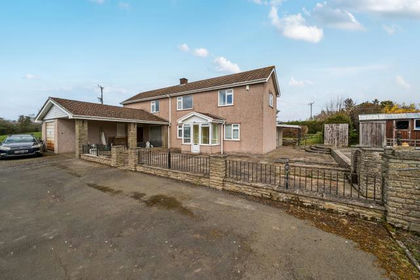
- Price
- Guide Price£565,000
- Size
- 2 acres
Kingswood, Kington, Herefordshire, County, Kington Rural, Herefordshire, County of HR5 England
Added on 19/09/2026House with Land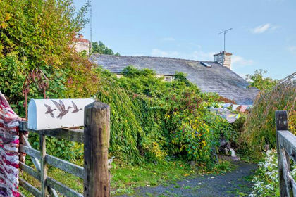
- Price
- £650,000
- Size
- 1.5 acres
Brilley, Whitney-On-Wye, Hereford, Brilley, Herefordshire, County of HR3 England
Added on 03/07/2026House with Land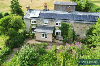
- Price
- Guide Price£625,000
- Size
- 3.85 acres
Brilley, Whitney On Wye Hereford HR3, Brilley, Herefordshire, County of HR3 England
Added on 09/07/2026Smallholding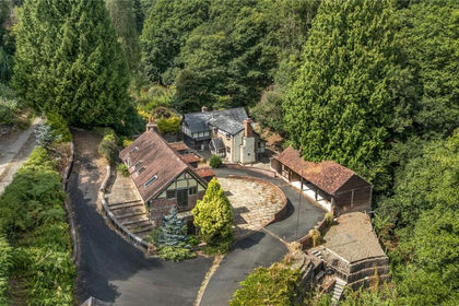
- Price
- £445,000
- Size
- 2.6 acres
Rushock, Kington, Herefordshire, Kington Rural, Herefordshire, County of HR5 England
Added on 11/05/2026House with Land
- Price
- Offers in Excess of£500,000
- Size
- 1.2 acres
Added on 28/01/2026Development Land
- Price
- Guide Price£420,000
Development Site At Titley, Kington, HR5, Titley, Herefordshire, County of HR5 England
Added on 20/05/2026Development Land
- Price
- Guide Price£550,000
- Size
- 2 acres
Cregrina, Llandrindod Wells, Powys, Glascwm, Powys LD1 Wales
Added on 28/09/2026House with Land
- Price
- £560,000
- Size
- 17 acres
Added on 17/06/2026House with Land
- Price
- Offers Over£485,000
- Size
- 4.66 acres
Llandegley, Llandrindod Wells, Powys, LD1, Penybont, Powys LD1 Wales
Added on 26/06/2026Equestrian property
- Price
- £625,000
- Size
- 1.2 acres
Lyonshall, Kington with approx 1.2 acre garden, Lyonshall, Herefordshire, County of HR5 England
Added on 18/06/2026House with Land