Rood Lane, Idridgehay
- Land size
- 1.93 acres
- Bedrooms
- 4
- Bathrooms
- 3
Key Features
- Grade II Listed Former Railway Station Dating From 1867
- Unique Four Bedroom Detached Character Home
- Set Within Approximately 1.93 Acres
- Four Double Bedrooms & Three Bathrooms
- Two Reception Rooms Plus Study / Potential Fifth Bedroom
- Dining Kitchen, Boot Room & Ground Floor Shower Room
- Oak-Framed Double Garage, Workshop & Summer House
- EPC rating G. Council tax band G
- 45' x 22' Timber-Clad Storage Barn With Power
- Excellent Home Working / Workshop Potential with Fibre Available
Description
The Old Station represents a rare opportunity to acquire an exceptional Grade II listed former railway station, coming to the market for the first time in approximately 25 years. Dating from 1867 and retaining a strong sense of its original character, this distinctive detached home combines its railway heritage with generous and versatile accommodation, extensive grounds and a particularly useful range of outbuildings. Set within approximately 1.93 acres, the property enjoys a private and peaceful setting in the desirable Derbyshire village of Idridgehay, close to the Peak District, while remaining well placed for access to Duffield, Wirksworth and the wider road and rail network. The property is offered for sale with no upward chain.
Uniquely preserved and sympathetically adapted for modern living, the house provides four double bedrooms, two first-floor bathrooms, two principal reception rooms and a generous dining kitchen. A separate study, positioned alongside a ground floor shower room, provides valuable flexibility and could readily serve as an occasional fifth bedroom, guest room or dedicated home office. Starlink is currently used at the property for internet access, while fibre broadband is available within the village.
Outside, the scale and versatility of the grounds are a major feature. In addition to extensive parking and hardstanding, there is an oak-framed double garage and workshop, an oak-framed summer house and a substantial steel-framed storage barn measuring approximately 45' x 22', timber clad with Yorkshire boarding and supplied with power and electricity. The range of ancillary buildings creates excellent scope for hobbies, vehicle storage, workshop use or home working, and may also offer potential for further adaptation or development, subject to any necessary planning and listed building consents.
Built circa 1867, The Old Station is the original Idridgehay railway station, constructed for the Midland Railway's Wirksworth branch. The line opened in October 1867 and later became affectionately known as the "Milk and Honey Line", reflecting the quantities of milk and agricultural produce once carried from the surrounding Derbyshire countryside towards Derby and London. This history remains an important part of the identity of the property and gives it a provenance rarely found in a residential home.
Idridgehay lies within the attractive Ecclesbourne Valley, between Duffield and the historic market town of Wirksworth, in a rural setting close to the Peak District. The railway remains part of the character of the area, although today it operates as the volunteer-run Ecclesbourne Valley heritage railway, with occasional heritage services running between Duffield and Wirksworth via Idridgehay and Shottle rather than as a conventional mainline railway. This provides an interesting connection with the property's past while preserving the peaceful rural nature of its setting.
The accommodation begins with a well-proportioned dining kitchen, designed as a practical central space for day-to-day living. Tiled flooring runs throughout, with wooden preparation surfaces incorporating a ceramic one-and-a-half bowl sink with drainer and mixer tap. Appliances include a Bosch double electric fan-assisted oven and grill with warming drawer, four-ring induction hob and extractor, together with an American-style fridge freezer, integrated dishwasher, washing machine and additional integrated fridge. Complementary wall-mounted cupboards and extensive storage are provided, while a matching central island incorporates further cupboards, drawers and seating space. The kitchen opens naturally into the dining area, with a timber stable-style door providing access outside.
From the kitchen, a door leads into the boot room, finished with quarry tiled flooring and providing access to both the study and ground floor shower room. The shower room is fitted with a pedestal wash hand basin, low-level WC and enclosed shower unit.
Adjoining this is the dual aspect study, a useful and adaptable room which could equally be used as a home office, occasional bedroom or fifth bedroom, particularly given its proximity to the shower room. A cupboard within the room houses the boiler.
The living room is a generous reception space with an exposed stone wall and dual aspect windows to the front and rear. Timber doors provide access to both elevations, while a substantial log burner set on a stone hearth forms a natural focal point. A staircase rises to the first floor and a further door leads through into the snug.
The snug is one of the most characterful rooms within the house, with a triple aspect and doors opening to the side and rear. A double-sided log burner with stone fireplace and hearth sits at the centre of the room. Historically, this part of the property formed the station master's office and lamp room, providing a particularly tangible reminder of the building's original use.
On the first floor, a semi-galleried landing features an exposed stone wall and Velux roof window and provides access to the four bedrooms and bathroom facilities. All four bedrooms are doubles and benefit from Velux roof windows, with the principal bedroom being especially spacious. One of the bedrooms also provides loft hatch access.
The first floor is completed by both a separate shower room and bathroom. The shower room is fitted with a pedestal wash hand basin, low-level WC and corner shower enclosure with electric shower, together with a chrome ladder-style radiator. The bathroom has a white suite comprising a pedestal wash hand basin with chrome mixer tap, low-level WC and bath with chrome mixer tap, together with an airing cupboard housing the hot water tank.
Combining genuine historical interest with approximately 1.93 acres, substantial outbuildings, extensive parking and adaptable family accommodation, The Old Station offers a particularly unusual opportunity for those seeking a characterful country home with space for hobbies, work and family life. Its peaceful setting, preserved railway heritage and practical ancillary buildings distinguish it from more conventional period properties, while the absence of an upward chain provides added flexibility for prospective purchasers.
Tenure: Freehold (purchasers are advised to satisfy themselves as to the tenure via their legal representative).
Please note: It is quite common for some properties to have a Ring doorbell and internal recording devices.
Property construction: Standard
Parking: Off street
Electricity supply: Mains
Water supply: Mains
Sewerage: Septic tank
Heating: LPG
(Purchasers are advised to satisfy themselves as to their suitability).
Broadband type: FTTP - See Ofcom link for speed:
Mobile signal/coverage: See Ofcom link
Local Authority/Tax Band: Amber Valley Borough Council / Tax Band G
Useful Websites:
Our Ref: JGA/19082026
The property information provided by John German Estate Agents Ltd is based on enquiries made of the vendor and from information available in the public domain. If there is any point on which you require further clarification, please contact the office and we will be pleased to check the information for you, particularly if contemplating travelling some distance to view the property. Please note if your enquiry is of a legal or structural nature, we advise you to seek advice from a qualified professional in their relevant field.
We are required by law to comply fully with The Money Laundering Regulations 2017 and as such need to complete AML ID verification and proof / source of funds checks on all buyers and, where relevant, cash donors once an offer is accepted on a property. We use the Checkboard app to complete the necessary checks, this is not a credit check and therefore will have no effect on your credit history. With effect from 1st March 2025 a non-refundable compliance fee of £30.00 inc. VAT per buyer / donor will be required to be paid in advance when an offer is agreed and prior to a sales memorandum being issued.
Map Location
Property details
- Tenure
- Freehold
- Council Tax Band
- G
- Date Posted
- 2026-08-26
Market Value Analysis
Compared with 708 Homes with Land listings in East Midlands (1+ acres).
Energy Performance Certificate
Energy Efficiency Rating
Based on UK Energy Performance Certificate standards (EU Directive 2002/91/EC)
Running costs are one side. Planning activity, flood history and ground risks for this location are in the full report.
Utilities & Restrictions
Utilities
- Electricity
- Mains
- Water
- Mains
- Heating
- Ask Agent
- Broadband
- Full Fibre (FTTP)
- Sewerage
- Septic Tank / Private
Rights & Restrictions
- Public Rights of Way
- Ask Agent
- Private Rights of Way
- Ask Agent
- Listed Property
- Ask Agent
- Restrictions
- Ask Agent
Listed status, conservation areas and planning constraints for this location are in the full report.
Property Features
- Accessibility
- Ask Agent
- Parking
- Garage, Off-Street Parking
- Garden
- Garden
Beyond the particulars: planning activity, flood history, heritage and ground risks, checked for this exact spot.
Connectivity
Broadband
Fastest speed available at this postcode
1.8 Gbps
Gigabit full fibre
Suitable for
- 4K streaming on every screen
- Full-time home working
- Online gaming & big downloads
Mobile signal
Predicted 4G and 5G signal; indoor signal depends on building materials.
Ofcom Connected Nations postcode-level predictions. Speeds and signal are modelled, not measured, and vary between addresses and providers.
Signal is the easy part. Planning activity, flood history and protected designations here are in the full report.
Nearest Schools
Primary
- Turnditch Church of England Primary School1.5 milesOfsted: Good
- Ages
- 4 to 11
- Pupils
- 68
- Type
- Academy converter
- Faith
- Church of England
- Kirk Ireton C of E Primary School1.6 milesOfsted: Good *
- Ages
- 4 to 11
- Pupils
- 40
- Type
- Voluntary controlled school
- Faith
- Church of England
- Hulland CofE Primary School2.9 milesNo Ofsted rating
- Ages
- 5 to 11
- Pupils
- 51
- Type
- Academy converter
- Faith
- Church of England
- Wirksworth Junior School3.2 milesOfsted: Good
- Ages
- 7 to 11
- Pupils
- 76
- Type
- Community school
- Wirksworth CofE Infant School3.3 milesOfsted: Good
- Ages
- 5 to 7
- Pupils
- 47
- Type
- Voluntary controlled school
- Faith
- Church of England
Secondary
- Anthony Gell School3 milesNo Ofsted rating
- Ages
- 11 to 18
- Pupils
- 776
- Type
- Academy converter
- Belper School and Sixth Form Centre4.7 milesOfsted: Good *
- Ages
- 11 to 18
- Pupils
- 1,212
- Type
- Foundation school
- The Ecclesbourne School4.8 milesOfsted: Good
- Ages
- 11 to 18
- Pupils
- 1,604
- Type
- Academy converter
- John Flamsteed Community School6.1 milesOfsted: Good *
- Ages
- 11 to 16
- Pupils
- 850
- Type
- Academy converter
- Allestree Woodlands School6.4 milesOfsted: Good
- Ages
- 11 to 18
- Pupils
- 1,373
- Type
- Academy converter
* Latest graded judgement covers quality of education only; no overall grade was issued under the 2024-25 inspection framework.
Distances are straight-line from the advertised location. Source: the national school registers (DfE, Welsh Government, Scottish Government) and Ofsted.
Schools are just the start: sold prices nearby, planning activity and any flood history are in the full report.
Amenities
Supermarket
GP surgery
Pharmacy
Hospital
Straight-line distances from the advertised location. Sources: NHS records, Geolytix supermarket locations, OS Open Greenspace and the national trails registers.
The area stacks up? Now check the location itself: planning nearby, protected designations and past flooding.
Getting Around
Nearest station
Nearest bus stop
Typical drive times
Straight-line distances from the advertised location; drive times are typical free-flow times over OpenStreetMap road data, so allow more at peak. Public transport locations from DfT NaPTAN.
Easy to reach matters. So do planning activity, flood history and ground risks: all in the full report.
Flood Risk
Environment Agency open data, checked around the advertised map pin for the listed acreage. Long-term risk counts flood defences; the planning map's flood zones do not. Provided by LandSale, not the listing agent, and not part of the agent's particulars. Risk varies across a holding, so verify before committing.
Rivers and the sea
Planning map: Flood Zone 3, about 30 metres away.
Surface water
Not at the pin: mapped about 20 metres away.
These bandings are the summary. Where this location sits on the flood maps, plus planning activity, heritage and ground risks, is in the full report.
Important notice: Information, maps and tags on this page are drawn from the advertising agent's marketing materials or generated automatically. LandSale has not verified them. Relying on these details is at your own risk, always carry out independent checks before committing to a purchase.
LandSale full disclaimer
Marketing information only - not formal particulars. The details on this website are provided for general guidance and do not constitute an offer or contract. Neither LandSale nor the advertising estate/land agent accepts responsibility for any inaccuracy.
1. Source of information
- Listing content: Core description, asking price, tenure, measurements, photographs and planning history originate from the marketing materials of the advertising estate or land agent. LandSale does not author this content and cannot guarantee its accuracy.
- Automated tags & categorisation: Property type, land-use class, acreage bands and similar labels may be applied by machine-learning models. They are intended as a helpful guide only and may not reflect the property's legal status or permitted use.
- Third-party & enriched data layers: Maps, boundary outlines, planning designations, soil reports, broadband coverage and other environmental or location-based insights are licensed from external suppliers. Such data are supplied “as is", may be incomplete or out of date and are subject to change without notice.
2. Verification required
Prospective purchasers must verify critical matters, including but not limited to planning permission, title boundaries, public rights of way, environmental constraints, acreage, services, access and VAT status, through their own inspections, specialist surveys, legal advisers and the selling agent before relying on the information or entering into any contract.
3. No warranty or liability
LandSale gives no warranty, express or implied, as to the accuracy, completeness or fitness for any particular purpose of the information displayed. LandSale shall not be liable for any loss, damage, cost or expense arising directly or indirectly from any use of or reliance on such information, save where liability may not be excluded by law.
4. Updates & feedback
If you believe any detail on this listing is inaccurate, please let us know. We will investigate and, where appropriate, update the listing or notify the agent.
© LandSale | Version 1.3 - August 2026
Similar properties for sale
- Price
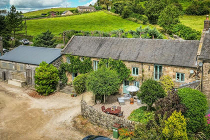
- Offers Over£750,000
- Size
- 1.5 acres
Shottle, Belper, Derbyshire, Ashleyhay, Derbyshire DE56 England
Added on 28/04/2026Cottage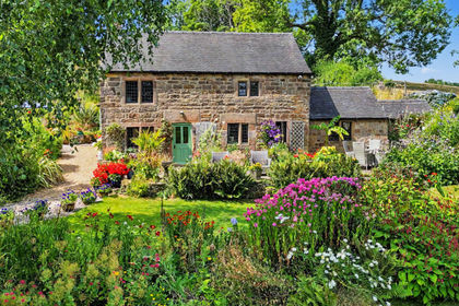
- Price
- Guide Price£900,000
- Size
- 2.31 acres
Moor Lane, Kirk Ireton, DE6, Kirk Ireton, Derbyshire DE6 England
Added on 30/07/2026Cottage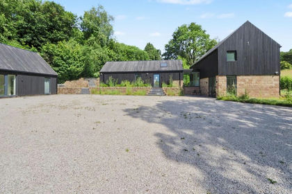
- Price
- Guide Price£1,000,000
- Size
- 4 acres
Slaters Barn, Blackbrook, Belper, Derbyshire, DE56, Belper, Derbyshire DE56 England
Added on 27/05/2026Barn Conversion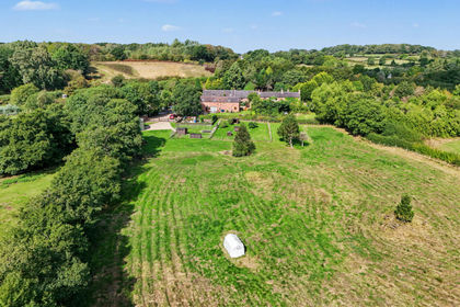
- Price
- Guide Price£800,000
- Size
- 2.33 acres
Mercaston Lane, Turnditch, DE56, Ravensdale Park, Derbyshire DE56 England
Added on 05/09/2026Barn Conversion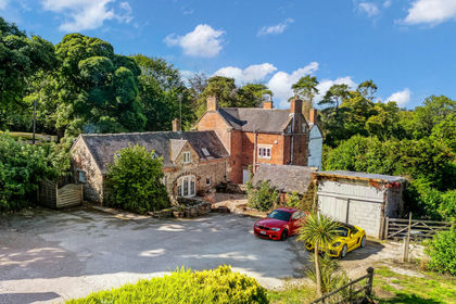
- Price
- Offers Over£900,000
- Size
- 6.8 acres
Hulland Village, Ashbourne, DE6, Hulland, Derbyshire DE6 England
Added on 18/09/2026House with Land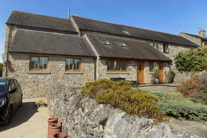
- Price
- £825,000
- Size
- 1.5 acres
Rowan House, Main Street, Hopton, Derbyshire, Hopton, Derbyshire DE4 England
Added on 05/09/2026House with Land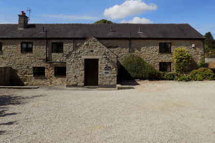
- Price
- Offers in Region of£710,000
Linden House, Main Street, Hopton, Derbyshire, Hopton, Derbyshire DE4 England
Added on 29/08/2026Barn Conversion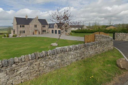
- Price
- Guide Price£950,000
- Size
- 1.85 acres
Carsington Grange, Carsington, Matlock, Derbyshire, DE4, Brassington, Derbyshire DE4 England
Added on 17/10/2026House with Land
- Price
- £995,000
- Size
- 6.04 acres
Added on 20/08/2026Equestrian property
- Price
- £795,000
- Size
- 12.09 acres
Added on 25/09/2026Barn Conversion