Development Land at Bellfield, Eddleston, Peebles, EH45
- Land size
- 9.93 acres
Key Features
- A single field on the edge of the village
- Outlined in the Local Development Plan for residential development
- “Indicative Site Capacity” of 35 units
- Edge of village / rural location
- Easy commuting distance of Edinburgh
- Total area of approximately 4.02 hectares (9.93 acres)
Description
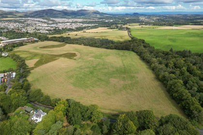
The land currently comprises a single grazing field which gently slopes with a westerly aspect.
Field gate access is taken off the Old Edinburgh Road, which remains adopted (reference - D87 1 “Former A703 North of Eddleston Old Edinburgh Road”) and joins up with Bellfield Crescent to the south and the A703 to the west.
LOCATION
The land at Bellfield lies to the north-east of the conservation village of Eddleston, which is approximately 5 miles north of the town of Peebles and approximately 17 miles south of Edinburgh city centre. Eddleston is a small village with restaurant/bar, a church and a primary school (currently mothballed). Larger town services are available in Peebles, where primary and secondary schooling are provided. A new multi-use path, linking Eddleston and Peebles has been completed recently. In addition, the Old Edinburgh Road adjoining the land is a “Core Path”, giving the land added access benefits.
Post Code: EH45 8QB. It is strongly recommended that you do not rely on a Satnav in this rural location and check on a route map prior to any scheduled viewing.
What3Words: rooster.crafts.lingering
DIRECTIONS
Traveling south from Edinburgh on the A701, continue straight on at the Leadburn junction onto the A703 and travel south for approximately 5 miles. On entering the “40” speed limit for Eddleston, turn left off the main road onto a short tree lined section of Old Edinburgh Road, which sits back from the A703. The land is on the left had side and is accessed off Old Edinburgh Road through the current field gate.
PLANNING
Planning policy is contained within the Scottish Borders Local Development Plan 2 (Adopted 22 August 2024). The Proposals Map shows the land as lying within the Eddleston village envelope and specifically identified under the “Development and Safeguarding Proposals” as a housing site (AEDDL002 – “North of Bellfield”).
The Local Development Plan describes the site as approximately 4.1 Hectares, with an “Indicative Site Capacity” of 35 residential units. The site is shown to retain a mixture of Housing Allocation; Open Space; and Structural Planting/Landscaping.
There are a number of specific site requirements, as follows:
· A vehicular link via Bellfield Crescent to the south and from the A703 further north will be required
· Provision of structure planting along the northern edge of the site with an area of open space to the east of the site along with buffer areas alongside new and existing landscaping will be required
· Provision of amenity access within the development for pedestrians and cyclists
· Assessment and mitigation of flood risk from overland flow will be required
· Mitigation measures are required to prevent any impact on the River Tweed Special Area of Conservation
· Water resilient construction measures should be employed in the development of the site.
SERVICES
Electricity, mains water and mains drainage are available close by to the south-west of the site. Interested parties should make their own enquiries with the relevant utility providers with regards to availability and costings for servicing the site.
Further details on utilities and services are available from the selling agents, on request, within the additional Information Pack.
ACCESS
Access to the land is taken off the Old Edinburgh Road, which in turn takes access off either Bellfield Crescent to the south and the A703 to the west. Old Edinburgh Road, as well as being and adopted road, is marked as a “Tweed Trail” route and is a “Core Path”.
ENTRY
By mutual agreement.
VIEWINGS AND FURTHER INFORMATION
For further information or to arrange an appointment to view please contact Walker Scott Ireland Ltd. Viewing is strictly by appointment. Please note that the fields may be grazed by stock (cattle and sheep) at the time of viewing and viewers must take all steps not to unduly disturb stock or put themselves in danger by approaching stock in a manner that might cause them disturbance.
Interested parties are advised to note interest with Walker Scott Ireland Ltd in order to be kept informed of any closing date that is set. Please note, our client need not accept the highest offer, nor indeed any offer.
INFORMATION PACK
An information pack, including copies of key documents, will be available on request from the selling agents to all those who note interest through their solicitor and can provide acceptable proof of funding.
ANTI-MONEY LAUNDERING REGULATIONS
To comply with current Anti-Money Laundering Regulations, before an offer can be accepted and the property put “Under Offer”, the offer must be accompanied with Notarised/certified photographic evidence of the purchaser’s identity and separate evidence of the purchaser’s residential address, or the offering parties must attend our offices with the original documents. In addition, all offers must be accompanied by clear confirmation of the sources of funding.
LOCAL AUTHORITY
Scottish Borders Council
Newtown St Boswells
Melrose
TD6 0SA
Tel: 01835 824000
W: www.scotborders.gov.uk
UTILITY PROVIDERS
SP Energy Networks, Customer Connections, 55 Fullarton Drive, Cambuslang, Glasgow, G32 8FA
Tel: 0141 614 9997
Scottish Water, Castle House, 6 Castle Drive, Carnegie Campus, Dunfermline, KY11 8GG.
Tel: 0800 0778 778
SEPA, Burnbrae, Mossilee Road, Galashiels, TD1 1NF.
Tel: 01896 754797
GENERAL NOTICE
Walker Scott Ireland Ltd give notice that: They are not authorised to make or give any representations or warranties in relation to the business or property for sale, either here or elsewhere, either on their own behalf or on behalf of their client or otherwise. These details do not form part of any offer or contract and must not be relied upon as statements or representations of fact. Any areas, measurements or distances are approximate. The text, photographs and plans are for guidance only and are not necessarily comprehensive. Photographs may show parts of neighbouring properties. It should not be assumed that the property has all necessary planning, building regulation or any other consents. No tests to any services, equipment or facilities have been carried out. Purchasers must satisfy themselves in all aspects of the property by inspection and their own due diligence, or otherwise. Photos June 2023 and text June 2023.
Map Location
Property details
- Tenure
- Ask Agent
- Council Tax Band
- Ask Agent
- Date Posted
- 2026-08-26
Market Value Analysis
Compared with 39 Bare & Undeveloped Land listings in Scotland (5+ acres).
Utilities & Restrictions
Utilities
- Electricity
- Ask Agent
- Water
- Ask Agent
- Heating
- Ask Agent
- Broadband
- Ask Agent
- Sewerage
- Ask Agent
Rights & Restrictions
- Public Rights of Way
- Ask Agent
- Private Rights of Way
- Ask Agent
- Listed Property
- Ask Agent
- Restrictions
- Ask Agent
Listed status, conservation areas and planning constraints for this location are in the full report.
Property Features
- Accessibility
- Ask Agent
- Parking
- Ask Agent
- Garden
- Ask Agent
Beyond the particulars: planning activity, flood history, heritage and ground risks, checked for this exact spot.
Connectivity
Broadband
Fastest speed available at this postcode
1.8 Gbps
Gigabit full fibre
Suitable for
- 4K streaming on every screen
- Full-time home working
- Online gaming & big downloads
Mobile signal
Predicted 4G and 5G signal; indoor signal depends on building materials.
Ofcom Connected Nations postcode-level predictions. Speeds and signal are modelled, not measured, and vary between addresses and providers.
Signal is the easy part. Planning activity, flood history and protected designations here are in the full report.
Nearest Schools
Primary
- Halyrude Primary School4 miles
- Pupils
- 83
- Type
- Roman Catholic
- Kingsland Primary School4.3 miles
- Pupils
- 332
- Type
- Non-denominational
- Priorsford Primary School5 miles
- Pupils
- 388
- Type
- Non-denominational
- Newlands Primary School5.4 miles
- Pupils
- 67
- Type
- Non-denominational
- West Linton Primary School6.3 miles
- Pupils
- 215
- Type
- Non-denominational
Secondary
- Peebles High School4.9 miles
- Pupils
- 1,342
- Type
- Non-denominational
- Penicuik High School8 miles
- Pupils
- 640
- Type
- Non-denominational
- Beeslack Community High School8.6 miles
- Pupils
- 751
- Type
- Non-denominational
- Lasswade High School Centre11 miles
- Pupils
- 1,604
- Type
- Non-denominational
- Newbattle High School13 miles
- Pupils
- 1,172
- Type
- Non-denominational
Distances are straight-line from the advertised location. Source: the national school registers (DfE, Welsh Government, Scottish Government) and Ofsted.
Schools are just the start: planning activity, heritage and any flood history here are in the full report.
Amenities
Supermarket
GP surgery
Pharmacy
Green space
Straight-line distances from the advertised location. Sources: NHS records, Geolytix supermarket locations, OS Open Greenspace and the national trails registers.
The area stacks up? Now check the location itself: planning nearby, protected designations and past flooding.
Getting Around
Nearest station
Nearest bus stop
Typical drive times
Straight-line distances from the advertised location; drive times are typical free-flow times over OpenStreetMap road data, so allow more at peak. Public transport locations from DfT NaPTAN.
Easy to reach matters. So do planning activity, flood history and ground risks: all in the full report.
Flood Risk
SEPA open data, checked around the advertised map pin for the listed acreage. Provided by LandSale, not the listing agent, and not part of the agent's particulars. Risk varies across a holding, so verify before committing.
Rivers and the sea
Not at the pin: mapped about 60 metres away.
Surface water
Not at the pin: mapped about 50 metres away.
These bandings are the summary. Where this location sits on the flood maps, plus planning activity, heritage and ground risks, is in the full report.
Important notice: Information, maps and tags on this page are drawn from the advertising agent's marketing materials or generated automatically. LandSale has not verified them. Relying on these details is at your own risk, always carry out independent checks before committing to a purchase.
LandSale full disclaimer
Marketing information only - not formal particulars. The details on this website are provided for general guidance and do not constitute an offer or contract. Neither LandSale nor the advertising estate/land agent accepts responsibility for any inaccuracy.
1. Source of information
- Listing content: Core description, asking price, tenure, measurements, photographs and planning history originate from the marketing materials of the advertising estate or land agent. LandSale does not author this content and cannot guarantee its accuracy.
- Automated tags & categorisation: Property type, land-use class, acreage bands and similar labels may be applied by machine-learning models. They are intended as a helpful guide only and may not reflect the property's legal status or permitted use.
- Third-party & enriched data layers: Maps, boundary outlines, planning designations, soil reports, broadband coverage and other environmental or location-based insights are licensed from external suppliers. Such data are supplied “as is", may be incomplete or out of date and are subject to change without notice.
2. Verification required
Prospective purchasers must verify critical matters, including but not limited to planning permission, title boundaries, public rights of way, environmental constraints, acreage, services, access and VAT status, through their own inspections, specialist surveys, legal advisers and the selling agent before relying on the information or entering into any contract.
3. No warranty or liability
LandSale gives no warranty, express or implied, as to the accuracy, completeness or fitness for any particular purpose of the information displayed. LandSale shall not be liable for any loss, damage, cost or expense arising directly or indirectly from any use of or reliance on such information, save where liability may not be excluded by law.
4. Updates & feedback
If you believe any detail on this listing is inaccurate, please let us know. We will investigate and, where appropriate, update the listing or notify the agent.
© LandSale | Version 1.3 - August 2026

Listing agent
Walker Scott Ireland
82 High Street, Peebles, EH45 8SW
Similar properties for sale
- Price
- Offers Over£795,000
- Size
- 181.83 acres
Pomathorn Farm - Lot 2, Penicuik, Midlothian, EH26, Midlothian, Midlothian EH26 Scotland
Added on 29/01/2026Vacant Land
- Price
- Offers Over£425,000
- Size
- 94.06 acres
Pomathorn Farm - Lot 1, Penicuik, Midlothian, EH26, Midlothian, Midlothian EH26 Scotland
Added on 29/01/2026Agricultural Land
- Price
- Offers Over£400,000
- Size
- 21.11 acres
Added on 22/07/2026Farmland
- Price
- Offers in Excess of£600,000
- Size
- 5.16 acres
Added on 14/09/2026Development Land
- Price
- Guide Price£765,000
- Size
- 72 acres
Added on 02/07/2026Development Land
- Price
- Guide Price£425,000
- Size
- 71.43 acres
Added on 19/08/2026Timberland
- Price
- Offers Over£450,000
- Size
- 51.1 acres
Ardochrig Wood, S.Lanarkshire G75, East Kilbride and Strathaven, South Lanarkshire G75 Scotland
Added on 28/01/2026Timberland
- Price
- Offers in Excess of£640,000
- Size
- 259.61 acres
Land at Darrach Hill, By Carron Valley, Denny, FK6, Stirling and Strathallan, Stirling FK6 Scotland
Added on 11/05/2026Farmland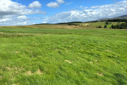
- Price
- Offers Over£495,000
- Size
- 203.07 acres
Added on 29/01/2026Grazing Land
- Price
- Offers Over£525,000
- Size
- 191.85 acres
Added on 12/10/2026Timberland