
Land & Buildings At Allowenshay Farm, Allowenshay, Hinton St George, TA17
- Land size
- 238.8 acres
Key Features
- Subject to a Farm Business Tenancy until 28/09/2027
- Direct access off public highway
- Agricultural buildings
- Planning consent for AOC Bungalow
- Grade I & Grade II land
- Organic farming history
- Productive arable/pasture land
Description
A rare opportunity to acquire a well-equipped and versatile agricultural holding extending to 238.8 acres (96.64 ha) of productive pasture and arable land which has been farmed organically under a Farm Business Tenancy. The land is classified as a mix of Grade I and II Land on the Provisional Agricultural Land Classification Maps.
The property benefits from a well-presented farmyard, with planning consent for the erection of a four bedroomed bungalow and two substantial modern farm buildings, extensive concrete yards and a significant acreage of prime agricultural land in this popular farming district, and offers considerable appeal for farming, diversification, equestrian, and investment purposes.
For Sale by Private Treaty.
A rare opportunity to acquire a well-equipped and versatile agricultural holding extending to 238.8 acres (96.64 ha) of productive pasture and arable land which has been farmed organically under a Farm Business Tenancy. The land is classified as a mix of Grade I and II Land on the Provisional Agricultural Land Classification Maps. The property is centred upon an attractive and well-presented farmyard, benefitting from secured planning consent for the erection of a four bedroomed bungalow (subject to an Agricultural Occupancy Condition) and approved under the reserved matter application no: 20/02772/REM.
Flooding: The land is in an area at a very low risk from river or sea flooding and a very low risk from surface water flooding. (Gov.uk)
Planning Permission: We understand that both agricultural buildings at Allowenshay were erected with full planning permission. A full planning application was submitted under reference number 17/01268/FUL for the erection of an agricultural building to house cattle, together with the formation of a new vehicular access, track and hardstanding. This application was approved in March 2017. Subsequently, the application under reference number 17/02690/S73 was submitted to vary the approved scheme, allowing for the erection of a second agricultural building. This application was approved in June 2017.
We further understand that the property benefits from the secured permission for the erection of an agricultural workers dwelling (4 bedroom bungalow) on Lot 1. This was Permitted with Conditions under application number 20/02772/REM. And has since been secured as the Drainage field has been installed for the dwelling with The commencement of works form submitted to South Somerset Council on 15-03-2024 with a commencement date of 09-05-2024.
Services and outgoings - We understand the plot and buildings (in Lot 1) are served by a private water supply (Allowenshay Water Company) providing raw and untreated water which will be metred and charged at a standard rate to the purchaser under a separate agreement. We understand that this water supply comes from a private borehole which is piped across Lot 6, Lot 2 and Lot 1 to serve the buildings, with connections into this supply available to those lots but by negotiation with Allowenshay Water Company.
The balance of the Land at Allowenshay is served by natural watering only, though we understand that there is a spring in the northern most field in Lot 1.
We further understand that Lot 1 does benefit from an electricity supply, however we understand that this is currently not connected to the Buildings or the building plot but a 3 phase electricity supply was put in within 30ft of the Farm Building closest to the road in May 2019 by Western Power. The supply number for further connections at this site is S220004 3031 672.
The property will be sold subject to a Farm Business Tenancy which will end on 28th September 2027 and is of freehold tenure with vacant possession available thereafter.
We understand that the current tenant has entered the land into both a Countryside Stewardship Mid-Tier agreement, due to end on 31st December 2026 and a Sustainable Farming Incentive Agreement, due to end in May 2027.
The Land and Buildings at Allowenshay are situated in an attractive rural position on the northern and western outskirts of the idyllic hamlet of Allowenshay, Somerset. Lots 5-7 are located to the north and to the east of Allowenshay. The popular local village of Hinton St George lies approximately 2.2 miles to the east offering a range of local amenities including a busy local pub, namely the Lord Poulett Arms, a village shop and a church. The town of Ilminster lies approximately 2.0 miles to the west of the property and provides a more extensive range of services and amenities, including a wide range of shops, healthcare facilities, services and recreational opportunities. The property is conveniently located, being approximately 0.6 miles from the A303 (to the north), which provides easy access to the wider road network, including connections to the M5 motorway, the A30 and the A358 for broader regional travel.
Directions
To reach Lot 1 from the hamlet of Allowenshay head west on Castles Hill towards Kingstone. Continue on this road for approximately 0.65 miles before taking a right onto Longforward Lane. Continue on this road for approximately 0.25 miles before turning right on the concrete track where the gate will be marked with a Greenslade Taylor Hunt ‘For Sale’ Board. Please see below the What3Words locations for each lot, which will take you directly to the gateway of each individual lot thereafter.
WHAT.3.WORDS
Lot 1: ///grow.bloodshot.sponsors (to buildings)
///broadens.buffoon.ballooned (off Castles Hill)
Lot 2: ///baker.issues.craft (off Castles Hill)
Lot 3: ///coverings.artist.pull (off Longforward Lane)
Lot 4: ///megawatt.midwinter.podcast (off Boyton Hill)
Lot 5: ///represent.padding.lessening
Lot 6: ///snooping.oppose.accusing (off Longforward Lane)
Lot 7: ///shimmered.protester.regaining (off Longforward Lane)
Grade I & Grade II
Livestock Building, silage clamp and fodder storage area
Map Location
Property details
- Tenure
- Ask Agent
- Council Tax Band
- TBC
- Date Posted
- 2026-08-26
Market Value Analysis
Compared with 20 Farms & Smallholdings listings in South West England (100+ acres).
Property Brochure
Seen the details? The full report adds the independent checks: planning activity, flood history, heritage and ground.
Utilities & Restrictions
Utilities
- Electricity
- Ask Agent
- Water
- Ask Agent
- Heating
- Ask Agent
- Broadband
- Ask Agent
- Sewerage
- Ask Agent
Rights & Restrictions
- Public Rights of Way
- Ask Agent
- Private Rights of Way
- Ask Agent
- Listed Property
- Ask Agent
- Restrictions
- Ask Agent
Listed status, conservation areas and planning constraints for this location are in the full report.
Property Features
- Accessibility
- Ask Agent
- Parking
- Ask Agent
- Garden
- Garden
Beyond the particulars: planning activity, flood history, heritage and ground risks, checked for this exact spot.
Connectivity
Broadband
Fastest speed available at this postcode
27 Mbps
Standard (10-30 Mbps)
Suitable for
- Web & social
- Music streaming
- Standard video calls
Mobile signal
Predicted 4G and 5G signal; indoor signal depends on building materials.
Ofcom Connected Nations postcode-level predictions. Speeds and signal are modelled, not measured, and vary between addresses and providers.
Signal is the easy part. Planning activity, flood history and protected designations here are in the full report.
Nearest Schools
Primary
- Herne View Church of England Primary1.6 milesOfsted: Good
- Ages
- 4 to 11
- Pupils
- 401
- Type
- Voluntary controlled school
- Faith
- Church of England
- Shepton Beauchamp Church School2.2 milesOfsted: Good *
- Ages
- 4 to 11
- Pupils
- 23
- Type
- Academy sponsor led
- Faith
- Church of England
- Hinton St George Church of England Primary School2.3 milesNo Ofsted rating
- Ages
- 4 to 11
- Pupils
- 90
- Type
- Voluntary controlled school
- Faith
- Church of England
- St Mary's & St Peter's Church School2.9 milesOfsted: Good *
- Ages
- 4 to 11
- Pupils
- 29
- Type
- Academy sponsor led
- Faith
- Church of England
- South Petherton Church of England Infants and Pre School3.5 milesOfsted: Good *
- Ages
- 2 to 7
- Pupils
- 102
- Type
- Voluntary aided school
- Faith
- Church of England
Secondary
- Wadham School4.6 milesOfsted: Requires improvement *
- Ages
- 11 to 16
- Pupils
- 763
- Type
- Voluntary controlled school
- Faith
- Church of England
- Holyrood Academy5 milesOfsted: Good
- Ages
- 11 to 18
- Pupils
- 1,282
- Type
- Academy converter
- Stanchester Academy6.9 milesOfsted: Requires improvement *
- Ages
- 11 to 16
- Pupils
- 829
- Type
- Academy converter
- Huish Episcopi Academy8.4 milesOfsted report card · May 2026
- Ages
- 11 to 18
- Pupils
- 1,192
- Type
- Academy converter
- Beaminster School9.5 milesOfsted: Good
- Ages
- 11 to 18
- Pupils
- 673
- Type
- Voluntary controlled school
- Faith
- Christian
* Latest graded judgement covers quality of education only; no overall grade was issued under the 2024-25 inspection framework.
Distances are straight-line from the advertised location. Source: the national school registers (DfE, Welsh Government, Scottish Government) and Ofsted.
Schools are just the start: sold prices nearby, planning activity and any flood history are in the full report.
Amenities
Supermarket
GP surgery
Pharmacy
Hospital
Green space
Straight-line distances from the advertised location. Sources: NHS records, Geolytix supermarket locations, OS Open Greenspace and the national trails registers.
The area stacks up? Now check the location itself: planning nearby, protected designations and past flooding.
Getting Around
Nearest station
Nearest bus stop
Typical drive times
Straight-line distances from the advertised location; drive times are typical free-flow times over OpenStreetMap road data, so allow more at peak. Public transport locations from DfT NaPTAN.
Easy to reach matters. So do planning activity, flood history and ground risks: all in the full report.
Flood Risk
Environment Agency open data, checked around the advertised map pin for the listed acreage. Long-term risk counts flood defences; the planning map's flood zones do not. Provided by LandSale, not the listing agent, and not part of the agent's particulars. Risk varies across a holding, so verify before committing.
Rivers and the sea
Planning map: Flood Zone 1.
Surface water
Not at the pin: mapped about 150 metres away.
These bandings are the summary. Where this location sits on the flood maps, plus planning activity, heritage and ground risks, is in the full report.
Important notice: Information, maps and tags on this page are drawn from the advertising agent's marketing materials or generated automatically. LandSale has not verified them. Relying on these details is at your own risk, always carry out independent checks before committing to a purchase.
LandSale full disclaimer
Marketing information only - not formal particulars. The details on this website are provided for general guidance and do not constitute an offer or contract. Neither LandSale nor the advertising estate/land agent accepts responsibility for any inaccuracy.
1. Source of information
- Listing content: Core description, asking price, tenure, measurements, photographs and planning history originate from the marketing materials of the advertising estate or land agent. LandSale does not author this content and cannot guarantee its accuracy.
- Automated tags & categorisation: Property type, land-use class, acreage bands and similar labels may be applied by machine-learning models. They are intended as a helpful guide only and may not reflect the property's legal status or permitted use.
- Third-party & enriched data layers: Maps, boundary outlines, planning designations, soil reports, broadband coverage and other environmental or location-based insights are licensed from external suppliers. Such data are supplied “as is", may be incomplete or out of date and are subject to change without notice.
2. Verification required
Prospective purchasers must verify critical matters, including but not limited to planning permission, title boundaries, public rights of way, environmental constraints, acreage, services, access and VAT status, through their own inspections, specialist surveys, legal advisers and the selling agent before relying on the information or entering into any contract.
3. No warranty or liability
LandSale gives no warranty, express or implied, as to the accuracy, completeness or fitness for any particular purpose of the information displayed. LandSale shall not be liable for any loss, damage, cost or expense arising directly or indirectly from any use of or reliance on such information, save where liability may not be excluded by law.
4. Updates & feedback
If you believe any detail on this listing is inaccurate, please let us know. We will investigate and, where appropriate, update the listing or notify the agent.
© LandSale | Version 1.3 - August 2026
Similar properties for sale
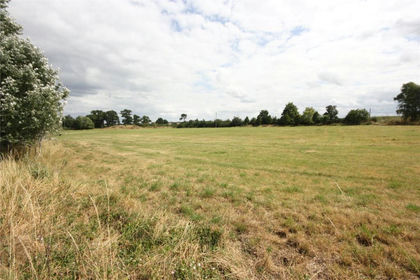
- Price
- Guide Price£1,750,000
- Size
- 6.36 acres
Cannington, Bridgwater, Somerset, Cannington, Somerset TA5 England
Added on 05/03/2026Undeveloped Land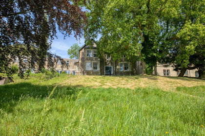
- Price
- Guide Price£1,750,000
- Size
- 2 acres
Added on 21/07/2026Development Land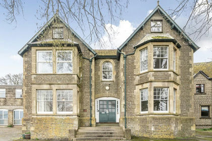
- Price
- Guide Price£1,750,000
- Size
- 6 acres
Added on 15/04/2026Development Land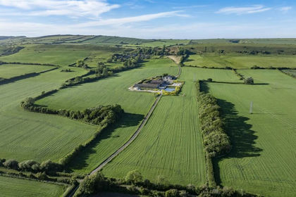
- Price
- Guide Price£1,850,000
- Size
- 167.61 acres
Added on 06/10/2026Farm
- Price
- Guide Price£1,750,000
- Size
- 6.21 acres
Land at Beavers Lodge Farm, Lympsham Road, BS24, Lympsham, Somerset BS24 England
Added on 29/01/2026Development Land
- Price
- Guide Price£1,950,000
- Size
- 1.4 acres
Wraxall Hill, Wraxall, Bristol, Somerset, BS48, Wraxall and Failand, North Somerset BS48 England
Added on 18/04/2026Historic House
- Price
- Guide Price£2,500,000
Branksea Avenue, Poole, Poole, Bournemouth, Christchurch and Poole BH15 England
Added on 22/06/2026Development Land
- Price
- Offers in Excess of£2,000,000
Panorama Road, Sandbanks, Poole, Bournemouth, Christchurch and Poole BH13 England
Added on 29/01/2026Redevelopment Land
- Price
- Guide Price£2,000,000
Watkin Road, Boscombe, Bournemouth East, Bournemouth, Christchurch and Poole BH5 England
Added on 29/01/2026Redevelopment Land
- Price
- Offers in Excess of£2,250,000
- Size
- 11.66 acres
Added on 29/01/2026Commercial Land