Fairwarp, Uckfield, TN22
- Land size
- 1.2 acres
- Bedrooms
- 4
- Bathrooms
- 3
Description
GUIDE PRICE: £1,250,000
• Original 1920s Arts & Craft home in Ashdown Forest, offering four bedrooms and three bathrooms.
• Approximately 1.2 acres (TBV) in total, comprising an approximately 0.9-acre paddock and 0.3-acre cottage garden/grounds. The paddock has running water and electricity.
• Direct, private access onto Ashdown Forest, with heathland and woodland beginning where the garden ends.
• 28 ft vaulted Drawing Room with exposed timber eaves and trusses, timber flooring, original open fireplace, fitted bookshelves and French doors to the garden.
• Excellent and flexible reception space, including a separate formal Dining Room, a Sitting/Family Room with its own fireplace, and a versatile ground-floor fourth bedroom/study with adjoining en-suite shower room.
• Four bedrooms including a generous principal suite with spacious en-suite bathroom and steam room, plus two further first-floor double bedrooms and a family bathroom.
• Granted planning permission for a replacement double garage with attached storage and a self-contained home office above (Ref: WD/2024/1653/F).
• 23 ft kitchen/breakfast room with bespoke timber cabinetry, central island, range cooker, bay window and direct garden access.
• Commoners' rights attached to the property, including wood-cutting rights and equestrian riding permits across Ashdown Forest.
• Superb country lifestyle with London Bridge reachable in just over an hour, with Crowborough and Uckfield stations within easy reach.
LOCATION: The property occupies an entirely private woodland enclave in sought-after Fairwarp, with gated access directly onto Ashdown Forest. The Forest - the landscape that inspired A.A. Milne's Hundred Acre Wood - offers thousands of acres of protected heathland and ancient woodland for walking, riding and cycling. A quarter-mile walk through the trees brings you to The Foresters Arms in Fairwarp, while Uckfield, Lewes, Royal Tunbridge Wells, Glyndebourne and the South Coast are all within easy reach.
Despite the secluded setting, the property remains well connected. Uckfield and Crowborough stations provide services towards London Bridge, with journey times in just over an hour on suitable services; Buxted provides a further nearby option. This combination of privacy, direct access to the Forest and access to London makes the property particularly appealing to those seeking a genuine country lifestyle without becoming disconnected.
Schooling in the area is genuinely strong. Uckfield College, rated Outstanding by Ofsted, and Bonners CofE Primary in Maresfield, rated Good, cover the state options. On the independent side, Michael Hall Steiner School and Cumnor House Sussex in Danehill — rated Excellent by the Independent Schools Inspectorate — are both close by, alongside other well-regarded local preparatory schools.
DESCRIPTION: Set in a private woodland enclave with direct access onto Ashdown Forest, the property combines an unusually secluded setting with a practical family layout.
Its Arts & Crafts character, flexible accommodation and direct connection to the Forest are central to its appeal.
THE HOUSE
The house retains clear Arts & Crafts character, with timber detailing, generous proportions and a strong connection to its woodland setting.
The property will mean different things to different buyers — those already rooted locally who have long wanted to live closer to the Forest, and those from further afield for whom this represents a quieter, more considered way of living. Either way, it is the kind of home that tends to mark a before and after.
KITCHEN/BREAKFAST ROOM: A generous 23 ft space at the heart of the house, with a bay window over the front garden and a door straight out onto it. Bespoke timber cabinetry, a central island, range cooker and good natural light make it work equally well for a quiet breakfast or a full house of guests.
DRAWING ROOM: A generous 28 ft reception room with a vaulted ceiling, exposed timber eaves and trusses, and wide-board timber flooring.
The original open fireplace is flanked by fitted bookshelves, with ample space for several seating areas and larger pieces of furniture.
French doors open directly onto the garden and bring good natural light into the room.
DINING ROOM: A separate, well-proportioned dining room with its own character — a good backdrop for slower, more formal evenings while the room connects conveniently with the central ground-floor accommodation.
SITTING ROOM: A further reception room on the opposite side of the central staircase and dining room, with its own fireplace, a multi-sided bay window and a further side window.
It works well as an informal sitting room, television room or family room, adding useful flexibility alongside the larger Drawing Room.
BEDROOM FOUR & EN-SUITE: A versatile ground-floor room with its own en-suite shower room. It has served as a study, a creative studio and a guest bedroom, and adapts readily to whoever needs it — home working, or simply avoiding the stairs.
The en-suite is fitted with a WC, wall-mounted wash basin and shower.
FIRST FLOOR
PRINCIPAL BEDROOM: A generous principal bedroom with a bay window, timber flooring, fitted or bespoke storage and space for additional bedroom furniture, together with a spacious en-suite bathroom.
EN-SUITE: A spacious principal en-suite with a bath, separate shower enclosure, WC and wash basin, together with a steam room.
BEDROOM TWO: A well-proportioned double bedroom on the first floor, with a window overlooking the garden and characterful sloping ceilings and timber detailing.
BEDROOM THREE: A further generous double bedroom with good natural light, a sloping ceiling, timber floor and built-in storage.
FAMILY BATHROOM: Positioned between Bedrooms Two and Three, the family bathroom has a bath, separate shower, WC and wash basin.
OUTSIDE AREA/GARDEN: The property extends to approximately 1.2 acres (TBV) in total, including an approximately 0.3-acre south-facing cottage garden/grounds and an approximately 0.9-acre fenced paddock. Mature trees, hedging, lawns and wildflower areas provide privacy around the house.
Behind the house are stone-paved paths and informal seating terraces, together with a polytunnel and detached summer house. The summer house has electricity. Gated access leads directly onto Ashdown Forest. The paddock has running water and electricity and offers scope for equestrian, smallholding or productive garden use, subject to individual requirements.
GARAGE / PLANNING PERMISSION: The existing detached garage is positioned beside the house and approached directly from the driveway. Planning permission has also been granted for a replacement double garage with attached storage and a self-contained home office above (Ref: WD/2024/1653/F).
The approved scheme provides scope for dedicated home-working space separate from the main house. Purchasers should satisfy themselves as to the planning consent, approved drawings, conditions and any implementation requirements.
SUMMER HOUSE: A detached garden summer house with electricity, currently used as a seasonal studio and also suitable as a garden room, hobbies space or occasional home office, subject to individual requirements.
POLYTUNNEL: A useful polytunnel within the grounds provides practical growing space for keen gardeners and complements the property's cottage garden, wildflower grounds and paddock.
THE FOREST: Private access directly onto Ashdown Forest is one of the property’s key features, with heathland and woodland immediately beyond the garden.
Commoners' rights are attached to the property, including wood-cutting rights and equestrian riding permits across the Forest. Buyers should satisfy themselves as to the precise nature, extent and administration of those rights.
AGENTS NOTE: Please note that these details have been prepared as a general guide and do not form part of a contract. We have not carried out a detailed survey, nor tested the services, appliances and specific fittings. Room sizes are approximate and should not be relied upon. Any verbal statements or information given about this property, again, should not be relied on and should not form part of a contract or agreement to purchase.
Map Location
Property details
- Tenure
- Freehold
- Council Tax Band
- G
- Date Posted
- 2026-08-25
Market Value Analysis
Compared with 1,734 Homes with Land listings in South East England (1+ acres).
Energy Performance Certificate
Energy Efficiency Rating
Based on UK Energy Performance Certificate standards (EU Directive 2002/91/EC)
Running costs are one side. Planning activity, flood history and ground risks for this location are in the full report.
Utilities & Restrictions
Utilities
- Electricity
- Ask Agent
- Water
- Ask Agent
- Heating
- Ask Agent
- Broadband
- Ask Agent
- Sewerage
- Ask Agent
Rights & Restrictions
- Public Rights of Way
- Ask Agent
- Private Rights of Way
- Ask Agent
- Listed Property
- Ask Agent
- Restrictions
- Ask Agent
Listed status, conservation areas and planning constraints for this location are in the full report.
Property Features
- Accessibility
- Ask Agent
- Parking
- Parking Available
- Garden
- Garden
Beyond the particulars: planning activity, flood history, heritage and ground risks, checked for this exact spot.
Connectivity
Broadband
Fastest speed available at this postcode
80 Mbps
Superfast
Suitable for
- HD streaming
- Video calls
- Web & social
Mobile signal
Predicted 4G and 5G signal; indoor signal depends on building materials.
Ofcom Connected Nations postcode-level predictions. Speeds and signal are modelled, not measured, and vary between addresses and providers.
Signal is the easy part. Planning activity, flood history and protected designations here are in the full report.
Nearest Schools
Primary
- High Hurstwood Church of England Primary School1.6 milesOfsted: Good
- Ages
- 4 to 11
- Pupils
- 101
- Type
- Voluntary controlled school
- Faith
- Church of England
- Nutley Church of England Primary School1.8 milesOfsted report card · Jan 2026
- Ages
- 5 to 11
- Pupils
- 60
- Type
- Voluntary controlled school
- Faith
- Church of England
- Bonners CofE School2 milesNo Ofsted rating
- Ages
- 2 to 11
- Pupils
- 145
- Type
- Voluntary controlled school
- Faith
- Church of England
- Buxted CofE Primary School2.5 milesNo Ofsted rating
- Ages
- 4 to 11
- Pupils
- 192
- Type
- Voluntary controlled school
- Faith
- Church of England
- Fletching Church of England Primary School3.3 milesOfsted: Good
- Ages
- 4 to 11
- Pupils
- 64
- Type
- Voluntary controlled school
- Faith
- Church of England
Secondary
- Uckfield College3.4 milesOfsted: Outstanding
- Ages
- 11 to 18
- Pupils
- 1,671
- Type
- Community school
- Beacon Academy4.1 milesOfsted: Outstanding
- Ages
- 11 to 18
- Pupils
- 1,642
- Type
- Academy converter
- Chailey School7.8 milesOfsted report card · Feb 2026
- Ages
- 11 to 16
- Pupils
- 862
- Type
- Community school
- Sackville School8.1 milesNo Ofsted rating
- Ages
- 11 to 18
- Pupils
- 1,525
- Type
- Community school
- Oathall Community College8.2 milesNo Ofsted rating
- Ages
- 11 to 16
- Pupils
- 1,341
- Type
- Community school
Distances are straight-line from the advertised location. Source: the national school registers (DfE, Welsh Government, Scottish Government) and Ofsted.
Schools are just the start: sold prices nearby, planning activity and any flood history are in the full report.
Amenities
Supermarket
GP surgery
Pharmacy
Hospital
Green space
Straight-line distances from the advertised location. Sources: NHS records, Geolytix supermarket locations, OS Open Greenspace and the national trails registers.
The area stacks up? Now check the location itself: planning nearby, protected designations and past flooding.
Getting Around
Nearest station
Nearest bus stop
Typical drive times
Straight-line distances from the advertised location; drive times are typical free-flow times over OpenStreetMap road data, so allow more at peak. Public transport locations from DfT NaPTAN.
Easy to reach matters. So do planning activity, flood history and ground risks: all in the full report.
Flood Risk
Environment Agency open data, checked around the advertised map pin for the listed acreage. Long-term risk counts flood defences; the planning map's flood zones do not. Provided by LandSale, not the listing agent, and not part of the agent's particulars. Risk varies across a holding, so verify before committing.
Rivers and the sea
Planning map: Flood Zone 1.
Surface water
These bandings are the summary. Where this location sits on the flood maps, plus planning activity, heritage and ground risks, is in the full report.
Important notice: Information, maps and tags on this page are drawn from the advertising agent's marketing materials or generated automatically. LandSale has not verified them. Relying on these details is at your own risk, always carry out independent checks before committing to a purchase.
LandSale full disclaimer
Marketing information only - not formal particulars. The details on this website are provided for general guidance and do not constitute an offer or contract. Neither LandSale nor the advertising estate/land agent accepts responsibility for any inaccuracy.
1. Source of information
- Listing content: Core description, asking price, tenure, measurements, photographs and planning history originate from the marketing materials of the advertising estate or land agent. LandSale does not author this content and cannot guarantee its accuracy.
- Automated tags & categorisation: Property type, land-use class, acreage bands and similar labels may be applied by machine-learning models. They are intended as a helpful guide only and may not reflect the property's legal status or permitted use.
- Third-party & enriched data layers: Maps, boundary outlines, planning designations, soil reports, broadband coverage and other environmental or location-based insights are licensed from external suppliers. Such data are supplied “as is", may be incomplete or out of date and are subject to change without notice.
2. Verification required
Prospective purchasers must verify critical matters, including but not limited to planning permission, title boundaries, public rights of way, environmental constraints, acreage, services, access and VAT status, through their own inspections, specialist surveys, legal advisers and the selling agent before relying on the information or entering into any contract.
3. No warranty or liability
LandSale gives no warranty, express or implied, as to the accuracy, completeness or fitness for any particular purpose of the information displayed. LandSale shall not be liable for any loss, damage, cost or expense arising directly or indirectly from any use of or reliance on such information, save where liability may not be excluded by law.
4. Updates & feedback
If you believe any detail on this listing is inaccurate, please let us know. We will investigate and, where appropriate, update the listing or notify the agent.
© LandSale | Version 1.3 - August 2026
Listing agent
Neville & Neville Estate Agents, Cowbeech
Forge Meadow Hammer Lane, Cowbeech, BN27 4JL
Contact Neville & Neville Estate Agents, Cowbeech
Forge Meadow Hammer Lane, Cowbeech, BN27 4JL
View agent profileSimilar properties for sale
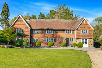
- Price
- Guide Price£1,500,000
- Size
- 1.2 acres
Fairwarp, Uckfield, TN22, Maresfield, East Sussex TN22 England
Added on 07/05/2026Country Home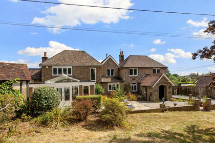
- Price
- £1,350,000
- Size
- 1.36 acres
Oldlands, Herons Ghyll, TN22, Maresfield, East Sussex TN22 England
Added on 01/09/2026House with Land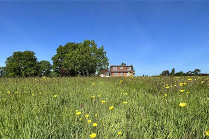
- Price
- Guide Price£1,395,000
- Size
- 13.78 acres
Near Ashdown Forest, Fairwarp, TN22, Maresfield, East Sussex TN22 England
Added on 07/05/2026Development Land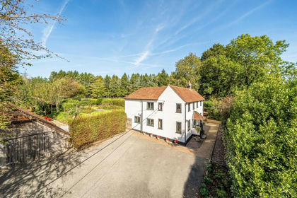
- Price
- Guide Price£1,350,000
- Size
- 3 acres
Herons Ghyll, Uckfield, East Sussex, Buxted, East Sussex TN22 England
Added on 29/09/2026House with Land
- Price
- Offers Over£1,250,000
- Size
- 1.1 acres
Rocks Lane, High Hurstwood, Uckfield, Buxted, East Sussex TN22 England
Added on 10/09/2026House with Land
- Price
- Offers in Excess of£1,500,000
- Size
- 1.3 acres
High Broom Lane, Crowborough, TN6, Crowborough, East Sussex TN6 England
Added on 10/03/2026House with Land
- Price
- £1,250,000
- Size
- 1.65 acres
Snatts Road, Uckfield, East Sussex, TN22, Uckfield, East Sussex TN22 England
Added on 15/09/2026House with Land
- Price
- £1,175,000
- Size
- 1.37 acres
Stone Cross, Crowborough, Rotherfield, East Sussex TN6 England
Added on 08/04/2026House with Land
- Price
- Offers in Excess of£1,500,000
- Size
- 4 acres
Pound Green, Buxted, Uckfield, East Sussex, TN22, Buxted, East Sussex TN22 England
Added on 31/03/2026House with Land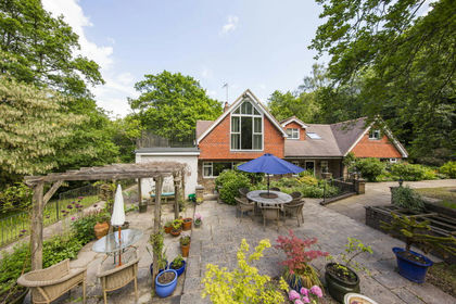
- Price
- £1,150,000
- Size
- 1.5 acres
Glenmore Road, Crowborough, Withyham, East Sussex TN6 England
Added on 24/03/2026House with Land