Isington Road, Isington, GU34
- Land size
- 5 acres
- Bedrooms
- 4
- Bathrooms
- 3
Key Features
- Entrance Hall
- Sitting Room
- Dining Room
- Kitchen/Breakfast Room
- Snug/2nd Sitting Room
- Utility Room
- Cloakroom
- Study
- 4 Bedrooms
- 2 En Suite Bath/Shower Rooms
Description
Southview Cottage occupies a superb position within some of Hampshire’s most attractive countryside adjoining a beautiful chalk river. The River Wey is at the far end of the grounds and provides a beautiful natural habitat. Designed to embrace its exceptional setting, the property offers light and versatile accommodation with many of the rooms enjoying multiple aspects, vaulted ceilings and far-reaching views across the surrounding gardens and grounds.
The accommodation combines spacious reception areas with flexible bedroom accommodation, creating a home ideally suited to both family living and entertaining. Throughout, there is a wonderful sense of connection to the landscape, with large windows framing views of the gardens, fields and mature trees beyond.
The first-floor vaulted sitting room is particularly impressive where exposed beams and full-height glazing together with a wood burning stove create a welcoming living space opening onto a balcony with stunning views. The kitchen/breakfast room forms the heart of the home, while a separate dining room provides an excellent space for more formal occasions and a charming and inviting snug with lovely views over the gardens provides a space for more relaxed family time.
Southview Cottage offers a rare opportunity to enjoy country living yet is only about half a mile from the mainline railway station at Bentley (London Waterloo in about an hour). Whether entertaining family and friends, gardening, keeping animals or simply enjoying the tranquillity of the surrounding landscape, the property offers an enviable lifestyle centred around space, privacy and nature.
The proximity of Alice Holt Forest provides extensive walking, cycling and riding opportunities, whilst the wider countryside and South Downs National Park offer endless opportunities to explore.
Outside
A particular feature of Southview Cottage is its beautiful setting and wonderfully maintained grounds, extending in all to just over five acres.
The established landscaped gardens immediately surround the house and offer colour, privacy and year-round interest. An attractive inner garden includes a pond, mature trees, seating areas and winding pathways, creating a series of charming outdoor spaces from which to enjoy the peaceful surroundings.
There is an impressive and productive kitchen garden to the east of the house with raised beds, greenhouses, growing and compost areas.
Beyond the formal gardens, the grounds open into three paddocks together with an established orchard, creating a wonderful balance of amenity, recreation and wildlife habitat. The grounds extend to include a length of the River Wey, a chalk stream valued for its fishing and enjoy glorious rural views, providing ample space for walking, recreation and outdoor pursuits.
There is a range of outbuildings including a stable yard with a loose box, tack room and workshop together with a small garage as well as a variety of useful garden stores and shed. Together, the paddocks and outbuildings offer considerable versatility and create an exceptional country lifestyle opportunity in this highly accessible yet peaceful rural setting. There is also a solar panel array currently generating cira £2500pa. The feed in tariff is guaranteed for approximately another 10 years.
Situation
Isington is a small and highly regarded Hampshire hamlet surrounded by attractive rolling countryside yet conveniently positioned for access to the market town of Alton and the Georgian town of Farnham. Neighbouring Bentley is a mile or so and has a mainline station (only about half a mile distant), village store, primary school and ‘The Star’ public house. A wider range of shops and services can be found in the market town of Farnham (5.2 miles) or Alton (5.7 miles). There is sailing and fishing at the National Trust Frensham Ponds and many well-regarded golf courses close by. The South Downs National Park and surrounding countryside offers some wonderful opportunities for walking, riding and cycling. The nearby Alice Holt Forest and Mad Swans ‘cafe, stay and play’ also provide ample opportunity for many outdoor pursuits.
There are a number of well-regarded schools in the area including Bentley and Binsted village primary schools, Frensham Heights, Lord Wandsworth College and Edgeborough. The A31 provides access to the A3 and M3 linking to London, the south coast and beyond.
Property Ref Number:
HAM-67101Additional Information
Local Authority
East Hampshire District Council
Council Tax Band: G
Map Location
Property details
- Tenure
- Freehold
- Council Tax Band
- G
- Date Posted
- 2026-08-13
Market Value Analysis
Compared with 471 Homes with Land listings in South East England (5+ acres).
Energy Performance Certificate
Energy Efficiency Rating
Based on UK Energy Performance Certificate standards (EU Directive 2002/91/EC)
Utilities & Restrictions
Utilities
- Electricity
- Ask Agent
- Water
- Ask Agent
- Heating
- Ask Agent
- Broadband
- Ask Agent
- Sewerage
- Ask Agent
Rights & Restrictions
- Public Rights of Way
- Ask Agent
- Private Rights of Way
- Ask Agent
- Listed Property
- Ask Agent
- Restrictions
- Ask Agent
Property Features
- Accessibility
- Ask Agent
- Parking
- Garage
- Garden
- Private Garden
Connectivity
Broadband
Fastest speed available at this postcode
80 Mbps
Superfast
Suitable for
- HD streaming
- Video calls
- Web & social
Mobile signal
Outdoor predictions; indoor signal depends on building materials.
Ofcom Connected Nations postcode-level predictions. Speeds and signal are modelled, not measured, and vary between addresses and providers.
Nearest Schools
Primary
- Bentley Church of England Primary School0.8 milesOfsted report card · Jan 2026
- Ages
- 4 to 11
- Pupils
- 179
- Type
- Voluntary controlled school
- Faith
- Church of England
- Binsted Church of England Primary School1.5 milesOfsted: Good
- Ages
- 4 to 11
- Pupils
- 80
- Type
- Voluntary controlled school
- Faith
- Church of England
- Rowledge Church of England Controlled Primary School2.2 milesNo Ofsted rating
- Ages
- 4 to 11
- Pupils
- 207
- Type
- Voluntary controlled school
- Faith
- Church of England
- St Peter's CofE Primary School3.1 milesNo Ofsted rating
- Ages
- 4 to 11
- Pupils
- 420
- Type
- Voluntary aided school
- Faith
- Church of England
- Crondall Primary School3.5 milesNo Ofsted rating
- Ages
- 5 to 11
- Pupils
- 189
- Type
- Academy converter
Secondary
- Weydon School3.1 milesOfsted: Good
- Ages
- 11 to 16
- Pupils
- 1,666
- Type
- Academy converter
- Eggar's School3.8 milesNo Ofsted rating
- Ages
- 11 to 16
- Pupils
- 744
- Type
- Academy converter
- Amery Hill School4.7 milesNo Ofsted rating
- Ages
- 11 to 16
- Pupils
- 982
- Type
- Academy converter
- Oakmoor School4.8 milesOfsted report card · Jan 2026
- Ages
- 11 to 16
- Pupils
- 912
- Type
- Academy sponsor led
- Farnham Heath End5.5 milesOfsted: Good
- Ages
- 11 to 16
- Pupils
- 1,059
- Type
- Academy converter
Distances are straight-line from the advertised location. Source: the national school registers (DfE, Welsh Government, Scottish Government) and Ofsted.
Amenities
Supermarket
GP surgery
Pharmacy
Hospital
Straight-line distances from the advertised location. Sources: NHS records, Geolytix supermarket locations, OS Open Greenspace and the national trails registers.
Getting Around
Nearest station
Nearest bus stop
Typical drive times
Straight-line distances from the advertised location; drive times are typical free-flow times over OpenStreetMap road data, so allow more at peak. Public transport locations from DfT NaPTAN.
Flood Risk
From Environment Agency flood map open data, checked around the advertised map pin and allowing for the listed acreage where known. This summary comes from LandSale, the advertising platform, not from the listing agent, and is not part of the agent's particulars. Risk can vary across a single holding, so verify anything critical through your own searches before committing.
Rivers and the sea
Mapped within the area searched, not at the advertised map pin itself.
Surface water
Mapped within the area searched, not at the advertised map pin itself.
The detail behind these bandings, including exact zones and annual chances, any recorded past flooding, plus planning, heritage, nature and ground checks, is in the .
Important notice: Information, maps and tags on this page are supplied by the advertising agent or generated automatically. LandSale has not verified them. Relying on these details is at your own risk, always carry out independent checks before committing to a purchase.
LandSale full disclaimer
Marketing information only - not formal particulars. The details on this website are provided for general guidance and do not constitute an offer or contract. Neither LandSale nor the advertising estate/land agent accepts responsibility for any inaccuracy.
1. Source of information
- Agent-supplied content: Core description, asking price, tenure, measurements, photographs and planning history are uploaded by the appointed agent, who remains solely responsible for their accuracy.
- Automated tags & categorisation: Property type, land-use class, acreage bands and similar labels may be applied by machine-learning models. They are intended as a helpful guide only and may not reflect the property's legal status or permitted use.
- Third-party & enriched data layers: Maps, boundary outlines, planning designations, soil reports, broadband coverage and other environmental or location-based insights are licensed from external suppliers. Such data are supplied “as is", may be incomplete or out of date and are subject to change without notice.
2. Verification required
Prospective purchasers must verify critical matters, including but not limited to planning permission, title boundaries, public rights of way, environmental constraints, acreage, services, access and VAT status, through their own inspections, specialist surveys, legal advisers and the selling agent before relying on the information or entering into any contract.
3. No warranty or liability
LandSale gives no warranty, express or implied, as to the accuracy, completeness or fitness for any particular purpose of the information displayed. LandSale shall not be liable for any loss, damage, cost or expense arising directly or indirectly from any use of or reliance on such information, save where liability may not be excluded by law.
4. Updates & feedback
If you believe any detail on this listing is inaccurate, please let us know. We will investigate and, where appropriate, update the listing or notify the agent.
© LandSale | Version 1.2 - January 2026
Listing agent
Hamptons, Alton
31 High Street, Alton, GU34 1AW
Similar properties for sale
- Price
- Offers in Excess of£1,250,000
- Size
- 4.2 acres
Added on 12/06/2026House with Land
- Price
- Offers in Excess of£2,000,000
- Size
- 3.6 acres
The Straits, Kingsley, GU35, Binsted, Hampshire GU35 England
Added on 27/03/2026Country Home
- Price
- Offers in Excess of£2,000,000
- Size
- 3.62 acres
The Straits, Wheatley, Hampshire, GU35, Binsted, Hampshire GU35 England
Added on 27/03/2026Country Home
- Price
- Guide Price£1,850,000
- Size
- 5 acres
Gardeners Hill Road, Lower Bourne, Farnham, Surrey, GU10, Farnham, Surrey GU10 England
Added on 22/06/2026House with Land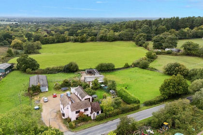
- Price
- Offers Over£1,400,000
- Size
- 15 acres
Doras Green Lane, Ewshot, Farnham, Crondall, Hampshire GU10 England
Added on 26/06/2026House with Land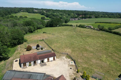
- Price
- Guide Price£1,500,000
- Size
- 6.5 acres
Added on 24/06/2026Barn Conversion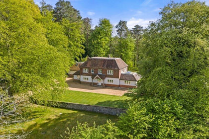
- Price
- Guide Price£1,595,000
- Size
- 2.17 acres
Headley Hill Road, Arford, Hampshire, GU35, Headley, Hampshire GU35 England
Added on 16/07/2026House with Land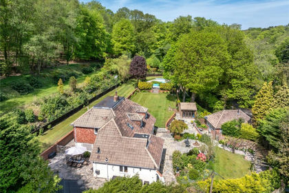
- Price
- Guide Price£1,695,000
- Size
- 7 acres
Fullers Vale, Headley Down, Hampshire, GU35, Headley, Hampshire GU35 England
Added on 22/06/2026House with Land
- Price
- Guide Price£1,750,000
- Size
- 5.5 acres
Lowicks Road, Rushmoor, Farnham, Surrey, GU10, Frensham, Surrey GU10 England
Added on 25/07/2026House with Land
- Price
- Guide Price£1,500,000
- Size
- 8 acres
Kitts Lane, Churt, Farnham, Hampshire, GU10, Churt, Surrey GU10 England
Added on 04/06/2026Mill Conversion