Lodge Farm, The Fosse Way, Upper Broughton, Melton Mowbray LE14
- Land size
- 76 acres
- Bedrooms
- 4
- Bathrooms
- 1
Key Features
- A ring-fenced farm set in approximately 76 acres (31 hectares).
- Well-positioned directly off the A46 with a 4-bedroom farmhouse and versatile range of agricultural buildings.
- Melton Mowbray 10 miles, Loughborough 10 miles, Nottingham 14 miles
- For sale as a whole
- Offers In Excess Of £1,600,000
Description
A ring-fenced farm set in approximately 76 acres (31 hectares). Well-positioned directly off the A46 with a 4-bedroom farmhouse and versatile range of agricultural buildings.
Melton Mowbray 10 miles, Loughborough 10 miles, Nottingham 14 miles
For sale as a whole
Offers In Excess Of £1,600,000
Situation - Lodge Farm is located to the north east of the village of Willoughby-on-the-Wolds and lies directly off the A46 on the historic Fosse Way.
The Farmland - The farmland comprises of 10 separate fields, which total approximately 76 acres (31 hectares). All the fields are pasture except for parcel SK6426 6452, which has been sown with a break crop of winter barley for harvest this year. The ring-fenced land surrounds both the farmhouse and farm buildings and is easily accessible from the main farm track leading to and from the public highway.
The land has an Agricultural Land Classification of Grade 3 (Good to Moderate) and all fields bar one have a mains water connection. The soil is of the Ragdale Association, made up of slowly permeable seasonally wet slightly acid but base-rich loamy and clayey soils mostly suited to grass production for beef and some cereals.
Viewings - Strictly by confirmed appointment with the vendor’s agent, Shouler & Son of Melton Mowbray. To arrange a viewing please telephone Ben Shouler on or Tim Harris on . Please note, viewing is at your own risk and neither Shouler & Son nor the vendor take any responsibility for any losses or damages incurred during inspection.
Method Of Sale - The freehold property is offered for sale by private treaty with vacant possession on completion.
Services - Private drainage system, mains electricity (single-phase and three-phase), mains water and oil-fired central heating.
Basic Payment - There are no delinked payments available to the purchaser.
Environmental Schemes - The land is part of a Sustainable Farming Incentive Agreement that commenced on the 1st December 2023 and ends on the 30th November 2026. Further details are available from the vendor’s agent.
Designations - The land is situated in a Nitrate Vulnerable Zone (NVZ).
Sporting, Timber And Mineral Rights - All sporting, timber and mineral rights are included in the freehold sale in so far as they are owned.
Overage - The farm buildings at Lodge Farm will be sold subject to an overage on future residential development, save only for any extension of the existing dwelling. The overage will apply to any other residential development of the farm buildings, including that linked to agricultural or equestrian uses. The grant of planning permission will be a trigger event for overage. The rate will be 25% for 30 years from the completion date.
Local Authority - Nottinghamshire County Council (County Council)
Rushcliffe Borough Council (Borough Council)
Wayleaves, Easements And Rights Of Way - The land and buildings are sold subject to and with the benefit of all rights including; rights of way, whether public or private, light, support, drainage, water and electricity supplies and other rights and obligations, easements and quasi-easements and restrictive covenants and all existing and proposed wayleaves for masts, pylons, stays, cables, drains, water and gas and other pipes whether referred to in these particulars or not.
A public bridleway and a public footpath run through the land and are shown by their respective dashed green lines on the plan within the particulars of sale. Both traverse north east from the village of Willoughby-on-the-Wolds to the A46.
There are a number of telegraph poles with overhead electricity lines situated within the land and the telegraph pole within the farmyard has a transformer.
Vat - We understand the property has not been opted to tax and therefore VAT will not be chargeable in addition to the purchase price. In the event that a sale of the property or any part thereof becomes a chargeable supply for the purposes of VAT, such tax will be payable in addition to the sale price.
Health And Safety - Given the potential hazards of a working farm, we ask you be as vigilant as possible when making your inspection for your own personal safety, particularly around farm buildings, livestock and machinery.
What3words Access Point - bath.remover.chaos
Lodge Farm Buildings And Yard - 1. Lodge Farmhouse – see floorplan and description on page 10 of the particulars of sale.
2. Old Cow Shed & Boiler Room - built of brick with concrete floor, timber roof trusses and asbestos roof sheets, approximately 25ft x 15ft.
3. Water Tank Shed – built of brick with concrete floor, timber roof trusses and asbestos roof sheets, approximately 30ft x 15ft.
4. Pole Barn - part sleeper walled and part walled in metal sheeting with a mixture of fibre cement and asbestos roof sheets, approximately 2,900 ft2 in total.
5. Atcost Building – a two-bay concrete portal-framed building with concrete floor, open frontage and brick walling to three sides. Part-clad in metal and asbestos sheeting with asbestos roof sheets, approximately 30ft x 20ft.
6. Former Piggery/Kennels –timber-framed construction with concrete floor and brick and concrete-rendered walls, timber cladding, timber roof trusses and slate roof tiles, approximately 80ft x 15ft.
7. Brick Built Wash House – concrete floor with sink unit, water heater and asbestos roof sheets, approximately 15ft x 10ft.
8. Open Fronted Hovel – made of four brick columns and breeze block walling to sides, with a metal framed roof and asbestos roof sheets, approximately 30ft x 15ft.
9. Dutch Barn & Lean-to – a three-bay steel-framed Dutch barn with an attached three-bay timber-framed lean-to, both with fibre cement roof sheets. The lean-to has a sheeted door and gate to the front, concrete wall panels to the rear, diagonal feed barriers to one side and Armco barriers to the other. The external side and rear elevations are clad in Yorkshire boarding. Approximately 45ft x 45ft in total.
To the rear of the Dutch Barn is a further small lean-to, constructed with steel girders and fibre cement roof sheets. It has breeze block walling to the rear and metal sheeting to one side, measuring approximately 23½ft x 15ft.
10. Grain Store – a steel portal-framed building with part concrete floor and fibre cement roof sheets. Grain walling to part, with the remainder finished in corrugated metal sheets. Clad in fibre cement sheeting with access via a roller shutter door. The building contains two Kongskilde 30-tonne grain drying bins and measures approximately 75ft x 45ft.
11. Livestock Building – built by Graham Heath Construction Ltd, this steel portal-framed building includes a 14ft concrete feed pad, concrete wall panels and HIGHLIGHT cladding to both gable ends and the rear elevation. It has fibre cement roof sheets and sheeted doors to the gable ends. The open-fronted side is fitted with self-locking yoke panels and cattle yard gates and measures approximately 100ft x 40ft.
12. Agricultural Building – also built by Graham Heath Construction Ltd, this steel portal-framed building includes a 15ft concrete apron, concrete wall panels and HIGHLIGHT cladding to both gable ends and the rear elevation. It also has fibre cement roof sheets and measures approximately 100ft x 50ft.
13. Workshop – built of breeze block walling with metal double doors, concrete floor and box profile roof sheets, approximately 35ft x 20ft.
Lodge Farmhouse - Lodge Farmhouse combines traditional character with spacious family accommodation, offering a practical layout, bright and comfortable living areas, and generous outside space including a large garden, productive vegetable patch and adjoining orchard.
The property is entered via an entrance porch, leading into a well-appointed kitchen with ample storage and workspace. A separate utility room keeps laundry and household appliances neatly tucked away, while the living room and dining area form the heart of the home, providing comfortable space for everyday family life and more formal entertaining, with views over the rear aspect.
On the first floor, a central landing gives access to four well-proportioned bedrooms, including three generous double bedrooms and a versatile single bedroom currently used as a home office, making it well suited to remote working or use as a nursery. The accommodation is completed by a family bathroom serving all four bedrooms.
EPC energy rating: E
Council Tax band: Band E – 2026/27 payment £3,170.93
Map Location
Property details
- Tenure
- Freehold
- Council Tax Band
- Ask Agent
- Date Posted
- 2026-08-11
Market Value Analysis
Compared with 26 Farms & Smallholdings listings in East Midlands (75+ acres).
Energy Performance Certificate
Energy Efficiency Rating
Based on UK Energy Performance Certificate standards (EU Directive 2002/91/EC)
Running costs are one side. Planning activity, flood history and ground risks for this location are in the full report.
Utilities & Restrictions
Utilities
- Electricity
- Ask Agent
- Water
- Ask Agent
- Heating
- Ask Agent
- Broadband
- Ask Agent
- Sewerage
- Ask Agent
Rights & Restrictions
- Public Rights of Way
- Ask Agent
- Private Rights of Way
- Ask Agent
- Listed Property
- Ask Agent
- Restrictions
- Ask Agent
Listed status, conservation areas and planning constraints for this location are in the full report.
Property Features
- Accessibility
- Ask Agent
- Parking
- Ask Agent
- Garden
- Garden
Beyond the particulars: planning activity, flood history, heritage and ground risks, checked for this exact spot.
Connectivity
Broadband
Fastest speed available at this postcode
4 Mbps
Under 10 Mbps here
Suitable for
- Basic browsing & email
Mobile signal
Predicted 4G and 5G signal; indoor signal depends on building materials.
Ofcom Connected Nations postcode-level predictions. Speeds and signal are modelled, not measured, and vary between addresses and providers.
Signal is the easy part. Planning activity, flood history and protected designations here are in the full report.
Nearest Schools
Primary
- Willoughby Primary School1.2 milesOfsted report card · Apr 2026
- Ages
- 4 to 11
- Pupils
- 47
- Type
- Community school
- Old Dalby Church of England Primary School2.2 milesOfsted: Good
- Ages
- 4 to 11
- Pupils
- 163
- Type
- Academy converter
- Faith
- Church of England
- Kinoulton Primary School2.9 milesOfsted: Good
- Ages
- 3 to 11
- Pupils
- 141
- Type
- Academy converter
- Willow Brook Primary School3.1 milesNo Ofsted rating
- Ages
- 5 to 11
- Pupils
- 191
- Type
- Community school
- Wymeswold Church of England Primary School3.5 milesNo Ofsted rating
- Ages
- 4 to 11
- Pupils
- 115
- Type
- Voluntary controlled school
- Faith
- Church of England
Secondary
- The South Wolds Academy & Sixth Form3.5 milesOfsted: Good *
- Ages
- 11 to 18
- Pupils
- 1,033
- Type
- Academy converter
- East Leake Academy5.7 milesOfsted: Good *
- Ages
- 11 to 18
- Pupils
- 1,118
- Type
- Academy converter
- Rushcliffe Spencer Academy6.9 milesOfsted: Outstanding *
- Ages
- 11 to 18
- Pupils
- 2,039
- Type
- Academy converter
- John Ferneley College7.2 milesOfsted: Requires improvement
- Ages
- 11 to 16
- Pupils
- 1,170
- Type
- Academy converter
- Humphrey Perkins School7.2 milesOfsted: Good *
- Ages
- 11 to 16
- Pupils
- 863
- Type
- Academy converter
* Latest graded judgement covers quality of education only; no overall grade was issued under the 2024-25 inspection framework.
Distances are straight-line from the advertised location. Source: the national school registers (DfE, Welsh Government, Scottish Government) and Ofsted.
Schools are just the start: sold prices nearby, planning activity and any flood history are in the full report.
Amenities
Supermarket
GP surgery
Pharmacy
Hospital
Straight-line distances from the advertised location. Sources: NHS records, Geolytix supermarket locations, OS Open Greenspace and the national trails registers.
The area stacks up? Now check the location itself: planning nearby, protected designations and past flooding.
Getting Around
Nearest station
Nearest bus stop
Typical drive times
Straight-line distances from the advertised location; drive times are typical free-flow times over OpenStreetMap road data, so allow more at peak. Public transport locations from DfT NaPTAN.
Easy to reach matters. So do planning activity, flood history and ground risks: all in the full report.
Flood Risk
Environment Agency open data, checked around the advertised map pin for the listed acreage. Long-term risk counts flood defences; the planning map's flood zones do not. The map pin for this listing is approximate, so these readings describe the surrounding area. Provided by LandSale, not the listing agent, and not part of the agent's particulars. Risk varies across a holding, so verify before committing.
Rivers and the sea
Planning map: Flood Zone 1.
Surface water
Not at the pin: mapped about 30 metres away.
These bandings are the summary. Where this location sits on the flood maps, plus planning activity, heritage and ground risks, is in the full report.
Important notice: Information, maps and tags on this page are drawn from the advertising agent's marketing materials or generated automatically. LandSale has not verified them. Relying on these details is at your own risk, always carry out independent checks before committing to a purchase.
LandSale full disclaimer
Marketing information only - not formal particulars. The details on this website are provided for general guidance and do not constitute an offer or contract. Neither LandSale nor the advertising estate/land agent accepts responsibility for any inaccuracy.
1. Source of information
- Listing content: Core description, asking price, tenure, measurements, photographs and planning history originate from the marketing materials of the advertising estate or land agent. LandSale does not author this content and cannot guarantee its accuracy.
- Automated tags & categorisation: Property type, land-use class, acreage bands and similar labels may be applied by machine-learning models. They are intended as a helpful guide only and may not reflect the property's legal status or permitted use.
- Third-party & enriched data layers: Maps, boundary outlines, planning designations, soil reports, broadband coverage and other environmental or location-based insights are licensed from external suppliers. Such data are supplied “as is", may be incomplete or out of date and are subject to change without notice.
2. Verification required
Prospective purchasers must verify critical matters, including but not limited to planning permission, title boundaries, public rights of way, environmental constraints, acreage, services, access and VAT status, through their own inspections, specialist surveys, legal advisers and the selling agent before relying on the information or entering into any contract.
3. No warranty or liability
LandSale gives no warranty, express or implied, as to the accuracy, completeness or fitness for any particular purpose of the information displayed. LandSale shall not be liable for any loss, damage, cost or expense arising directly or indirectly from any use of or reliance on such information, save where liability may not be excluded by law.
4. Updates & feedback
If you believe any detail on this listing is inaccurate, please let us know. We will investigate and, where appropriate, update the listing or notify the agent.
© LandSale | Version 1.3 - August 2026
Listing agent
Shouler & Son, Melton Mowbray
County Chambers, Kings Road, Melton Mowbray, LE13 1QF
Contact Shouler & Son, Melton Mowbray
County Chambers, Kings Road, Melton Mowbray, LE13 1QF
View agent profileSimilar properties for sale
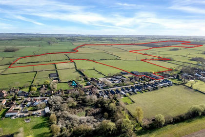
- Price
- Guide Price£2,000,000
- Size
- 213.99 acres
Land and Buildings at Ivy Farm, Kinoulton, Nottinghamshire, Kinoulton, Nottinghamshire NG12 England
Added on 15/03/2026Farmland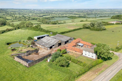
- Price
- Guide Price£1,500,000
- Size
- 98.77 acres
Lodge Farm, Melton Road, Long Clawson, Melton Mowbray LE14, Ab Kettleby, Leicestershire LE14 England
Added on 23/09/2026Farm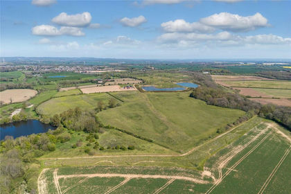
- Price
- Guide Price£1,200,000
- Size
- 156.74 acres
Added on 27/06/2026Farm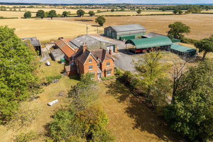
- Price
- Guide Price£1,630,000
- Size
- 98.8 acres
Added on 18/09/2026Farm
- Price
- Guide Price£1,450,000
- Size
- 84.26 acres
Main Street Newbold, Rugby CV21, Rugby, Warwickshire CV21 England
Added on 10/05/2026Farm
- Price
- Guide Price£1,995,000
- Size
- 73.92 acres
Monkwood Farm, Barlow, Dronfield, Barlow, Derbyshire S18 England
Added on 25/04/2026House with Land- Price
- Offers in Region of£1,750,000
- Size
- 50 acres
Monkwood Farm, Barlow, Dronfield, Barlow, Derbyshire S18 England
Added on 07/05/2026House with Land