Far Hanging Stones Barn, Hanging Stones Lane, Ripponden HX6
- Land size
- 3.71 acres
- Bedrooms
- 4
- Bathrooms
- 3
Key Features
- STYLISH BARN CONVERSION WITH LAND
- SOUGHT AFTER LOCATION WITH FAR-REACHING VIEWS
- QUALITY FIXTURES & FITTINGS THROUGHOUT
- SPACIOUS BREAKFAST KITCHEN & SEPARATE UTILITY
- OPEN PLAN LIVING/DINING ROOM
- FOUR DOUBLE BEDROOMS
- BATHROOM, SHOWER ROOM & EN-SUITE
- OFF-ROAD PARKING
- LANDSCAPED GARDENS & LAND
Description
Far Hanging Stones Barn is a semi-detached barn conversion, recently renovated and finished to a high standard with quality fixtures and fittings. The property enjoys an elevated position with expansive views and is located on a private lane just a short walk from the centre of Ripponden; extensive countryside and riverside walks can be enjoyed from the doorstep.
The accommodation is arranged over two floors and briefly comprises a huge living room / dining room which opens through to a luxurious kitchen, utility room, four double bedrooms, bathroom and two shower rooms.
Externally there are extensive landscaped gardens to front and rear as well as a 1.5 hectare paddock and generous off-road parking.
GROUND FLOOR
Breakfast Kitchen
Sitting Room / Dining Room
Bedroom 4
Shower Room
Utility Room
FIRST FLOOR
Bedroom 1
En-suite Shower
Bedroom 2
Bedroom 3
House Bathroom
INTERNAL
The property is entered into the light and airy breakfast kitchen that benefits from windows to two elevations and Velux rooflights affording plentiful natural light. The breakfast kitchen is fitted with quality units and complementary work surfaces incorporating a Butler sink and equipped with a Bosch double oven, induction hob, filter canopy with integrated fridge, freezer and dishwasher.
The breakfast kitchen is open through to the spacious Sitting / Dining Room which features the original barn door, now fully glazed and affording extensive views across the valley; an open staircase rises to the first floor. There is a ground floor bedroom / study with adjacent three-piece shower room and the ground floor accommodation is completed with a smart utility room which houses full height storage and has plumbing for a washing machine and space for a dryer. A door gives access to the rear garden and patio.
There are three double bedrooms to the first floor, the Master features ceilings open to roof height with exposed timber beams and dual aspect windows afford far-reaching views across the valley. The Master en-suite houses a shower cubicle, WC and wash basin. The stunning family bathroom houses a shower cubicle, free-standing bath, WC and wash basin mounted on a vanity unit. The first floor accommodation is completed with a useful store room.
EXTERNAL
A pathway of Yorkshire stone flags surrounds the property and there is ample parking for 3-5 vehicles. The extensive front garden has a level lawn and features a delightful pergola with electric points and lighting – an ideal al fresco entertainment area; there is a newly planted fruit orchard and useful timber sheds. To the rear of the property are raised stone flagged patios and timber sundecks surrounded by sloping lawns. There is a timber summerhouse with electric, internet and heat, currently utilised as a home office. In addition there is a sloping paddock of approximately 1.5 hectares which could provide grazing.
LOCATION
The property is located just a short distance from the heart of Ripponden, close to all local amenities which include a church, village school, health centre, vets, dental practice and a selection of shops, pubs and restaurants. The M62 is only 15 minutes’ drive away, providing excellent commuter links and there are mainline railway stations with direct links to Manchester and Leeds in Sowerby Bridge and Littleborough. There is also a regular bus service through Ripponden.
SERVICES
Water is provided by a bore hole which means no monthly water bills; a treatment plant caters for waste from the property. There is mains gas and electricity and CCTV installed around the property.
TENURE
Freehold
DIRECTIONS
From the traffic lights in the centre of Ripponden turn right into Elland Road and then first left into Bridge End, bearing right in front of St. Bartholomew’s Church into Old Bank and continue uphill bearing left on to Hanging Stones Lane. Continue along the lane, keeping left where the road forks. Far Hanging Stones Barn is the second property on the right.
IMPORTANT NOTICE
These particulars are produced in good faith, but are intended to be a general guide only and do not constitute any part of an offer or contract. No person in the employment of VG Estate Agent has any authority to make any representation of warranty whatsoever in relation to the property. Photographs are reproduced for general information only and do not imply that any item is included for sale with the property. All measurements are approximate. Sketch plan not to scale and for identification only. The placement and size of all walls, doors, windows, staircases and fixtures are only approximate and cannot be relied upon as anything other than an illustration for guidance purposes only.
MONEY LAUNDERING REGULATIONS
In order to comply with the ‘Money Laundering, Terrorist Financing and Transfer of Funds (Information on the Payer) Regulations 2017’, intending purchasers will be asked to produce identification documentation and we would ask for your co-operation in order that there will be no delay in agreeing the sale.
Map Location
Property details
- Tenure
- Freehold
- Council Tax Band
- E
- Date Posted
- 2026-08-08
Market Value Analysis
Compared with 670 Homes with Land listings in Yorkshire and The Humber (1+ acres).
Utilities & Restrictions
Utilities
- Electricity
- Ask Agent
- Water
- Ask Agent
- Heating
- Ask Agent
- Broadband
- Ask Agent
- Sewerage
- Ask Agent
Rights & Restrictions
- Public Rights of Way
- Ask Agent
- Private Rights of Way
- Ask Agent
- Listed Property
- Ask Agent
- Restrictions
- Ask Agent
Listed status, conservation areas and planning constraints for this location are in the full report.
Property Features
- Accessibility
- Ask Agent
- Parking
- Parking Available
- Garden
- Garden
Beyond the particulars: planning activity, flood history, heritage and ground risks, checked for this exact spot.
Connectivity
Broadband
Fastest speed available at this postcode
1.8 Gbps
Gigabit full fibre · available to 50% of premises
Suitable for
- 4K streaming on every screen
- Full-time home working
- Online gaming & big downloads
Fixed wireless access may also be an option here.
Mobile signal
Predicted 4G and 5G signal; indoor signal depends on building materials.
Ofcom Connected Nations postcode-level predictions. Speeds and signal are modelled, not measured, and vary between addresses and providers.
Signal is the easy part. Planning activity, flood history and protected designations here are in the full report.
Nearest Schools
Primary
- Ripponden Junior and Infant School199 metresNo Ofsted rating
- Ages
- 4 to 11
- Pupils
- 171
- Type
- Community school
- Barkisland CofE VA Primary School932 metresOfsted: Good
- Ages
- 4 to 11
- Pupils
- 197
- Type
- Voluntary aided school
- Faith
- Church of England
- St Mary's CofE (VC) J and I School1 mileOfsted: Good
- Ages
- 4 to 11
- Pupils
- 61
- Type
- Voluntary controlled school
- Faith
- Church of England
- Triangle CofE VC Primary School1.4 milesOfsted: Good
- Ages
- 4 to 11
- Pupils
- 173
- Type
- Voluntary controlled school
- Faith
- Church of England
- St John's Primary School In Rishworth1.4 milesOfsted: Good
- Ages
- 4 to 11
- Pupils
- 152
- Type
- Academy converter
- Faith
- Church of England
Secondary
- Ryburn Valley High School1.8 milesNo Ofsted rating
- Ages
- 11 to 18
- Pupils
- 1,589
- Type
- Academy converter
- Trinity Academy Grammar2.8 milesOfsted: Good
- Ages
- 11 to 16
- Pupils
- 968
- Type
- Academy sponsor led
- The Crossley Heath School3.3 milesOfsted: Good
- Ages
- 11 to 18
- Pupils
- 1,179
- Type
- Academy converter
- The Brooksbank School3.5 milesOfsted: Good *
- Ages
- 11 to 18
- Pupils
- 1,446
- Type
- Academy converter
- The Halifax Academy3.7 milesOfsted: Good
- Ages
- 4 to 16
- Pupils
- 1,461
- Type
- Academy converter
* Latest graded judgement covers quality of education only; no overall grade was issued under the 2024-25 inspection framework.
Distances are straight-line from the advertised location. Source: the national school registers (DfE, Welsh Government, Scottish Government) and Ofsted.
Schools are just the start: sold prices nearby, planning activity and any flood history are in the full report.
Amenities
Supermarket
GP surgery
Pharmacy
Hospital
Green space
Straight-line distances from the advertised location. Sources: NHS records, Geolytix supermarket locations, OS Open Greenspace and the national trails registers.
The area stacks up? Now check the location itself: planning nearby, protected designations and past flooding.
Getting Around
Nearest station
Nearest bus stop
Typical drive times
Straight-line distances from the advertised location; drive times are typical free-flow times over OpenStreetMap road data, so allow more at peak. Public transport locations from DfT NaPTAN.
Easy to reach matters. So do planning activity, flood history and ground risks: all in the full report.
Flood Risk
Environment Agency open data, checked around the advertised map pin for the listed acreage. Long-term risk counts flood defences; the planning map's flood zones do not. Provided by LandSale, not the listing agent, and not part of the agent's particulars. Risk varies across a holding, so verify before committing.
Rivers and the sea
Not at the pin: mapped about 60 metres away.
Planning map: Flood Zone 3, about 50 metres away.
Surface water
Not at the pin: mapped about 70 metres away.
These bandings are the summary. Where this location sits on the flood maps, plus planning activity, heritage and ground risks, is in the full report.
Important notice: Information, maps and tags on this page are drawn from the advertising agent's marketing materials or generated automatically. LandSale has not verified them. Relying on these details is at your own risk, always carry out independent checks before committing to a purchase.
LandSale full disclaimer
Marketing information only - not formal particulars. The details on this website are provided for general guidance and do not constitute an offer or contract. Neither LandSale nor the advertising estate/land agent accepts responsibility for any inaccuracy.
1. Source of information
- Listing content: Core description, asking price, tenure, measurements, photographs and planning history originate from the marketing materials of the advertising estate or land agent. LandSale does not author this content and cannot guarantee its accuracy.
- Automated tags & categorisation: Property type, land-use class, acreage bands and similar labels may be applied by machine-learning models. They are intended as a helpful guide only and may not reflect the property's legal status or permitted use.
- Third-party & enriched data layers: Maps, boundary outlines, planning designations, soil reports, broadband coverage and other environmental or location-based insights are licensed from external suppliers. Such data are supplied “as is", may be incomplete or out of date and are subject to change without notice.
2. Verification required
Prospective purchasers must verify critical matters, including but not limited to planning permission, title boundaries, public rights of way, environmental constraints, acreage, services, access and VAT status, through their own inspections, specialist surveys, legal advisers and the selling agent before relying on the information or entering into any contract.
3. No warranty or liability
LandSale gives no warranty, express or implied, as to the accuracy, completeness or fitness for any particular purpose of the information displayed. LandSale shall not be liable for any loss, damage, cost or expense arising directly or indirectly from any use of or reliance on such information, save where liability may not be excluded by law.
4. Updates & feedback
If you believe any detail on this listing is inaccurate, please let us know. We will investigate and, where appropriate, update the listing or notify the agent.
© LandSale | Version 1.3 - August 2026
Listing agent
V G Estate Agent, Ripponden
119A Halifax Road, Ripponden, West Yorkshire HX6 4DA
View agent profileSimilar properties for sale
- Price
- £650,000
- Size
- 2 acres
Stone Gables, Cross Wells Road, Soyland HX6, Ripponden, Calderdale HX6 England
Added on 17/06/2026Barn Conversion
- Price
- £625,000
- Size
- 2 acres
2 Helm Barn, Helm Lane, Triangle HX6, Calder Valley, Calderdale HX6 England
Added on 30/06/2026Barn Conversion
- Price
- £595,950
- Size
- 4 acres
Added on 13/06/2026House with Land
- Price
- Guide Price£795,000
- Size
- 1.26 acres
The Woodlands, Ripley Terrace, Luddendenfoot, Halifax, HX2, Calder Valley, Calderdale HX2 England
Added on 23/07/2026House with Land
- Price
- Offers Over£595,950
- Size
- 1 acres
Foster Clough, Height Road, Hebden Bridge, Hebden Royd, Calderdale HX7 England
Added on 16/09/2026Barn Conversion
- Price
- Offers Over£700,000
- Size
- 1 acres
New Hall, Whitwell Green Lane, Elland, Calder Valley, Calderdale HX5 England
Added on 25/06/2026House with Land
- Price
- £810,000
- Size
- 5 acres
Meadows Farm, Lee Bottom Road, Todmorden, OL14, Todmorden, Calderdale OL14 England
Added on 27/03/2026Farmhouse
- Price
- Guide Price£590,000
- Size
- 1.2 acres
Crosland Edge, Meltham, Holmfirth, West Yorkshire, HD9, Meltham, Kirklees HD9 England
Added on 26/08/2026Cottage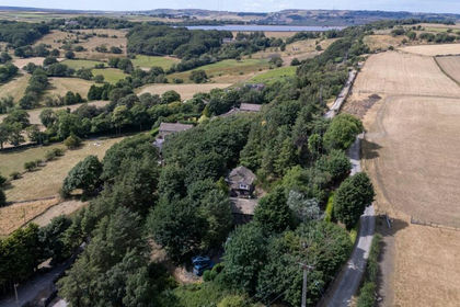
- Price
- Guide Price£590,000
- Size
- 1.2 acres
Added on 20/08/2026Cottage
- Price
- Offers Over£600,000
- Size
- 8.5 acres
Butternab Farm, Butternab Road, Beaumont Park, Huddersfield, Huddersfield, Kirklees HD4 England
Added on 29/01/2026House with Land