Scrubbs Lane, Shilton, Burford
- Land size
- 1.46 acres
Key Features
- Sale by Auction on Wednesday 30 September 2026
- 1.455 acres of land suitable for development
- Planning Permission granted
- Viewings strictly by appointment only
Description
For sale by public auction at North Cotswold Saleroom at 6pm on Wednesday 30th September 2026.
A rare opportunity to purchase 1.455 acres of prime commercial development land with planning permission granted, situated within the Oxford-Cambridge Growth Corridor and within 3 miles of the fastest growing town in West Oxfordshire.
Viewings - Viewing is strictly by appointment only. If you wish to view the land, please contact Oliver Evans in our Stow-on-the-Wold office - oliver.
Important Notice - If you take it upon yourself to view the land unaccompanied (with or without consent) then you do so at your own risk. The vendors and their agents [who are willing to accompany you at any reasonable time by prior arrangement] accept no responsibility for any accidents which may occur during a viewing.
Potential purchasers are advised to wear sturdy footwear and take utmost care and caution at all times.
Directions - From Burford, continue on the A361 towards Lechlade, at the junction to the Cotswold Wildlife Park, turn left onto Hen 'n' Chic Lane, proceed until the right hand turning for Scrubbs Lane, pass the Cotswold Natural Stone yard and the land is situated up the next turn on the right hand side.
What3words - ///sourcing.regulator.streamers.
Location - The land is situated approximately 1 mile from the desirable village of Shilton, which lies between the towns of Burford (3 miles) and Carterton (3 miles) in West Oxfordshire. Often regarded as the gateway to the Cotswolds, Burford is a picturesque market town with a good range of independent shops serving both residents and tourists alike, with the larger town of Carterton, the fastest growing town in West Oxfordshire, providing a number of local services and facilities. The land is well positioned to the A40, providing direct access to both Oxford (20 miles) and Cheltenham (25 miles) leading to both London (approx. 75 miles) and Bristol (approx. 60 miles). Most notably, the site sits within the increasingly desirable Oxford-Cambridge Growth Corridor. The nearest rail stations are Charlbury and Kingham both within 12 miles.
Description - The land, totalling 1.455 acres, is predominantly level and suitable for development. Currently laid to a hardcore and utilised as car parking and storage, the land also houses a portacabin. Site is securely fenced and gated.
Planning - The land has recently been granted planning permission on two occasions, firstly in April 2025 (reference: 25/00273/FUL) for the erection of two storage buildings and a portacabin, and secondly for the erection of an office building in November 2025 (reference: 25/01574/FUL). We understand the site sits outside of the Cotswolds AONB. Prospective purchasers must satisfy themselves as to the planning status of the Property and the suitability of the Property for their intended use.
Tenure & Possession - Freehold. We understand the land will be sold with vacant possession, to include the portacabin, on completion.
Services - We understand services including water, sewage and electricity are connected to the existing portacabin.
Local Authority - West Oxfordshire District Council, Woodgreen, Witney, Oxon OX28 1NB. Tel: .
Special Conditions Of Sale - These will be available for inspection at the Stow-on-the-Wold office of the Auctioneers, during normal office hours for fourteen days prior to the Auction Sale. They will not be read out at the Auction. It will be assumed that the purchaser has bid with full knowledge of such conditions of sale whether in fact he or she has inspected the same or not.
Auction Pack - This will be available from the Vendor's solicitor 14 days before the auction.
Vendor's Solicitor - Mr Joe Middleton
Lightfoot LLP
2, High Street
Thame
OX9 2BX
Tel:
Email:
Prospective Purchasers - Parties interested in purchasing the land are advised to register an interest with the agents prior to the auction so that they may be advised of any variations or updates.
Administrative Fee - The successful purchaser will be liable for an administration charge of £2,000 plus VAT payable to ‘Tayler and Fletcher’ and this will be a condition of the contract.
Reserve - The land will be offered for sale subject to an undisclosed Reserve and the vendors retain the right for the Auctioneers to bid on their behalf up to the Reserve price. The Vendor’s also reserve the right to sell or withdraw the land prior to the auction.
Telephone / Proxy Bidding - Prospective purchasers are advised that it may be possible to leave a Proxy bid with the auctioneers or bid by telephone, subject to prior agreement. For our terms relating to proxy/ telephone bidding please ask for a copy of our policy. Please note there may be an additional cost associated for this service.
Deposit & Completion - On the fall of the hammer the successful purchaser will be required to sign the contract in the sale room and pay ten per cent deposit by bank transfer the following morning and by prior agreement with the Vendor’s solicitors. Completion will be 28 days thereafter or earlier by mutual agreement, when the balance of the purchase monies are due.
Anti Money Laundering - Anyone wishing to bid at the auction will be required to provide proof of identity to satisfy the money laundering regulations before the auction commences. This must be a proof of address, Utility bill no older than 3 months or Council Tax bill for the current period, and photographic ID, Driving Licence or Passport.
Date Of Sale - Wednesday 30th September 2026 at 6pm precisely.
Place Of Sale - The auction sale will take place at Tayler & Fletcher's North Cotswold Saleroom, Lansdowne, Bourton-on-the-Water, Gloucestershire GL54 2AR.
Please see map opposite and do not rely on Sat Nav.
Map Location
Property details
- Tenure
- Freehold
- Council Tax Band
- Ask Agent
- Date Posted
- 2026-08-05
Market Value Analysis
Compared with 109 Development Land listings in South East England (1+ acres).
Utilities & Restrictions
Utilities
- Electricity
- Ask Agent
- Water
- Ask Agent
- Heating
- Ask Agent
- Broadband
- Ask Agent
- Sewerage
- Ask Agent
Rights & Restrictions
- Public Rights of Way
- Ask Agent
- Private Rights of Way
- Ask Agent
- Listed Property
- Ask Agent
- Restrictions
- Ask Agent
Property Features
- Accessibility
- Ask Agent
- Parking
- Parking Available
- Garden
- Garden
Connectivity
Broadband
Fastest speed available at this postcode
1 Gbps
Gigabit full fibre
Suitable for
- 4K streaming on every screen
- Full-time home working
- Online gaming & big downloads
Mobile signal
Outdoor predictions; indoor signal depends on building materials.
Ofcom Connected Nations postcode-level predictions. Speeds and signal are modelled, not measured, and vary between addresses and providers.
Nearest Schools
Primary
- St Joseph's Catholic Primary School, Carterton1.1 milesOfsted: Good
- Ages
- 3 to 11
- Pupils
- 107
- Type
- Academy converter
- Faith
- Roman Catholic
- Carterton Primary School1.1 milesOfsted: Requires improvement
- Ages
- 3 to 11
- Pupils
- 225
- Type
- Academy sponsor led
- Edith Moorhouse Primary School1.2 milesOfsted: Good
- Ages
- 3 to 11
- Pupils
- 336
- Type
- Academy converter
- St John the Evangelist CofE VA Primary School1.3 milesOfsted: Outstanding
- Ages
- 3 to 11
- Pupils
- 452
- Type
- Voluntary aided school
- Faith
- Church of England
- Gateway Primary School1.5 milesOfsted: Good
- Ages
- 4 to 11
- Pupils
- 300
- Type
- Community school
Secondary
- Carterton Community College0.8 milesOfsted report card · Apr 2026
- Ages
- 11 to 18
- Pupils
- 774
- Type
- Community school
- Burford School2.4 milesNo Ofsted rating
- Ages
- 11 to 18
- Pupils
- 1,452
- Type
- Academy converter
- The Henry Box School5.5 milesNo Ofsted rating
- Ages
- 11 to 18
- Pupils
- 1,027
- Type
- Academy converter
- Wood Green School6.4 milesNo Ofsted rating
- Ages
- 11 to 18
- Pupils
- 1,335
- Type
- Academy converter
- Farmor's School8.1 milesOfsted report card · Feb 2026
- Ages
- 11 to 18
- Pupils
- 1,067
- Type
- Academy converter
Distances are straight-line from the advertised location. Source: the national school registers (DfE, Welsh Government, Scottish Government) and Ofsted.
Amenities
Supermarket
GP surgery
Pharmacy
Hospital
Green space
Straight-line distances from the advertised location. Sources: NHS records, Geolytix supermarket locations, OS Open Greenspace and the national trails registers.
Getting Around
Nearest station
Nearest bus stop
Typical drive times
Straight-line distances from the advertised location; drive times are typical free-flow times over OpenStreetMap road data, so allow more at peak. Public transport locations from DfT NaPTAN.
Flood Risk
From Environment Agency flood map open data, checked around the advertised map pin and allowing for the listed acreage where known. This summary comes from LandSale, the advertising platform, not from the listing agent, and is not part of the agent's particulars. Risk can vary across a single holding, so verify anything critical through your own searches before committing.
Rivers and the sea
Surface water
The detail behind these bandings, including exact zones and annual chances, any recorded past flooding, plus planning, heritage, nature and ground checks, is in the .
Important notice: Information, maps and tags on this page are supplied by the advertising agent or generated automatically. LandSale has not verified them. Relying on these details is at your own risk, always carry out independent checks before committing to a purchase.
LandSale full disclaimer
Marketing information only - not formal particulars. The details on this website are provided for general guidance and do not constitute an offer or contract. Neither LandSale nor the advertising estate/land agent accepts responsibility for any inaccuracy.
1. Source of information
- Agent-supplied content: Core description, asking price, tenure, measurements, photographs and planning history are uploaded by the appointed agent, who remains solely responsible for their accuracy.
- Automated tags & categorisation: Property type, land-use class, acreage bands and similar labels may be applied by machine-learning models. They are intended as a helpful guide only and may not reflect the property's legal status or permitted use.
- Third-party & enriched data layers: Maps, boundary outlines, planning designations, soil reports, broadband coverage and other environmental or location-based insights are licensed from external suppliers. Such data are supplied “as is", may be incomplete or out of date and are subject to change without notice.
2. Verification required
Prospective purchasers must verify critical matters, including but not limited to planning permission, title boundaries, public rights of way, environmental constraints, acreage, services, access and VAT status, through their own inspections, specialist surveys, legal advisers and the selling agent before relying on the information or entering into any contract.
3. No warranty or liability
LandSale gives no warranty, express or implied, as to the accuracy, completeness or fitness for any particular purpose of the information displayed. LandSale shall not be liable for any loss, damage, cost or expense arising directly or indirectly from any use of or reliance on such information, save where liability may not be excluded by law.
4. Updates & feedback
If you believe any detail on this listing is inaccurate, please let us know. We will investigate and, where appropriate, update the listing or notify the agent.
© LandSale | Version 1.2 - January 2026
Listing agent
Tayler & Fletcher, Stow-On-The-Wold
Tayler & Fletcher, Digbeth Street, Stow On The Wold, GL54 1BN
Contact Tayler & Fletcher, Stow-On-The-Wold
Tayler & Fletcher, Digbeth Street, Stow On The Wold, GL54 1BN
View agent profileSimilar properties for sale
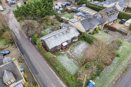
- Price
- Guide Price£239,000
- Size
- 0.17 acres
Burford Road, Minster Lovell, OX29, Curbridge, Oxfordshire OX29 England
Added on 20/05/2026Building Plot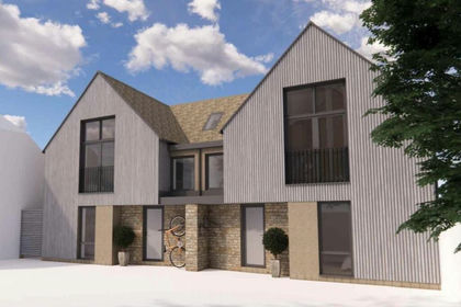
- Price
- Guide Price£175,000
Added on 13/08/2026Development Land
- Price
- Guide Price£200,000
2 Pine Close, Garsington, OX44, Garsington, Oxfordshire OX44 England
Added on 29/01/2026Building Plot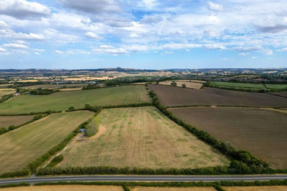
- Price
- Guide Price£175,000
- Size
- 8.26 acres
Fosse Way, Shipston-on-Stour, Warwickshire, CV36, Tredington, Warwickshire CV36 England
Added on 22/08/2026Agricultural Land Added on 24/06/2026Development Land
- Price
- Guide Price£160,000
St Margarets Road, Alderton, Alderton, Gloucestershire GL20 England
Added on 05/06/2026Building Plot Added on 15/07/2026Building Plot
- Price
- Guide Price£240,000
- Size
- 0.11 acres
Barnfield, Marlborough, Wiltshire, SN8, Marlborough, Wiltshire SN8 England
Added on 15/07/2026Building Plot
- Price
- Guide Price£150,000
- Size
- 0.09 acres
Added on 14/08/2026Development Land
- Price
- From£162,500
Added on 25/05/2026Development Land