Nantuat, St Ewe, Cornwall
- Land size
- 3 acres
- Bedrooms
- 5
- Bathrooms
- 3
Description
“A magnificent early 19th-century former rectory, centred on an exquisite galleried landing”
Set within three acres of private grounds, Nantuat is an elegant Grade II-listed home situated in St Ewe’s village centre, in Cornwall. Some spectacular 4,924 sq ft lend the house a statuesque presence, embedded in age-old Cornish landscape and gently unfolding across a ribbon of refined colours and classical proportions to a distinguished heritage palette. With five bedrooms and multifunctional living spaces, this home forms an integral part of St Ewe’s historic fabric, positioned next to the atmospheric Grade I-listed All Saints Church.
Setting the Scene
The picturesque village of St Ewe has an intimate historic core that dates back centuries, defined by traditional stone cottages and landmarks that make up the village’s architectural footprint. The rural parish spans nearly ten miles of classic rural tapestry characterised by rolling hills, ancient woodland, and deeply carved valleys that slope toward the coast, much of the landscape falling within the protected boundaries of the Cornwall National Landscape. The celebrated Lost Gardens of Heligan are located just a mile from the village.
Built in 1836 as the village rectory and officially designated as Grade II-listed in 1988, Nantuat’s charming stucco façade sits within its setting with utmost poise; a symmetrical three-window front is defined by 12-pane sashes and a grand porticoed entrance enclosed by fluted Tuscan columns, and crowned with a hipped roof.
More recently, the home has been used by various writers and filmmakers for their respective creative endeavours.
The Grand Tour
From the quiet village lane, a private driveway shapes the approach to the house and leads to a dedicated parking area. The porticoed entrance opens to a large galleried central hall with a sculpted staircase, around which the rest of the plan is delightfully arranged. Above, an intricate roof lantern invites light deep into the space, and original floorboards beneath run throughout.
The generous double-depth footprint allows spaces to unfold with a natural sense of continuity. To the back, a predominantly open-plan kitchen-living room is partitioned by an elegant, moulded arch, lending to two distinct yet fluid areas. Throughout, traces of the home’s architectural origins are deeply embedded: intricate cornicing decorates the ceiling, while original 19th-century French doors with panelled internal shutters open to the garden.
The kitchen is beautifully finished, with bespoke light-coloured cabinetry topped with dark polished granite worktops. An island is wrapped in softly painted timber with a textured granite counterpoint, fronted by a cream AGA range cooker with a cerulean-blue-and-white-tiled splashback. Concealed from view, a boot room, utility room and WC are conveniently positioned next to the kitchen.
A drawing room, a formal dining room and a study complete this floor, with arresting classical proportions that draw southerly light and greenery inward. Deep-toned walls are framed by original joinery and fine cornicing.
An elegantly curved, white-painted timber staircase with a polished mahogany handrail rises to the first floor, where five bedrooms, a dressing room, and a shared bathroom are elegantly woven around the galleried landing. The principal bedroom is one of two with an en suite bathroom, with enchanting dual-aspect views across the grounds. A neutral colour palette is applied throughout to soothing effect, and the well-appointed bathroom has a claw-foot roll-top bath and a walk-in shower.
A roster of refined paint colours defines the additional bedrooms, where original features include cast-iron fireplaces, tall sash windows, and oak floorboards.
On the lower ground floor, a sequence of adjoining cellar rooms, including the original slate-lined wine cellar, provides the opportunity for extended living/storage space.
Located next door to the house, the former stables building has been converted to a three-bedroom home and is available for purchase by separate negotiation. Please enquire for details.
The Great Outdoors
The unfolding three acres of garden are composed of lawned spaces, mature trees and established planting that provide both privacy and a strong sense of repose. A west-facing gravel terrace sits to the front, while gently terraced gardens with dappled shade and seasonal flowering to one side lead towards an enchanting greenhouse with a walled vegetable garden, lending the landscape a quietly productive character. In the spring, the garden is washed with the colourful hues of rhododendrons, magnolias and azaleas.
Out and About
St Ewe village is perhaps best known for its proximity to The Lost Gardens of Heligan, one of Britain's finest restored Victorian gardens, which lies a less than five-minute drive away. Nearby Pentewan provides access to a long sandy beach and the South West Coast Path, while the Georgian harbour at Charlestown can be reached in approximately 20 minutes. The Eden Project is around 15 minutes away, and the sailing waters of the Roseland Peninsula and Fowey are both within half an hour's drive.
The picturesque fishing village of Mevagissey is around 10 minutes away, its narrow streets lined with independent galleries, cafés and seafood restaurants overlooking the historic harbour. For dining, favourites include The Kings Arms in Mevagissey, while St Austell’s The Longstore and Edie's Kitchen are within easy reach. Farm shops including Lobbs Farm Shop showcase some of Cornwall's excellent local produce.
The area is well served by schooling, with highly regarded Gorran School, Mevagissey Community Primary School, Penrice Academy in St Austell and The Roseland Academy in nearby Tregony. Independent options include Truro School and Truro High School, both within an easy drive.
The nearest railway station is St Austell railway station (approximately 15 minutes by car), with direct services to Truro, Exeter and London Paddington. The A390 provides convenient access across south Cornwall and to the A30 beyond.
Map Location
Property details
- Tenure
- Freehold
- Council Tax Band
- G
- Date Posted
- 2026-07-31
Market Value Analysis
Compared with 1,727 Homes with Land listings in South West England (1+ acres).
Utilities & Restrictions
Utilities
- Electricity
- Ask Agent
- Water
- Ask Agent
- Heating
- Ask Agent
- Broadband
- Ask Agent
- Sewerage
- Ask Agent
Rights & Restrictions
- Public Rights of Way
- Ask Agent
- Private Rights of Way
- Ask Agent
- Listed Property
- Ask Agent
- Restrictions
- Ask Agent
Listed status, conservation areas and planning constraints for this location are in the full report.
Property Features
- Accessibility
- Ask Agent
- Parking
- Garage, Driveway, Off-Street Parking
- Garden
- Garden
Beyond the particulars: planning activity, flood history, heritage and ground risks, checked for this exact spot.
Connectivity
Broadband
Fastest speed available at this postcode
1.8 Gbps
Gigabit full fibre · available to 91% of premises
Suitable for
- 4K streaming on every screen
- Full-time home working
- Online gaming & big downloads
Mobile signal
Outdoor predictions; indoor signal depends on building materials.
Ofcom Connected Nations postcode-level predictions. Speeds and signal are modelled, not measured, and vary between addresses and providers.
Signal is the easy part. Planning activity, flood history and protected designations here are in the full report.
Nearest Schools
Primary
- Mevagissey Community Primary School2.4 milesNo Ofsted rating
- Ages
- 2 to 11
- Pupils
- 160
- Type
- Academy converter
- Grampound-With-Creed CofE Primary School3 milesOfsted report card · Apr 2026
- Ages
- 2 to 11
- Pupils
- 41
- Type
- Academy converter
- Faith
- Church of England
- Gorran School3.1 milesOfsted: Good
- Ages
- 4 to 11
- Pupils
- 91
- Type
- Community school
- Tregony Community Primary School3.1 milesNo Ofsted rating
- Ages
- 2 to 11
- Pupils
- 171
- Type
- Academy converter
- St Mewan Community Primary School3.7 milesNo Ofsted rating
- Ages
- 3 to 11
- Pupils
- 441
- Type
- Academy converter
Secondary
- The Roseland Academy3 milesNo Ofsted rating
- Ages
- 11 to 16
- Pupils
- 665
- Type
- Academy converter
- Brannel School4.5 milesOfsted: Good
- Ages
- 11 to 16
- Pupils
- 888
- Type
- Academy sponsor led
- Poltair School4.9 milesOfsted: Good
- Ages
- 11 to 16
- Pupils
- 882
- Type
- Academy sponsor led
- Penrice Academy5 milesOfsted: Outstanding *
- Ages
- 11 to 16
- Pupils
- 1,405
- Type
- Academy converter
- Penair School8.5 milesNo Ofsted rating
- Ages
- 11 to 16
- Pupils
- 1,223
- Type
- Academy converter
* Latest graded judgement covers quality of education only; no overall grade was issued under the 2024-25 inspection framework.
Distances are straight-line from the advertised location. Source: the national school registers (DfE, Welsh Government, Scottish Government) and Ofsted.
Schools are just the start: sold prices nearby, planning activity and any flood history are in the full report.
Amenities
Supermarket
GP surgery
Pharmacy
Hospital
Straight-line distances from the advertised location. Sources: NHS records, Geolytix supermarket locations, OS Open Greenspace and the national trails registers.
The area stacks up? Now check the location itself: planning nearby, protected designations and past flooding.
Getting Around
Nearest station
Nearest bus stop
Typical drive times
Straight-line distances from the advertised location; drive times are typical free-flow times over OpenStreetMap road data, so allow more at peak. Public transport locations from DfT NaPTAN.
Easy to reach matters. So do planning activity, flood history and ground risks: all in the full report.
Flood Risk
From Environment Agency flood map open data, checked around the advertised map pin and allowing for the listed acreage where known. This summary comes from LandSale, the advertising platform, not from the listing agent, and is not part of the agent's particulars. Risk can vary across a single holding, so verify anything critical through your own searches before committing.
Rivers and the sea
Surface water
These bandings are the summary. Where this location sits on the flood maps, plus planning activity, heritage and ground risks, is in the full report.
Important notice: Information, maps and tags on this page are drawn from the advertising agent's marketing materials or generated automatically. LandSale has not verified them. Relying on these details is at your own risk, always carry out independent checks before committing to a purchase.
LandSale full disclaimer
Marketing information only - not formal particulars. The details on this website are provided for general guidance and do not constitute an offer or contract. Neither LandSale nor the advertising estate/land agent accepts responsibility for any inaccuracy.
1. Source of information
- Listing content: Core description, asking price, tenure, measurements, photographs and planning history originate from the marketing materials of the advertising estate or land agent. LandSale does not author this content and cannot guarantee its accuracy.
- Automated tags & categorisation: Property type, land-use class, acreage bands and similar labels may be applied by machine-learning models. They are intended as a helpful guide only and may not reflect the property's legal status or permitted use.
- Third-party & enriched data layers: Maps, boundary outlines, planning designations, soil reports, broadband coverage and other environmental or location-based insights are licensed from external suppliers. Such data are supplied “as is", may be incomplete or out of date and are subject to change without notice.
2. Verification required
Prospective purchasers must verify critical matters, including but not limited to planning permission, title boundaries, public rights of way, environmental constraints, acreage, services, access and VAT status, through their own inspections, specialist surveys, legal advisers and the selling agent before relying on the information or entering into any contract.
3. No warranty or liability
LandSale gives no warranty, express or implied, as to the accuracy, completeness or fitness for any particular purpose of the information displayed. LandSale shall not be liable for any loss, damage, cost or expense arising directly or indirectly from any use of or reliance on such information, save where liability may not be excluded by law.
4. Updates & feedback
If you believe any detail on this listing is inaccurate, please let us know. We will investigate and, where appropriate, update the listing or notify the agent.
© LandSale | Version 1.3 - August 2026
Listing agent
Inigo, London
St Alphege Hall Kings Bench Street, London, SE1 0QX
Similar properties for sale
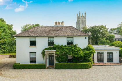
- Price
- £1,250,000
- Size
- 1 acres
St. Enoder, near Newquay - North Cornish Coast, Cornwall, St. Enoder, Cornwall TR8 England
Added on 25/08/2026Country Home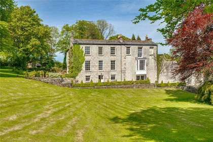
- Price
- £1,250,000
- Size
- 3.13 acres
Added on 06/05/2026Country Home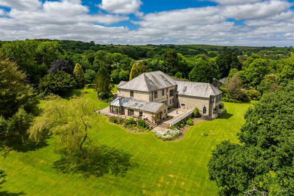
- Price
- Guide Price£1,595,000
- Size
- 3 acres
Added on 11/04/2026Country Home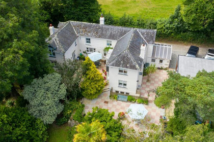
- Price
- Guide Price£1,150,000
- Size
- 1 acres
Added on 09/04/2026Country Home
- Price
- £1,750,000
- Size
- 17 acres
Added on 01/08/2026Holiday Let Property
- Price
- £1,350,000
- Size
- 15.5 acres
Added on 23/03/2026Country Estate
- Price
- Offers in Excess of£1,500,000
- Size
- 6 acres
Holman Park, Camborne, TR14, Camborne, Cornwall TR14 England
Added on 06/05/2026Country Home
- Price
- Guide Price£1,140,000
- Size
- 2 acres
Higher Poldown Farm, Nr Porthleven, South Cornwall, Sithney, Cornwall TR13 England
Added on 08/08/2026Farmhouse
- Price
- Guide Price£1,250,000
- Size
- 21 acres
Morvah, Saltash, Cornwall, Landrake with St. Erney, Cornwall PL12 England
Added on 08/04/2026Farmhouse
- Price
- Guide Price£1,500,000
- Size
- 2.5 acres
Added on 11/07/2026Country Home