Line Farm, Orleton, Ludlow, Herefordshire
- Land size
- 2 acres
- Bedrooms
- 4
- Bathrooms
- 4
Key Features
- Sought After and Idyllic Location with 360 Degree Views
- Four Bedroom / Four Bathroom Main Residence
- Three Reception Rooms
- Two Bedroom Annexe
- Auxiliary Accommodation / Holiday Let
- Approximately 2 Acres (0.80 Ha) of Paddocks and Gardens
- Range of Outbuildings
- Separate Vehicle Access
- Potential Commercial Equestrian or Agricultural Purposes
- EPC: D
Description
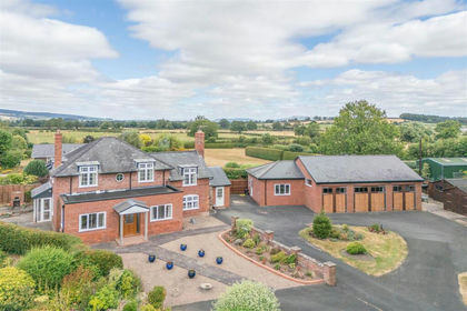
Situation: Line Farm enjoys an elevated position with 360 degree views close to the popular village of Orleton, surrounded by glorious countryside. The accommodation comprises of a large entrance hall with an oak staircase that leads into the main living room with duel aspect views and a Clearview wood burning stove. The ground floor also offers a good sized dining room, an open plan kitchen / diner with an Aga, a large utility room and a downstairs shower room. On the first floor there are four double bedrooms including two with en-suite facilities and one with a WC. The family bathroom can also act as a Jack and Jill. The master bedroom offers underfloor heating in the en-suite.
Lodge
A detached timber clad lodge which comprises of two bedrooms, two bathrooms and an open plan kitchen / dining / family room. The area would suit multi-generational family living, auxiliary accommodation or as a holiday let.
Outside
The property sits in its own generous grounds spanning approximately 2 acres (0.80ha), which include mature gardens with a selection of fruit trees, ample parking and a small paddock with separate access onto the lane. The range of outbuildings comprises of a formal Dutch Barn, a garage / workshop and a storage area. The complex sits on a hard standing floor and would suit someone who wishes to run a business from home, ideal for commercial, equestrian or agricultural purposes.
Orleton has a thriving community and offers many sporting and recreational facilities. Within the village itself, there is a village hall with playing fields, a doctor’s surgery, a church, two established public houses, a village post office / store and an excellent primary school which is considered a leading school within the area.
A further range of amenities can be found in the attractive market town of Leominster. The popular market town of Ludlow is a thriving market town and an architectural gem with a lively community feel, busy with events and festivals throughout the year.
The county town of Shrewsbury lies to the north and Hereford is to the south. Birmingham and the West Midlands are an approximate one-hour commute with many convenient rail links. There are excellent state and independent schools in the area including Moor Park, Ludlow and Shrewsbury School. Ludlow Golf Club and Ludlow National Hunt racecourse are within a fifteen-minute drive.
Services: Mains electricity. Private water supply. Oil fired heating and log burner. Septic tank drainage.
Council Tax:
House - Band E
Lodge - Band A
Postcode: SY8 4HY
Local Authority: Herefordshire Council
Mobile Signal:
EE Y
Vodafone Y
O2 Y
Three Y
Broadband Speed: Our research has indicated that Airband is connected at this property. Please conduct your own research to ensure the speeds meet your requirements.
Flood Risk: Surface Water, Rivers and the Sea: Very Low Risk.
Fixtures and Fittings: Whilst all attempts have been made to accurately describe the property in regard to fixtures and fittings, a comprehensive list will be made available by the seller’s solicitors.
Wayleaves, Easements and Rights of Way: The property will be sold subject to and with the benefit of all wayleaves, easements and rights of way, whether mentioned in these particulars or not.
Please Note: Bridleway adjacent to property.
Directions: From Ludlow take the B4361 Richards Castle Road. Carry on into Orleton and turn left opposite The Maidenhead into the village along Millbrook Way, at the junction drive straight over onto Tunnel Lane and continue for approximately 0.7 miles. The property can be found on the left-hand side.
What3Words: flag.delighted.cracking
Map Location
Property details
- Tenure
- Freehold
- Council Tax Band
- TBC
- Date Posted
- 2026-07-30
Market Value Analysis
Compared with 1,047 Homes with Land listings in West Midlands (1+ acres).
Energy Performance Certificate
Energy Efficiency Rating
Based on UK Energy Performance Certificate standards (EU Directive 2002/91/EC)
Running costs are one side. Planning activity, flood history and ground risks for this location are in the full report.
Utilities & Restrictions
Utilities
- Electricity
- Ask Agent
- Water
- Ask Agent
- Heating
- Ask Agent
- Broadband
- Ask Agent
- Sewerage
- Ask Agent
Rights & Restrictions
- Public Rights of Way
- Ask Agent
- Private Rights of Way
- Ask Agent
- Listed Property
- Ask Agent
- Restrictions
- Ask Agent
Listed status, conservation areas and planning constraints for this location are in the full report.
Property Features
- Accessibility
- Ask Agent
- Parking
- Parking Available
- Garden
- Garden
Beyond the particulars: planning activity, flood history, heritage and ground risks, checked for this exact spot.
Connectivity
Broadband
Fastest speed available at this postcode
900 Mbps
Gigabit full fibre
Suitable for
- 4K streaming on every screen
- Full-time home working
- Online gaming & big downloads
Fixed wireless access may also be an option here.
Mobile signal
Outdoor predictions; indoor signal depends on building materials.
Ofcom Connected Nations postcode-level predictions. Speeds and signal are modelled, not measured, and vary between addresses and providers.
Signal is the easy part. Planning activity, flood history and protected designations here are in the full report.
Nearest Schools
Primary
- Orleton CofE Primary School0.6 milesNo Ofsted rating
- Ages
- 5 to 11
- Pupils
- 175
- Type
- Voluntary controlled school
- Faith
- Church of England
- Luston Primary School2.2 milesNo Ofsted rating
- Ages
- 4 to 11
- Pupils
- 94
- Type
- Community school
- Bishop Hooper Church of England Primary School3.2 milesOfsted: Good *
- Ages
- 2 to 11
- Pupils
- 121
- Type
- Voluntary aided school
- Faith
- Church of England
- Kimbolton St James CofE Primary School3.6 milesNo Ofsted rating
- Ages
- 4 to 11
- Pupils
- 91
- Type
- Voluntary aided school
- Faith
- Church of England
- Kingsland CofE School4.6 milesOfsted: Good
- Ages
- 5 to 11
- Pupils
- 155
- Type
- Voluntary aided school
- Faith
- Church of England
Secondary
- Earl Mortimer College4.9 milesOfsted: Good
- Ages
- 11 to 16
- Pupils
- 502
- Type
- Community school
- Wigmore School5.4 milesNo Ofsted rating
- Ages
- 11 to 19
- Pupils
- 467
- Type
- Academy converter
- Tenbury High Ormiston Academy5.8 milesOfsted: Good
- Ages
- 11 to 16
- Pupils
- 453
- Type
- Academy sponsor led
- Ludlow Church of England School5.8 milesOfsted: Requires improvement *
- Ages
- 11 to 16
- Pupils
- 626
- Type
- Academy converter
- Faith
- Church of England
- Weobley High School11 milesNo Ofsted rating
- Ages
- 11 to 16
- Pupils
- 533
- Type
- Community school
* Latest graded judgement covers quality of education only; no overall grade was issued under the 2024-25 inspection framework.
Distances are straight-line from the advertised location. Source: the national school registers (DfE, Welsh Government, Scottish Government) and Ofsted.
Schools are just the start: sold prices nearby, planning activity and any flood history are in the full report.
Amenities
Supermarket
GP surgery
Pharmacy
Hospital
Straight-line distances from the advertised location. Sources: NHS records, Geolytix supermarket locations, OS Open Greenspace and the national trails registers.
The area stacks up? Now check the location itself: planning nearby, protected designations and past flooding.
Getting Around
Nearest station
Nearest bus stop
Typical drive times
Straight-line distances from the advertised location; drive times are typical free-flow times over OpenStreetMap road data, so allow more at peak. Public transport locations from DfT NaPTAN.
Easy to reach matters. So do planning activity, flood history and ground risks: all in the full report.
Flood Risk
From Environment Agency flood map open data, checked around the advertised map pin and allowing for the listed acreage where known. This summary comes from LandSale, the advertising platform, not from the listing agent, and is not part of the agent's particulars. Risk can vary across a single holding, so verify anything critical through your own searches before committing.
Rivers and the sea
Surface water
These bandings are the summary. Where this location sits on the flood maps, plus planning activity, heritage and ground risks, is in the full report.
Important notice: Information, maps and tags on this page are drawn from the advertising agent's marketing materials or generated automatically. LandSale has not verified them. Relying on these details is at your own risk, always carry out independent checks before committing to a purchase.
LandSale full disclaimer
Marketing information only - not formal particulars. The details on this website are provided for general guidance and do not constitute an offer or contract. Neither LandSale nor the advertising estate/land agent accepts responsibility for any inaccuracy.
1. Source of information
- Listing content: Core description, asking price, tenure, measurements, photographs and planning history originate from the marketing materials of the advertising estate or land agent. LandSale does not author this content and cannot guarantee its accuracy.
- Automated tags & categorisation: Property type, land-use class, acreage bands and similar labels may be applied by machine-learning models. They are intended as a helpful guide only and may not reflect the property's legal status or permitted use.
- Third-party & enriched data layers: Maps, boundary outlines, planning designations, soil reports, broadband coverage and other environmental or location-based insights are licensed from external suppliers. Such data are supplied “as is", may be incomplete or out of date and are subject to change without notice.
2. Verification required
Prospective purchasers must verify critical matters, including but not limited to planning permission, title boundaries, public rights of way, environmental constraints, acreage, services, access and VAT status, through their own inspections, specialist surveys, legal advisers and the selling agent before relying on the information or entering into any contract.
3. No warranty or liability
LandSale gives no warranty, express or implied, as to the accuracy, completeness or fitness for any particular purpose of the information displayed. LandSale shall not be liable for any loss, damage, cost or expense arising directly or indirectly from any use of or reliance on such information, save where liability may not be excluded by law.
4. Updates & feedback
If you believe any detail on this listing is inaccurate, please let us know. We will investigate and, where appropriate, update the listing or notify the agent.
© LandSale | Version 1.3 - August 2026
Listing agent
Balfours LLP, Ludlow
1-2 King Street Ludlow SY8 1AQ
Similar properties for sale
- Price
- £825,000
- Size
- 2.5 acres
Eye Lane, Luston with 2 acre plot, Luston, Herefordshire, County of HR6 England
Added on 31/07/2026House with Land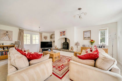
- Price
- Offers in Excess of£800,000
- Size
- 2 acres
Orleton Common, Orleton, SY8, Orleton, Herefordshire, County of SY8 England
Added on 16/04/2026House with Land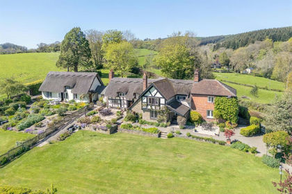
- Price
- Offers in Region of£1,000,000
- Size
- 1.67 acres
Richards Castle, Ludlow, Richard's Castle (Shropshire), Shropshire SY8 England
Added on 11/05/2026Country Home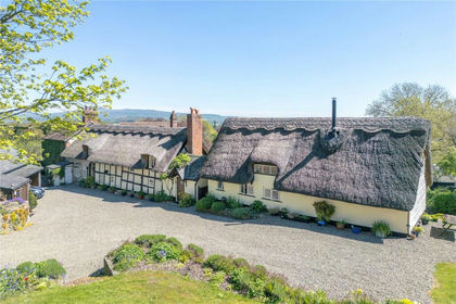
- Price
- Guide Price£1,000,000
- Size
- 1.68 acres
Added on 07/05/2026Country Home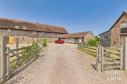
- Price
- £775,000
- Size
- 3.5 acres
Leysters with circa 3 acres and annex, Middleton on the Hill, Herefordshire, County of HR6 England
Added on 31/07/2026Barn Conversion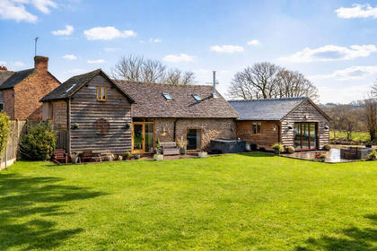
- Price
- Guide Price£775,000
- Size
- 2 acres
Added on 25/02/2026Barn Conversion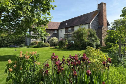
- Price
- Guide Price£995,000
- Size
- 1.8 acres
Perth House, Berrington Green, Tenbury, Worcestershire WR15 England
Added on 03/04/2026Barn Conversion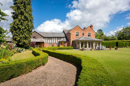
- Price
- Guide Price£900,000
- Size
- 1 acres
nr Kingsland, Herefordshire, Kingsland, Herefordshire, County of HR6 England
Added on 12/06/2026Country Home
- Price
- Guide Price£775,000
- Size
- 2 acres
Wigmore, Leominster, Wigmore, Herefordshire, County of HR6 England
Added on 21/07/2026House with Land
- Price
- Guide Price£799,950
- Size
- 2.4 acres
Newtown, Leominster, Herefordshire, Leominster, Herefordshire, County of HR6 England
Added on 14/04/2026House with Land