Aston-On-Clun, Craven Arms, Shropshire
- Land size
- 26.81 acres
Description
An excellent opportunity to purchase approximately 26.81 acres (10.85 hectares) of productive arable land within a single block. With direct access onto a single-track road, bound by mature hedgerows, and situated in the magnificent rolling Shropshire Hills just under 3 miles southwest of the market town of Craven Arms, with good road access beyond.
- 26.81 acres (10.85 hectares) in one lot.
- Intermittent Natural Water Supplies
- Productive and Gently Sloping
- Roadside frontage
- Future opportunities for investment in natural capital, carbon sequestration and biodiversity
For sale by Informal Tender (subject to prior sale)
Tenders close Friday 28th August 2026 at 12 noon.
LAND AT BROOME. ASTON-ON-CLUN
The land is currently planted with Winter Wheat over the 26.81 acres (10.85 hectares) of gently sloping to level topography and is bordered with mature hedgerows. Water is occasionally available through a natural pond which borders the hedgerow against the road, however in the warmer spring and summer months it is known to dry up. Access is available off the Broome to Rowton road.
.
The land has currently been used for arable purposes in a rotation of wheat, potatoes and spring barley. It has produced plentiful crops for many years but also has the potential for livestock grazing or fodder conservation, if desired. The land is situated in the Shropshire Hills National Landscape which is a well renowned farming area close to the Marches border and is classified as being freely draining, slightly acidic loamy soil by LandIS. The land leads itself to a variety of uses including agriculture, amenity, equestrian, tourism and offers future opportunities for investment in natural capital, carbon sequestration and biodiversity.
..
The land is located within the popular Clun Valley, which is designated as a National Landscape. The land sits nearby to renowned walks such as the Offa’s Dyke footpath, The Shropshire Way and the ancient Iron age fort of the Bury Ditches, along with many other footpaths and bridleways. The market town of Craven Arms is a rural market town and parish situated amongst the South Shropshire countryside close to the Welsh borders and the Marches and is located on the A49 carriageway between Shrewsbury and Hereford and the heart of Wales railway line. The town lies in the valley of the River Onny.
...
The town benefits from a railway station linking north to Shrewsbury, Crewe and Manchester and south to Ludlow, Hereford, Cardiff and Swansea as well as local bus links. Local amenities include, a Post Office, Primary School, Doctors surgery and Dental practice, two Public Houses, a large supermarket and many convenience stores amongst other light commercial businesses.
SPORTING & MINERAL RIGHTS
These are in hand and will pass with the sale of the freehold.
TIMBER
All standing timber is included in the sale.
RURAL PAYMENT AGENCY & POLICY
We have been informed that the property is registered with the Rural Payment Agency (RPA) and the land is entered into a Sustainable Farming Incentive (SFI) Agreement currently.
SERVICES
The land is not connected to any services.
TENURE
We have been informed that the land is freehold, with vacant possession given on completion. The vendor will harvest the crop and leave in the stubble for the successful purchaser to plant an autumn crop.
EASEMENTS, WAYLEAVES AND RIGHTS OF WAY
The property is offered subject to, and with the benefit of, any rights-of-way both public and private, all wayleaves, easements and other rights whether or not specifically referred to.
METHOD OF SALE
The property is offered for sale as a whole by Informal Tender (unless previously sold). The tender forms will be available from the Vendor’s agents. Tenders close Friday 28th August at 12 noon. Tenders are to be delivered to; McCartneys LLP, Corvedale Road, Craven Arms, Shropshire, SY7 9NE marked “Tender – Land at Broome”. The Vendor reserves the right not to accept the highest, or indeed, any offer. The Vendor reserves the right to accept offers prior to the tender date.
SOLICITORS
Andrew Whittle, Greens Solicitors, Ludlow /
GUIDE PRICES
£12,500/acre
TOWN AND COUNTRY PLANNING
The land is offered subject to any development plans, tree preservation orders, ancient orders, public rights-of-way, town planning schedules, or resolutions which may be or may come into force. The purchaser(s) will be deemed to have full knowledge of these and have satisfied themselves as to the effects such matters have on the property.
AUTHORITIES
Shropshire Council: RPA:
PLANS, AREAS AND SCHEDULES
These are based on Ordnance Survey and are for reference only. They have been checked and compiled by the vendor’s agents and the purchaser(s) shall be deemed to have satisfied themselves as to the description of the property. Any error or misstatement shall not annul a sale or entitle any party to compensation in respect thereof.
BOUNDARIES, ROADS AND FENCES
The purchaser(s) shall be deemed to have full knowledge of the boundaries and neither the Vendor nor the Vendors agents will be responsible for defining the boundaries of ownership thereof.
WHAT3WORDS
///released.pinging.pesky
VIEWINGS AND HEALTH AND SAFETY
Strictly by appointment through the selling agents. The agents advise all prospective purchasers when viewing the land to take due care.
ANTI MONEY LAUNDERING
The successful purchaser should please provide a photographic form of ID such as driver’s licence or passport, and a utility bill or bank statement confirming their home address.
IMPORTANT NOTICE
McCartneys, for themselves and for the Vendor of this property and any joint agents give notice that;
1.
These particulars are intended for guidance only. They are prepared and issued in good faith and are intended to give a fair description but do not constitute part of an offer or contract. Any information should not be relied on as statement or representation of fact or that the property or its services are in good condition.
2.
McCartneys have not made any investigations into the existence or otherwise of any issues concerning pollution and potential land, air and water contamination, the purchaser is responsible for making his/her own enquiries in this regard.
3.
Neither McCartneys nor any of their employees have authority to make or give any representation or warranty whatsoever in relation to the property
4.
The images show only certain parts and aspects of the property at the time they were taken/created.
5.
Any areas, measurements or distances given are approximate only. Any plans are for identification purposes only.
6.
Any reference to alterations to, or use of, any part of the property is not a statement that any necessary planning, building regulations or other consents have been obtained. An intending purchaser must verify these matters. Potential purchaser(s) should not rely upon the use stated in these particulars and should check their proposed use with the relevant planning authority to ensure it is permitted.
Map Location
Property details
- Tenure
- Freehold
- Council Tax Band
- TBC
- Date Posted
- 2026-07-22
Utilities & Restrictions
Utilities
- Electricity
- Ask Agent
- Water
- Ask Agent
- Heating
- Ask Agent
- Broadband
- Ask Agent
- Sewerage
- Ask Agent
Rights & Restrictions
- Public Rights of Way
- Ask Agent
- Private Rights of Way
- Ask Agent
- Listed Property
- Ask Agent
- Restrictions
- Ask Agent
Listed status, conservation areas and planning constraints for this location are in the full report.
Property Features
- Accessibility
- Ask Agent
- Parking
- Ask Agent
- Garden
- Ask Agent
Beyond the particulars: planning activity, flood history, heritage and ground risks, checked for this exact spot.
Connectivity
Broadband
Fastest speed available at this postcode
1.8 Gbps
Gigabit full fibre · available to 9% of premises
Suitable for
- 4K streaming on every screen
- Full-time home working
- Online gaming & big downloads
Fixed wireless access may also be an option here.
Mobile signal
Outdoor predictions; indoor signal depends on building materials.
Ofcom Connected Nations postcode-level predictions. Speeds and signal are modelled, not measured, and vary between addresses and providers.
Signal is the easy part. Planning activity, flood history and protected designations here are in the full report.
Nearest Schools
Primary
- Clunbury CofE Primary School2 milesOfsted report card · Feb 2026
- Ages
- 2 to 11
- Pupils
- 55
- Type
- Voluntary aided school
- Faith
- Church of England
- Stokesay Primary School2.2 milesOfsted report card · Apr 2026
- Ages
- 3 to 11
- Pupils
- 150
- Type
- Academy sponsor led
- Onny CofE (A) Primary School3.4 milesOfsted: Good
- Ages
- 2 to 11
- Pupils
- 87
- Type
- Academy converter
- Faith
- Church of England
- Wistanstow CofE Primary School3.5 milesOfsted: Requires improvement *
- Ages
- 4 to 11
- Pupils
- 51
- Type
- Voluntary controlled school
- Faith
- Church of England
- Leintwardine Endowed CE Primary School4 milesOfsted: Good
- Ages
- 4 to 11
- Pupils
- 75
- Type
- Voluntary aided school
- Faith
- Church of England
Secondary
- The Community College, Bishop's Castle6.8 milesNo Ofsted rating
- Ages
- 11 to 16
- Pupils
- 507
- Type
- Foundation school
- Ludlow Church of England School7.1 milesOfsted: Requires improvement *
- Ages
- 11 to 16
- Pupils
- 626
- Type
- Academy converter
- Faith
- Church of England
- Wigmore School7.5 milesNo Ofsted rating
- Ages
- 11 to 19
- Pupils
- 467
- Type
- Academy converter
- Church Stretton School9 milesNo Ofsted rating
- Ages
- 11 to 16
- Pupils
- 539
- Type
- Academy converter
- Tenbury High Ormiston Academy14 milesOfsted: Good
- Ages
- 11 to 16
- Pupils
- 453
- Type
- Academy sponsor led
* Latest graded judgement covers quality of education only; no overall grade was issued under the 2024-25 inspection framework.
Distances are straight-line from the advertised location. Source: the national school registers (DfE, Welsh Government, Scottish Government) and Ofsted.
Schools are just the start: sold prices nearby, planning activity and any flood history are in the full report.
Amenities
Supermarket
GP surgery
Pharmacy
Hospital
Green space
Straight-line distances from the advertised location. Sources: NHS records, Geolytix supermarket locations, OS Open Greenspace and the national trails registers.
The area stacks up? Now check the location itself: planning nearby, protected designations and past flooding.
Getting Around
Nearest station
Nearest bus stop
Typical drive times
Straight-line distances from the advertised location; drive times are typical free-flow times over OpenStreetMap road data, so allow more at peak. Public transport locations from DfT NaPTAN.
Easy to reach matters. So do planning activity, flood history and ground risks: all in the full report.
Flood Risk
From Environment Agency flood map open data, checked around the advertised map pin and allowing for the listed acreage where known. This summary comes from LandSale, the advertising platform, not from the listing agent, and is not part of the agent's particulars. Risk can vary across a single holding, so verify anything critical through your own searches before committing.
Rivers and the sea
Surface water
Mapped within the area searched, not at the advertised map pin itself.
The detail behind these bandings
The full report pinpoints where this location sits on the flood maps, and runs the deeper checks that usually only surface after an offer.
- Exact flood zones & annual chances (included in the full report)
- Any recorded past flooding (included in the full report)
- Planning activity nearby (included in the full report)
- Heritage & conservation (included in the full report)
- Protected nature designations (included in the full report)
- Ground risks (included in the full report)
- Sold prices nearby (included in the full report)
£14.99 · one-off purchase
By LandSale, the platform. Not provided by the listing agent. Ready in about a minute.
Important notice: Information, maps and tags on this page are drawn from the advertising agent's marketing materials or generated automatically. LandSale has not verified them. Relying on these details is at your own risk, always carry out independent checks before committing to a purchase.
LandSale full disclaimer
Marketing information only - not formal particulars. The details on this website are provided for general guidance and do not constitute an offer or contract. Neither LandSale nor the advertising estate/land agent accepts responsibility for any inaccuracy.
1. Source of information
- Listing content: Core description, asking price, tenure, measurements, photographs and planning history originate from the marketing materials of the advertising estate or land agent. LandSale does not author this content and cannot guarantee its accuracy.
- Automated tags & categorisation: Property type, land-use class, acreage bands and similar labels may be applied by machine-learning models. They are intended as a helpful guide only and may not reflect the property's legal status or permitted use.
- Third-party & enriched data layers: Maps, boundary outlines, planning designations, soil reports, broadband coverage and other environmental or location-based insights are licensed from external suppliers. Such data are supplied “as is", may be incomplete or out of date and are subject to change without notice.
2. Verification required
Prospective purchasers must verify critical matters, including but not limited to planning permission, title boundaries, public rights of way, environmental constraints, acreage, services, access and VAT status, through their own inspections, specialist surveys, legal advisers and the selling agent before relying on the information or entering into any contract.
3. No warranty or liability
LandSale gives no warranty, express or implied, as to the accuracy, completeness or fitness for any particular purpose of the information displayed. LandSale shall not be liable for any loss, damage, cost or expense arising directly or indirectly from any use of or reliance on such information, save where liability may not be excluded by law.
4. Updates & feedback
If you believe any detail on this listing is inaccurate, please let us know. We will investigate and, where appropriate, update the listing or notify the agent.
© LandSale | Version 1.3 - August 2026
Listing agent
McCartneys LLP, Craven Arms
Corvedale Road, Craven Arms, SY7 9NE
Similar properties for sale
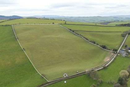
- Price
- Guide Price£100,000
- Size
- 16.28 acres
Obley, Bucknell, Shropshire, Clunbury, Shropshire SY7 England
Added on 24/04/2026Grazing Land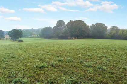
- Price
- £250,000
- Size
- 25.77 acres
Cold Weston, Craven Arms, Clee St. Margaret, Shropshire SY7 England
Added on 04/09/2026Agricultural Land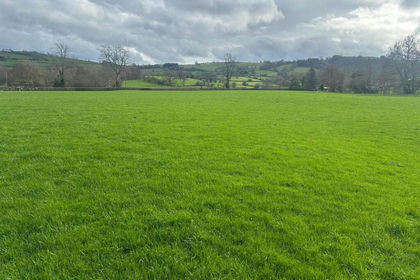
- Price
- Guide Price£575,000
- Size
- 47.77 acres
Land known as Land at Cwm Meadows, Churchstoke, Churchstoke, Powys SY15 Wales
Added on 20/03/2026Grazing Land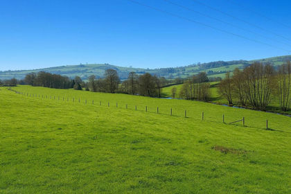
- Price
- Sale by Tender
- Size
- 59.66 acres
Added on 31/03/2026Grazing Land
- Price
- Guide Price£675,000
- Size
- 135.39 acres
Added on 02/06/2026Farmland
- Price
- Guide Price£400,000
- Size
- 50 acres
Ditton Priors, Bridgnorth, Shropshire, Ditton Priors, Shropshire WV16 England
Added on 08/08/2026Pasture
- Price
- Sale by Tender
- Size
- 61.73 acres
Added on 01/09/2026Pasture
- Price
- Offers in Region of£275,000
- Size
- 41.92 acres
Land at Meadowtown, Shrewsbury, Worthen with Shelve, Shropshire SY5 England
Added on 29/01/2026Grazing Land
- Price
- £125,000
- Size
- 16.6 acres
Land at Meadowtown, Shrewsbury, Worthen with Shelve, Shropshire SY5 England
Added on 29/01/2026Pasture
- Price
- £560,000
- Size
- 56.44 acres
Lot 5, Parsonage Farm, Kyre, Tenbury Wells, Worcestershire, Kyre, Worcestershire WR15 England
Added on 16/05/2026Farm