Norton Disney, Lincoln
- Land size
- 44.9 acres
- Bedrooms
- 3
- Bathrooms
- 1
Key Features
- House, Farm Buildings & Land
- 44.9 Acres Or Thereabouts
- Two Reception Rooms
- Three Bedrooms Plus Box Room
- General Purpose & Stock Buildings
- Grassland Within A Ring Fence
- Light Sand Loam In Character
- Open Countryside Location
- Newark 6.5 Miles, Lincoln 11 Miles
- EPC Rating E
Description
Rose Farm comprises a detached house, a range of modern general purpose farm buildings, and land within a ring fence extending to 44.9 acres or thereabouts. The property is situated on a country lane, close to the small village of Norton Disney. The land generally a light sandy loam in character is ideal for equestrian purposes.
The farmhouse built in 1967 is exceptionally well maintained and nicely decorated throughout. Constructed of cavity brick elevations under a tiled roof, the property has a solid fuel central heating system and double glazing throughout. The accommodation briefly provides a front porch, reception hall, separate dining room and kitchen. The first floor provides three bedrooms, a box room and family bathroom. There are gardens surrounding the property.
The agricultural buildings comprising modern general purpose and stock buildings, provide a gross internal area of 1,470 sq. m (15,800 sq. ft) approximately. There is a three phase electricity supply.
The holding is registered with the Rural Payments Agency, more recently used for sheep grazing and fodder crops.
The Parish of Norton Disney is located close to the Lincolnshire and Nottinghamshire border, 2 miles east of the A46 Fosse Way. Within the immediate vicinity of the property are scattered a number of cottages and a school. The central point of the village is the Grade I Listed Church, the village also supports a public house known as The Green Man, well known as a traditional village pub and restaurant. Norton Disney is steeped in character and a history dating back to the feudal times. It is well known for its links with the Disney family and Walt Disney personally visited the village in 1949, whilst filming the Disney film 'Treasure Island'.
The historic town of Newark on Trent is just 6.5 miles from the property. The town lies on the main East Coast railway line providing services between London and Edinburgh. Fast trains are capable of journey times from Newark Northgate to London King's Cross in just over 75 minutes. The city of Lincoln just 10 miles to the north provides university education. There are local primary schools nearby at Collingham, Thurlby, Winthorpe and Bassingham. Private schools are at Highfields Preparatory at Newark and The Minster High School at Lincoln.
The farmhouse provides the following accommodation:
Ground Floor -
Front Porch - 2.72m x 1.22m (8'11 x 4') - With Terrazzo tiled floor.
Reception Hall - 3.33m x 1.42m (10'11 x 4'8) - With built-in cupboards and radiator.
Lounge - 4.65m x 4.01m (15'3 x 13'2) - With north and west facing windows. Radiator.
Dining Room - 4.52m x 2.74m (14'10 x 9') - With south and west facing windows, fireplace with marble surround and back boiler for the central heating system.
Kitchen - 3.35m x 3.35m (11' x 11') - With base units, wall cupboards, working surfaces incorporating a one and a half sink unit. Terrazzo tiled floor.
First Floor -
Landing - With built-in airing cupboard.
Bedroom One - 4.57m x 3.96m (15' x 13') - Windows in the north and west elevations. Built-in wardrobes and radiator.
Bedroom Two - 4.57m x 2.74m (15' x 9') - Windows in the south and west elevations. Radiator.
Bedroom Three - 3.35m x 2.34m (11' x 7'8) - With built-in wardrobe and radiator.
Box Room - 2.29m x 1.09m (7'6 x 3'7) -
Bathroom - 2.31m x 2.11m (7'7 x 6'11) - With bath, basin and close coupled WC.
Outside - There are gardens surrounding the property.
Garage - 4.72m x 2.31m (15'6 x 7'7) - Brick construction adjoining the property together with a coal house and outside WC.
Gross Internal Area - The gross internal area of the house is 106.5 sq. m (1,150 sq. ft) approximately.
Agricultural Buildings -
General Purpose - 41.15m x 9.14m (135' x 30') - A steel framed building with breeze block walling to 2 metres height, open bays, concrete fibre corrugated roof and cladding. The building incorporates a secure workshop bay with roller shutter door.
Stock Building - 27.43m x 18.29m (90' x 60') - A Charcon concrete frame building constructed circa 1974, corrugated cladding and roof.
General Purpose - 13.72m x 3.96m (45' x 13') - A Charcon concrete frame building with breeze block walling to 2 metres height, corrugated cladding and roof.
Stock Building - 22.86m x 13.72m (75' x 45') - Robinsons steel frame building with timber frame lean-to.
Pole Barn Stock Pens -
General Purpose - 18.29m x 12.19m (60' x 40') - Galvanised steel frame cement fibre corrugated roof and cladding.
There is a concrete yard and apron areas.
Schedule of Land:
House garden and farm buildings - 0.85 ha (2.1 acre)
OS9016 Grassland - 4.78 ha (11.82 acre)
OS0308 Grassland - 4.61 ha (11.39 acre)
OS8090 Grassland - 7.93 ha (19.59 acre)
TOTAL - 18.17 ha (44.9 acre)
The OS field numbers referred to are parcel identity as listed in the Rural Land Register, a copy of which is available from the selling agents on request.
The Land - The land at Rose Farm is contained within a ring fence. This is a light sandy loam, at present down to grass for a hay crop and subsequently grazing.
Tenure - The property is freehold, HMLR Title number LL388848.
Covenant - There is a covenant restricting development on land OS8090 south of the drain and part OS0308 east of the drain.
Tenantright - There will be no claim for Tenantright, growing crops or manurial values.
Rural Payment Agency Entitlements - The entitlements are registered to the former C S & J E Wright.
Services - Mains water and electricity are connected to the property. There is a three phase supply to a farm building. Drainage is by means of a septic tank (with soakaway system) installed just over 12 years ago.
Possession - Vacant possession will be given on completion of the sale.
Mortgage - Mortgage advice is available through our Mortgage Adviser. Your home is at risk if you do not keep up repayments on a mortgage or other loan secured on it.
Viewing - Strictly by appointment with the selling agents.
Council Tax - This property comes under North Kesteven District Council Tax Band D.
Map Location
Property details
- Tenure
- Freehold
- Council Tax Band
- D
- Date Posted
- 2026-07-21
Market Value Analysis
Compared with 33 Farms & Smallholdings listings in East Midlands (25+ acres).
Energy Performance Certificate
Energy Efficiency Rating
Based on UK Energy Performance Certificate standards (EU Directive 2002/91/EC)
Running costs are one side. Planning activity, flood history and ground risks for this location are in the full report.
Utilities & Restrictions
Utilities
- Electricity
- Mains
- Water
- Mains
- Heating
- Ask Agent
- Broadband
- Ask Agent
- Sewerage
- Septic Tank / Private
Rights & Restrictions
- Public Rights of Way
- Ask Agent
- Private Rights of Way
- Ask Agent
- Listed Property
- Ask Agent
- Restrictions
- Ask Agent
Listed status, conservation areas and planning constraints for this location are in the full report.
Property Features
- Accessibility
- Ask Agent
- Parking
- Parking Available
- Garden
- Garden
Beyond the particulars: planning activity, flood history, heritage and ground risks, checked for this exact spot.
Connectivity
Broadband
Fastest speed available at this postcode
80 Mbps
Superfast · available to 87% of premises
Suitable for
- HD streaming
- Video calls
- Web & social
Fixed wireless access may also be an option here.
Mobile signal
Predicted 4G and 5G signal; indoor signal depends on building materials.
Ofcom Connected Nations postcode-level predictions. Speeds and signal are modelled, not measured, and vary between addresses and providers.
Signal is the easy part. Planning activity, flood history and protected designations here are in the full report.
Nearest Schools
Primary
- Bassingham Primary School1.7 milesNo Ofsted rating
- Ages
- 4 to 11
- Pupils
- 167
- Type
- Academy converter
- Witham St Hughs Academy2.1 milesOfsted: Outstanding
- Ages
- 4 to 11
- Pupils
- 411
- Type
- Academy converter
- Swinderby All Saints Church of England Primary School2.7 milesOfsted: Good
- Ages
- 4 to 11
- Pupils
- 77
- Type
- Voluntary controlled school
- Faith
- Church of England
- Brant Broughton Church of England and Methodist Primary School3.6 milesOfsted: Requires improvement *
- Ages
- 4 to 11
- Pupils
- 61
- Type
- Voluntary controlled school
- Faith
- Church of England/Methodist
- John Blow Primary School3.6 milesOfsted: Good
- Ages
- 4 to 11
- Pupils
- 192
- Type
- Community school
Secondary
- North Kesteven Academy5.6 milesOfsted report card · May 2026
- Ages
- 11 to 18
- Pupils
- 587
- Type
- Academy converter
- Sir Robert Pattinson Academy5.7 milesNo Ofsted rating
- Ages
- 11 to 18
- Pupils
- 1,310
- Type
- Academy converter
- Sir William Robertson Academy, Welbourn6.1 milesNo Ofsted rating
- Ages
- 11 to 18
- Pupils
- 1,015
- Type
- Academy converter
- The Newark Academy6.1 milesNo Ofsted rating
- Ages
- 11 to 18
- Pupils
- 1,164
- Type
- Academy sponsor led
- Magnus Church of England Academy6.3 milesOfsted: Requires improvement *
- Ages
- 11 to 18
- Pupils
- 678
- Type
- Academy sponsor led
- Faith
- Church of England
* Latest graded judgement covers quality of education only; no overall grade was issued under the 2024-25 inspection framework.
Distances are straight-line from the advertised location. Source: the national school registers (DfE, Welsh Government, Scottish Government) and Ofsted.
Schools are just the start: sold prices nearby, planning activity and any flood history are in the full report.
Amenities
Supermarket
GP surgery
Pharmacy
Hospital
Straight-line distances from the advertised location. Sources: NHS records, Geolytix supermarket locations, OS Open Greenspace and the national trails registers.
The area stacks up? Now check the location itself: planning nearby, protected designations and past flooding.
Getting Around
Nearest station
Nearest bus stop
Typical drive times
Straight-line distances from the advertised location; drive times are typical free-flow times over OpenStreetMap road data, so allow more at peak. Public transport locations from DfT NaPTAN.
Easy to reach matters. So do planning activity, flood history and ground risks: all in the full report.
Flood Risk
Environment Agency open data, checked around the advertised map pin for the listed acreage. Long-term risk counts flood defences; the planning map's flood zones do not. The map pin for this listing is approximate, so these readings describe the surrounding area. Provided by LandSale, not the listing agent, and not part of the agent's particulars. Risk varies across a holding, so verify before committing.
Rivers and the sea
Planning map: Flood Zone 1.
Surface water
Not at the pin: mapped about 90 metres away.
These bandings are the summary. Where this location sits on the flood maps, plus planning activity, heritage and ground risks, is in the full report.
Important notice: Information, maps and tags on this page are drawn from the advertising agent's marketing materials or generated automatically. LandSale has not verified them. Relying on these details is at your own risk, always carry out independent checks before committing to a purchase.
LandSale full disclaimer
Marketing information only - not formal particulars. The details on this website are provided for general guidance and do not constitute an offer or contract. Neither LandSale nor the advertising estate/land agent accepts responsibility for any inaccuracy.
1. Source of information
- Listing content: Core description, asking price, tenure, measurements, photographs and planning history originate from the marketing materials of the advertising estate or land agent. LandSale does not author this content and cannot guarantee its accuracy.
- Automated tags & categorisation: Property type, land-use class, acreage bands and similar labels may be applied by machine-learning models. They are intended as a helpful guide only and may not reflect the property's legal status or permitted use.
- Third-party & enriched data layers: Maps, boundary outlines, planning designations, soil reports, broadband coverage and other environmental or location-based insights are licensed from external suppliers. Such data are supplied “as is", may be incomplete or out of date and are subject to change without notice.
2. Verification required
Prospective purchasers must verify critical matters, including but not limited to planning permission, title boundaries, public rights of way, environmental constraints, acreage, services, access and VAT status, through their own inspections, specialist surveys, legal advisers and the selling agent before relying on the information or entering into any contract.
3. No warranty or liability
LandSale gives no warranty, express or implied, as to the accuracy, completeness or fitness for any particular purpose of the information displayed. LandSale shall not be liable for any loss, damage, cost or expense arising directly or indirectly from any use of or reliance on such information, save where liability may not be excluded by law.
4. Updates & feedback
If you believe any detail on this listing is inaccurate, please let us know. We will investigate and, where appropriate, update the listing or notify the agent.
© LandSale | Version 1.3 - August 2026
Listing agent
Richard Watkinson & Partners, Newark25 Stodman Street Newark NG24 1AT
View agent profileSimilar properties for sale
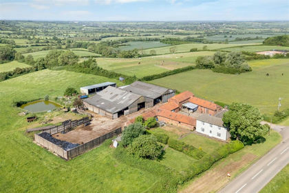
- Price
- Guide Price£1,500,000
- Size
- 98.77 acres
Lodge Farm, Melton Road, Long Clawson, Melton Mowbray LE14, Ab Kettleby, Leicestershire LE14 England
Added on 23/09/2026Farm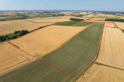
- Price
- Guide Price£995,000
- Size
- 116.99 acres
Added on 08/08/2026Agricultural Land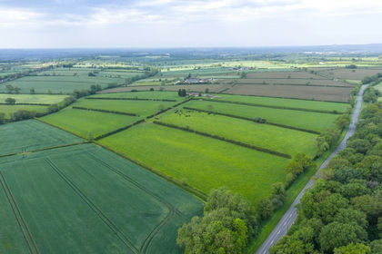
- Price
- Guide Price£1,150,000
- Size
- 53.58 acres
Added on 22/06/2026Farm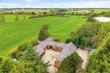
- Price
- Guide Price£1,000,000
- Size
- 32 acres
Wymeswold Road, Hoton, Loughborough, Hoton, Leicestershire LE12 England
Added on 18/09/2026Smallholding