Harty Ferry Road, Leysdown-On-Sea, Sheerness, ME12
- Land size
- 1.87 acres
- Bedrooms
- 5
- Bathrooms
- 3
Key Features
- 5 Bedroom Grade II Listed Detached House
- Set across two plots totaling approx. 1.87 acres
- Stunning original fireplaces
- Modernised kitchen
- Loft room with development potential
- Two detached outbuildings
- Well water and drainage is provided via cesspit and run off
- Idyllic countryside setting on the historic Harty Estate
- EPC F (31)
- Council Tax Band E
Description
Historic Five-Bedroom Grade II Listed Home with Two Plots on the Harty Estate – A Rare Countryside Opportunity!
Property Overview - Welcome to a truly unique opportunity in the heart of the Harty Estate, where timeless charm, rural privacy, and land ownership combine. This remarkable five-bedroom Grade II listed home, set across two generous plots (approx. 0.9 acres and 0.97 acres), offers a rare blend of heritage, character, and potential. Originally a C16 timber-framed dwelling, the home has been sympathetically refaced with painted brick and thoughtfully updated in key areas, while preserving the authentic details that make it so special. A specialist mortgage may be required due to its listed status.
Entering the home, you’re immediately struck by the sense of scale and tradition. The spacious lounge features a stunning original brick fireplace, while a wide central hallway leads to a formal dining room with a mirrored fireplace. At the end of the hall lies a beautifully modernised kitchen, complete with garden access, a breakfast bar, and a second staircase to the upper levels—an elegant blend of form and function. The hallway continues to a utility/storage area and a substantial 15’ x 11’ family bathroom, offering rare space by modern standards.
Upstairs, the home continues to impress. The main staircase accesses bedrooms two, three, and four, plus a dedicated office space, while the master suite is privately accessed via a connecting door or via the second landing. The fifth bedroom, also with en-suite, is accessible from this second staircase, which links back down to the kitchen—creating a flexible and practical upstairs layout.
A true hidden asset lies in the loft room, bursting with potential. The house originally had dormers many years ago but in 1987~ however they were never replaced after the big storm and have since been converted back to a typical pitched roof. No planning should be needed for them to be reinstated, the space could accommodate two further bedrooms and a bathroom, subject to the relevant consents. Outside, the home is accompanied by two outbuildings, ripe for conversion into workshops, studios, or ancillary accommodation.
Water is supplied via a private well system, eliminating monthly water bills, and drainage is provided via cesspit and run off, keeping ongoing costs manageable. This is a property with soul, scale, and an undeniable sense of rural identity—perfect for those looking to embrace countryside living with space to grow, restore, or reimagine.
About The Area - Nestled within the serene landscapes of the Isle of Sheppey, the Harty Estate offers a unique blend of historical significance and natural beauty. This secluded enclave, once a tidal island, is characterized by its expansive marshlands, rich biodiversity, and a profound sense of tranquility.
The area is home to the Swale National Nature Reserve, a haven for birdwatchers and nature enthusiasts. Here, one can observe a myriad of bird species, including marsh harriers, avocets, and short-eared owls, amidst the reed beds and tidal creeks. The nearby Capel Fleet Raptor Viewpoint further accentuates the region's appeal to wildlife aficionados.
Adding to its charm is the Church of St Thomas the Apostle, a Grade II* listed building dating back to the 11th or 12th century. Remarkably preserved, the church operates without electricity or running water, illuminated by paraffin lamps, offering a glimpse into a bygone era.
The Ferry House Inn, a 16th-century establishment, stands as a testament to the area's rich history. Once serving ferry passengers between Harty and the mainland, it now offers award-winning dining experiences, emphasizing local produce and traditional recipes.
For those seeking outdoor pursuits, the Isle of Harty Trail provides a flat, circular route ideal for walking or cycling, allowing visitors to immerse themselves in the area's natural splendor. The trail meanders through coastal paths, offering panoramic views of the Thames Estuary and the surrounding marshlands.
Despite its secluded ambiance, Harty remains accessible, with the Sheppey Crossing connecting it to mainland Kent. This ensures that while residents can enjoy the peace and solitude of rural life, they are never too far from modern conveniences.
In essence, the Harty Estate embodies a harmonious blend of history, nature, and tranquility, making it an idyllic setting for those yearning for a retreat from the hustle and bustle of contemporary life.
Lounge - 5.59m x 4.29m (18'4 x 14'1) -
Dining Room - 5.99m x 3.30m (19'8 x 10'10) -
Kitchen - 6.60m x 4.19m (21'8 x 13'9) -
Family Bathroom - 4.60m x 3.40m (15'1 x 11'2) -
Bedroom One - 5.51m x 4.39m (18'1 x 14'5) - With Ensuite
Bedroom Two - 3.00m x 2.84m (9'10 x 9'4) - With Ensuite
Bedroom Three - 4.90m x 4.60m (16'1 x 15'1) -
Bedroom Four - 4.27m x 2.49m (14'0 x 8'2) -
Bedroom Five - 3.05m '0.61m x 3.05m (10 '2 x 10') -
Office - 2.84m x 1.50m (9'4 x 4'11) -
Loft - 10.49m x 4.19m (34'5 x 13'9) -
About Lambornhill - Our agency has grown steadily over the years, built on a foundation of recommendations, reputation, and respect.
Since 2009, we have been helping buyers, sellers, landlords, and tenants navigate the property market in Sittingbourne and the wider Swale area. Our experienced team is dedicated to providing expert advice, tailored solutions, and a seamless property journey. With a strong local reputation built on trust and results, we are here to make your next move a success. Contact us today and experience the LambornHill difference.
Lets Keep It Local, Lets Keep It Lambornhill! -
Map Location
Property details
- Tenure
- Freehold
- Council Tax Band
- E
- Date Posted
- 2026-07-21
Market Value Analysis
Compared with 1,937 Homes with Land listings in South East England (1+ acres).
Energy Performance Certificate
Energy Efficiency Rating
Based on UK Energy Performance Certificate standards (EU Directive 2002/91/EC)
Running costs are one side. Planning activity, flood history and ground risks for this location are in the full report.
Utilities & Restrictions
Utilities
- Electricity
- Ask Agent
- Water
- Ask Agent
- Heating
- Ask Agent
- Broadband
- Ask Agent
- Sewerage
- Ask Agent
Rights & Restrictions
- Public Rights of Way
- Ask Agent
- Private Rights of Way
- Ask Agent
- Listed Property
- Ask Agent
- Restrictions
- Ask Agent
Listed status, conservation areas and planning constraints for this location are in the full report.
Property Features
- Accessibility
- Ask Agent
- Parking
- Off-Street Parking
- Garden
- Garden
Beyond the particulars: planning activity, flood history, heritage and ground risks, checked for this exact spot.
Connectivity
Broadband
Fastest speed available at this postcode
2 Mbps
Under 10 Mbps here
Suitable for
- Basic browsing & email
Fixed wireless access may also be an option here.
Mobile signal
Outdoor predictions; indoor signal depends on building materials.
Ofcom Connected Nations postcode-level predictions. Speeds and signal are modelled, not measured, and vary between addresses and providers.
Signal is the easy part. Planning activity, flood history and protected designations here are in the full report.
Nearest Schools
Primary
- St. Clement's CofE Primary School2.6 milesNo Ofsted rating
- Ages
- 4 to 11
- Pupils
- 177
- Type
- Academy converter
- Faith
- Church of England
- Davington Primary School2.8 milesOfsted: Good
- Ages
- 5 to 11
- Pupils
- 415
- Type
- Community school
- Luddenham School2.8 milesNo Ofsted rating
- Ages
- 4 to 11
- Pupils
- 200
- Type
- Academy converter
- Bysing Wood Primary School3.1 milesOfsted: Good
- Ages
- 2 to 11
- Pupils
- 245
- Type
- Academy converter
- St Mary of Charity CofE (Aided) Primary School3.1 milesOfsted: Good *
- Ages
- 4 to 11
- Pupils
- 208
- Type
- Academy sponsor led
- Faith
- Church of England
Secondary
- Queen Elizabeth's Grammar School3 milesOfsted: Good
- Ages
- 11 to 18
- Pupils
- 1,156
- Type
- Academy converter
- The Abbey School3.7 milesOfsted report card · Jan 2026
- Ages
- 11 to 19
- Pupils
- 1,061
- Type
- Academy converter
- Leigh Academy Minster6.2 milesNo Ofsted rating
- Ages
- 11 to 18
- Pupils
- 1,005
- Type
- Academy sponsor led
- The Sittingbourne School6.3 milesOfsted: Good
- Ages
- 11 to 19
- Pupils
- 1,556
- Type
- Academy sponsor led
- The Whitstable School6.3 milesOfsted: Good
- Ages
- 11 to 18
- Pupils
- 1,112
- Type
- Academy converter
* Latest graded judgement covers quality of education only; no overall grade was issued under the 2024-25 inspection framework.
Distances are straight-line from the advertised location. Source: the national school registers (DfE, Welsh Government, Scottish Government) and Ofsted.
Schools are just the start: sold prices nearby, planning activity and any flood history are in the full report.
Amenities
Supermarket
GP surgery
Pharmacy
Hospital
Straight-line distances from the advertised location. Sources: NHS records, Geolytix supermarket locations, OS Open Greenspace and the national trails registers.
The area stacks up? Now check the location itself: planning nearby, protected designations and past flooding.
Getting Around
Nearest station
Nearest bus stop
Typical drive times
Straight-line distances from the advertised location; drive times are typical free-flow times over OpenStreetMap road data, so allow more at peak. Public transport locations from DfT NaPTAN.
Easy to reach matters. So do planning activity, flood history and ground risks: all in the full report.
Flood Risk
From Environment Agency flood map open data, checked around the advertised map pin and allowing for the listed acreage where known. This summary comes from LandSale, the advertising platform, not from the listing agent, and is not part of the agent's particulars. Risk can vary across a single holding, so verify anything critical through your own searches before committing.
Rivers and the sea
Surface water
These bandings are the summary. Where this location sits on the flood maps, plus planning activity, heritage and ground risks, is in the full report.
Important notice: Information, maps and tags on this page are drawn from the advertising agent's marketing materials or generated automatically. LandSale has not verified them. Relying on these details is at your own risk, always carry out independent checks before committing to a purchase.
LandSale full disclaimer
Marketing information only - not formal particulars. The details on this website are provided for general guidance and do not constitute an offer or contract. Neither LandSale nor the advertising estate/land agent accepts responsibility for any inaccuracy.
1. Source of information
- Listing content: Core description, asking price, tenure, measurements, photographs and planning history originate from the marketing materials of the advertising estate or land agent. LandSale does not author this content and cannot guarantee its accuracy.
- Automated tags & categorisation: Property type, land-use class, acreage bands and similar labels may be applied by machine-learning models. They are intended as a helpful guide only and may not reflect the property's legal status or permitted use.
- Third-party & enriched data layers: Maps, boundary outlines, planning designations, soil reports, broadband coverage and other environmental or location-based insights are licensed from external suppliers. Such data are supplied “as is", may be incomplete or out of date and are subject to change without notice.
2. Verification required
Prospective purchasers must verify critical matters, including but not limited to planning permission, title boundaries, public rights of way, environmental constraints, acreage, services, access and VAT status, through their own inspections, specialist surveys, legal advisers and the selling agent before relying on the information or entering into any contract.
3. No warranty or liability
LandSale gives no warranty, express or implied, as to the accuracy, completeness or fitness for any particular purpose of the information displayed. LandSale shall not be liable for any loss, damage, cost or expense arising directly or indirectly from any use of or reliance on such information, save where liability may not be excluded by law.
4. Updates & feedback
If you believe any detail on this listing is inaccurate, please let us know. We will investigate and, where appropriate, update the listing or notify the agent.
© LandSale | Version 1.3 - August 2026
Similar properties for sale
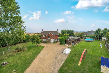
- Price
- Offers Over£700,000
- Size
- 1 acres
Harty Ferry Road, Leysdown-on-Sea, Sheerness, ME12, Leysdown, Kent ME12 England
Added on 24/05/2026House with Land
- Price
- Guide Price£600,000
- Size
- 3.7 acres
Added on 08/09/2026Development Land
- Price
- Guide Price£725,000
- Size
- 1.92 acres
Elmley Road, Minster On Sea, Sheerness, Kent, Minster-on-Sea, Kent ME12 England
Added on 27/05/2026House with Land
- Price
- Offers in Excess of£640,000
- Size
- 1.19 acres
Added on 29/01/2026Development Land
- Price
- Offers in Excess of£550,000
Added on 29/01/2026Barn Conversion
- Price
- £875,000
- Size
- 1.48 acres
Upper Rodmersham, Rodmersham, Sittingbourne, Kent, ME9, Rodmersham, Kent ME9 England
Added on 02/07/2026House with Land
- Price
- Guide Price£700,000
Added on 29/01/2026Development Land
- Price
- Guide Price£725,000
- Size
- 4 acres
Added on 14/08/2026Equestrian property
- Price
- Guide Price£845,000
240-248 High Street, Sheerness, Sheerness, Kent ME12 England
Added on 29/01/2026Development Land
- Price
- Offers in Region of£800,000
Seed Road, Newnham, Sittingbourne, Doddington, Kent ME9 England
Added on 29/01/2026Development Land