Development Site, North Street, Inverurie, Aberdeenshire, AB51
- Land size
- 3.74 acres
Key Features
- Well positioned brownfield development site.
- Outline planning consent for residential use and offers significant redevelopment potential.
- Dual access site, within walking distance of local services.
- Suitable for private or affordable housing schemes - the site is ready for transformation.
Description
Local Information
The site is located on the east side of North Street (B9001), a well-trafficked road linking directly into the town centre. Strathburn Primary School lies immediately to the south, with Inverurie Academy and major retailers (Tesco, ALDI, Inverurie Retail Park) all within easy reach.
Inverurie is a thriving and expanding market town approximately 16 miles northwest of Aberdeen, with a population of around 12,750 and over 1,300 new homes already in the planning and development pipeline.
The town benefits from excellent transport links to the surrounding local area and beyond. By road, Inverurie is just a 15-minute drive along the A96 dual carriageway from Aberdeen International Airport, which provides air connections both to the rest of the UK and abroad. From here, the Aberdeen Western Peripheral Route (AWPR) facilitates easy road access past Aberdeen to the south of Aberdeenshire and beyond. In addition, Inverurie benefits from excellent public transport links, with regular buses and a centrally located train station providing a 25-minute journey into Aberdeen city centre.
Description
The subjects comprise a former Scotbeef abattoir site extending to approximately 1.512 hectares (3.74 acres) or thereby.
The site will be delivered as a cleared, level plot ready for development, with dual frontage and access from both North Street to the north and Old Chapel Road to the south.
The site benefits from having a flat topography, therefore making it suitable for efficient residential development and infrastructure.
Services
Mains services are currently available on-site. Purchasers should confirm capacity and connection requirements with relevant purchasers.
Planning
The site benefits from Outline Planning Permission for residential development, granted in October 2023. Further information on this planning application, as well as related documents, can be found on the planning section of the Aberdeenshire Council website using planning reference APP/2023/02432.
The site was identified as Site OP12 in the Aberdeenshire Local Development Plan 2023, being described as a "Significant redevelopment opportunity in close proximity to town centre". The site was designated in the previous 2017 Local Development Plan.
Interested parties are advised to consult Aberdeenshire Council Planning Department for further guidance on capacity and design parameters.
Indicative layouts suggest capacity for approximately 50 - 80 residential units (subject to detailed design and density). The site may suit private housing schemes, affordable or key-worker
housing (e.g. corporate accommodation tied to infrastructure projects such as the SSE Pathway to 2030).
Rateable Value
The site is currently assessed as a slaughterhouse, with a Rateable Value of £122,000 (effective 1 April 2026). The site will be re-assessed post-demolition.
Viewing
For viewing requests, by appointment only, please contact the selling agents on .
Local Authority:
Aberdeenshire Council, Woodhill House, Westburn Road, Aberdeen, AB16 5GB
Entry:
By mutual arrangement.
Note:
Prospective purchasers should note that unless their interest in the property is formally intimated to the selling agents following inspection, the agents cannot guarantee that notice of a closing date for offers will be advised and consequently the property may be sold without notice.
Anti Money Laundering Compliance:
In accordance with The Money Laundering, Terrorist Financing and Transfer of Funds (Information on the Payer) Regulations 2017, we are required to carry out checks and due diligence on property purchasers. If an offer has been accepted, the purchaser(s) will need to provide proof of identity, residence and proof of funds, as a minimum, prior to any transaction proceeding.
Offers:
Formal offers, in the acceptable Scottish form should be submitted, along with the relevant anti-money laundering paperwork in accordance with The Money Laundering, Terrorist Financing and Transfer of Funds (Information on the Payer) Regulations 2017, through a Scottish Solicitor, to the Selling Agent.
Servitude Rights, Burdens and Wayleaves:
The property is sold subject to and with the benefit of all servitude rights, including rights of access and rights of way, whether public or private. The buyer(s) will be held to have satisfied himself/themselves as to the nature of all such servitude rights and others.
Title:
The buyer(s) shall be bound to accept the title as it presently stands in the name of the seller(s) and the conveyance in favour of the buyer(s) shall be subject to all the exceptions, reservations, burdens and conditions presently contained in the title deeds. There shall be excepted from warrandice in the conveyance in favour of the buyer(s) any leases, tenancies, tenants' rights, missives, agreements, rights of possession, rights of way, access rights, and sewerage and drainage facilities, and all other servitudes and other rights without prejudice to the right of the buyer(s) to quarrel or impugn the same on any ground not inferring warrandice against the seller(s).
Map Location
Property details
- Tenure
- Freehold
- Council Tax Band
- Ask Agent
- Date Posted
- 2026-07-17
Utilities & Restrictions
Utilities
- Electricity
- Ask Agent
- Water
- Ask Agent
- Heating
- Ask Agent
- Broadband
- Ask Agent
- Sewerage
- Ask Agent
Rights & Restrictions
- Public Rights of Way
- Ask Agent
- Private Rights of Way
- Ask Agent
- Listed Property
- Ask Agent
- Restrictions
- Ask Agent
Listed status, conservation areas and planning constraints for this location are in the full report.
Property Features
- Accessibility
- Ask Agent
- Parking
- Ask Agent
- Garden
- Ask Agent
Beyond the particulars: planning activity, flood history, heritage and ground risks, checked for this exact spot.
Connectivity
Broadband
Fastest speed available at this postcode
1.8 Gbps
Gigabit full fibre
Suitable for
- 4K streaming on every screen
- Full-time home working
- Online gaming & big downloads
Mobile signal
Outdoor predictions; indoor signal depends on building materials.
Ofcom Connected Nations postcode-level predictions. Speeds and signal are modelled, not measured, and vary between addresses and providers.
Signal is the easy part. Planning activity, flood history and protected designations here are in the full report.
Nearest Schools
Primary
- Strathburn School353 metres
- Pupils
- 442
- Type
- Non-denominational
- Uryside School0.7 miles
- Pupils
- 458
- Type
- Non-denominational
- Kellands School0.7 miles
- Pupils
- 396
- Type
- Non-denominational
- Port Elphinstone School1.4 miles
- Pupils
- 71
- Type
- Non-denominational
- Keithhall School2.3 miles
- Pupils
- 36
- Type
- Non-denominational
Secondary
- Inverurie Academy0.7 miles
- Pupils
- 1,292
- Type
- Non-denominational
- Meldrum Academy3.9 miles
- Pupils
- 1,004
- Type
- Non-denominational
- Kemnay Academy4 miles
- Pupils
- 993
- Type
- Non-denominational
- Dyce Academy9.9 miles
- Pupils
- 689
- Type
- Non-denominational
- Westhill Academy10 miles
- Pupils
- 847
- Type
- Non-denominational
Distances are straight-line from the advertised location. Source: the national school registers (DfE, Welsh Government, Scottish Government) and Ofsted.
Schools are just the start: planning activity, heritage and any flood history here are in the full report.
Amenities
Supermarket
GP surgery
Pharmacy
Green space
Walking trail
Straight-line distances from the advertised location. Sources: NHS records, Geolytix supermarket locations, OS Open Greenspace and the national trails registers.
The area stacks up? Now check the location itself: planning nearby, protected designations and past flooding.
Getting Around
Nearest station
Nearest bus stop
Typical drive times
Straight-line distances from the advertised location; drive times are typical free-flow times over OpenStreetMap road data, so allow more at peak. Public transport locations from DfT NaPTAN.
Easy to reach matters. So do planning activity, flood history and ground risks: all in the full report.
Flood Risk
From SEPA flood map open data, checked around the advertised map pin and allowing for the listed acreage where known. This summary comes from LandSale, the advertising platform, not from the listing agent, and is not part of the agent's particulars. Risk can vary across a single holding, so verify anything critical through your own searches before committing.
Rivers and the sea
Surface water
The detail behind these bandings
The full report pinpoints where this location sits on the flood maps, and runs the deeper checks that usually only surface after an offer.
- Exact flood zones & annual chances (included in the full report)
- Any recorded past flooding (included in the full report)
- Planning activity nearby (included in the full report)
- Heritage & conservation (included in the full report)
- Protected nature designations (included in the full report)
- Ground risks (included in the full report)
£14.99 · one-off purchase
By LandSale, the platform. Not provided by the listing agent. Ready in about a minute.
Important notice: Information, maps and tags on this page are drawn from the advertising agent's marketing materials or generated automatically. LandSale has not verified them. Relying on these details is at your own risk, always carry out independent checks before committing to a purchase.
LandSale full disclaimer
Marketing information only - not formal particulars. The details on this website are provided for general guidance and do not constitute an offer or contract. Neither LandSale nor the advertising estate/land agent accepts responsibility for any inaccuracy.
1. Source of information
- Listing content: Core description, asking price, tenure, measurements, photographs and planning history originate from the marketing materials of the advertising estate or land agent. LandSale does not author this content and cannot guarantee its accuracy.
- Automated tags & categorisation: Property type, land-use class, acreage bands and similar labels may be applied by machine-learning models. They are intended as a helpful guide only and may not reflect the property's legal status or permitted use.
- Third-party & enriched data layers: Maps, boundary outlines, planning designations, soil reports, broadband coverage and other environmental or location-based insights are licensed from external suppliers. Such data are supplied “as is", may be incomplete or out of date and are subject to change without notice.
2. Verification required
Prospective purchasers must verify critical matters, including but not limited to planning permission, title boundaries, public rights of way, environmental constraints, acreage, services, access and VAT status, through their own inspections, specialist surveys, legal advisers and the selling agent before relying on the information or entering into any contract.
3. No warranty or liability
LandSale gives no warranty, express or implied, as to the accuracy, completeness or fitness for any particular purpose of the information displayed. LandSale shall not be liable for any loss, damage, cost or expense arising directly or indirectly from any use of or reliance on such information, save where liability may not be excluded by law.
4. Updates & feedback
If you believe any detail on this listing is inaccurate, please let us know. We will investigate and, where appropriate, update the listing or notify the agent.
© LandSale | Version 1.3 - August 2026

Listing agent
Aberdeen & Northern (Estates) Ltd, Inverurie
Thainstone Agricultural Centre, Inverurie, AB51 5XZ
Contact Aberdeen & Northern (Estates) Ltd, Inverurie
Thainstone Agricultural Centre, Inverurie, AB51 5XZ
View agent profileSimilar properties for sale
- Price
- Offers Over£110,000
- Size
- 1.5 acres
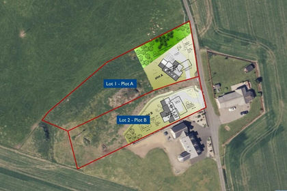
House Sites at Little Greenford, Daviot, AB51, Gordon and Buchan, Aberdeenshire AB51 Scotland
Added on 17/07/2026Vacant Land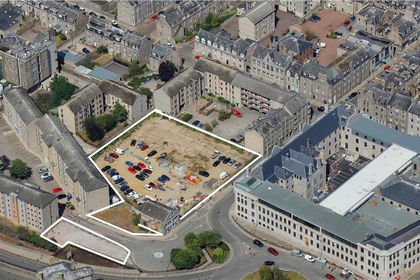
- Price
- POA
- Size
- 1.06 acres
John Street, Aberdeen, Aberdeen, AB25, Aberdeen South, Aberdeen City AB25 Scotland
Added on 31/03/2026Development Land
- Price
- Offers Over£250,000
- Size
- 2.5 acres
Added on 17/07/2026Development Land
- Price
- Offers Over£150,000
- Size
- 4.03 acres
Added on 29/01/2026Commercial Land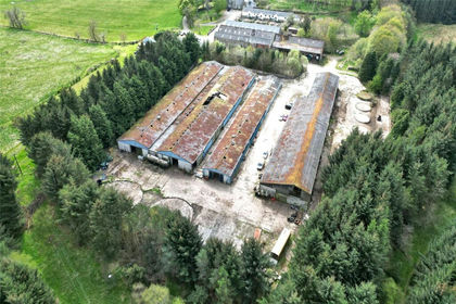
- Price
- Offers Over£150,000
- Size
- 4.03 acres
Added on 21/07/2026Commercial Land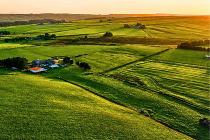
- Price
- Guide Price£180,000
- Size
- 16.6 acres
Added on 27/08/2026Development Land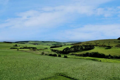
- Price
- Offers Over£445,000
- Size
- 25.75 acres
Added on 19/02/2026Farmland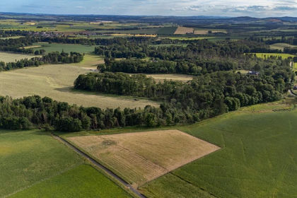
- Price
- Offers Over£198,000
- Size
- 3.3 acres
Fasque Estate, Aberdeenshire, AB30, West Aberdeenshire and Kincardine, Aberdeenshire AB30 Scotland
Added on 29/01/2026Building Plot
- Price
- Offers Over£198,000
- Size
- 4.73 acres
Added on 29/01/2026Building Plot- Price
- Fixed Price£125,000
- Size
- 2.63 acres
Added on 29/01/2026Building Plot