The Albion Inn, 10 Main Street, Spittal, Northumberland
- Use Class
- Use Class: 3
Key Features
- Prominent location in an attractive setting
- Traditional Public Bar
- Well-established Business
Description
BRIEF RESUME
- Prominent location in an attractive setting
- Traditional public bar
- Well-established business
DESCRIPTION
Prominently positioned on the corner of Princes Street and Dock Road, this attractive corner-terraced property offers accommodation arranged over two floors. The property does not include any external garden or yard areas.
Believed to date from the 1920s or 1930s, the building is of traditional cavity construction with a rendered exterior and elements of stone cladding. The main roof is pitched and hipped, finished in slate, while the eastern section of the building—incorporating the entrance hall to the flat and WC facilities features a flat roof with mineral felt covering.
The tapered corner frontage creates a distinctive profile, with chimney stacks located to the Dock Road elevation, the west wall of the original bar area, and the east gable adjacent to the former pool table area.
Rainwater goods are of PVC specification, and the windows are uPVC double glazed units throughout.
Internally, the property was originally configured to provide a bar and kitchen. The principal bar area is now largely open plan, featuring a panelled timber bar along the eastern end of the north wall. Fixed seating is arranged along the south and east walls, and a fireplace with a wood-burning stove provides an attractive focal point in the south-east corner.
LICENCE
Presumed Full licence for on and off sales.
Licensing hours (tbc) understood to be:
11am-12 midnight Mon- Thurs
11am – 1am Friday and Saturday
12.30 – midnight on Sunday.
The property is understood to be a Freehouse.
LOCATION
The subjects are located at the northern end of Spittal Main Street, occupying a relatively prominent corner position at the junction of Dock Road, Princes Street, Billendean Road and Main Street within Spittal, immediately south of Berwick upon Tweed.
Berwick upon Tweed is situated in Northumberland in the north of England and has a population of 13,170 according to the 2021 Census, representing growth of approximately 2.33% since 2001. The town lies broadly equidistant between Edinburgh to the north and Newcastle upon Tyne to the south, approximately 65 miles in each direction. It is served by the A1 trunk road, providing direct access to the national road network, and by the East Coast Main Line railway with regular services to Edinburgh and Newcastle, each approximately 45 miles distant, and London in around three and a half hours.
Although relatively modest in size, Berwick upon Tweed functions as the principal market town for North Northumberland and the eastern Scottish Borders, serving a catchment population of approximately 42,000. The town provides a full range of retail, leisure, educational and financial services and supports a significant tourism sector. During peak holiday periods the resident population is understood to increase substantially due to seasonal visitors. The population within a ten mile radius was recorded as 26,937 in 2022 with an average household income of £27,885.
Airports at both Edinburgh and Newcastle provide a range of domestic and international flights. Berwick also benefits from an active commercial harbour on the River Tweed, capable of accommodating vessels of up to approximately 115 metres in length, with tidal constraints influencing operational capacity.
Spittal itself is a traditional coastal settlement forming part of the wider Berwick urban area. Historically characterised by fishing and maritime activity, the locality is now principally residential in nature, with a mix of housing, small scale commercial uses and seafront amenities. The property occupies a visible and accessible position within this mixed use environment. The former fish factory opposite has been redeveloped into general purpose commercial units with residential properties to the south and east, and the surrounding area has been subject to recent residential redevelopment proposals.
While Spittal provides a limited range of day to day amenities, it is within easy reach of the more extensive facilities available in Tweedmouth and Berwick upon Tweed town centre, both of which are a short distance away and readily accessible by road, foot and public transport. Overall, the location combines local prominence with access to the wider services and infrastructure of Berwick upon Tweed and the North Northumberland catchment.
AREAS
The property has been measured in accordance with the RICS Code of Measuring Practice (Latest Edition) to provide the following Gross Internal Areas:
Ground Floor: 115.09 sq m / 1,238 sq ft
First Floor: 113.13 sq m / 1,217 sq ft
Basement: 30.00 sq m / 323 sq ft
Total: 258.22 sq m / 2,779 sq ft
E & oe measurements taken with a laser measure.
RATEABLE VALUE
According to the Scottish Assessor’s Association Website this unit is assessed to a Rateable Value of £11,750 per annum effective from 01-Apr-2026.
The Small Business Rates Relief Scheme (SBRR) currently provides 100% rates relief units with a combined rateable value of £12,000 or less based on the total of all the occupier’s business premises within England, subject to application and eligibility.
SERVICES
All mains services are understood to be connected.
A gas combi boiler provides heating via radiators and hot water.
OFFERS
A closing date may be set for offers. Please note that only those parties who formally notify their interest will be informed of the closing date. Interested parties are advised to notify the selling agents of their interest as soon as possible. The sellers reserve the right to sell privately and are not bound to accept the highest or indeed any offer.
THE BUSINESS
Financial statements are available on application to the selling agents.
ENTRY
On the conclusion of legal missives.
VAT
Unless otherwise stated the prices quoted are exclusive of VAT. Any intending purchasers must satisfy themselves independently as to the instances of VAT in respect of any transaction.
LEGAL COSTS
Each party will be responsible for their own legal costs incurred in connection with this transaction.
In the normal manner, the purchaser will be liable for any land and buildings transaction tax, registration dues and VAT thereon.
VIEWING ARRANGEMENTS
By appointment only with the sole agents.
Edwin Thompson
76 Overhaugh Street
Galashiels
TD1 1DP
Tel:
Email: g.
Map Location
Property details
- Tenure
- Freehold
- Council Tax Band
- Ask Agent
- Date Posted
- 2026-07-17
Price history
| Date | Change | Price |
|---|---|---|
| 27 Jul 2026 | Reduced 8.1% (−£15,000) | £170,000 |
| Until 27 Jul 2026 | Asking price | £185,000 |
Utilities & Restrictions
Utilities
- Electricity
- Ask Agent
- Water
- Ask Agent
- Heating
- Ask Agent
- Broadband
- Ask Agent
- Sewerage
- Ask Agent
Rights & Restrictions
- Public Rights of Way
- Ask Agent
- Private Rights of Way
- Ask Agent
- Listed Property
- Ask Agent
- Restrictions
- Ask Agent
Listed status, conservation areas and planning constraints for this location are in the full report.
Property Features
- Accessibility
- Ask Agent
- Parking
- Ask Agent
- Garden
- Ask Agent
Beyond the particulars: planning activity, flood history, heritage and ground risks, checked for this exact spot.
Connectivity
Broadband
Fastest speed available at this postcode
10 Gbps
Gigabit full fibre
Suitable for
- 4K streaming on every screen
- Full-time home working
- Online gaming & big downloads
Mobile signal
Predicted 4G and 5G signal; indoor signal depends on building materials.
Ofcom Connected Nations postcode-level predictions. Speeds and signal are modelled, not measured, and vary between addresses and providers.
Signal is the easy part. Planning activity, flood history and protected designations here are in the full report.
Nearest Schools
Primary
- Spittal Community Primary School345 metresNo Ofsted rating
- Ages
- 4 to 11
- Pupils
- 128
- Type
- Community school
- Prior Park Primary School878 metresOfsted: Good
- Ages
- 3 to 11
- Pupils
- 110
- Type
- Community school
- St Cuthberts Catholic Primary School, Berwick0.7 milesNo Ofsted rating
- Ages
- 3 to 11
- Pupils
- 98
- Type
- Academy converter
- Faith
- Roman Catholic
- Tweedmouth West Primary School0.7 milesOfsted: Good
- Ages
- 4 to 11
- Pupils
- 145
- Type
- Community school
- Holy Trinity Church of England Primary School1.1 milesNo Ofsted rating
- Ages
- 3 to 11
- Pupils
- 161
- Type
- Voluntary aided school
- Faith
- Church of England
Secondary
- Berwick Academy562 metresOfsted: Requires improvement
- Ages
- 13 to 18
- Pupils
- 601
- Type
- Academy converter
- The Duchess's Community High School28 milesOfsted: Requires improvement
- Ages
- 11 to 18
- Pupils
- 1,276
- Type
- Academy converter
- Dr Thomlinson Church of England Middle School32 milesNo Ofsted rating
- Ages
- 9 to 13
- Pupils
- 184
- Type
- Academy converter
- Faith
- Church of England
- James Calvert Spence College34 milesOfsted: Good
- Ages
- 11 to 19
- Pupils
- 567
- Type
- Community school
- The King Edward VI School42 milesOfsted: Good *
- Ages
- 13 to 18
- Pupils
- 1,426
- Type
- Academy converter
* Latest graded judgement covers quality of education only; no overall grade was issued under the 2024-25 inspection framework.
Distances are straight-line from the advertised location. Source: the national school registers (DfE, Welsh Government, Scottish Government) and Ofsted.
Schools are just the start: sold prices nearby, planning activity and any flood history are in the full report.
Amenities
Supermarket
GP surgery
Pharmacy
Hospital
Green space
Straight-line distances from the advertised location. Sources: NHS records, Geolytix supermarket locations, OS Open Greenspace and the national trails registers.
The area stacks up? Now check the location itself: planning nearby, protected designations and past flooding.
Getting Around
Nearest station
Nearest bus stop
Typical drive times
Straight-line distances from the advertised location; drive times are typical free-flow times over OpenStreetMap road data, so allow more at peak. Public transport locations from DfT NaPTAN.
Easy to reach matters. So do planning activity, flood history and ground risks: all in the full report.
Flood Risk
Environment Agency open data, checked around the advertised map pin for the listed acreage. Long-term risk counts flood defences; the planning map's flood zones do not. The map pin for this listing marks the postcode area rather than the exact location, so these readings describe the surrounding area. Provided by LandSale, not the listing agent, and not part of the agent's particulars. Risk varies across a holding, so verify before committing.
Rivers and the sea
Planning map: Flood Zone 1.
Surface water
Not at the pin: mapped about 10 metres away.
These bandings are the summary. Where this location sits on the flood maps, plus planning activity, heritage and ground risks, is in the full report.
Important notice: Information, maps and tags on this page are drawn from the advertising agent's marketing materials or generated automatically. LandSale has not verified them. Relying on these details is at your own risk, always carry out independent checks before committing to a purchase.
LandSale full disclaimer
Marketing information only - not formal particulars. The details on this website are provided for general guidance and do not constitute an offer or contract. Neither LandSale nor the advertising estate/land agent accepts responsibility for any inaccuracy.
1. Source of information
- Listing content: Core description, asking price, tenure, measurements, photographs and planning history originate from the marketing materials of the advertising estate or land agent. LandSale does not author this content and cannot guarantee its accuracy.
- Automated tags & categorisation: Property type, land-use class, acreage bands and similar labels may be applied by machine-learning models. They are intended as a helpful guide only and may not reflect the property's legal status or permitted use.
- Third-party & enriched data layers: Maps, boundary outlines, planning designations, soil reports, broadband coverage and other environmental or location-based insights are licensed from external suppliers. Such data are supplied “as is", may be incomplete or out of date and are subject to change without notice.
2. Verification required
Prospective purchasers must verify critical matters, including but not limited to planning permission, title boundaries, public rights of way, environmental constraints, acreage, services, access and VAT status, through their own inspections, specialist surveys, legal advisers and the selling agent before relying on the information or entering into any contract.
3. No warranty or liability
LandSale gives no warranty, express or implied, as to the accuracy, completeness or fitness for any particular purpose of the information displayed. LandSale shall not be liable for any loss, damage, cost or expense arising directly or indirectly from any use of or reliance on such information, save where liability may not be excluded by law.
4. Updates & feedback
If you believe any detail on this listing is inaccurate, please let us know. We will investigate and, where appropriate, update the listing or notify the agent.
© LandSale | Version 1.3 - August 2026
Listing agent
EDWIN THOMPSON PROPERTY SERVICES LIMITED, Galashiels
Contact EDWIN THOMPSON PROPERTY SERVICES LIMITED, Galashiels
View agent profileSimilar properties for sale
- Price
- Offers Over£150,000
- Size
- 0.28 acres
Added on 02/07/2026Self Build Plot
- Price
- Offers Over£210,000
2 Daniels Brae, Spott Dunbar, EH42, Lothian East, East Lothian EH42 Scotland
Added on 25/06/2026Development Land
- Price
- Offers Over£175,000
New Row, Alnwick, Northumberland, NE66, Alnwick, Northumberland NE66 England
Added on 09/10/2026Warehouse
- Price
- Offers in Excess of£150,000
Added on 12/05/2026Development Land
- Price
- Offers Over£145,000
2 Fraser Avenue, Edinburgh, EH5, Edinburgh North and Leith, City of Edinburgh EH5 Scotland
Added on 29/01/2026Development Land
- Price
- Offers Over£115,000
- Size
- 1.66 acres
Burntisland Road, Kinghorn, KY3, Cowdenbeath and Kirkcaldy, Fife KY3 Scotland
Added on 29/01/2026Building Plot
- Price
- Guide Price£170,000
- Size
- 0.11 acres
Fowler Street, South Shields, Tyne and Wear, NE33, South Shields, South Tyneside NE33 England
Added on 29/09/2026Warehouse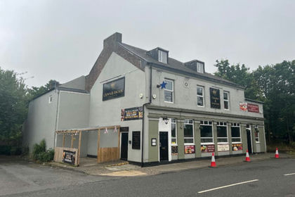
- Price
- Offers in Region of£155,000
Crown and Anchor Chapel Row, Jarrow, NE32, Jarrow and Gateshead East, South Tyneside NE32 England
Added on 12/10/2026Pub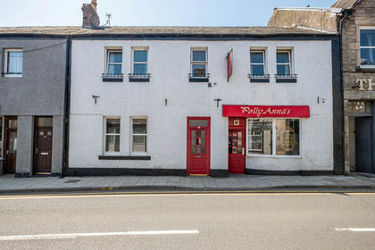
- Price
- Offers Over£185,000
PollyAnnas, 88 High Street, Langholm, DG13, Langholm, Dumfries and Galloway DG13 Scotland
Added on 13/06/2026Pub
- Price
- £180,000
- Size
- 0.05 acres
Added on 10/08/2026Industrial Land