Gelliwrgan Farm, Gelli Wrgan Road, Ynysbwl, Pontypridd, CF37
- Land size
- 3.9 acres
- Bedrooms
- 3
- Bathrooms
- 2
Key Features
- 17th Century Farm House
- Set in approximately 3.901 acres
- Outstanding views over woodland and mountains
- 3/4 Bedroom Property
- Solar Panels, Bore Hole and Private drainage
- Suitable for multi-generational living.
Description
Dating back as far as the 17th century, Gelliwrgan Farm a 3/4 bed farmhouse set within 3.901 acres, occupies a wonderfully private position on the outskirts of the village of Ynysybwl, within Rhondda Cynon Taf and close to the town of Pontypridd. Set amid a peaceful rural sanctuary, the property enjoys an enviable sense of seclusion while remaining within easy reach of everyday amenities, including local schools, shops and restaurants. To the south, the historic market town of Pontypridd sits at the meeting point of the three valleys, while to the north lies the expansive Llanwynno forestry, offering a striking natural backdrop. Combining tranquillity, heritage and convenience, Gelliwrgan Farm presents a rare opportunity to enjoy the best of both worlds: a private countryside retreat with town life and the M4 corridor readily accessible when required.
Situation - Dating back as far as the 17th century, Gelliwrgan Farm a 3/4 bed farmhouse set within 3.901 acres, occupies a wonderfully private position on the outskirts of the village of Ynysybwl, within Rhondda Cynon Taf and close to the town of Pontypridd. Set amid a peaceful rural sanctuary, the property enjoys an enviable sense of seclusion while remaining within easy reach of everyday amenities, including local schools, shops and restaurants. To the south, the historic market town of Pontypridd sits at the meeting point of the three valleys, while to the north lies the expansive Llanwynno forestry, offering a striking natural backdrop. Combining tranquillity, heritage and convenience, Gelliwrgan Farm presents a rare opportunity to enjoy the best of both worlds: a private countryside retreat with town life and the M4 corridor readily accessible when required.
About The Property - Approached from the driveway, the ground floor opens into a practical utility area, with access to both a storeroom and boiler room. From here, stairs rise to the true heart of the home: an impressive open-plan kitchen, dining and living space designed for modern country living. Generously proportioned and wonderfully sociable, this inviting space is ideal for entertaining, while the substantial feature log burner creates a warm and atmospheric focal point for cosy evenings in the Welsh hills. Just off the kitchen, a hallway leads to a ground-floor shower room, a charming sitting room with its own feature fireplace, and a well-appointed ground-floor bedroom, the entrance hall itself can be used as an ancillary kitchen, for potential use as multi-generational living or other opportunities such as Air BnB subject to all necessary planning consents.
The first floor is accessed from the kitchen, opening directly into a versatile landing area currently arranged as an artist’s studio. This flexible space would lend itself beautifully to use as a study, creative retreat or fourth bedroom, subject to requirements. Continuing along the landing are two further double bedrooms and a family bathroom, completing the accommodation with a comfortable and well-balanced layout.
Gardens And Grounds - Gelliwrgan Farm is set within approximately four acres of attractive grounds, comprising small paddocks, woodland and established gardens. The holding includes a range of useful outbuildings, including pole-barn-style stabling and storage sheds, together with a characterful stone-built shed. The gardens are arranged to include both floral and productive vegetable areas, ideal for those seeking a more self-sufficient country lifestyle. With distinct garden sections, meandering walkways and terraced features, the grounds offer an immediate sense of peace and tranquillity. The paddocks are currently grazed by ponies under an existing tenancy arrangement.
Additional Information - Freehold. Mains electric along withe use of installed solar panels and a private bore hole water supply to the property which is metered and shared with the neighbour under a legal agreement. Council Tax Band ‘F’. Rhondda Cynnon Taf County Borough Council Heating is provided by source heat pumps and log burner. There is private drainage by way of a cesspit.
Proceeds Of Crime Act 2002 - Watts & Morgan LLP are obliged to report any knowledge or reasonable suspicion of money laundering to NCA (National Crime Agency) and should such a report prove necessary may be precluded from conducting any further work without consent from NCA.
Map Location
Property details
- Tenure
- Freehold
- Council Tax Band
- F
- Date Posted
- 2026-07-17
Market Value Analysis
Compared with 363 Farms & Smallholdings listings in Wales (1+ acres).
Energy Performance Certificate
Energy Efficiency Rating
Based on UK Energy Performance Certificate standards (EU Directive 2002/91/EC)
Running costs are one side. Planning activity, flood history and ground risks for this location are in the full report.
Utilities & Restrictions
Utilities
- Electricity
- Ask Agent
- Water
- Ask Agent
- Heating
- Ask Agent
- Broadband
- Ask Agent
- Sewerage
- Ask Agent
Rights & Restrictions
- Public Rights of Way
- Ask Agent
- Private Rights of Way
- Ask Agent
- Listed Property
- Ask Agent
- Restrictions
- Ask Agent
Listed status, conservation areas and planning constraints for this location are in the full report.
Property Features
- Accessibility
- Ask Agent
- Parking
- Parking Available
- Garden
- Garden
Beyond the particulars: planning activity, flood history, heritage and ground risks, checked for this exact spot.
Connectivity
Broadband
Fastest speed available at this postcode
14 Mbps
Standard (10-30 Mbps)
Suitable for
- Web & social
- Music streaming
- Standard video calls
Fixed wireless access may also be an option here.
Mobile signal
Predicted 4G and 5G signal; indoor signal depends on building materials.
Ofcom Connected Nations postcode-level predictions. Speeds and signal are modelled, not measured, and vary between addresses and providers.
Signal is the easy part. Planning activity, flood history and protected designations here are in the full report.
Nearest Schools
Primary
- Miskin Primary0.9 miles
- Pupils
- 94
- Type
- Nursery, Infants & Juniors
- Language
- English medium school / provision
- Perthcelyn Community Primary School1 mile
- Pupils
- 126
- Type
- Nursery, Infants & Juniors
- Language
- English medium school / provision
- Pengeulan Primary1 mile
- Pupils
- 136
- Type
- Nursery, Infants & Juniors
- Language
- English medium school / provision
- Darrenlas Primary School1.1 miles
- Pupils
- 222
- Type
- Nursery, Infants & Juniors
- Language
- English medium school / provision
- Penrhiwceibr Primary1.1 miles
- Pupils
- 118
- Type
- Nursery, Infants & Juniors
- Language
- English medium school / provision
Secondary
- Mountain Ash Comprehensive School1.7 miles
- Pupils
- 909
- Type
- Secondary (ages 11-19)
- Language
- English medium school / provision
- Porth Community School3.5 miles
- Pupils
- 927
- Type
- Middle (ages 3-16)
- Language
- English medium school / provision
- Afon Taf High School3.7 miles
- Pupils
- 798
- Type
- Secondary (ages 11-16)
- Language
- English medium school / provision
- Ferndale Community School3.7 miles
- Pupils
- 636
- Type
- Secondary (ages 11-16)
- Language
- English medium school / provision
- Ysgol Bro Taf3.9 miles
- Pupils
- 902
- Type
- Middle (ages 3-16)
- Language
- English medium school / provision
Distances are straight-line from the advertised location. Source: the national school registers (DfE, Welsh Government, Scottish Government) and Ofsted.
Schools are just the start: sold prices nearby, planning activity and any flood history are in the full report.
Amenities
Supermarket
GP surgery
Pharmacy
Straight-line distances from the advertised location. Sources: NHS records, Geolytix supermarket locations, OS Open Greenspace and the national trails registers.
The area stacks up? Now check the location itself: planning nearby, protected designations and past flooding.
Getting Around
Nearest station
Nearest bus stop
Typical drive times
Straight-line distances from the advertised location; drive times are typical free-flow times over OpenStreetMap road data, so allow more at peak. Public transport locations from DfT NaPTAN.
Easy to reach matters. So do planning activity, flood history and ground risks: all in the full report.
Flood Risk
Natural Resources Wales open data, checked around the advertised map pin for the listed acreage. Long-term risk counts flood defences; the planning map's flood zones do not. Provided by LandSale, not the listing agent, and not part of the agent's particulars. Risk varies across a holding, so verify before committing.
Rivers and the sea
Planning map: Flood Zone 1.
Surface water
Not at the pin: mapped about 30 metres away.
These bandings are the summary. Where this location sits on the flood maps, plus planning activity, heritage and ground risks, is in the full report.
Important notice: Information, maps and tags on this page are drawn from the advertising agent's marketing materials or generated automatically. LandSale has not verified them. Relying on these details is at your own risk, always carry out independent checks before committing to a purchase.
LandSale full disclaimer
Marketing information only - not formal particulars. The details on this website are provided for general guidance and do not constitute an offer or contract. Neither LandSale nor the advertising estate/land agent accepts responsibility for any inaccuracy.
1. Source of information
- Listing content: Core description, asking price, tenure, measurements, photographs and planning history originate from the marketing materials of the advertising estate or land agent. LandSale does not author this content and cannot guarantee its accuracy.
- Automated tags & categorisation: Property type, land-use class, acreage bands and similar labels may be applied by machine-learning models. They are intended as a helpful guide only and may not reflect the property's legal status or permitted use.
- Third-party & enriched data layers: Maps, boundary outlines, planning designations, soil reports, broadband coverage and other environmental or location-based insights are licensed from external suppliers. Such data are supplied “as is", may be incomplete or out of date and are subject to change without notice.
2. Verification required
Prospective purchasers must verify critical matters, including but not limited to planning permission, title boundaries, public rights of way, environmental constraints, acreage, services, access and VAT status, through their own inspections, specialist surveys, legal advisers and the selling agent before relying on the information or entering into any contract.
3. No warranty or liability
LandSale gives no warranty, express or implied, as to the accuracy, completeness or fitness for any particular purpose of the information displayed. LandSale shall not be liable for any loss, damage, cost or expense arising directly or indirectly from any use of or reliance on such information, save where liability may not be excluded by law.
4. Updates & feedback
If you believe any detail on this listing is inaccurate, please let us know. We will investigate and, where appropriate, update the listing or notify the agent.
© LandSale | Version 1.3 - August 2026
Listing agent
Watts & Morgan, Cowbridge
55 High Street, Cowbridge, CF71 7AE
Similar properties for sale
- Price
- Guide Price£685,000
- Size
- 3.7 acres
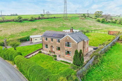
Penrhiwceiber Farm, Llanwonno Road Mountain Ash, CF45, Penrhiwceiber, Rhondda Cynon Taf CF45 Wales
Added on 29/01/2026Farmhouse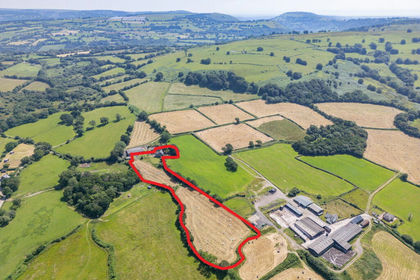
- Price
- Guide Price£650,000
- Size
- 4.57 acres
Gwerna Hall Farm Lot 1, Pandy Lane, Maesycwmmer, Hengoed, CF82, Maesycwmmer, Caerphilly CF82 Wales
Added on 10/07/2026Smallholding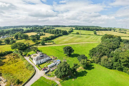
- Price
- £695,000
- Size
- 3.33 acres
Llwynrhyddid Farmhouse, Hensol, Pontyclun, CF72, Pendoylan, Vale of Glamorgan CF72 Wales
Added on 29/01/2026Farmhouse
- Price
- Guide Price£865,000
- Size
- 11.47 acres
Added on 09/10/2026Smallholding
- Price
- £650,000
- Size
- 3 acres
Added on 29/01/2026Smallholding
- Price
- Offers in Region of£950,000
- Size
- 12 acres
Dyffryn Crawnon, Llangynidr, Crickhowell, Powys., Llangynidr, Powys NP8 Wales
Added on 26/03/2026Farmhouse
- Price
- £960,000
- Size
- 24 acres
Added on 15/04/2026Farm
- Price
- £850,000
- Size
- 6.5 acres
Added on 08/08/2026Smallholding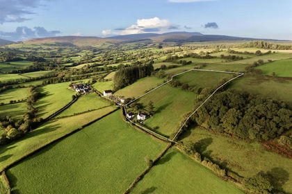
- Price
- Guide Price£725,000
- Size
- 5.8 acres
Added on 13/10/2026Multiple Dwelling Property
- Price
- Guide Price£860,000
- Size
- 24.71 acres
Bettws, Abergavenny, Monmouthshire, Crucorney, Monmouthshire NP7 Wales
Added on 01/10/2026Smallholding