Land adjacent to Cartmel Road, Grange-over-Sands Cumbria LA11
- Land size
- 3.1 acres
Key Features
- 1.253 Hectares/3.096 Acres of Residential Development Land
- Allocated in the South Lakeland Local Plan for approximately 28 dwellings
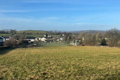
- Elevated site with panoramic views over Morecambe Bay and to the hills of Arnside & Silverdale AONB
- 2 miles from Lake District National Park and Cartmel
Description
A southeast facing residential development site in a desirable area of Grange-over-Sands, extending to just over 3 acres allocated in the South Lakeland Local Development Plan for approximately 28 houses. The elevated land boasts beautiful views out to Morecambe Bay and over to the Arnside and Silverdale AONB benefitting from good access to local facilities and the town centre as well as being 2 miles from The Lake District National Park.
LOCATION
The land is situated adjacent to Cartmel Road in Grange-over-Sands which is in the district of South Lakeland and the South of Cumbria, North West England. Grange-over-Sands is a desirable and attractive seaside town with an approximate population of 4,114 (2011 Census). It is situated on the north side of Morecambe Bay and offers good local services including shops, hotels and leisure attractions. There is a lively centre that has cafes and restaurants, a promenade that runs along the shores of the bay, ornamental gardens and a popular golf course.
The south boundaries of The Lake District National Park lie just two miles away and the A590 is 3 miles to the north which is the main arterial road between Junction 36 of the M6 and Kendal (14 miles) and Barrow-in-Furness (25 miles). Cartmel, which is reached directly from Cartmel Road is just 2 miles away and provides popular leisure offerings including Rogans which is a well-known Michelin Star restaurant, a range of cafes and public houses and Cartmel Racecourse which hosts annual race days.
There are train stations within the town centre and at Kents Bank which is just a 10 minute walk from Cartmel Road with services running to and from Barrow-in-Furness and the Coast to Lancaster and Manchester Airport. A bus service operates routes to Kendal, Allithwaite, Cark, Cartmel and Barrow-in-Furness and a local stop sits at the foot of the subject site leading directly into the town centre.
The land lies opposite Low Fell Gate Farm adjacent to Cartmel Road at its junction with Kents Bank Road and Allithwaite Road. Immediately north is Cat Tree Road which forms part of a very desirable and quiet residential estate including The Heads. There is a cricket ground and sports fields 100 metres to the west beyond which is access to The Promenade and Grange Lido, which is subject to a restoration project, is around 400 metres away. Low Fell Gate Caravan Park and open countryside are to the west and southwest.
DESCRIPTION
Currently a single field enclosure of permanent pasture, being broadly rectangular in shape extending and rising from Kents Bank Road up the north side of Cartmel Road, where there is a gate access mid-way up. The east boundary is formed in natural stone and the north, west and south in mature hedging.
The land extends to approximately 1.253 hectares (3.096 acres).
PLANNING
The land is included in the South Lakeland Local Plan Land Allocations adopted 17 December 2013. The site is referred to as Land opposite Low Fell Gate Farm and is allocated for residential development to accommodate approximately 28 dwellings.
Local Planning Authority - Westmorland & Furness Council, South Lakeland House, Lowther Street, Kendal LA9 4DQ.
SITE CONDITIONS
The purchaser will be responsible for the assessment of the ground conditions and will need to satisfy themselves that development can take place safely.
SERVICES
Services are thought to be situated in the adjacent Kents Bank Road - the purchaser should satisfy themselves as to the availability of the services and connection to them in consultation with the service providers.
TENURE
Freehold with vacant possession being part of Title Number: CU200895.
METHOD OF SALE
The site is offered for sale as a whole with vacant possession by private treaty. The sellers reserve the right to sell privately and are not bound to accept the highest or any offer received.
VALUE ADDED TAX
The land is not elected for VAT and therefore VAT will not be payable on the sale consideration.
BOUNDARIES
The purchaser will be responsible for the maintenance of boundaries where required.
SALE PLAN AND PARTICULARS
The sale plan is based on the Ordnance Survey sheet. Prospective purchasers should check the contract documents. The Purchaser shall raise no objection or query in respect of any variation between the physical boundaries and the Ordnance Survey sheet plan. The plans are strictly for identification purposes only.
MONEY LAUNDERING LEGISLATION
Edwin Thompson are bound to comply with Anti Money Laundering legislation including obtaining evidence of the identity and proof of address of potential buyers. Prior to an offer being accepted, interested parties will need to provide the requested evidence as well as proof of funds.
EASEMENTS, WAYLEAVES AND RIGHTS OF WAY
The land is sold subject to and with the benefit of all public and private rights of way, lights, drainage, cable, pylons or other easements, restrictions or obligations whether or not the same are described in these particulars of sale.
VIEWING
The land can be viewed at a reasonable time without prior appointment and when undertaking an inspection, prospective purchasers should have a copy of these sales details to hand.
SELLING AGENTS
Edwin Thompson
97 Stricklandgate
Kendal
LA9 4RA
F.A.O. John Haley
IMPORTANT NOTICE
Edwin Thompson for themselves and for the Vendor of this property, whose Agents they are, give notice that:
The particulars are set out as a general outline only for the guidance of intending purchasers and do not constitute, nor constitute part of, any offer or contract.
All descriptions, dimensions, plans, reference to condition and necessary conditions for use and occupation and other details are given in good faith and are believed to be correct, but any intending purchasers should not rely on them as statements or representations of fact, but must satisfy themselves by inspection or otherwise as to their correctness.
No person in the employment of Edwin Thompson has any authority to make or give any representation or warranty whatsoever in relation to this property or these particulars, nor to enter into any contract relating to the property on behalf of the Agents, nor into any contract on behalf of the Vendor.
No responsibility can be accepted for loss or expense incurred in viewing the property or in any other way in the event of the property being sold or withdrawn.
These particulars were prepared in March 2024.
Map Location
Property details
- Tenure
- Ask Agent
- Council Tax Band
- Ask Agent
- Date Posted
- 2026-07-17
Utilities & Restrictions
Utilities
- Electricity
- Ask Agent
- Water
- Ask Agent
- Heating
- Ask Agent
- Broadband
- Ask Agent
- Sewerage
- Ask Agent
Rights & Restrictions
- Public Rights of Way
- Ask Agent
- Private Rights of Way
- Ask Agent
- Listed Property
- Ask Agent
- Restrictions
- Ask Agent
Listed status, conservation areas and planning constraints for this location are in the full report.
Property Features
- Accessibility
- Ask Agent
- Parking
- Ask Agent
- Garden
- Ask Agent
Beyond the particulars: planning activity, flood history, heritage and ground risks, checked for this exact spot.
Connectivity
Broadband
Fastest speed available at this postcode
65 Mbps
Superfast
Suitable for
- HD streaming
- Video calls
- Web & social
Fixed wireless access may also be an option here.
Mobile signal
Predicted 4G and 5G signal; indoor signal depends on building materials.
Ofcom Connected Nations postcode-level predictions. Speeds and signal are modelled, not measured, and vary between addresses and providers.
Signal is the easy part. Planning activity, flood history and protected designations here are in the full report.
Nearest Schools
Primary
- Grange CofE Primary School458 metresOfsted: Good
- Ages
- 3 to 11
- Pupils
- 192
- Type
- Voluntary controlled school
- Faith
- Church of England
- Allithwaite CofE Primary School0.8 milesNo Ofsted rating
- Ages
- 3 to 11
- Pupils
- 109
- Type
- Voluntary controlled school
- Faith
- Church of England
- Cartmel CofE Primary School1.4 milesOfsted: Good
- Ages
- 4 to 11
- Pupils
- 47
- Type
- Voluntary controlled school
- Faith
- Church of England
- Lindale CofE Primary School2.3 milesOfsted: Good
- Ages
- 3 to 11
- Pupils
- 47
- Type
- Voluntary controlled school
- Faith
- Church of England
- Flookburgh CofE Primary School2.3 milesNo Ofsted rating
- Ages
- 3 to 11
- Pupils
- 58
- Type
- Foundation school
- Faith
- Church of England
Secondary
- Cartmel Priory CofE School1.3 milesOfsted report card · May 2026
- Ages
- 11 to 16
- Pupils
- 371
- Type
- Academy converter
- Faith
- Church of England
- Dallam School6.9 milesOfsted report card · Apr 2026
- Ages
- 11 to 18
- Pupils
- 761
- Type
- Academy converter
- Ulverston Victoria High School7 milesOfsted: Good *
- Ages
- 11 to 18
- Pupils
- 1,319
- Type
- Community school
- Carnforth High School7.8 milesOfsted report card · Apr 2026
- Ages
- 11 to 16
- Pupils
- 657
- Type
- Academy converter
- Morecambe Bay Academy8.3 milesOfsted: Good
- Ages
- 11 to 18
- Pupils
- 1,045
- Type
- Academy sponsor led
* Latest graded judgement covers quality of education only; no overall grade was issued under the 2024-25 inspection framework.
Distances are straight-line from the advertised location. Source: the national school registers (DfE, Welsh Government, Scottish Government) and Ofsted.
Schools are just the start: sold prices nearby, planning activity and any flood history are in the full report.
Amenities
Supermarket
GP surgery
Pharmacy
Hospital
Green space
Straight-line distances from the advertised location. Sources: NHS records, Geolytix supermarket locations, OS Open Greenspace and the national trails registers.
The area stacks up? Now check the location itself: planning nearby, protected designations and past flooding.
Getting Around
Nearest station
Nearest bus stop
Typical drive times
Straight-line distances from the advertised location; drive times are typical free-flow times over OpenStreetMap road data, so allow more at peak. Public transport locations from DfT NaPTAN.
Easy to reach matters. So do planning activity, flood history and ground risks: all in the full report.
Flood Risk
Environment Agency open data, checked around the advertised map pin for the listed acreage. Long-term risk counts flood defences; the planning map's flood zones do not. The map pin for this listing is approximate, so these readings describe the surrounding area. Provided by LandSale, not the listing agent, and not part of the agent's particulars. Risk varies across a holding, so verify before committing.
Rivers and the sea
Planning map: Flood Zone 1.
Surface water
Not at the pin: mapped about 40 metres away.
These bandings are the summary. Where this location sits on the flood maps, plus planning activity, heritage and ground risks, is in the full report.
Important notice: Information, maps and tags on this page are drawn from the advertising agent's marketing materials or generated automatically. LandSale has not verified them. Relying on these details is at your own risk, always carry out independent checks before committing to a purchase.
LandSale full disclaimer
Marketing information only - not formal particulars. The details on this website are provided for general guidance and do not constitute an offer or contract. Neither LandSale nor the advertising estate/land agent accepts responsibility for any inaccuracy.
1. Source of information
- Listing content: Core description, asking price, tenure, measurements, photographs and planning history originate from the marketing materials of the advertising estate or land agent. LandSale does not author this content and cannot guarantee its accuracy.
- Automated tags & categorisation: Property type, land-use class, acreage bands and similar labels may be applied by machine-learning models. They are intended as a helpful guide only and may not reflect the property's legal status or permitted use.
- Third-party & enriched data layers: Maps, boundary outlines, planning designations, soil reports, broadband coverage and other environmental or location-based insights are licensed from external suppliers. Such data are supplied “as is", may be incomplete or out of date and are subject to change without notice.
2. Verification required
Prospective purchasers must verify critical matters, including but not limited to planning permission, title boundaries, public rights of way, environmental constraints, acreage, services, access and VAT status, through their own inspections, specialist surveys, legal advisers and the selling agent before relying on the information or entering into any contract.
3. No warranty or liability
LandSale gives no warranty, express or implied, as to the accuracy, completeness or fitness for any particular purpose of the information displayed. LandSale shall not be liable for any loss, damage, cost or expense arising directly or indirectly from any use of or reliance on such information, save where liability may not be excluded by law.
4. Updates & feedback
If you believe any detail on this listing is inaccurate, please let us know. We will investigate and, where appropriate, update the listing or notify the agent.
© LandSale | Version 1.3 - August 2026
Listing agent
EDWIN THOMPSON PROPERTY SERVICES LIMITED, Kendal
Contact EDWIN THOMPSON PROPERTY SERVICES LIMITED, Kendal
View agent profileSimilar properties for sale
- Price
- Guide Price£450,000
- Size
- 1.86 acres
Added on 17/07/2026Development Land
- Price
- £170,000
- Size
- 18.65 acres
Added on 11/08/2026Agricultural Land
- Price
- £580,000
- Size
- 6 acres
Brookhouse Road, Brookhouse, Lancaster, Lancashire, Caton-with-Littledale, Lancashire LA2 England
Added on 20/03/2026Development Land
- Price
- Guide Price£1,050,000
- Size
- 3.88 acres
Mill House, Spout Lane, Wennington, LA2, Wennington, Lancashire LA2 England
Added on 29/01/2026Development Land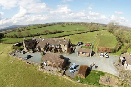
- Price
- Offers in Region of£1,500,000
- Size
- 5 acres
Oysterber Farm, Burton Road, Low Bentham, North Yorkshire, LA2, Bentham, North Yorkshire LA2 England
Added on 25/04/2026Development Land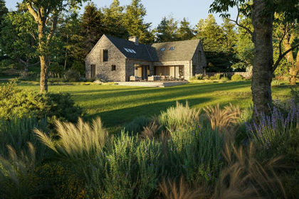
- Price
- Offers Over£500,000
- Size
- 1.4 acres
Skyfall Barn, Troutbeck, Windermere, LA23, Lakes, Westmorland and Furness LA23 England
Added on 01/07/2026Building Plot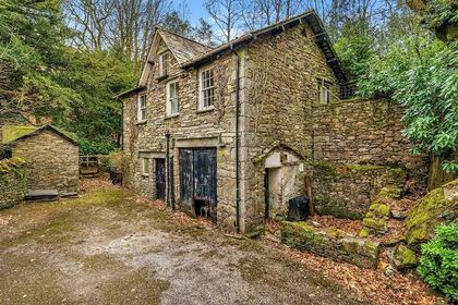
- Price
- Guide Price£450,000
- Size
- 1.3 acres
Land Lying To The East Of, Ambleside, Cumbria, LA22, Lakes, Westmorland and Furness LA22 England
Added on 08/08/2026Development Land
- Price
- Offers in Region of£6,950,000
- Size
- 64 acres
Lancaster Road, Out Rawcliffe, Preston, Lancashire, Out Rawcliffe, Lancashire PR3 England
Added on 22/05/2026Commercial Land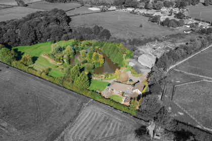
- Price
- £900,000
- Size
- 5 acres
Blackpool Road, St. Michaels, Preston, Upper Rawcliffe-with-Tarnacre, Lancashire PR3 England
Added on 11/07/2026Development Land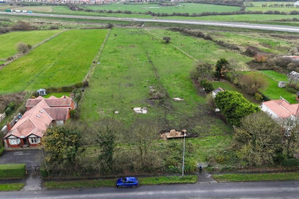
- Price
- Offers in Excess of£600,000
- Size
- 1.21 acres
Land Adjoining 179 Mains Lane, Poulton-Le-Fylde, Singleton, Lancashire FY6 England
Added on 11/03/2026Development Land