Kilgetty, SA68
- Land size
- 4.5 acres
- Bedrooms
- 4
- Bathrooms
- 3
Key Features
- Detached 4 Bedroom House With 3 Bathrooms (2 x En-Suites)
- Approximately 4.5 Acres / Well Kept Level Land & Grounds
- Nicely Presented Accommodation With Charm & Cottage Features
- Ample Off Road Parking Space Plus Workshop/Garage
- Plot Of Land To The Side With Caravan & Its Own Roadside Access
- Electric Hook-Ups For 5 Caravan/Motorhome Camping Pitches
- Conveniently Situated Along The A477 Just Outside Kilgetty / 3 Miles From Saundersfoot & The Coast
Description
A charming 4 bedroom detached house with approximately 4.5 acres, situated just outside the village of Kilgetty, along the A477. This well presented home offers accommodation that is of a good size, boasting 2 en-suites and a family bathroom, plus lovely features such as exposed beams, fireplace with woodburning stove, stone walls etc. There is ample off road parking and a sizeable rear garden. To one side there is a separate plot with static caravan which enjoys its own roadside access and could possibly make a building plot, subject to planning. The remaining land is generally level and also well maintained, being currently used as a camping site with electric hook-ups, but could easily be utilised for keeping animals if preferred. Please note, this property sale is for a residential dwelling with land only and does not include any business.
EPC Rating: D
Situation
The property is situated along the A477 road just outside the village of Kilgetty and is roughly 3 miles from Saundersfoot and the south coast, with many popular beaches and seaside locations near by, which is much loved by locals and tourists alike for the family friendly beaches and natural scenery.
Accommodation
Front door opens into:
Entrance
Stairs rise to first floor, wooden flooring, open plan with lounge, door to bedroom 4.
Lounge
Feature stone fireplace housing a wood burning stove, continuation of wooden floor, understairs storage cupboard, double glazed window to front, radiator. Door opens to:
Kitchen / Diner
Fitted with a range of wall and base storage units and worktops, tiled splash backs, tiled flooring, part exposed feature stone walls, exposed beams, double glazed windows to front and rear, external double glazed door to rear, fire recess providing space for cooker/range/oven, plumbing for washing machine and dish washer, one and a half bowl single drainer sink, wall mounted boiler serving the domestic hot water and central heating, radiator.
Bedroom 4
Double glazed window to front, radiator, door to:
En-Suite
Comprising a shower cubical, W.C, pedestal wash hand basin, radiator, part tiled walls.
First Floor Landing
Wooden flooring, semi-vaulted ceiling with exposed beams, spindle balustrades, radiator, doors to:
Bedroom 3
Twin double glazed windows to front with countryside views, wooden flooring, vaulted ceiling with exposed beams, radiator, door to:
En-Suite
Comprising a shower cubical, W.C, pedestal wash hand basin, radiator, semi-vaulted ceiling with Velux roof window, part tiled walls.
Bedroom 2
Double glazed window to front with countryside views, semi-vaulted ceiling with exposed beams, radiator.
Bedroom 1
Double glazed window to front with countryside views, exposed beams, built in storage cupboard, access to loft, radiator.
Bathroom
Comprising a bath with shower over and screen, W.C, wash hand basin, vaulted ceiling with Velux roof window, tiled floor, radiator.
Externally
To the front of the house there is a traditional pillared stone wall with entrance gate, small front lawn and paving. To the left side there is an in & out double gated driveway providing ample hardstanding off road parking space for several cars and where access leads on to the land/camping area. Adjoining the house to the side is an outside toilet and store shed, adjoining to the rear is a further stone built storage shed. To the rear is a detached workshop/garage and good size garden laid mainly to lawn, being private and bordered by mature hedgerows and trees. A gateway continues to the far side plot which enjoys its own separate gated driveway from the road and where there is a well kept static caravan. This has been used for holiday letting, but the plot has great potential as possibly a building plot, subject to planning permission. Around the property are open fields and rolling countryside, with no immediate neighbours, plus lovely far reaching rural views are enjoyed.
Land
Gated access from the in & out driveway opens onto a hardstanding road which leads up to 5 x electric motorhome/caravan pitches and a further static caravan as the campsite shower and toilet. To the side of here are large parkland style open areas of well kept grassland, used for pitching tents, plus there is a fenced paddock currently used as a dog exercise area. The grounds could also be easily be used for keeping a small number of animals, ponies etc or for growing produce, poly tunnels etc. The campsite is licensed under the Camping & Caravanning Club for 5 caravans/motorhomes and 10 tents which makes a total of 15 pitches and a total of 10 hook-ups. Please note, we recommend checking if any planning might be required for your intended purpose.
Campsite
The campsite is a small lifestyle business run by the current owner. It does not form part of this sale. The business accounts will not be released and it would be up to the next owner to decide if they wish to continue a camping business at the property. No planning is currently required for a camping business due to an exemption and is certificated by the Camping & Caravanning club, issued under section 269(6) of the 1936 Act.
Directions
From Narberth, travel south along the A478 to the roundabouts at Kilgetty, taking the right hand turning signposted for Pembroke Dock on the 2nd roundabout, and travel a short way along the A477, until you see the property on the left hand side, identified by our JJ Morris for sale sign.
What3words Location: ///lousy.sketching.punters
Services
Heating Source: LPG gas
Services -
Electric: Mains
Water: Mains
Drainage: Modern Private Sewage Treatment Plant Installed in 2022.
Local Authority: Pembrokeshire County Council
Council Tax Band: F
EPC: D
Tenure: Freehold and available with vacant possession upon completion.
Broadband Coverage
According to the Ofcom website, this property has standard broadband available. Please note this data was obtained from an online search conducted on ofcom.org.uk and was correct at the time of production.
Some rural areas are yet to have the infrastructure upgraded and there are alternative options which include satellite and mobile broadband available. Prospective buyers should make their own enquiries into the availability of services with their chosen provider.
Mobile Phone Coverage
The Ofcom website states that the property has the following indoor mobile coverage
EE Voice & Data - 76%
Three Voice & Data - 75%
O2 Voice & Data - 61%
Vodafone Voice & Data - 73%
Results are predictions and not a guarantee. Actual services available may be different from results and may be affected by network outages. Please note this data was obtained from an online search conducted on ofcom.org.uk and was correct at the time of production. Prospective buyers should make their own enquiries into the availability of services with their chosen provider.
Anti Money Laundering
Please note when making an offer we will require information to enable us to confirm all parties identities as required by Anti Money Laundering (AML) Regulations. We may also conduct a digital search to confirm your identity.
We will also require full proof of funds such as a mortgage agreement in principle, proof of cash deposit or if no mortgage is required, we will require sight of a bank statement. Should the purchase be funded through the sale of another property, we will require confirmation the sale is sufficient enough to cover the purchase.
Disclaimer
These particulars are provided for guidance only and do not constitute any part of an offer or contract. Whilst every effort has been made to ensure the accuracy of the information, descriptions, measurements, floor plans, and other details provided, they should not be relied upon as statements of fact. Prospective purchasers should satisfy themselves by inspection and other enquiries as to their accuracy.
Photographs, drone imagery, virtual tours, and other marketing images are for illustrative purposes only and may have been digitally enhanced, edited, or altered to improve presentation. Such images should not be relied upon as an exact representation of the property’s current condition, appearance, boundaries, or surroundings.
Services, appliances, and fittings have not been tested, and no warranty is given as to their condition or suitability. All measurements and distances are approximate. Purchasers should seek independent professional advice before proceeding with any trans...
Map Location
Property details
- Tenure
- Freehold
- Council Tax Band
- F
- Date Posted
- 2026-07-15
Market Value Analysis
Compared with 1,207 Homes with Land listings in Wales (1+ acres).
Energy Performance Certificate
Energy Efficiency Rating
Based on UK Energy Performance Certificate standards (EU Directive 2002/91/EC)
Running costs are one side. Planning activity, flood history and ground risks for this location are in the full report.
Utilities & Restrictions
Utilities
- Electricity
- Mains
- Water
- Mains
- Heating
- Gas Central Heating
- Broadband
- Fibre (FTTC)
- Sewerage
- Septic Tank / Private
Rights & Restrictions
- Public Rights of Way
- Ask Agent
- Private Rights of Way
- Ask Agent
- Listed Property
- Ask Agent
- Restrictions
- Ask Agent
Listed status, conservation areas and planning constraints for this location are in the full report.
Property Features
- Accessibility
- Ask Agent
- Parking
- Parking Available
- Garden
- Garden
Beyond the particulars: planning activity, flood history, heritage and ground risks, checked for this exact spot.
Connectivity
Broadband
Fastest speed available at this postcode
24 Mbps
Standard (10-30 Mbps)
Suitable for
- Web & social
- Music streaming
- Standard video calls
Mobile signal
Outdoor predictions; indoor signal depends on building materials.
Ofcom Connected Nations postcode-level predictions. Speeds and signal are modelled, not measured, and vary between addresses and providers.
Signal is the easy part. Planning activity, flood history and protected designations here are in the full report.
Nearest Schools
Primary
- Stepaside Community Primary School1.3 miles
- Pupils
- 119
- Type
- Nursery, Infants & Juniors
- Language
- English medium school / provision
- St Oswalds Church in Wales VA School1.5 miles
- Pupils
- 135
- Type
- Nursery, Infants & Juniors
- Language
- English medium school / provision
- Saundersfoot Community Primary School2 miles
- Pupils
- 172
- Type
- Nursery, Infants & Juniors
- Language
- English medium school / provision
- Templeton Community Primary School3.4 miles
- Pupils
- 126
- Type
- Nursery, Infants & Juniors
- Language
- English medium school / provision
- Ysgol Hafan Y Mor3.7 miles
- Pupils
- 236
- Type
- Nursery, Infants & Juniors
- Language
- Welsh medium school / provision (including transitional)
Secondary
- Ysgol Greenhill School3.9 miles
- Pupils
- 877
- Type
- Secondary (ages 11-19)
- Language
- English medium school / provision
- Ysgol Harri Tudur / Henry Tudor School8.4 miles
- Pupils
- 1,152
- Type
- Secondary (ages 11-19)
- Language
- English medium school / provision
- Dyffryn Taf8.4 miles
- Pupils
- 890
- Type
- Secondary (ages 11-19)
- Language
- Dual language school / provision (Welsh and English) (including transitional)
- Ysgol Caer Elen11 miles
- Pupils
- 907
- Type
- Middle (ages 3-16)
- Language
- Welsh medium school / provision (including transitional)
- Haverfordwest High VC School11 miles
- Pupils
- 1,699
- Type
- Secondary (ages 11-19)
- Language
- English medium school / provision
Distances are straight-line from the advertised location. Source: the national school registers (DfE, Welsh Government, Scottish Government) and Ofsted.
Schools are just the start: sold prices nearby, planning activity and any flood history are in the full report.
Amenities
Supermarket
GP surgery
Pharmacy
Green space
Straight-line distances from the advertised location. Sources: NHS records, Geolytix supermarket locations, OS Open Greenspace and the national trails registers.
The area stacks up? Now check the location itself: planning nearby, protected designations and past flooding.
Getting Around
Nearest station
Nearest bus stop
Typical drive times
Straight-line distances from the advertised location; drive times are typical free-flow times over OpenStreetMap road data, so allow more at peak. Public transport locations from DfT NaPTAN.
Easy to reach matters. So do planning activity, flood history and ground risks: all in the full report.
Flood Risk
From Natural Resources Wales flood map open data, checked around the advertised map pin and allowing for the listed acreage where known. This summary comes from LandSale, the advertising platform, not from the listing agent, and is not part of the agent's particulars. Risk can vary across a single holding, so verify anything critical through your own searches before committing.
Rivers and the sea
Surface water
Mapped within the area searched, not at the advertised map pin itself.
These bandings are the summary. Where this location sits on the flood maps, plus planning activity, heritage and ground risks, is in the full report.
Important notice: Information, maps and tags on this page are drawn from the advertising agent's marketing materials or generated automatically. LandSale has not verified them. Relying on these details is at your own risk, always carry out independent checks before committing to a purchase.
LandSale full disclaimer
Marketing information only - not formal particulars. The details on this website are provided for general guidance and do not constitute an offer or contract. Neither LandSale nor the advertising estate/land agent accepts responsibility for any inaccuracy.
1. Source of information
- Listing content: Core description, asking price, tenure, measurements, photographs and planning history originate from the marketing materials of the advertising estate or land agent. LandSale does not author this content and cannot guarantee its accuracy.
- Automated tags & categorisation: Property type, land-use class, acreage bands and similar labels may be applied by machine-learning models. They are intended as a helpful guide only and may not reflect the property's legal status or permitted use.
- Third-party & enriched data layers: Maps, boundary outlines, planning designations, soil reports, broadband coverage and other environmental or location-based insights are licensed from external suppliers. Such data are supplied “as is", may be incomplete or out of date and are subject to change without notice.
2. Verification required
Prospective purchasers must verify critical matters, including but not limited to planning permission, title boundaries, public rights of way, environmental constraints, acreage, services, access and VAT status, through their own inspections, specialist surveys, legal advisers and the selling agent before relying on the information or entering into any contract.
3. No warranty or liability
LandSale gives no warranty, express or implied, as to the accuracy, completeness or fitness for any particular purpose of the information displayed. LandSale shall not be liable for any loss, damage, cost or expense arising directly or indirectly from any use of or reliance on such information, save where liability may not be excluded by law.
4. Updates & feedback
If you believe any detail on this listing is inaccurate, please let us know. We will investigate and, where appropriate, update the listing or notify the agent.
© LandSale | Version 1.3 - August 2026
Similar properties for sale
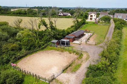
- Price
- Offers in Region of£649,950
- Size
- 3 acres
Cold Inn, Kilgetty, SA68, East Williamston, Pembrokeshire SA68 Wales
Added on 25/06/2026Equestrian property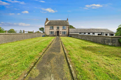
- Price
- Guide Price£635,000
- Size
- 12 acres
Reynalton, Kilgetty, SA68, Kilgetty, Pembrokeshire SA68 Wales
Added on 18/06/2026Farmhouse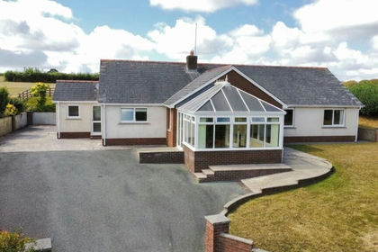
- Price
- Offers in Region of£599,950
- Size
- 9 acres
Princes Gate, Narberth, SA67, Lampeter Velfrey, Pembrokeshire SA67 Wales
Added on 26/08/2026Smallholding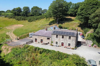
- Price
- Offers in Region of£465,000
- Size
- 2 acres
Added on 01/08/2026Smallholding
- Price
- Offers in Region of£499,950
- Size
- 4 acres
Added on 08/09/2026Smallholding
- Price
- Offers in Region of£525,000
- Size
- 2.1 acres
The Haggard, Kingswood, Pembroke Dock, Pembroke Dock, Pembrokeshire SA72 Wales
Added on 29/01/2026Barn Conversion
- Price
- £640,000
- Size
- 4.5 acres
St Clears, Carmarthenshire, SA33, Eglwyscummin, Carmarthenshire SA33 Wales
Added on 25/03/2026Smallholding
- Price
- Offers in Region of£579,000
- Size
- 3 acres
Penffordd, Clynderwen, SA66, New Moat, Pembrokeshire SA66 Wales
Added on 07/07/2026Farmhouse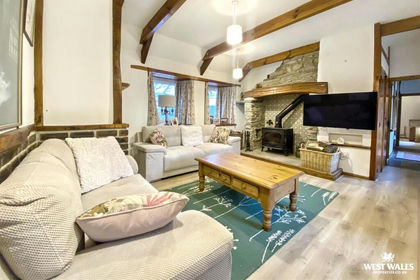
- Price
- Offers in Excess of£525,000
- Size
- 5 acres
Added on 11/02/2026Barn Conversion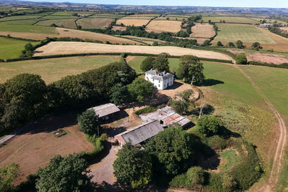
- Price
- Guide Price£485,000
- Size
- 21.54 acres
Llandawke, Laugharne, Carmarthen, SA33, Carmarthen, Carmarthenshire SA33 Wales
Added on 26/08/2026Smallholding