Kirkbride Airfield, CA7
- Land size
- 160.77 acres
Key Features
- 127.93 acres of grassland & arable, 32.84 acres of runways, hardstanding and helipad
- Established aviation fuel sales location
- Potential for diversification to commercial, logistics, storge, leisure or holiday use.
- Accessible location with good road connections
- Total annual income in the region of £60,000 per annum
- Available as a whole, offers for part may be considered
Description
*CLOSING DATE FOR OFFERS SET - 12 NOON MONDAY 7TH SEPTEMBER 2026* CONTACT THE SELLING AGENTS FOR OFFER FORMS.
'Former World War II Airfield with enormous potential'
Kirkbride Airfield, Kirkbride, Cumbria, CA7 5HP
Distances: Wigton - 5.7 miles, Carlisle - 13.4 miles, Penrith - 28.2 miles (All milages are approximate). What3Words: ///northward.tripods.happening
Guide Price: £1,500,000
In all about 160.77 acres (65.06 hectares).
Offered for sale as whole, offers for part may be considered.
For sale by Private Treaty.
History:
Royal Air Force Kirkbride opened in June 1939 predominantly as an aircraft repair depot, far enough away from the threat of enemy aircraft. After the Second World War, the site remained open as a maintenance unit and disposal airfield for redundant aircraft, closing in 1960.
Summary:
The sale comprises of a significant portion of the former World War II RAF Kirkbride, including significant runways, hard standings and access ways. Between the runways and service roads are a series of agricultural fields which are predominantly good quality meadowland. The sale also includes a control tower and club house with office, WC and kitchen facilities, adjacent to which is a steel framed aircraft hangar. There is also a helipad near the control tower and a further redundant building in rougher pasture to the south. Beyond aviation, the site is used for a number of events which generate additional income, such as motorsports, storage and demonstrations. Kirkbride Airfield also offers a significant range of opportunities for futher development and commercialisation, subject to consents. The scale of the site is well suited to storage, logistics, manufacturing or leisure uses.
Hangar
The hangar is a steel portal frame building with concrete apron adjacent (20m x 24m). The building provides ad-hoc storage for aircraft and is a steel frame construction ,with steel profile roof and cladding and a concrete floor.
Disused Building
South of the core site, is a brick built former service building associated with the historic RAF use, this sits within a grassland parcel and although derelict, could be repurposed or developed (Subject to consents).
Control Tower
The Control Tower extends to approximately 753 sq.ft over three floors and includes a reception, club house, meeting rooms and office, with WC and kitchen facilities. This could be further developed into a range of uses (subject to consents).
Runways
The principal runway is predominantly included in the sale, with two sections leased from third party adjoining owners, to complete the full runway for ease of operation. The secondary runway is partially grassed over, and the remainder used for model aircraft, storage or events.
Land
Between the runways and service roads, there are a series of agricultural fields which are predominantly good quality meadowland, but have historically provided arable acreage. There are further areas of land which are rougher permanent pasture to the south of the airfield. The land is Grade 3 with soils from the 'Rockcliffe' series, typical to the area, a deep silty and fine sandy soil.
Breakdown of Areas
104.75 acres of arable and temporary grassland
32.84 acres of buildings, runways, former runways and perimeter tracks
23.81 acres of permanent pasture and rough grazing, including the dog agility field
General Remarks
Tenure
The site is occupied on a series of short term arrangements, the farmland being let on annual grazing or mowing licences to local farmers, the hangar building provides light aircraft storage on an ad-hoc basis, the control tower and office forms a base for a company operating from the site selling aviation fuel. There is a small paddock to the north east corner adjacent to the road which is occupied and used for a dog walking and agility business. Other income streams include grant scheme over the farmland, aircraft landing fees and various other short terms uses, such as demonstration days, storage and motorsport events.
Rights of way, easements & wayleaves
The property is sold subject to and with the benefit of all wayleaves, easements and rights of way whether public or private, whether mentioned or not. Typical of former airfields, various reciprocal private rights of way cross land, runways and service roads.
Services
Mains electricity (60 kVA 3 phase supply) and mains water, with private drainage. The private drainage system is unlikely to comply with current regulations and will require replacement by the purchaser with a new system.
Subsidies and Grants
The land is registered on the Rural Land Registry. We are not aware of any stewardship schemes or agreements. The land is within an Sustainable Farming Incentive agreement, however this is non-transferable and will terminate when the property is sold.
Sporting Rights
The sporting rights are included in the sale in so far as they are owned.
Mineral Rights
The mineral rights are included in the sale in so far as they are owned.
Sale Conditions
The property is sold without sale restrictions, overage, or clawback.
Business Rates
It is understood there are no business rates payable for the site.
Tenure
The freehold of the property is offered for sale with vacant possession on completion, subject to aforementioned licences and agreements.
VIEWING: - VIEWING IS STRICTLY BY APPOINTMENT ONLY. PLEASE CONTACT THE SELLING AGENTS TO ARRANGE A FORMAL APPOINTMENT TO VISIT.
Money Laundering Regulations
Please note that in connection with the Money Laundering Regulations (The Money Laundering, Terrorist Financing, and Transfer of Funds (Information on the Payer) Regulations 2017), we are legally required to carry out money laundering checks against Tenants. To enable us to complete these checks, Tenants will need to provide along with their offer, proof of primary (E.g. Passport) and secondary (E.g. Current Council tax or utility bill) identity documents. Failure to provide this information may result in an offer not being considered.
Map Location
Property details
- Tenure
- Freehold
- Council Tax Band
- Ask Agent
- Date Posted
- 2026-07-15
Market Value Analysis
Compared with 21 land-only listings in North West England (100+ acres).
Utilities & Restrictions
Utilities
- Electricity
- Ask Agent
- Water
- Ask Agent
- Heating
- Ask Agent
- Broadband
- Ask Agent
- Sewerage
- Ask Agent
Rights & Restrictions
- Public Rights of Way
- Ask Agent
- Private Rights of Way
- Ask Agent
- Listed Property
- Ask Agent
- Restrictions
- Ask Agent
Listed status, conservation areas and planning constraints for this location are in the full report.
Property Features
- Accessibility
- Ask Agent
- Parking
- Ask Agent
- Garden
- Garden
Beyond the particulars: planning activity, flood history, heritage and ground risks, checked for this exact spot.
Connectivity
Broadband
Fastest speed available at this postcode
40 Mbps
Superfast · available to 36% of premises
Suitable for
- HD streaming
- Video calls
- Web & social
Fixed wireless access may also be an option here.
Mobile signal
Predicted 4G and 5G signal; indoor signal depends on building materials.
Ofcom Connected Nations postcode-level predictions. Speeds and signal are modelled, not measured, and vary between addresses and providers.
Signal is the easy part. Planning activity, flood history and protected designations here are in the full report.
Nearest Schools
Primary
- Kirkbride Primary School0.8 milesOfsted: Good
- Ages
- 3 to 11
- Pupils
- 77
- Type
- Community school
- Holm Cultram Abbey CofE Primary School4.2 milesNo Ofsted rating
- Ages
- 4 to 11
- Pupils
- 43
- Type
- Voluntary controlled school
- Faith
- Church of England
- St Cuthbert's Catholic Primary School4.4 milesNo Ofsted rating
- Ages
- 3 to 11
- Pupils
- 136
- Type
- Academy converter
- Faith
- Roman Catholic
- Wiggonby CofE School4.5 milesNo Ofsted rating
- Ages
- 3 to 11
- Pupils
- 61
- Type
- Voluntary aided school
- Faith
- Church of England
- Thomlinson Junior School4.6 milesOfsted: Good *
- Ages
- 7 to 11
- Pupils
- 227
- Type
- Community school
Secondary
- The Nelson Thomlinson School4.7 milesOfsted: Good
- Ages
- 11 to 18
- Pupils
- 1,095
- Type
- Voluntary controlled school
- Solway Community School7 milesOfsted: Good *
- Ages
- 11 to 16
- Pupils
- 150
- Type
- Community school
- Richard Rose Morton Academy9.4 milesOfsted: Good *
- Ages
- 11 to 18
- Pupils
- 905
- Type
- Academy sponsor led
- Caldew School9.5 milesOfsted: Good
- Ages
- 11 to 18
- Pupils
- 990
- Type
- Academy converter
- Beacon Hill Community School9.6 milesOfsted: Requires improvement *
- Ages
- 11 to 16
- Pupils
- 135
- Type
- Community school
* Latest graded judgement covers quality of education only; no overall grade was issued under the 2024-25 inspection framework.
Distances are straight-line from the advertised location. Source: the national school registers (DfE, Welsh Government, Scottish Government) and Ofsted.
Schools are just the start: sold prices nearby, planning activity and any flood history are in the full report.
Amenities
Supermarket
GP surgery
Pharmacy
Hospital
Straight-line distances from the advertised location. Sources: NHS records, Geolytix supermarket locations, OS Open Greenspace and the national trails registers.
The area stacks up? Now check the location itself: planning nearby, protected designations and past flooding.
Getting Around
Nearest station
Nearest bus stop
Typical drive times
Straight-line distances from the advertised location; drive times are typical free-flow times over OpenStreetMap road data, so allow more at peak. Public transport locations from DfT NaPTAN.
Easy to reach matters. So do planning activity, flood history and ground risks: all in the full report.
Flood Risk
Environment Agency open data, checked around the advertised map pin for the listed acreage. Long-term risk counts flood defences; the planning map's flood zones do not. Provided by LandSale, not the listing agent, and not part of the agent's particulars. Risk varies across a holding, so verify before committing.
Rivers and the sea
Planning map: Flood Zone 2, about 410 metres away.
Surface water
Not at the pin: mapped about 10 metres away.
These bandings are the summary. Where this location sits on the flood maps, plus planning activity, heritage and ground risks, is in the full report.
Important notice: Information, maps and tags on this page are drawn from the advertising agent's marketing materials or generated automatically. LandSale has not verified them. Relying on these details is at your own risk, always carry out independent checks before committing to a purchase.
LandSale full disclaimer
Marketing information only - not formal particulars. The details on this website are provided for general guidance and do not constitute an offer or contract. Neither LandSale nor the advertising estate/land agent accepts responsibility for any inaccuracy.
1. Source of information
- Listing content: Core description, asking price, tenure, measurements, photographs and planning history originate from the marketing materials of the advertising estate or land agent. LandSale does not author this content and cannot guarantee its accuracy.
- Automated tags & categorisation: Property type, land-use class, acreage bands and similar labels may be applied by machine-learning models. They are intended as a helpful guide only and may not reflect the property's legal status or permitted use.
- Third-party & enriched data layers: Maps, boundary outlines, planning designations, soil reports, broadband coverage and other environmental or location-based insights are licensed from external suppliers. Such data are supplied “as is", may be incomplete or out of date and are subject to change without notice.
2. Verification required
Prospective purchasers must verify critical matters, including but not limited to planning permission, title boundaries, public rights of way, environmental constraints, acreage, services, access and VAT status, through their own inspections, specialist surveys, legal advisers and the selling agent before relying on the information or entering into any contract.
3. No warranty or liability
LandSale gives no warranty, express or implied, as to the accuracy, completeness or fitness for any particular purpose of the information displayed. LandSale shall not be liable for any loss, damage, cost or expense arising directly or indirectly from any use of or reliance on such information, save where liability may not be excluded by law.
4. Updates & feedback
If you believe any detail on this listing is inaccurate, please let us know. We will investigate and, where appropriate, update the listing or notify the agent.
© LandSale | Version 1.3 - August 2026
Listing agent
Hopes Auction Company, Cumbria
Hopes Auction Company Syke Road, Wigton, CA7 9NS
View agent profileSimilar properties for sale
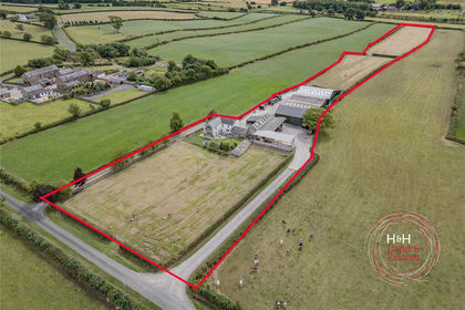
- Price
- Guide Price£975,000
- Size
- 5.96 acres
Beech Villa, Wigton, Cumbria, Woodside, Cumberland CA7 England
Added on 04/09/2026Commercial Land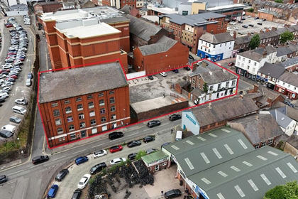
- Price
- Guide Price£1,200,000
- Size
- 0.57 acres
Crown Street, Carlisle, Cumberland, Carlisle, Cumberland CA1 England
Added on 17/07/2026Commercial Land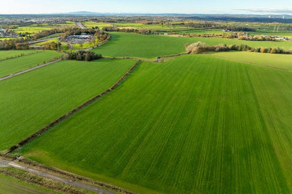
- Price
- Offers Over£1,550,000
- Size
- 136.94 acres
Land at Brunstock, Carlisle, CA6, Stanwix Rural, Cumberland CA6 England
Added on 29/01/2026Farmland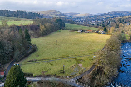
- Price
- Offers Over£1,175,000
- Size
- 12.19 acres
Added on 05/02/2026Development Land
- Price
- Offers Over£1,200,000
- Size
- 17.79 acres
Added on 29/01/2026Development Land
- Price
- £1,300,000
- Size
- 144.89 acres
Added on 15/10/2026Agricultural Land
- Price
- £1,500,000
- Size
- 315.03 acres
Old Broadgate Farm, Millom, Cumbria, Millom Without, Cumberland LA18 England
Added on 21/09/2026Farmland
- Price
- From£900,000
South Clarewood Barns, Corbridge, Northumberland, NE45, Whittington, Northumberland NE45 England
Added on 11/03/2026Development Land
- Price
- Offers Over£1,750,000
- Size
- 276.76 acres
Added on 13/08/2026Timberland
- Price
- Guide Price£1,050,000
- Size
- 3.88 acres
Mill House, Spout Lane, Wennington, LA2, Wennington, Lancashire LA2 England
Added on 29/01/2026Development Land