Brook Lane, Parkgate, Neston, Cheshire, CH64
- Land size
- 1.15 acres
- Bedrooms
- 5
- Bathrooms
- 2
Description
A wonderful 1930's house providing spacious family accommodation, occupying an extremely private and peaceful position on the edge of Parkgate.
GROUND FLOOR
- Reception Hall; Drawing Room; Dining Room; Open plan Kitchen with Sitting and Dining Areas; Store/Study; Utility; Cloakroom.
FIRST FLOOR
- 5 Principal Bedrooms; 2 Bathrooms (1 En-Suite); Interconnecting 6th Bedroom above garage.
OUTSIDE
- Integral Double Garage; Timber Garden Shed; Landscaped Gardens with Lawns; Terraces; Vegetable Garden; Wildflower Area; Parking. In all about 1.15 acres
DESCRIPTION
The White House dates from 1937, and is a substantial and superbly proportioned property. Constructed of brick with white painted rendered elevations beneath a tiled roof, The White House is a charming family home which has been carefully maintained and upgraded during the present owners’ tenure since 2007. In recent years the house has been double glazed, and a new boiler installed in 2020, and it provides spacious and well appointed accommodation extending to over 3600 square feet including a large garage which was built in around 2009.
There is great character throughout, with elegant reception rooms with high plaster moulded ceilings, hardwood floors, period fireplaces in the dining and drawing rooms, and lovely large windows which bring in great natural light and open aspects into the gardens. The kitchen is open plan to seating and dining areas which make for a fantastic everyday living space, with woodburner and under floor heating, along with a garden room extension which has direct access into the gardens. The kitchen provides extensive storage with integrated appliances and a four oven AGA, part of which is electric. There is a useful utility and cloakroom, and the garage is integral to the main living space which is a large double and provides excellent storage.
A lovely turned staircase rises from the hall to an impressive landing at first floor level. There are three large double bedrooms, two with deep bay windows, two smaller doubles, one of which is used as a study, and an additional interconnecting room above the garage which has been used as a sixth bedroom. All bedrooms have either fitted wardobes or space for extra furniture, and enjoy aspects across the gardens and in some cases glimpses to the Dee Estuary and Welsh Hills. There are two bath/shower rooms, and three store rooms which are extremely useful but do also offer scope for the creation of an third bathroom if so required. In summary, The White House is a wonderful family home occupying a prime location on the edge of one of South Wirral’s most sought after residential addresses.
LOCATION
The White House occupies an extremely private position on the edge of Parkgate, set amongst mature gardens and grounds which extend to approximately 1.15 acres. It enjoys a tucked away and extremely peaceful location off Brook Lane, away from the thriving Parade on Parkgate front, yet is within walking distance of the village’s extensive amenities, which include a choice of gastro pubs and restaurants, ice cream shops, The Neston Club and Parkgate Primary School. Indeed, it is rare for a property to enjoy such a secluded position yet one which is so convenient.
The towns of Heswall and Neston are both nearby which offer a more comprehensive range of services for everyday needs including supermarkets, local shops, pubs, restaurants, doctors and dentist’s surgeries as well as a number of high street banks. On the recreational front there is a variety of sports clubs and leisure facilities nearby, notably The Neston Club which offers hockey, squash and tennis, and has a busy social calendar. There is golf at Heswall, Caldy and Hoylake, and there is sailing on the marine lake at West Kirby and at Dee Estuary. Schooling is well catered for with both private and state schools nearby including Parkgate Primary, Neston High, Calday and West Kirby Grammar, Wirral Grammar for Boys & Girls, Upton, Birkenhead School, and the Kings and Queens in Chester.
COMMUNICATIONS
The White House benefits from excellent road communications being a short distance from the A540 Parkgate Road providing fast access to both ends of Wirral and into Cheshire and to Chester. Liverpool is also within easy commuting distance via the M53, as is Manchester via the M56. For travel further afield there is a sub 2 hour rail service from Chester to London Euston via Crewe, with local rail connections at Neston, Spital and Hooton. For international travel both Liverpool and Manchester are served by international airports.
OUTSIDE
The property is approached through a brick splayed gated entrance with granite setts, and over a tarmacadamed drive which is flanked by dense floral borders to a parking area for several vehicles beside the house. A gate and pergola with climbing roses leads to the main gardens to the south west of the house, which have been beautifully landscaped over the years. There are steps from the house to flagged patios and on to a lovely wide lawn directly in front of the house, with floral and herbaceous borders and which extends to a group of Corsican pines. To one side is a high beech hedge beyond which is a vegetable garden, and towards the far end of the garden is a charming wild flower area which extends to the southerly boundary. Alongside Brook Lane are several mature trees, notably an impressive copper beech, which all help provide a high degree of privacy, and further lawns which extend back up towards the drive. On the far side of the house is a useful utility/store area and a timber garden shed, with further secluded patio ideal for BBQ and with access into the kitchen.
PROPERTY INFORMATION
Address: The White House, Brook Lane, Parkgate, Neston, Cheshire, CH64 6TP.
Services: Mains water, electricity and drainage. Oil central heating. Fibre to the property.
NB: Brook Lane is a private lane owned by Brook Lane (Wirral) Limited. There are 5 Directors and Shareholders in the Company who are the owners of the adjoining properties in the lane. They are responsible for the expense of maintenance, repair and management of the lane in equal shares. The Seller will resign as a Director of Brook Lane (Wirral) Limited, and the Buyer will apply to become a Director .The Seller will transfer his shareholding in the Company to the Buyer for £1.
Local Authority: Cheshire West & Chester Council - T: .
Council Tax: Band G.
Viewing: Only by appointment with Jackson-Stops Chester office.
Map Location
Property details
- Tenure
- Freehold
- Council Tax Band
- TBC
- Date Posted
- 2026-07-15
Market Value Analysis
Compared with 780 Homes with Land listings in North West England (1+ acres).
Utilities & Restrictions
Utilities
- Electricity
- Ask Agent
- Water
- Ask Agent
- Heating
- Ask Agent
- Broadband
- Ask Agent
- Sewerage
- Ask Agent
Rights & Restrictions
- Public Rights of Way
- Ask Agent
- Private Rights of Way
- Ask Agent
- Listed Property
- Ask Agent
- Restrictions
- Ask Agent
Listed status, conservation areas and planning constraints for this location are in the full report.
Property Features
- Accessibility
- Ask Agent
- Parking
- Parking Available
- Garden
- Garden
Beyond the particulars: planning activity, flood history, heritage and ground risks, checked for this exact spot.
Connectivity
Broadband
Fastest speed available at this postcode
1.8 Gbps
Gigabit full fibre · available to 40% of premises
Suitable for
- 4K streaming on every screen
- Full-time home working
- Online gaming & big downloads
Mobile signal
Predicted 4G and 5G signal; indoor signal depends on building materials.
Ofcom Connected Nations postcode-level predictions. Speeds and signal are modelled, not measured, and vary between addresses and providers.
Signal is the easy part. Planning activity, flood history and protected designations here are in the full report.
Nearest Schools
Primary
- Parkgate Primary School530 metresNo Ofsted rating
- Ages
- 4 to 11
- Pupils
- 184
- Type
- Community school
- Neston Primary School1.1 milesOfsted report card · Dec 2025
- Ages
- 3 to 11
- Pupils
- 146
- Type
- Community school
- St Winefride's Catholic Primary School1.3 milesNo Ofsted rating
- Ages
- 4 to 11
- Pupils
- 153
- Type
- Voluntary aided school
- Faith
- Roman Catholic
- Gayton Primary School1.5 milesOfsted report card · Jan 2026
- Ages
- 2 to 11
- Pupils
- 213
- Type
- Academy converter
- Barnston Primary School1.5 milesOfsted report card · Mar 2026
- Ages
- 4 to 11
- Pupils
- 299
- Type
- Community school
Secondary
- Neston High School0.8 milesNo Ofsted rating
- Ages
- 11 to 18
- Pupils
- 1,712
- Type
- Academy converter
- Pensby High School3.3 milesNo Ofsted rating
- Ages
- 11 to 18
- Pupils
- 915
- Type
- Foundation school
- South Wirral High School4 milesOfsted: Good
- Ages
- 11 to 18
- Pupils
- 1,019
- Type
- Academy converter
- Wirral Grammar School for Girls4.1 milesOfsted: Outstanding
- Ages
- 11 to 18
- Pupils
- 1,224
- Type
- Academy converter
- Gender
- Girls
- Wirral Grammar School for Boys4.1 milesOfsted: Good
- Ages
- 11 to 18
- Pupils
- 1,123
- Type
- Academy converter
- Gender
- Boys
Distances are straight-line from the advertised location. Source: the national school registers (DfE, Welsh Government, Scottish Government) and Ofsted.
Schools are just the start: sold prices nearby, planning activity and any flood history are in the full report.
Amenities
Supermarket
GP surgery
Pharmacy
Hospital
Green space
Straight-line distances from the advertised location. Sources: NHS records, Geolytix supermarket locations, OS Open Greenspace and the national trails registers.
The area stacks up? Now check the location itself: planning nearby, protected designations and past flooding.
Getting Around
Nearest station
Nearest bus stop
Typical drive times
Straight-line distances from the advertised location; drive times are typical free-flow times over OpenStreetMap road data, so allow more at peak. Public transport locations from DfT NaPTAN.
Easy to reach matters. So do planning activity, flood history and ground risks: all in the full report.
Flood Risk
Environment Agency open data, checked around the advertised map pin for the listed acreage. Long-term risk counts flood defences; the planning map's flood zones do not. Provided by LandSale, not the listing agent, and not part of the agent's particulars. Risk varies across a holding, so verify before committing.
Rivers and the sea
Planning map: Flood Zone 1.
Surface water
Not at the pin: mapped about 30 metres away.
These bandings are the summary. Where this location sits on the flood maps, plus planning activity, heritage and ground risks, is in the full report.
Important notice: Information, maps and tags on this page are drawn from the advertising agent's marketing materials or generated automatically. LandSale has not verified them. Relying on these details is at your own risk, always carry out independent checks before committing to a purchase.
LandSale full disclaimer
Marketing information only - not formal particulars. The details on this website are provided for general guidance and do not constitute an offer or contract. Neither LandSale nor the advertising estate/land agent accepts responsibility for any inaccuracy.
1. Source of information
- Listing content: Core description, asking price, tenure, measurements, photographs and planning history originate from the marketing materials of the advertising estate or land agent. LandSale does not author this content and cannot guarantee its accuracy.
- Automated tags & categorisation: Property type, land-use class, acreage bands and similar labels may be applied by machine-learning models. They are intended as a helpful guide only and may not reflect the property's legal status or permitted use.
- Third-party & enriched data layers: Maps, boundary outlines, planning designations, soil reports, broadband coverage and other environmental or location-based insights are licensed from external suppliers. Such data are supplied “as is", may be incomplete or out of date and are subject to change without notice.
2. Verification required
Prospective purchasers must verify critical matters, including but not limited to planning permission, title boundaries, public rights of way, environmental constraints, acreage, services, access and VAT status, through their own inspections, specialist surveys, legal advisers and the selling agent before relying on the information or entering into any contract.
3. No warranty or liability
LandSale gives no warranty, express or implied, as to the accuracy, completeness or fitness for any particular purpose of the information displayed. LandSale shall not be liable for any loss, damage, cost or expense arising directly or indirectly from any use of or reliance on such information, save where liability may not be excluded by law.
4. Updates & feedback
If you believe any detail on this listing is inaccurate, please let us know. We will investigate and, where appropriate, update the listing or notify the agent.
© LandSale | Version 1.3 - August 2026

Listing agent
Jackson-Stops, Chester
25 Nicholas Street, Chester, CH1 2NZ
Similar properties for sale
- Price
- Offers in Region of£1,250,000
- Size
- 1 acres
Chester High Road, Neston, Cheshire, CH64, Neston, Cheshire West and Chester CH64 England
Added on 08/09/2026House with Land
- Price
- £1,250,000
- Size
- 8 acres
Quarry Road, Neston, Cheshire, Neston, Cheshire West and Chester CH64 England
Added on 09/09/2026House with Land
- Price
- £1,400,000
- Size
- 1 acres
Hanns Hall Road, Neston, CH64, Neston, Cheshire West and Chester CH64 England
Added on 10/09/2026House with Land
- Price
- £1,350,000
- Size
- 1 acres
Quarry Road East, Heswall, Wirral, CH61, Wirral West, Wirral CH61 England
Added on 15/09/2026House with Land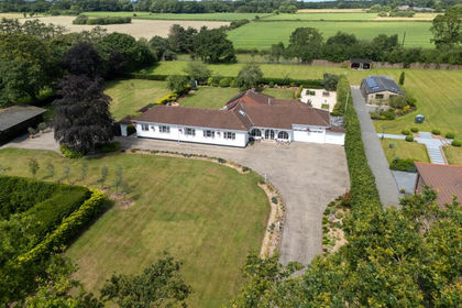
- Price
- £1,150,000
- Size
- 1.4 acres
Dunstan Lane, Burton, Neston, Chester North and Neston, Cheshire West and Chester CH64 England
Added on 25/06/2026House with Land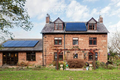
- Price
- £1,250,000
- Size
- 1 acres
Dunstan Lane, Burton, CH64, Chester North and Neston, Cheshire West and Chester CH64 England
Added on 29/01/2026Farmhouse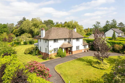
- Price
- Offers in Region of£950,000
- Size
- 1 acres
Mudhouse Lane, Burton, Neston, Chester North and Neston, Cheshire West and Chester CH64 England
Added on 04/06/2026House with Land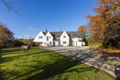
- Price
- £1,350,000
- Size
- 1.3 acres
Puddington Lane, Neston, CH64 5, Puddington, Cheshire West and Chester CH64 England
Added on 14/05/2026House with Land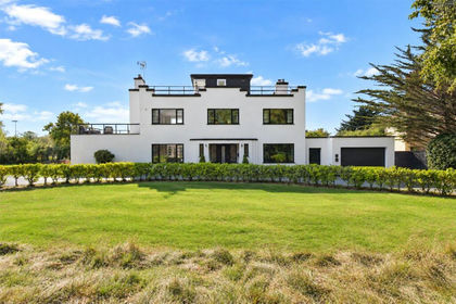
- Price
- £1,100,000
- Size
- 1.07 acres
Telegraph Road, West Kirby, Wirral, Wirral West, Wirral CH48 England
Added on 01/07/2026House with Land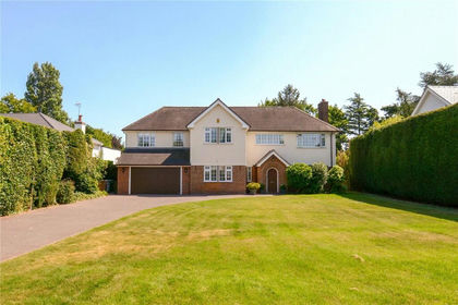
- Price
- £1,375,000
- Size
- 1 acres
Croft Drive East, Caldy, Wirral, Wirral West, Wirral CH48 England
Added on 07/02/2026Residential