Worlington, Suffolk
- Land size
- 2.8 acres
- Bedrooms
- 5
- Bathrooms
- 2
Description
3 ACRES - A beautifully situated former village rectory (not Listed) standing in mature partly-wooded grounds in the heart of the village, close to the cricket pitch. The elegant accommodation remains unspoilt and retains most of the original character features
The Old Rectory (1820) is a rare and original unlisted village rectory standing in mature wooded grounds of almost 2.8 acres STS. It retains much of its original charm, character and most of the original features, from open fireplaces with marble surrounds, floor to ceiling shuttered sash windows, larder, Butler’s pantry and an excellent fitted wine cellar. The two-storey accommodation is beautifully proportioned with high ceilings original panelled doors architraves and skirtings, whilst having a superb painted shaker-style kitchen with oil-fired AGA and a modern biomass central heating system. Truly a rare opportunity not to be missed.
RECEPTION HALL/STAIR HALL with sweeping staircase, understairs storage cupboard and connecting door to former gardeners WC, with door to outside. Separate CLOAKROOM - with low-level WC and corner vanity unit with inset wash hand basin.
DRAWING ROOM – an elegant double-aspect room with moulded cornicing two wall light points and elegant full-height sash windows, built-in book shelves, and open fireplace with cast-iron fire grate and Carrara marble fire surround and mantelpiece
DINING ROOM – an elegant double-aspect room, with moulded cornicing and dado rail, floor to ceiling sash windows, cast-iron fire grate with marble surround and mantelpiece over with slate hearth, and an arched recess.
SITTING ROOM – with floor to ceiling shuttered sash windows, moulded cornicing and picture rail, and open fireplace with cast-iron fire grate Carrara marble fire surround and mantelpiece.
KITCHEN/BREAKFAST ROOM – fitted with a painted shaker-style kitchen by Knights of Clare comprising an extensive range of wall and base units with ‘Stone’ worksurfaces inset with double bowl stone glazed Butlers sink, fitted Bosch oven with hob and extractor over, space for American fridge freezer and dishwasher, open fireplace with matching surround and mantel over fitted with AGA. walk-in shelved pantry, doors to maid’s staircases and cellar, original game hooks and service bells.
BOOT ROOM – with fire surround and mantelpiece, space and plumbing for washing machine and dryer, door to outside, and walk-in Butler’s pantry with shelving and brick floor.
CELLAR – with original brick floor, two wine stores and original stone shelving.
FIRST FLOOR
GALLERIED LANDING with lantern light and storage cupboard,
PRINCIPAL BEDROOM – superb, well-proportioned double-aspect room with views over the gardens, moulded cornicing, EN SUITE - a double-aspect room with panelled bath, separate shower unit and screen over, built-in vanity unit with wash basin and storage below, WC and heated towel rail.
BEDROOM TWO – double-aspect room with shuttered sash window, cast-iron fire grate with moulded surround and mantelpiece, cornicing, and connecting door to
BEDROOM THREE – with shuttered sash window and cornicing.
BEDROOM FOUR – with original cast-iron fire grate, moulded surround and mantelpiece, picture rail and exposed floorboards.
MAID’S STAIRCASE and secondary landing with walk-in shelved linen cupboard.
FAMILY BATHROOM – a generous space with large shower, free-standing roll-top slipper bath with mixer tap, WC, built-in vanity unit with wash basin and storage below.
BEDROOM FIVE – the maid’s room.
OUTSIDE
The property is approached over a sweeping tree lined driveway, to a gravel parking and turning areas, with a lawn and vegetable garden to the front screened by mature trees. Whilst at the rear are two former stables and a large double garage and workshop area also housing the biomass boiler, hot water storage tank and fuel hopper. Whilst the gardens surround the property the majority lie to the rear with a summer dining area enclosed with iron fencing and mature beech hedges. Of particular note are the partially wooded grounds with specimen trees, including oak, ash, maple, magnolia, copper beech, lilac, coppiced hazel, walnut, birch, yew, horse chestnut, plus a variety of fruit trees. Within the gardens is an ideal space for a tennis court, beyond the garden is the ‘Pan Handle’ a strip of woodland to the north of the Rectory .
GENERAL INFORMATION
• Mains water, and electricity. Septic tank drainage, Oil-fired AGA
• Biomass boiler
• Council Tax – West Suffolk – Band G - £3,721 pa
• Ofcom states Superfast broadband is available
• Ofcom states mobile signal is available
• EPC - E
Map Location
Property details
- Tenure
- Ask Agent
- Council Tax Band
- G
- Date Posted
- 2026-07-10
Market Value Analysis
Compared with 1,168 Homes with Land listings in East Anglia (1+ acres).
Energy Performance Certificate
Energy Efficiency Rating
Based on UK Energy Performance Certificate standards (EU Directive 2002/91/EC)
Running costs are one side. Planning activity, flood history and ground risks for this location are in the full report.
Utilities & Restrictions
Utilities
- Electricity
- Ask Agent
- Water
- Ask Agent
- Heating
- Ask Agent
- Broadband
- Ask Agent
- Sewerage
- Ask Agent
Rights & Restrictions
- Public Rights of Way
- Ask Agent
- Private Rights of Way
- Ask Agent
- Listed Property
- Ask Agent
- Restrictions
- Ask Agent
Listed status, conservation areas and planning constraints for this location are in the full report.
Property Features
- Accessibility
- Ask Agent
- Parking
- Parking Available
- Garden
- Garden
Beyond the particulars: planning activity, flood history, heritage and ground risks, checked for this exact spot.
Connectivity
Broadband
No premises records for this postcode, which is common for bare land and rural plots. A new connection would be quoted by the provider.
Mobile signal
No address-level signal records for this postcode, which is common for bare land.
Ofcom Connected Nations postcode-level predictions. Speeds and signal are modelled, not measured, and vary between addresses and providers.
Signal is the easy part. Planning activity, flood history and protected designations here are in the full report.
Nearest Schools
Primary
- St Mary's Church of England Academy1.6 milesOfsted: Requires improvement
- Ages
- 4 to 11
- Pupils
- 414
- Type
- Academy converter
- Faith
- Church of England
- Great Heath Academy1.8 milesOfsted: Good
- Ages
- 3 to 11
- Pupils
- 438
- Type
- Academy sponsor led
- The Pines Primary School1.9 milesOfsted: Good
- Ages
- 3 to 11
- Pupils
- 240
- Type
- Free schools
- West Row Academy1.9 milesOfsted report card · May 2026
- Ages
- 4 to 11
- Pupils
- 208
- Type
- Academy sponsor led
- St Christopher's CEVCP School2.2 milesOfsted: Good
- Ages
- 3 to 11
- Pupils
- 389
- Type
- Academy sponsor led
- Faith
- Church of England
Secondary
- Mildenhall College Academy1.9 milesNo Ofsted rating
- Ages
- 11 to 18
- Pupils
- 1,317
- Type
- Academy converter
- Soham Village College6.1 milesOfsted: Outstanding
- Ages
- 11 to 16
- Pupils
- 1,436
- Type
- Academy converter
- Newmarket Academy6.9 milesOfsted: Good
- Ages
- 11 to 16
- Pupils
- 797
- Type
- Academy sponsor led
- Breckland School8.9 milesNo Ofsted rating
- Ages
- 11 to 16
- Pupils
- 615
- Type
- Free schools
- St Benedict's Catholic School11 milesNo Ofsted rating
- Ages
- 11 to 18
- Pupils
- 968
- Type
- Academy converter
- Faith
- Roman Catholic
Distances are straight-line from the advertised location. Source: the national school registers (DfE, Welsh Government, Scottish Government) and Ofsted.
Schools are just the start: sold prices nearby, planning activity and any flood history are in the full report.
Amenities
Supermarket
GP surgery
Pharmacy
Hospital
Green space
Straight-line distances from the advertised location. Sources: NHS records, Geolytix supermarket locations, OS Open Greenspace and the national trails registers.
The area stacks up? Now check the location itself: planning nearby, protected designations and past flooding.
Getting Around
Nearest station
Nearest bus stop
Typical drive times
Straight-line distances from the advertised location; drive times are typical free-flow times over OpenStreetMap road data, so allow more at peak. Public transport locations from DfT NaPTAN.
Easy to reach matters. So do planning activity, flood history and ground risks: all in the full report.
Flood Risk
From Environment Agency flood map open data, checked around the advertised map pin and allowing for the listed acreage where known. This summary comes from LandSale, the advertising platform, not from the listing agent, and is not part of the agent's particulars. Risk can vary across a single holding, so verify anything critical through your own searches before committing.
Rivers and the sea
Surface water
The detail behind these bandings
The full report pinpoints where this location sits on the flood maps, and runs the deeper checks that usually only surface after an offer.
- Exact flood zones & annual chances (included in the full report)
- Any recorded past flooding (included in the full report)
- Planning activity nearby (included in the full report)
- Heritage & conservation (included in the full report)
- Protected nature designations (included in the full report)
- Ground risks (included in the full report)
- Sold prices nearby (included in the full report)
£14.99 · one-off purchase
By LandSale, the platform. Not provided by the listing agent. Ready in about a minute.
Important notice: Information, maps and tags on this page are drawn from the advertising agent's marketing materials or generated automatically. LandSale has not verified them. Relying on these details is at your own risk, always carry out independent checks before committing to a purchase.
LandSale full disclaimer
Marketing information only - not formal particulars. The details on this website are provided for general guidance and do not constitute an offer or contract. Neither LandSale nor the advertising estate/land agent accepts responsibility for any inaccuracy.
1. Source of information
- Listing content: Core description, asking price, tenure, measurements, photographs and planning history originate from the marketing materials of the advertising estate or land agent. LandSale does not author this content and cannot guarantee its accuracy.
- Automated tags & categorisation: Property type, land-use class, acreage bands and similar labels may be applied by machine-learning models. They are intended as a helpful guide only and may not reflect the property's legal status or permitted use.
- Third-party & enriched data layers: Maps, boundary outlines, planning designations, soil reports, broadband coverage and other environmental or location-based insights are licensed from external suppliers. Such data are supplied “as is", may be incomplete or out of date and are subject to change without notice.
2. Verification required
Prospective purchasers must verify critical matters, including but not limited to planning permission, title boundaries, public rights of way, environmental constraints, acreage, services, access and VAT status, through their own inspections, specialist surveys, legal advisers and the selling agent before relying on the information or entering into any contract.
3. No warranty or liability
LandSale gives no warranty, express or implied, as to the accuracy, completeness or fitness for any particular purpose of the information displayed. LandSale shall not be liable for any loss, damage, cost or expense arising directly or indirectly from any use of or reliance on such information, save where liability may not be excluded by law.
4. Updates & feedback
If you believe any detail on this listing is inaccurate, please let us know. We will investigate and, where appropriate, update the listing or notify the agent.
© LandSale | Version 1.3 - August 2026
Listing agent
Bedfords, Bury St Edmunds
15 Guildhall Street, Bury St. Edmunds, IP33 1QD
View agent profileSimilar properties for sale
- Price
- Guide Price£900,000
- Size
- 1.1 acres
The Street, Sturmer, Haverhill, Essex, CB9, Sturmer, Essex CB9 England
Added on 29/01/2026Country Home
- Price
- Guide Price£1,400,000
- Size
- 5.3 acres
Detached Home set in 5.3 Acres (STMS) in West Harling, Harling, Norfolk NR16 England
Added on 27/06/2026House with Land
- Price
- £875,000
- Size
- 1.5 acres
Added on 01/08/2026House with Land
- Price
- Guide Price£1,200,000
- Size
- 2 acres
Added on 22/06/2026Country Home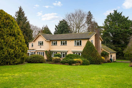
- Price
- Guide Price£1,250,000
- Size
- 3 acres
Frogge Street, Ickleton, Ickleton, Cambridgeshire CB10 England
Added on 27/02/2026Equestrian property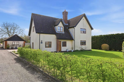
- Price
- £875,000
- Size
- 2.3 acres
Nedging Road, Nedging Tye, IP7, Nedging-with-Naughton, Suffolk IP7 England
Added on 21/05/2026Country Home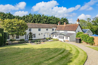
- Price
- Guide Price£1,395,000
- Size
- 1.88 acres
Lamb Lane, Sible Hedingham, Halstead, Essex, CO9, Sible Hedingham, Essex CO9 England
Added on 13/08/2026Country Home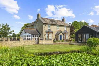
- Price
- £1,350,000
- Size
- 1 acres
Boyton End, Thaxted, Dunmow, Essex, CM6, Thaxted, Essex CM6 England
Added on 27/06/2026Country Home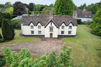
- Price
- Guide Price£900,000
- Size
- 2 acres
Added on 03/07/2026Country Home
- Price
- £1,195,000
- Size
- 5 acres
Palgrave Road, Little Dunham, PE32, Little Dunham, Norfolk PE32 England
Added on 29/01/2026Country Home