Tanglewood, St Margaret's at Cliffe, Kent
- Land size
- 2 acres
- Bedrooms
- 5
- Bathrooms
- 3
Description
Tanglewood is set within two acres of private land on the periphery of St Margaret’s at Cliffe in Kent. This impressive five-bedroom home is firmly anchored in its coastal position by panoramic sea views. It spans 3,488 sq ft, and a considered material palette and versatile blueprint emphasise its contemporary construction. In the warmer months, a cultivated flower garden encircles the house, providing bursts of colour.
The Tour
The house sits in a wonderfully secluded position, embedded in a rich topography of wild meadows and mature woodland. Built in 2017 to Passivhaus standard, this home is exceptionally energy-efficient, with triple-glazed aluminium-framed windows and structural insulation throughout. The frontage is striking and formed in an L-shape, with large bay windows at its centre: darkened Siberian larch cladding is discrete yet decidedly bold, and floor-to-ceiling windows at the rear are angled to draw in brilliant south-facing sunlight.
The approach to the house is via a large gravelled parking area and driveway to a raised porch. The front door opens to a fine entrance hall where there is a neat WC and storage for coats and shoes. Just beyond, a generous living room anchors the ground-floor plan. Expansive glazing on the south-facing elevation floods the room with natural light and is amplified by soft neutral tones, with beautiful views over the sea, to the east, and over the flower garden to the south and west.
On the right of the hall, a door gives way to an open-plan integrated kitchen and dining area. A change in materiality sees soft fabrics transition into arresting amber-hued Douglas fir joinery, grey Silestone quartz worktops and a nautical-coloured glass splashback. Underfoot, timber floorboards extend throughout. Local craftsmanship has been prioritised in this space: the kitchen cabinetry was made nearby from recycled Worcester sauce barrels, and a beautiful stained glass panel by a Deal artist has been fitted above a bespoke breakfast bar. There is a generous larder fitted with timber shelving and ventilation from a small louver window. Glazed doors open from the dining area to a large glazed-walled terrace.
A serene principal bedroom with an en suite bathroom occupies the rest of this floor. Southern, eastern and western windows frame the surrounding landscape and draw light inward, and fitted cupboards provide ample storage. The bathroom is well-appointed with a walk-in shower and freestanding bath.
A curved oak staircase descends to the lower-ground floor with versatile living spaces, four additional bedrooms and two bathrooms. A central bright sunroom has glazed doors that lead to a part-paved, part-pebbled terrace, enclosed by the cascading colours of ferns, ornamental grasses and seasonal flowers.
The four bright double bedrooms each have their own distinct atmosphere. One is currently arranged as a neat study and another as a sitting room, with doors opening onto the lower flower garden and peaceful Flow Form water feature. Throughout, walls have been finished in a warm, natural white. One of the bedrooms has fitted storage, and additional storage is found under the stairs and just off the hallway.
A handy utility room leads outdoors and is well-equipped with a large airing cupboard and drying rack, a sink, an MVHR system and a water softener.
Outdoor Space
The land between Tanglewood and the sea is preserved by the National Trust and leased to local farmers who tend the land, providing uninterrupted views. In the spring and summer, the garden is adorned with wildflower meadows, a vivacious collection of tulips and productive fruit trees, including cherry plum, plum, crab apple and medlar. The woodland is defined largely by mature sycamores, beech and Corsican pine.
Mounds and an array of flowers and herbaceous plants screen the house from coastal winds and provide a beautiful display of colour. A paved seating area sits peacefully next to a Flow Form water feature.
A separate workshop building has been crowned with solar panels and provides electricity to the house and to the grid. An attached greenhouse, raised-bed vegetable garden, and curated south-east facing treehouse lend a creative and restorative atmosphere.
The Area
Despite its private and peaceful position, Tanglewood is a 10-minute walk to the picturesque village of St Margaret’s at Cliffe. The village is defined by its white cliffs, rolling countryside, and bucolic setting for coastal walks. The nearby clifftop paths form part of the iconic White Cliffs coastline, while other favourite destinations include St Margaret's Beach and the surrounding gardens at Pines Garden, Café & Visitor Centre. The house is also brilliantly positioned for access to some of the country's best golfing including, Royal St George's and Walmer and Kingsdown Golf Club, the latter of which sits within walking distance.
The village has a thriving community centred around its independent cafés and pubs, and a thriving sports scene. The Coastguard Pub is renowned for its sea views, and The Smugglers and The Bay Bistro are equally popular. The historic towns of Deal, Dover and Canterbury are within easy reach, with a broader selection of independent shops, restaurants and cultural attractions.
The well-reputed St Margaret's at Cliffe Primary School is close by and the village also has a nursery. East Langdon and Kingsdown have well-regarded primary schools too. For secondary education there are both excellent state and independents including, Dover Boys Grammar, Dover Girls Grammar, St Edmund's Catholic School and Dover College. Northbourne Park School is a popular independent co-ed offering places from nursery to age 14. There are also schooling options in Canterbury including, The King's School.
Martin Mill station is a short drive away, providing regular services to Dover and London St Pancras, and Dover Priory offers further high-speed connections to principal London stations and the wider South East. The A2 also provides convenient road links to Canterbury, the M2 and London.
Map Location
Property details
- Tenure
- Freehold
- Council Tax Band
- G
- Date Posted
- 2026-07-09
Market Value Analysis
Compared with 1,739 Homes with Land listings in South East England (1+ acres).
Energy Performance Certificate
Energy Efficiency Rating
Based on UK Energy Performance Certificate standards (EU Directive 2002/91/EC)
Running costs are one side. Planning activity, flood history and ground risks for this location are in the full report.
Utilities & Restrictions
Utilities
- Electricity
- Mains
- Water
- Mains
- Heating
- Gas Central Heating
- Broadband
- Standard Copper (ADSL)
- Sewerage
- Mains
Rights & Restrictions
- Public Rights of Way
- Ask Agent
- Private Rights of Way
- Ask Agent
- Listed Property
- Ask Agent
- Restrictions
- Ask Agent
Listed status, conservation areas and planning constraints for this location are in the full report.
Property Features
- Accessibility
- Ask Agent
- Parking
- Driveway
- Garden
- Garden
Beyond the particulars: planning activity, flood history, heritage and ground risks, checked for this exact spot.
Connectivity
Broadband
Fastest speed available at this postcode
26 Mbps
Standard (10-30 Mbps)
Suitable for
- Web & social
- Music streaming
- Standard video calls
Fixed wireless access may also be an option here.
Mobile signal
Predicted 4G and 5G signal; indoor signal depends on building materials.
Ofcom Connected Nations postcode-level predictions. Speeds and signal are modelled, not measured, and vary between addresses and providers.
Signal is the easy part. Planning activity, flood history and protected designations here are in the full report.
Nearest Schools
Primary
- St Margaret's-at-Cliffe Primary School941 metresOfsted: Good *
- Ages
- 4 to 11
- Pupils
- 171
- Type
- Community school
- Kingsdown and Ringwould Church of England Primary School1.9 milesOfsted: Outstanding
- Ages
- 4 to 11
- Pupils
- 211
- Type
- Academy converter
- Faith
- Church of England
- Langdon Primary School1.9 milesNo Ofsted rating
- Ages
- 4 to 11
- Pupils
- 93
- Type
- Community school
- Guston Church of England Primary School3 milesNo Ofsted rating
- Ages
- 4 to 11
- Type
- Academy converter
- Faith
- Church of England
- The Downs Church of England Primary School3.3 milesOfsted: Good
- Ages
- 4 to 11
- Pupils
- 316
- Type
- Academy converter
- Faith
- Church of England
Secondary
- Duke of York's Royal Military School2.7 milesOfsted: Good
- Ages
- 11 to 18
- Pupils
- 470
- Type
- Academy sponsor led
- Dover Christ Church Academy3.5 milesOfsted: Requires improvement
- Ages
- 11 to 18
- Pupils
- 761
- Type
- Academy sponsor led
- St Edmund's Catholic School3.6 milesOfsted: Good
- Ages
- 11 to 18
- Pupils
- 644
- Type
- Academy sponsor led
- Faith
- Roman Catholic
- Dover Grammar School for Girls3.7 milesOfsted: Good *
- Ages
- 11 to 18
- Pupils
- 847
- Type
- Community school
- Gender
- Girls
- Goodwin Academy3.8 milesOfsted: Good *
- Ages
- 11 to 18
- Pupils
- 780
- Type
- Academy sponsor led
* Latest graded judgement covers quality of education only; no overall grade was issued under the 2024-25 inspection framework.
Distances are straight-line from the advertised location. Source: the national school registers (DfE, Welsh Government, Scottish Government) and Ofsted.
Schools are just the start: sold prices nearby, planning activity and any flood history are in the full report.
Amenities
Supermarket
GP surgery
Pharmacy
Hospital
Green space
Straight-line distances from the advertised location. Sources: NHS records, Geolytix supermarket locations, OS Open Greenspace and the national trails registers.
The area stacks up? Now check the location itself: planning nearby, protected designations and past flooding.
Getting Around
Nearest station
Nearest bus stop
Typical drive times
Straight-line distances from the advertised location; drive times are typical free-flow times over OpenStreetMap road data, so allow more at peak. Public transport locations from DfT NaPTAN.
Easy to reach matters. So do planning activity, flood history and ground risks: all in the full report.
Flood Risk
Environment Agency open data, checked around the advertised map pin for the listed acreage. Long-term risk counts flood defences; the planning map's flood zones do not. Provided by LandSale, not the listing agent, and not part of the agent's particulars. Risk varies across a holding, so verify before committing.
Rivers and the sea
Planning map: Flood Zone 1.
Surface water
These bandings are the summary. Where this location sits on the flood maps, plus planning activity, heritage and ground risks, is in the full report.
Important notice: Information, maps and tags on this page are drawn from the advertising agent's marketing materials or generated automatically. LandSale has not verified them. Relying on these details is at your own risk, always carry out independent checks before committing to a purchase.
LandSale full disclaimer
Marketing information only - not formal particulars. The details on this website are provided for general guidance and do not constitute an offer or contract. Neither LandSale nor the advertising estate/land agent accepts responsibility for any inaccuracy.
1. Source of information
- Listing content: Core description, asking price, tenure, measurements, photographs and planning history originate from the marketing materials of the advertising estate or land agent. LandSale does not author this content and cannot guarantee its accuracy.
- Automated tags & categorisation: Property type, land-use class, acreage bands and similar labels may be applied by machine-learning models. They are intended as a helpful guide only and may not reflect the property's legal status or permitted use.
- Third-party & enriched data layers: Maps, boundary outlines, planning designations, soil reports, broadband coverage and other environmental or location-based insights are licensed from external suppliers. Such data are supplied “as is", may be incomplete or out of date and are subject to change without notice.
2. Verification required
Prospective purchasers must verify critical matters, including but not limited to planning permission, title boundaries, public rights of way, environmental constraints, acreage, services, access and VAT status, through their own inspections, specialist surveys, legal advisers and the selling agent before relying on the information or entering into any contract.
3. No warranty or liability
LandSale gives no warranty, express or implied, as to the accuracy, completeness or fitness for any particular purpose of the information displayed. LandSale shall not be liable for any loss, damage, cost or expense arising directly or indirectly from any use of or reliance on such information, save where liability may not be excluded by law.
4. Updates & feedback
If you believe any detail on this listing is inaccurate, please let us know. We will investigate and, where appropriate, update the listing or notify the agent.
© LandSale | Version 1.3 - August 2026
Listing agent
The Modern House, London
St Alphege Hall Kings Bench Street London SE1 0QX
View agent profileSimilar properties for sale
- Price
- Guide Price£1,500,000
- Size
- 6 acres
Kingsdown, Deal CT14, Ringwould with Kingsdown, Kent CT14 England
Added on 10/06/2026House with Land
- Price
- Offers Over£2,250,000
- Size
- 7.04 acres
Singledge Lane, Dover, Kent, CT15, Whitfield, Kent CT15 England
Added on 16/04/2026House with Land
- Price
- Guide Price£1,450,000
- Size
- 62.5 acres
Added on 29/01/2026Farm
- Price
- Guide Price£2,250,000
- Size
- 12.58 acres
House & Gardens - Chalksole Manor, Dover, CT15, Alkham, Kent CT15 England
Added on 29/01/2026Country Home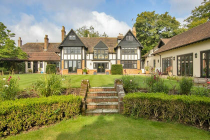
- Price
- Offers in Excess of£2,250,000
- Size
- 12.58 acres
Lot 1 - House & Gardens - Chalksole Manor, Alkham, CT15, Alkham, Kent CT15 England
Added on 28/01/2026House with Land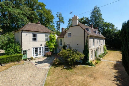
- Price
- Guide Price£1,750,000
- Size
- 12 acres
Added on 23/08/2026House with Land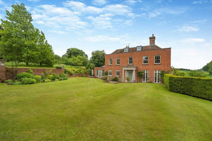
- Price
- Guide Price£1,770,000
- Size
- 1.06 acres
Added on 12/06/2026House with Land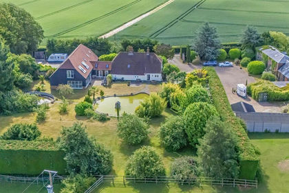
- Price
- Guide Price£1,850,000
- Size
- 12.3 acres
Added on 17/06/2026Equestrian property
- Price
- £1,950,000
- Size
- 4.16 acres
Sondes House, Station Road, Patrixbourne, Bekesbourne-with-Patrixbourne, Kent CT4 England
Added on 30/07/2026House with Land
- Price
- £1,995,000
- Size
- 5 acres
Hayne Barn Estate, Saltwood, CT21, Saltwood, Kent CT21 England
Added on 17/05/2026Country Estate