Lower House Farm, Stockton-on-Teme, Worcestershire
- Land size
- 1.5 acres
- Bedrooms
- 6
- Bathrooms
- 4
Description
Built in the late 17th century, this handsome Grade II-listed farmhouse lies amid open fields in the rural village of Stockton-on-Teme, Worcestershire. The six-bedroom house, spanning nearly 6,000 sq ft across three levels, is embraced by 1.5 acres of beautifully maintained grounds with elevated views over the Teme Valley. With the guidance of a conservation architect, the house was sensitively restored and updated for modern living, with a meticulous approach to detail and finishes.
Setting the Scene
Set within a private and quiet plot surrounded by open farmland, Lower House Farm is approached via a shared driveway leading to the main entrance and private driveway, with a turning circle and triple parking bay. Fronted by a neat lawn, the house’s elegant red-brick façade rises across three storeys and is topped by a pitched slate roof.
Both the internal and external parts of the building were the subject of a comprehensive renovation. In keeping with the period character of the house, a wealth of original features has been retained, including oak and elm floorboards, exposed beams and an Inglenook fireplace. Modern additions such as double-glazed casement windows, underfloor heating and insulated walls ensure energy efficiency and comfort.
The Grand Tour
At the front, a footpath leads to a panelled entrance door that opens onto a bright hallway, with tiled flooring and a large cupboard with space for storing coats and boots.
To the right is a formal dining room, anchored by a striking stone fireplace. From here, the plan naturally unfolds toward a central hall, with access to both the cellar and a separate WC room. Further to the left is a dual-aspect sitting room, bathed with natural light and warmed by a log burner.
Across the hall and at the heart of this home is an expansive open-plan kitchen, dining and living room, equally suited for day-to-day living and formal entertaining. Set beneath high ceilings, there are windows along three elevations, allowing natural light to pour in while framing views of the surrounding countryside. The sitting area is delineated by large stone slabs and oriented toward a walk-in Inglenook fireplace with a wood burner.
Arranged toward the back of the plan is a bespoke kitchen with bright red and Australian walnut elements. Integrated appliances include an Esse range cooker and an AEG electric oven and microwave. There is space to accommodate a large dining table. Two insulated original doors, one of which is used as the main entrance by the owners, lead to the rear and side patios.
A wide, solid oak staircase ascends to the first floor, with stunning views across the valley from each of its generously proportioned double bedrooms, all carefully finished and grounded by polished hardwood and timber floors. The principal bedroom is quietly removed to the right side and has two walk-in wardrobes.
There are two well-appointed bathrooms on this floor, one of which has a free-standing bathtub. Both have walk-in showers. Two additional bedrooms and a bathroom with a bathtub are positioned on the second floor.
There are also two brick-lined cellars with external and internal access.
The Great Outdoors
The house lies within a 1.5-acre private plot backed by open farmland on three sides. Impeccably maintained gardens fan out around the perimeter of the house, mainly laid to lawn and bordered by mature trees.
At the back, an expansive paved area is organised with a series of terraces for dining and relaxing outside, offering a quiet and private retreat. Wisteria traces its way along the brick elevation, offering colour and scent throughout the seasons.
The grounds are also home to a detached triple-bay garage with a self-contained office/artist studio, a summer house and a lean-to single garage.
Out and About
Lower House Farm lies along a tranquil yet well-connected country lane in Stockton-on-Teme, West Worcestershire. Plenty of well-served and charming villages are within easy reach by car. Mill Farm Country Retail in Stanford Bridge is home to a farm shop, café, hair salon, lifestyle shop and dance studio. The Bridge pub, a local favourite, is a short walk away. Great Witley and Abberley are also near, offering further opportunities for shopping and dining out. A short distance from the house, the historic Shelsey Walsh Hill Climb is a picturesque way to while away a weekend.
One of the most sought-after villages in Worcestershire, Ombersley is a 10-minute drive away and was named by the Telegraph as one of the most desirable places to live in the UK. It has a renowned butcher's, a deli, a primary school, a surgery and a post office. The picture-pretty market town of Ludlow is also within easy reach, offering numerous restaurants, shops and weekly markets.
The cathedral city of Worcester is less than a 30-minute drive away. Set along the banks of the Severn River, it has a lively high street lined with boutiques and cafés. It is home to one of England’s most impressive cathedrals, as well as cricket grounds, a rugby club, a racecourse and a university.
There are brilliant schools nearby, both state and private. The house is close to Martley High School, while a little further afield are the well-regarded The King’s School Worcester and The Royal Grammar School.
The stations of Worcester (a 30-minute drive away) and Birmingham (around an hour away by car) offer direct railway connections to the capital, with a two-hour and a 90-minute journey respectively. Birmingham airport can be reached in around an hour by car.
Council Tax Band: G
Map Location
Property details
- Tenure
- Freehold
- Council Tax Band
- G
- Date Posted
- 2026-07-09
Market Value Analysis
Compared with 1,031 Homes with Land listings in West Midlands (1+ acres).
Energy Performance Certificate
Energy Efficiency Rating
Based on UK Energy Performance Certificate standards (EU Directive 2002/91/EC)
Running costs are one side. Planning activity, flood history and ground risks for this location are in the full report.
Utilities & Restrictions
Utilities
- Electricity
- Mains
- Water
- Mains
- Heating
- Oil Heating
- Broadband
- Full Fibre (FTTP)
- Sewerage
- Septic Tank / Private
Rights & Restrictions
- Public Rights of Way
- Ask Agent
- Private Rights of Way
- Ask Agent
- Listed Property
- Yes
- Restrictions
- Ask Agent
Listed status, conservation areas and planning constraints for this location are in the full report.
Property Features
- Accessibility
- Ask Agent
- Parking
- On-Street Parking
- Garden
- Garden
Beyond the particulars: planning activity, flood history, heritage and ground risks, checked for this exact spot.
Connectivity
Broadband
Fastest speed available at this postcode
1.8 Gbps
Gigabit full fibre
Suitable for
- 4K streaming on every screen
- Full-time home working
- Online gaming & big downloads
Fixed wireless access may also be an option here.
Mobile signal
Predicted 4G and 5G signal; indoor signal depends on building materials.
Ofcom Connected Nations postcode-level predictions. Speeds and signal are modelled, not measured, and vary between addresses and providers.
Signal is the easy part. Planning activity, flood history and protected designations here are in the full report.
Nearest Schools
Primary
- Abberley Parochial VC Primary School2 milesOfsted: Good *
- Ages
- 4 to 11
- Pupils
- 102
- Type
- Voluntary controlled school
- Faith
- Church of England
- Great Witley CofE Primary School2.7 milesNo Ofsted rating
- Ages
- 5 to 11
- Pupils
- 187
- Type
- Academy converter
- Faith
- Church of England
- Lindridge St Lawrence CE Primary School2.8 milesOfsted: Good
- Ages
- 2 to 11
- Pupils
- 70
- Type
- Voluntary aided school
- Faith
- Church of England
- Clifton upon Teme Primary School3.3 milesNo Ofsted rating
- Ages
- 4 to 11
- Pupils
- 72
- Type
- Community school
- Bayton CofE Primary School4.2 milesOfsted: Good *
- Ages
- 3 to 11
- Pupils
- 95
- Type
- Voluntary controlled school
- Faith
- Church of England
Secondary
- The Chantry School4.9 milesOfsted: Good
- Ages
- 11 to 16
- Pupils
- 881
- Type
- Academy converter
- The Lacon Childe School6.3 milesOfsted: Requires improvement
- Ages
- 11 to 16
- Pupils
- 563
- Type
- Academy converter
- The Bewdley School6.9 milesOfsted: Good *
- Ages
- 11 to 18
- Pupils
- 970
- Type
- Foundation school
- The Stourport High School and Sixth Form College7 milesOfsted: Good
- Ages
- 11 to 18
- Pupils
- 1,039
- Type
- Academy converter
- Tenbury High Ormiston Academy7.6 milesOfsted: Good
- Ages
- 11 to 16
- Pupils
- 453
- Type
- Academy sponsor led
* Latest graded judgement covers quality of education only; no overall grade was issued under the 2024-25 inspection framework.
Distances are straight-line from the advertised location. Source: the national school registers (DfE, Welsh Government, Scottish Government) and Ofsted.
Schools are just the start: sold prices nearby, planning activity and any flood history are in the full report.
Amenities
Supermarket
GP surgery
Pharmacy
Hospital
Straight-line distances from the advertised location. Sources: NHS records, Geolytix supermarket locations, OS Open Greenspace and the national trails registers.
The area stacks up? Now check the location itself: planning nearby, protected designations and past flooding.
Getting Around
Nearest station
Nearest bus stop
Typical drive times
Straight-line distances from the advertised location; drive times are typical free-flow times over OpenStreetMap road data, so allow more at peak. Public transport locations from DfT NaPTAN.
Easy to reach matters. So do planning activity, flood history and ground risks: all in the full report.
Flood Risk
Environment Agency open data, checked around the advertised map pin for the listed acreage. Long-term risk counts flood defences; the planning map's flood zones do not. Provided by LandSale, not the listing agent, and not part of the agent's particulars. Risk varies across a holding, so verify before committing.
Rivers and the sea
Planning map: Flood Zone 1.
Surface water
Not at the pin: mapped about 20 metres away.
These bandings are the summary. Where this location sits on the flood maps, plus planning activity, heritage and ground risks, is in the full report.
Important notice: Information, maps and tags on this page are drawn from the advertising agent's marketing materials or generated automatically. LandSale has not verified them. Relying on these details is at your own risk, always carry out independent checks before committing to a purchase.
LandSale full disclaimer
Marketing information only - not formal particulars. The details on this website are provided for general guidance and do not constitute an offer or contract. Neither LandSale nor the advertising estate/land agent accepts responsibility for any inaccuracy.
1. Source of information
- Listing content: Core description, asking price, tenure, measurements, photographs and planning history originate from the marketing materials of the advertising estate or land agent. LandSale does not author this content and cannot guarantee its accuracy.
- Automated tags & categorisation: Property type, land-use class, acreage bands and similar labels may be applied by machine-learning models. They are intended as a helpful guide only and may not reflect the property's legal status or permitted use.
- Third-party & enriched data layers: Maps, boundary outlines, planning designations, soil reports, broadband coverage and other environmental or location-based insights are licensed from external suppliers. Such data are supplied “as is", may be incomplete or out of date and are subject to change without notice.
2. Verification required
Prospective purchasers must verify critical matters, including but not limited to planning permission, title boundaries, public rights of way, environmental constraints, acreage, services, access and VAT status, through their own inspections, specialist surveys, legal advisers and the selling agent before relying on the information or entering into any contract.
3. No warranty or liability
LandSale gives no warranty, express or implied, as to the accuracy, completeness or fitness for any particular purpose of the information displayed. LandSale shall not be liable for any loss, damage, cost or expense arising directly or indirectly from any use of or reliance on such information, save where liability may not be excluded by law.
4. Updates & feedback
If you believe any detail on this listing is inaccurate, please let us know. We will investigate and, where appropriate, update the listing or notify the agent.
© LandSale | Version 1.3 - August 2026
Listing agent
Inigo, London
St Alphege Hall Kings Bench Street, London, SE1 0QX
Similar properties for sale
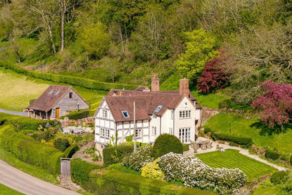
- Price
- Guide Price£1,250,000
- Size
- 18 acres
Nr Shelsley Beauchamp, Teme Valley, Worcestershire, Shelsley Beauchamp, Worcestershire WR6 England
Added on 07/07/2026Farmhouse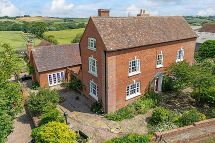
- Price
- Guide Price£1,250,000
- Size
- 2 acres
Added on 24/04/2026Farmhouse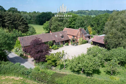
- Price
- Guide Price£1,375,000
- Size
- 3.3 acres
Abberley, Worcester, WR6, Abberley, Worcestershire WR6 England
Added on 30/04/2026Farmhouse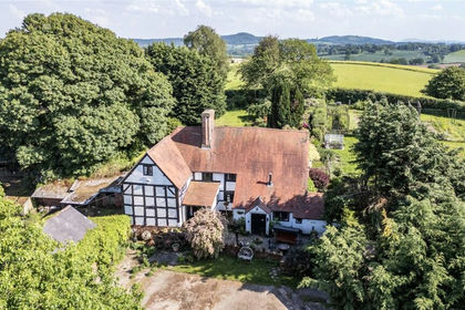
- Price
- £995,000
- Size
- 5 acres
Rock Cross, Rock, Kidderminster, Worcestershire, Rock, Worcestershire DY14 England
Added on 21/07/2026Country Home
- Price
- Guide Price£950,000
- Size
- 1.7 acres
Added on 20/07/2026House with Land
- Price
- Offers in Region of£1,100,000
- Size
- 9.5 acres
Added on 21/09/2026House with Land
- Price
- Guide Price£1,150,000
- Size
- 1.5 acres
Rock, Kidderminster, DY14, Rock, Worcestershire DY14 England
Added on 17/08/2026Farmhouse
- Price
- £950,000
- Size
- 1.5 acres
Added on 02/10/2026Cottage
- Price
- Guide Price£1,100,000
- Size
- 9.17 acres
Holly Cottage, Rock, Kidderminster, Rock, Worcestershire DY14 England
Added on 11/08/2026House with Land
- Price
- Guide Price£1,000,000
- Size
- 3.6 acres
Well Lane, Little Witley, WR6, Little Witley, Worcestershire WR6 England
Added on 29/01/2026Farmhouse