Copse House, Dorking, Surrey
- Land size
- 1.4 acres
- Bedrooms
- 5
- Bathrooms
- 3
Description
Set in around 1.4 acres of beautifully landscaped gardens and woodland, this striking modern house lies in a quiet rural setting in the Surrey Hills. It was designed by award-winning architect Mark Hillier and has over 3,560 sq ft of space, carefully apportioned across two light-filled storeys. Copse House occupies a private and secluded plot between Guildford and Dorking, with central London reachable in around 30 minutes from Guildford train station, just 9.5 miles west.
The Architect
Scottish-born, award-winning architect and landscape designer Mark Hillier has worked across the globe on both residential and commercial projects. He has been design lead at several renowened firms, founded London-based practice h2architecture, and works as a tutor at several UK universities. His context-driven approach can be seen in practice at Copse House, which, despite its modern feel, embeds itself into the age-old surrounding landscape.
The Tour
At the end of a private road, the house lies at the foot of a long, gated driveway. Its architectural profile is characterised by Welsh stonework, concrete, and timber cladding, making for a striking first impression. Strategically orientated within the topography of the site, the position enables both excellent privacy and wonderful views from the terraces and balconies at every level.
Internally, the impressive scale and volume unfold immediately. A series of dynamic, free-flowing living spaces, defined by soaring ceiling heights and clean lines of sight, are organised around a central glazed atrium with a resin floor. A highly efficient Poggenpohl kitchen adjoins the dining space, which, in warmer months, opens onto the terrace, providing a seamless fluidity between cooking and eating. Three bedrooms and their bathrooms are also positioned on this level.
A helical concrete staircase connects the ground and first floor levels, where walkways and recesses are paired with expansive walls of glass, merging interior and exterior spaces and inviting the outside into every room. The upper-level houses a beautifully bright secondary living area, opening onto a terrace with far-reaching views across the gardens. A glazed walkway leads to the master bedroom suite, complete with a dressing room, bathroom and private covered balcony, also with expansive views across the grounds.
The aluminium brise soleil brings shade to the glazed elevations, while solar panels at roof level supplement the hot water provision. There is also a MVHR system, ensuring a temperate internal environment throughout the seasons.
Outside Space
Extending to around 1.4 acres, the beautifully landscaped grounds warrant comparable merit to the design of the house itself. Intended to minimise the intervention of the house on its rural setting, the gardens are a rich curation of native trees and undulating lawns, interspersed with grasses and herbaceous borders. The sedum roof further encourages the rich cultivation of local wildlife.
Embraced by open fields to the south and west, a nearby footpath leads directly in to The Hurtwood and its extensive woodland walks.
The Area
Peaslake, Holmbury and Abinger are easily reached, with a village shop in Peaslake and a farm shop in Abinger, selling a variety of local produce and daily provisions. For a broader range of shopping and dining offerings, Guildford, Dorking and Cranleigh are all easily accessible by car, or by public transport.
Guildford is surrounded by the Surrey Hills Area of Outstanding Natural Beauty on three sides. It is known for its rolling landscape and country lanes, popular with walkers and cyclists (after the Olympic route passed over Box Hill). There are walking routes directly from Guildford into the countryside and along the Wey Navigation, with inlets loved by locals for river swimming. The Downs Link, a long-distance route following two disused railway lines crossing the Surrey Hills, offers great long-distance walking and cycling routes through the Low Weald, the South Downs and the Coastal Plain.
There are also some excellent places to eat in the nearby villages, including Michelin-starred The Clock House, the much-loved Anchor in Ripley, the Michelin-starred Sorrel in Dorking and several local vineyards, including Albury Vineyard and Greyfriars Vineyard, High Clandon Estate Vineyard and Denbies Wine Estate, Dorking.
Good schools in the area include St Catherine’s, Lanesborough, Tormead, Guildford High School, Royal Grammar School, Cranmore, St Teresa’s, Cranleigh, Charterhouse and Prior’s Field. There are also village schools in Peaslake and Abinger Hammer.
Guildford station is 25 minutes' drive from the house and runs direct services to London Waterloo, Gatwick and to the south coast.
Council Tax Band: H
Map Location
Property details
- Tenure
- Freehold
- Council Tax Band
- H
- Date Posted
- 2026-07-09
Market Value Analysis
Compared with 1,735 Homes with Land listings in South East England (1+ acres).
Energy Performance Certificate
Energy Efficiency Rating
Based on UK Energy Performance Certificate standards (EU Directive 2002/91/EC)
Running costs are one side. Planning activity, flood history and ground risks for this location are in the full report.
Utilities & Restrictions
Utilities
- Electricity
- Ask Agent
- Water
- Ask Agent
- Heating
- Ask Agent
- Broadband
- Ask Agent
- Sewerage
- Ask Agent
Rights & Restrictions
- Public Rights of Way
- Ask Agent
- Private Rights of Way
- Ask Agent
- Listed Property
- Ask Agent
- Restrictions
- Ask Agent
Listed status, conservation areas and planning constraints for this location are in the full report.
Property Features
- Accessibility
- Ask Agent
- Parking
- Parking Available
- Garden
- Garden
Beyond the particulars: planning activity, flood history, heritage and ground risks, checked for this exact spot.
Connectivity
Broadband
Fastest speed available at this postcode
66 Mbps
Superfast
Suitable for
- HD streaming
- Video calls
- Web & social
Mobile signal
Predicted 4G and 5G signal; indoor signal depends on building materials.
Ofcom Connected Nations postcode-level predictions. Speeds and signal are modelled, not measured, and vary between addresses and providers.
Signal is the easy part. Planning activity, flood history and protected designations here are in the full report.
Nearest Schools
Primary
- Peaslake Free School779 metresOfsted: Good *
- Ages
- 4 to 7
- Pupils
- 23
- Type
- Free schools
- Shere CofE Aided Infant School1.8 milesOfsted: Good *
- Ages
- 2 to 7
- Pupils
- 53
- Type
- Voluntary aided school
- Faith
- Church of England
- Ewhurst CofE Aided Infant School3.3 milesOfsted: Good *
- Ages
- 4 to 7
- Pupils
- 46
- Type
- Voluntary aided school
- Faith
- Church of England
- Surrey Hills All Saints Primary School3.6 milesOfsted: Good *
- Ages
- 4 to 11
- Pupils
- 125
- Type
- Academy sponsor led
- Faith
- Church of England
- Chilworth CofE (Aided) Infant School4.1 milesOfsted: Good *
- Ages
- 4 to 7
- Pupils
- 70
- Type
- Voluntary aided school
- Faith
- Church of England
Secondary
- The Priory Church of England School4.4 milesNo Ofsted rating
- Ages
- 11 to 16
- Pupils
- 598
- Type
- Academy converter
- Faith
- Church of England
- Glebelands School4.6 milesOfsted: Good
- Ages
- 11 to 16
- Pupils
- 762
- Type
- Academy converter
- The Ashcombe School5.3 milesNo Ofsted rating
- Ages
- 11 to 18
- Pupils
- 1,533
- Type
- Academy converter
- Howard of Effingham School5.3 milesOfsted: Good
- Ages
- 11 to 18
- Pupils
- 1,471
- Type
- Academy converter
- St Peter's Catholic School5.4 milesOfsted: Outstanding
- Ages
- 11 to 18
- Pupils
- 1,360
- Type
- Academy converter
- Faith
- Roman Catholic
* Latest graded judgement covers quality of education only; no overall grade was issued under the 2024-25 inspection framework.
Distances are straight-line from the advertised location. Source: the national school registers (DfE, Welsh Government, Scottish Government) and Ofsted.
Schools are just the start: sold prices nearby, planning activity and any flood history are in the full report.
Amenities
Supermarket
GP surgery
Pharmacy
Hospital
Green space
Straight-line distances from the advertised location. Sources: NHS records, Geolytix supermarket locations, OS Open Greenspace and the national trails registers.
The area stacks up? Now check the location itself: planning nearby, protected designations and past flooding.
Getting Around
Nearest station
Nearest bus stop
Typical drive times
Straight-line distances from the advertised location; drive times are typical free-flow times over OpenStreetMap road data, so allow more at peak. Public transport locations from DfT NaPTAN.
Easy to reach matters. So do planning activity, flood history and ground risks: all in the full report.
Flood Risk
Environment Agency open data, checked around the advertised map pin for the listed acreage. Long-term risk counts flood defences; the planning map's flood zones do not. Provided by LandSale, not the listing agent, and not part of the agent's particulars. Risk varies across a holding, so verify before committing.
Rivers and the sea
Planning map: Flood Zone 1.
Surface water
Not at the pin: mapped about 10 metres away.
These bandings are the summary. Where this location sits on the flood maps, plus planning activity, heritage and ground risks, is in the full report.
Important notice: Information, maps and tags on this page are drawn from the advertising agent's marketing materials or generated automatically. LandSale has not verified them. Relying on these details is at your own risk, always carry out independent checks before committing to a purchase.
LandSale full disclaimer
Marketing information only - not formal particulars. The details on this website are provided for general guidance and do not constitute an offer or contract. Neither LandSale nor the advertising estate/land agent accepts responsibility for any inaccuracy.
1. Source of information
- Listing content: Core description, asking price, tenure, measurements, photographs and planning history originate from the marketing materials of the advertising estate or land agent. LandSale does not author this content and cannot guarantee its accuracy.
- Automated tags & categorisation: Property type, land-use class, acreage bands and similar labels may be applied by machine-learning models. They are intended as a helpful guide only and may not reflect the property's legal status or permitted use.
- Third-party & enriched data layers: Maps, boundary outlines, planning designations, soil reports, broadband coverage and other environmental or location-based insights are licensed from external suppliers. Such data are supplied “as is", may be incomplete or out of date and are subject to change without notice.
2. Verification required
Prospective purchasers must verify critical matters, including but not limited to planning permission, title boundaries, public rights of way, environmental constraints, acreage, services, access and VAT status, through their own inspections, specialist surveys, legal advisers and the selling agent before relying on the information or entering into any contract.
3. No warranty or liability
LandSale gives no warranty, express or implied, as to the accuracy, completeness or fitness for any particular purpose of the information displayed. LandSale shall not be liable for any loss, damage, cost or expense arising directly or indirectly from any use of or reliance on such information, save where liability may not be excluded by law.
4. Updates & feedback
If you believe any detail on this listing is inaccurate, please let us know. We will investigate and, where appropriate, update the listing or notify the agent.
© LandSale | Version 1.3 - August 2026
Listing agent
The Modern House, London
St Alphege Hall Kings Bench Street London SE1 0QX
Contact The Modern House, London
St Alphege Hall Kings Bench Street London SE1 0QX
View agent profileSimilar properties for sale
- Price
- Guide Price£2,495,000
- Size
- 1.4 acres
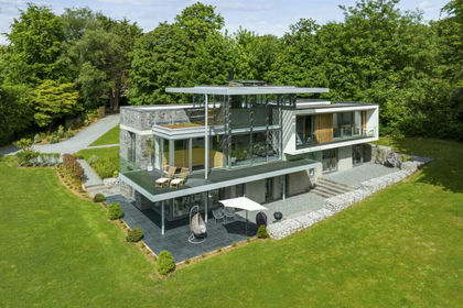
Hoe Lane, Abinger Hammer, Dorking, Shere, Surrey RH5 England
Added on 29/01/2026House with Land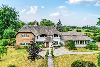
- Price
- Guide Price£2,500,000
- Size
- 1 acres
Added on 01/07/2026Country Home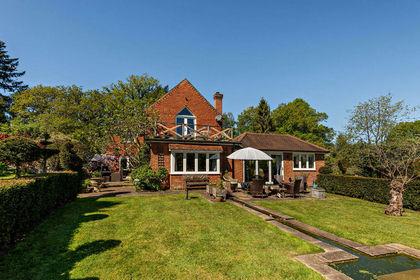
- Price
- £2,250,000
- Size
- 2 acres
Added on 10/05/2026House with Land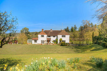
- Price
- Offers in Excess of£1,950,000
- Size
- 2.7 acres
Added on 04/06/2026House with Land
- Price
- Guide Price£2,350,000
- Size
- 1.8 acres
Pitch Hill, Ewhurst, Cranleigh, Surrey, GU6, Ewhurst, Surrey GU6 England
Added on 27/02/2026Country Home
- Price
- £2,995,000
- Size
- 1.66 acres
Added on 18/08/2026House with Land
- Price
- Guide Price£1,999,995
- Size
- 11 acres
Rookery Drive, Westcott, Dorking, RH4, Dorking and Horley, Surrey RH4 England
Added on 21/07/2026House with Land
- Price
- £1,875,000
- Size
- 1 acres
Added on 15/09/2026House with Land
- Price
- Guide Price£2,850,000
- Size
- 3.69 acres
Westcott, Surrey, RH4, Dorking and Horley, Surrey RH4 England
Added on 01/07/2026Country Home
- Price
- Guide Price£2,350,000
- Size
- 0.7 acres
Added on 01/07/2026Country Home