Pontyglasier, Crymych
- Land size
- 7 acres
- Bedrooms
- 5
- Bathrooms
- 3
Key Features
- Beautifully Presented House
- Five Bedrooms
- Approximately 7 Acres of Land
- Glamping Area
- Approximately 7.2 Miles To Newport
- River Boundary
- Stable Block & Useful Sheds
- Income Potential
- Oil Central Heating
- EPC Rating: G
Description
A beautifully presented country property nestled in the rural village of Pontyglasier, ideally located just 9 miles from the market town of Cardigan, approximately 3–4 miles from Crymych, and 7.2 miles from the popular coastal town of Newport. Bursting with character and charm, this exceptional property also offers fantastic income potential with its glamping business, all set within approximately 7 acres of grazing land.
The well-presented accommodation briefly comprises an entrance porch featuring a half-glazed stable door and traditional quarry tiled flooring. From here, you are welcomed into the impressive open-plan kitchen and dining room, a wonderful sociable space ideal for family gatherings and entertaining. The country-style kitchen is fitted with matching wall and base units, a breakfast bar, and an alcove with exposed wooden beam housing the Aga. A ladder staircase leads to part of the first floor, enhancing the home’s unique character. Thumb-latch doors lead through to a useful utility room with space for a washing machine and tumble dryer, a Belfast sink, and a separate storage cupboard.
To the rear of the property is a further side entrance opening into a hallway, along with a ground floor WC featuring half-panelled walls and a wash hand basin. The charming living room boasts a block-built fireplace with log-burning stove and floor-to-ceiling windows, creating a bright and inviting atmosphere. A door leads through to the sun room, where natural light floods in and provides access to the side patio area.
The first floor offers five bedrooms, three of which are doubles and one benefits from an ensuite shower room. The impressive principal bedroom benefits from a vaulted ceiling and floor-to-ceiling windows that perfectly frame the stunning countryside views across the surrounding land. Completing the accommodation is a beautifully appointed family bathroom featuring a freestanding roll-top bath and separate shower enclosure.
Attached to the main house is an area currently used as a B&B, accessible either from the rear of the property or via interconnecting doors from both the dining area and first-floor hallway. Ideal for multigenerational living or as an additional income opportunity. Here there is a further reception room and a kitchenette.
Externally, the property sits within approximately 7 acres including beautifully maintained grounds both to the front and the rear of the house, and pasture divided into four separate paddocks previously used for equestrian purposes, enjoying far-reaching countryside views towards the stunning Preseli Hills. A particularly attractive feature of the property is the established glamping and holiday accommodation area, comprising three charming shepherd’s huts currently operated as holiday lets, offering extra income potential. Supporting facilities include a dedicated camping kitchen, WC amenities, and one hut further benefits from a wood-fired hot tub, creating a truly idyllic rural retreat for guests. The land is bordered by the picturesque Afon Bannon, a principal tributary of the River Nevern, providing a wonderfully tranquil setting rich with mature trees, established shrubs, and seasonal carpets of bluebells.
To the front of the property is a beautifully enclosed cottage-style garden, thoughtfully landscaped with an abundance of mature flower beds, established planting, and several charming seating areas ideal for outdoor entertaining and relaxation. The garden also benefits from a greenhouse, raised vegetable beds, a practical log store, and a useful timber shed. The attractive frontage and bridge approach create an almost walled-garden feel, enhancing the sense of character.
To the rear, a delightful patio terrace enjoys elevated views overlooking the river and features a pergola and hot tub, providing the perfect space to unwind and enjoy the surroundings. Currently utilised as an outdoor area for guests staying in the attached Airbnb accommodation, this space can equally be enjoyed as part of the main residence, with direct access available from the sun room. Further benefits include ample off-road parking for multiple vehicles, a stable block, and a caravan positioned to the rear of the property.
The village of Pontyglasier is located approximately 3.5 miles to Crymych, which is situated to the east of the Preseli Mountains and sits astride the A478, the road that connects Tenby with Cardigan. The village offers amenities such as a primary and secondary school, local family run shops, cafes, takeaways, rugby club, petrol filling station, leisure centre, Spar supermarket and more. The surrounding area is very popular with walkers being so close to the Preseli Mountains and is within the Pembrokeshire Coast National Park. The larger town of Cardigan is only 8.3 miles north, while Haverfordwest is approximately 20 miles southwest.
VIEWING: By appointment only via the Agents.
TENURE: We are advised Freehold
SERVICES: We have not checked or tested any of the services or appliances at the property.
COUNCIL TAX: Band 'F' Pembrokeshire County Council
ref:LW/AMS/05/26/OK
FACEBOOK & TWITTER
Be sure to follow us on Twitter: @ WWProps
Map Location
Property details
- Tenure
- Freehold
- Council Tax Band
- F
- Date Posted
- 2026-07-03
Market Value Analysis
Compared with 365 Homes with Land listings in Wales (5+ acres).
Energy Performance Certificate
Energy Efficiency Rating
Based on UK Energy Performance Certificate standards (EU Directive 2002/91/EC)
Running costs are one side. Planning activity, flood history and ground risks for this location are in the full report.
Utilities & Restrictions
Utilities
- Electricity
- Ask Agent
- Water
- Ask Agent
- Heating
- Ask Agent
- Broadband
- Ask Agent
- Sewerage
- Ask Agent
Rights & Restrictions
- Public Rights of Way
- Ask Agent
- Private Rights of Way
- Ask Agent
- Listed Property
- Ask Agent
- Restrictions
- Ask Agent
Listed status, conservation areas and planning constraints for this location are in the full report.
Property Features
- Accessibility
- Ask Agent
- Parking
- Parking Available
- Garden
- Garden
Beyond the particulars: planning activity, flood history, heritage and ground risks, checked for this exact spot.
Connectivity
Broadband
Fastest speed available at this postcode
1.8 Gbps
Gigabit full fibre
Suitable for
- 4K streaming on every screen
- Full-time home working
- Online gaming & big downloads
Mobile signal
Predicted 4G and 5G signal; indoor signal depends on building materials.
Ofcom Connected Nations postcode-level predictions. Speeds and signal are modelled, not measured, and vary between addresses and providers.
Signal is the easy part. Planning activity, flood history and protected designations here are in the full report.
Nearest Schools
Primary
- Ysgol Gynradd Gymunedol Eglwyswrw1.3 miles
- Pupils
- 90
- Type
- Infants & Juniors
- Language
- Welsh medium school / provision (including transitional)
- Ysgol Bro Preseli3.2 miles
- Pupils
- 932
- Type
- Middle (ages 3-19)
- Language
- Welsh medium school / provision (including transitional)
- Cilgerran Church in Wales VC School5.3 miles
- Pupils
- 114
- Type
- Nursery, Infants & Juniors
- Language
- Welsh medium school / provision (including transitional)
- Ysgol Bro Ingli5.4 miles
- Pupils
- 104
- Type
- Nursery, Infants & Juniors
- Language
- Welsh medium school / provision (including transitional)
- Ysgol Llandudoch6.2 miles
- Pupils
- 77
- Type
- Nursery, Infants & Juniors
- Language
- Welsh medium school / provision (including transitional)
Secondary
- Ysgol Bro Preseli3.2 miles
- Pupils
- 932
- Type
- Middle (ages 3-19)
- Language
- Welsh medium school / provision (including transitional)
- Ysgol Uwchradd Aberteifi6.9 miles
- Pupils
- 614
- Type
- Secondary (ages 11-19)
- Language
- Welsh medium school / provision (including transitional)
- Ysgol Gyfun Emlyn11 miles
- Pupils
- 502
- Type
- Secondary (ages 11-19)
- Language
- Dual language school / provision (Welsh and English) (including transitional)
- Ysgol Bro Gwaun12 miles
- Pupils
- 574
- Type
- Secondary (ages 11-16)
- Language
- Dual language school / provision (Welsh and English) (including transitional)
- Dyffryn Taf13 miles
- Pupils
- 890
- Type
- Secondary (ages 11-19)
- Language
- Dual language school / provision (Welsh and English) (including transitional)
Distances are straight-line from the advertised location. Source: the national school registers (DfE, Welsh Government, Scottish Government) and Ofsted.
Schools are just the start: sold prices nearby, planning activity and any flood history are in the full report.
Amenities
Supermarket
GP surgery
Pharmacy
Straight-line distances from the advertised location. Sources: NHS records, Geolytix supermarket locations, OS Open Greenspace and the national trails registers.
The area stacks up? Now check the location itself: planning nearby, protected designations and past flooding.
Getting Around
Nearest station
Nearest bus stop
Typical drive times
Straight-line distances from the advertised location; drive times are typical free-flow times over OpenStreetMap road data, so allow more at peak. Public transport locations from DfT NaPTAN.
Easy to reach matters. So do planning activity, flood history and ground risks: all in the full report.
Flood Risk
Natural Resources Wales open data, checked around the advertised map pin for the listed acreage. Long-term risk counts flood defences; the planning map's flood zones do not. Provided by LandSale, not the listing agent, and not part of the agent's particulars. Risk varies across a holding, so verify before committing.
Rivers and the sea
Not at the pin: mapped about 20 metres away.
Planning map: Flood Zone 3, about 10 metres away.
Surface water
Not at the pin: mapped about 30 metres away.
These bandings are the summary. Where this location sits on the flood maps, plus planning activity, heritage and ground risks, is in the full report.
Important notice: Information, maps and tags on this page are drawn from the advertising agent's marketing materials or generated automatically. LandSale has not verified them. Relying on these details is at your own risk, always carry out independent checks before committing to a purchase.
LandSale full disclaimer
Marketing information only - not formal particulars. The details on this website are provided for general guidance and do not constitute an offer or contract. Neither LandSale nor the advertising estate/land agent accepts responsibility for any inaccuracy.
1. Source of information
- Listing content: Core description, asking price, tenure, measurements, photographs and planning history originate from the marketing materials of the advertising estate or land agent. LandSale does not author this content and cannot guarantee its accuracy.
- Automated tags & categorisation: Property type, land-use class, acreage bands and similar labels may be applied by machine-learning models. They are intended as a helpful guide only and may not reflect the property's legal status or permitted use.
- Third-party & enriched data layers: Maps, boundary outlines, planning designations, soil reports, broadband coverage and other environmental or location-based insights are licensed from external suppliers. Such data are supplied “as is", may be incomplete or out of date and are subject to change without notice.
2. Verification required
Prospective purchasers must verify critical matters, including but not limited to planning permission, title boundaries, public rights of way, environmental constraints, acreage, services, access and VAT status, through their own inspections, specialist surveys, legal advisers and the selling agent before relying on the information or entering into any contract.
3. No warranty or liability
LandSale gives no warranty, express or implied, as to the accuracy, completeness or fitness for any particular purpose of the information displayed. LandSale shall not be liable for any loss, damage, cost or expense arising directly or indirectly from any use of or reliance on such information, save where liability may not be excluded by law.
4. Updates & feedback
If you believe any detail on this listing is inaccurate, please let us know. We will investigate and, where appropriate, update the listing or notify the agent.
© LandSale | Version 1.3 - August 2026
Listing agent
West Wales Properties, Cardigan
41 High Street, Cardigan, Ceredigion, SA43 1JG
Contact West Wales Properties, Cardigan
41 High Street, Cardigan, Ceredigion, SA43 1JG
View agent profileSimilar properties for sale
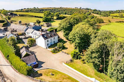
- Price
- £900,000
- Size
- 4 acres
Eglwyswrw, Crymych, SA41, Eglwyswrw, Pembrokeshire SA41 Wales
Added on 29/01/2026Holiday Let Property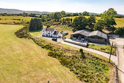
- Price
- £1,000,000
- Size
- 50 acres
Eglwyswrw, Crymych, SA41, Eglwyswrw, Pembrokeshire SA41 Wales
Added on 30/05/2026Farm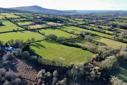
- Price
- £785,000
- Size
- 15 acres
Plas Preseli Brynberian Crymych SA41, Nevern, Pembrokeshire SA41 Wales
Added on 28/01/2026Smallholding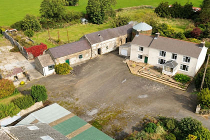
- Price
- £650,000
- Size
- 10.95 acres
Eglwyswrw, Crymych, SA41, Eglwyswrw, Pembrokeshire SA41 Wales
Added on 02/10/2026Smallholding
- Price
- £750,000
- Size
- 25.8 acres
Added on 25/07/2026Smallholding
- Price
- Offers in Region of£850,000
- Size
- 4.15 acres
Added on 20/08/2026House with Land
- Price
- £650,000
- Size
- 5.47 acres
Brynberian, Near Newport, SA41, Eglwyswrw, Pembrokeshire SA41 Wales
Added on 26/06/2026Smallholding
- Price
- £850,000
- Size
- 26 acres
Added on 29/01/2026Farmhouse
- Price
- £800,000
- Size
- 9 acres
Mynachlogddu, Clynderwen, SA66, Mynachlog-Ddu, Pembrokeshire SA66 Wales
Added on 29/01/2026Smallholding
- Price
- Guide Price£795,000
- Size
- 30.59 acres
Ty Canol, Rhosfach, Clunderwen, Mynachlog-Ddu, Pembrokeshire SA66 Wales
Added on 16/07/2026Smallholding