North End, Ashton Keynes
- Bedrooms
- 4
- Bathrooms
- 1
Description
GO TO OUR VR VIRTUAL TOUR TO VIEW THIS PROPERTY IMMEDIATELY ! A truly Unique opportunity to purchase a Cotswold Stone Barn conversion located on the edge of this highly sought after village with a full range of amenities and facilities. Ashton Keynes is an unspoilt Cotswold village with good local facilities including a shop, garage, renowned and popular primary school, public house and church; the village hall hosts the post office twice a week. The nearby main town of Cirencester is a renowned Cotswold market town offering excellent local shops and services. The larger centres of Cheltenham, Swindon, Gloucester, Oxford and Bristol are also in daily commuting distance. The Old Dairy offers open plan attractive living space with a large selection of sympathetic character features combined with modern high specification. Of special mention is the stunning main living area with fully vaulted ceiling and a superb selection of period timbers indicative of the age of the building. Externally there is a selection of landscaped gardens offering seclusion to enjoy the sunny aspect and off road parking for approx. seven cars with a single garage. Barn conversions are so rarely available we urge early viewing through Cain and Fuller in Cirencester.
Near By Cirencester - Cirencester is an historic Roman town which became an important centre for the wool trade in medieval times. Today it is a thriving market town. The property occupies a desirable situation. Shopping in Cirencester is highly regarded. Off the main streets there are many interesting back lanes with specialist shops, particularly Black Jack Street. On the outskirts of the town are several supermarkets, as well as a hospital. A new Leisure Centre was opened in 2006 and one of the oldest open-air pools in the country is a short walk. A gate to the 2500 acre Cirencester Park, belonging to the Bathurst family and open during the day, is also a short walk off Cecily Hill. Many concerts are given in the church and there are talented local choirs and amateur dramatic groups. Within about half an hour’s drive are the towns of Cheltenham, Gloucester and Swindon. Bath, Oxford and Stratford are about an hour by car, with superb cultural and recreational facilities. Private and State schools in the area are excellent, such as Beaudesert, Deer Park, Kingshill, Prior Park, Rendcomb and Hatherop Castle.
Kemble airfield has facilities for small aircraft and Aston Down is a gliding centre. Cirencester has had a golf course for over 100 years and others are at Minchinhampton, Burford and Naunton. Superb horse racing takes place at Cheltenham, as well as at meetings at Newbury and Bath. Sailing and other watersports are available on the lakes between Cirencester and Swindon.
Ashton Keynes - Ashton Keynes is a village and civil parish in north Wiltshire, England which borders with Gloucestershire. The village is about 5 miles (8 km) south of Cirencester and 3.5 miles (5.6 km) west of Cricklade. At the 2011 census the population of the parish was 1,400. The village lies within the Cotswold Water Park and is the only settlement substantially on both sides of the River Thames, which has many channels here, centred 6.5 miles (10 km) from its source at Thames Head.
The local school is Ashton Keynes Church of England School. Parts of the school building date back to 1870. Ashton Keynes is twinned with the French village of Grandchamps-des-Fontaines. There is a Twinning Association in the village, which organises regular exchange trips and other activities between the village communities. The village has many clubs and societies, most centred on the village hall or with links to the village church. Sports clubs include cricket, tennis, badminton and football. Musical groups include two choirs, an orchestra and a jazz band. There is also a Women's Institute and a Golden Years Club. Residents in the village have taken on two businesses (both on the High Road) as community businesses when they faced closure. The one remaining pub, the White Hart Inn, is collectively owned and run by several village residents who took on the licence in 2011. In 2012, the White Hart Inn was awarded 'Best Community Pub' for the South West region in the Great British Pub Awards. The local village shop has also been community owned and run since December 2011, located in a newly built annexe of the village hall on the High Road.
Description - Entrance door leads to a large reception hallway which gives access to most areas, A truly stunning main living space offers lounging/dining and kitchen areas all with a fully vaulted ceiling and a distinct selection of full exposed roof timbers, the lounging space if focused around a cotswold stone fireplace with fitted wood-burner a wonderful thing in the winter months. This area has a selection of dual aspect windows and opening doors onto the landscaped gardens. An open plan kitchen dining space gives ample space for large dining table and opens onto a comprehensively fitted kitchen area with large selection of storage, and extensive solid wood worksurfaces with Butler sink. A large integral range cooker is the focal point with stainless steel extraction above. There is a selection of recessed and under cabinet mood lighting within this dual aspect living space. The rest of the barn offers four bedrooms, master suite with en suite shower room and a high specification family shower room servicing guests.
Outside - The main access to the barn is through a five bar gate which leads to a large gravelled parking area enclosed and established with pedestrian access to the entrance door to the barn. The garden area is fully enclosed with access from many rooms within the barn and benefits from amazing seclusion with a selection of grassed and seating areas for entertaining. The garden provides a secure and safe environment for small animals or young children. Further gated access from the garden leads to the general courtyard parking area and a single garage with parking for two cars to the front belonging to the property.
Broadband And Mobile - We recommend purchasers go to Ofcom for further details
Garage And Parking - There is a good sized single garage with eaves storage space and additional parking to the front, further gravelled driveway with parking for approx. eight cars with five bar gated access.
Viewing - Through Cain and Fuller in Cirencester
Council Tax - Band F
Drainage - The property is serviced by a bio digester shared between the two neighbouring Barns there is a monthly fee of £30 for the maintenance of this unit.
Agents Note - These particulars, including any plan, are a general guide only and do not form any part of any offer or contract. All descriptions, including photographs, dimensions and other details are given in good faith but do not amount to a representation or warranty. They should not be relied upon as statements of fact and anyone interested must satisfy themselves as to their correctness by inspection or otherwise.
Any plan is for layout guidance only and is not drawn to scale. All dimensions, shapes and compass bearings are approximate and you should not rely upon them without checking them first.
Please discuss with us any aspects which are particularly important to you before travelling to view this property.
Please note that in line with Money Laundering Regulations potential purchasers will be required to provide proof of identification documents no later than where a purchaser’s offer is informally accepted by the seller.
Map Location
Property details
- Tenure
- Freehold
- Council Tax Band
- F
- Date Posted
- 2026-07-03
Energy Performance Certificate
Energy Efficiency Rating
Based on UK Energy Performance Certificate standards (EU Directive 2002/91/EC)
Running costs are one side. Planning activity, flood history and ground risks for this location are in the full report.
Utilities & Restrictions
Utilities
- Electricity
- Mains
- Water
- Mains
- Heating
- Electric Heating
- Broadband
- Ask Agent
- Sewerage
- Septic Tank / Private
Rights & Restrictions
- Public Rights of Way
- Ask Agent
- Private Rights of Way
- Ask Agent
- Listed Property
- Ask Agent
- Restrictions
- Ask Agent
Listed status, conservation areas and planning constraints for this location are in the full report.
Property Features
- Accessibility
- Ask Agent
- Parking
- Driveway
- Garden
- Garden
Beyond the particulars: planning activity, flood history, heritage and ground risks, checked for this exact spot.
Connectivity
Broadband
Fastest speed available at this postcode
80 Mbps
Superfast
Suitable for
- HD streaming
- Video calls
- Web & social
Mobile signal
Outdoor predictions; indoor signal depends on building materials.
Ofcom Connected Nations postcode-level predictions. Speeds and signal are modelled, not measured, and vary between addresses and providers.
Signal is the easy part. Planning activity, flood history and protected designations here are in the full report.
Nearest Schools
Primary
- Ashton Keynes Church of England Primary School985 metresOfsted: Good
- Ages
- 4 to 11
- Pupils
- 207
- Type
- Voluntary controlled school
- Faith
- Church of England
- Ann Edwards Church of England Primary School1.1 milesOfsted: Good
- Ages
- 4 to 11
- Pupils
- 206
- Type
- Voluntary controlled school
- Faith
- Church of England
- Minety Church of England Primary School2.8 milesOfsted: Good
- Ages
- 4 to 11
- Pupils
- 108
- Type
- Voluntary controlled school
- Faith
- Church of England
- Siddington Church of England Primary School3.2 milesOfsted: Good
- Ages
- 4 to 11
- Pupils
- 83
- Type
- Academy converter
- Faith
- Church of England
- St Sampson's Church of England Primary School3.6 milesOfsted report card · Feb 2026
- Ages
- 4 to 11
- Pupils
- 282
- Type
- Voluntary controlled school
- Faith
- Church of England
Secondary
- Cirencester Kingshill School4.4 milesOfsted: Good *
- Ages
- 11 to 16
- Pupils
- 806
- Type
- Academy converter
- Cirencester Deer Park School4.6 milesNo Ofsted rating
- Ages
- 11 to 16
- Pupils
- 1,020
- Type
- Academy converter
- Bradon Forest School5.5 milesOfsted: Good
- Ages
- 11 to 16
- Pupils
- 987
- Type
- Academy converter
- Great Western Academy6 milesOfsted: Good
- Ages
- 11 to 18
- Pupils
- 1,039
- Type
- Free schools
- Abbey Park School6.2 milesOfsted: Good
- Ages
- 11 to 16
- Pupils
- 1,193
- Type
- Academy sponsor led
* Latest graded judgement covers quality of education only; no overall grade was issued under the 2024-25 inspection framework.
Distances are straight-line from the advertised location. Source: the national school registers (DfE, Welsh Government, Scottish Government) and Ofsted.
Schools are just the start: sold prices nearby, planning activity and any flood history are in the full report.
Amenities
Supermarket
GP surgery
Pharmacy
Hospital
Walking trail
Straight-line distances from the advertised location. Sources: NHS records, Geolytix supermarket locations, OS Open Greenspace and the national trails registers.
The area stacks up? Now check the location itself: planning nearby, protected designations and past flooding.
Getting Around
Nearest station
Nearest bus stop
Typical drive times
Straight-line distances from the advertised location; drive times are typical free-flow times over OpenStreetMap road data, so allow more at peak. Public transport locations from DfT NaPTAN.
Easy to reach matters. So do planning activity, flood history and ground risks: all in the full report.
Flood Risk
From Environment Agency flood map open data, checked around the advertised map pin and allowing for the listed acreage where known. This summary comes from LandSale, the advertising platform, not from the listing agent, and is not part of the agent's particulars. Risk can vary across a single holding, so verify anything critical through your own searches before committing.
Rivers and the sea
Surface water
Mapped within the area searched, not at the advertised map pin itself.
These bandings are the summary. Where this location sits on the flood maps, plus planning activity, heritage and ground risks, is in the full report.
Important notice: Information, maps and tags on this page are drawn from the advertising agent's marketing materials or generated automatically. LandSale has not verified them. Relying on these details is at your own risk, always carry out independent checks before committing to a purchase.
LandSale full disclaimer
Marketing information only - not formal particulars. The details on this website are provided for general guidance and do not constitute an offer or contract. Neither LandSale nor the advertising estate/land agent accepts responsibility for any inaccuracy.
1. Source of information
- Listing content: Core description, asking price, tenure, measurements, photographs and planning history originate from the marketing materials of the advertising estate or land agent. LandSale does not author this content and cannot guarantee its accuracy.
- Automated tags & categorisation: Property type, land-use class, acreage bands and similar labels may be applied by machine-learning models. They are intended as a helpful guide only and may not reflect the property's legal status or permitted use.
- Third-party & enriched data layers: Maps, boundary outlines, planning designations, soil reports, broadband coverage and other environmental or location-based insights are licensed from external suppliers. Such data are supplied “as is", may be incomplete or out of date and are subject to change without notice.
2. Verification required
Prospective purchasers must verify critical matters, including but not limited to planning permission, title boundaries, public rights of way, environmental constraints, acreage, services, access and VAT status, through their own inspections, specialist surveys, legal advisers and the selling agent before relying on the information or entering into any contract.
3. No warranty or liability
LandSale gives no warranty, express or implied, as to the accuracy, completeness or fitness for any particular purpose of the information displayed. LandSale shall not be liable for any loss, damage, cost or expense arising directly or indirectly from any use of or reliance on such information, save where liability may not be excluded by law.
4. Updates & feedback
If you believe any detail on this listing is inaccurate, please let us know. We will investigate and, where appropriate, update the listing or notify the agent.
© LandSale | Version 1.3 - August 2026
Listing agent
Cain & Fuller Estate Agents, Cirencester
53 castle street cirencester GL7 1QD
View agent profileSimilar properties for sale
- Price
- Offers Over£600,000
- Size
- 1.31 acres
Woodstock Lane, Avening, Tetbury, Gloucestershire, GL8, Avening, Gloucestershire GL8 England
Added on 27/08/2026Development Land
- Price
- Offers Over£600,000
- Size
- 1.31 acres
Woodstock Lane, Avening, GL8, Avening, Gloucestershire GL8 England
Added on 25/05/2026House with Land
- Price
- Guide Price£500,000
- Size
- 4 acres
At Miry Fields, Pike Lane, Nailsworth, Nailsworth, Gloucestershire GL6 England
Added on 25/05/2026Barn
- Price
- £525,000
High Street, Watchfield, Swindon, Oxfordshire, SN6, Watchfield, Oxfordshire SN6 England
Added on 18/08/2026Barn Conversion
- Price
- Guide Price£525,000
Added on 18/08/2026Barn Conversion
- Price
- Guide Price£650,000
Manor Barns Court, Hazelton, Gloucestershire, GL54, Hazleton, Gloucestershire GL54 England
Added on 25/05/2026Barn Conversion
- Price
- Guide Price£600,000
- Size
- 0.34 acres
Added on 07/09/2026Development Land
- Price
- Guide Price£650,000
- Size
- 1.22 acres
Tickshill Barns, Uley, Dursley, Gloucestershire, GL11, Uley, Gloucestershire GL11 England
Added on 30/07/2026Conversion Land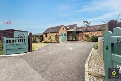
- Price
- Offers Over£450,000
Stroud Road, Brookthorpe, Harescombe, Gloucestershire GL4 England
Added on 01/09/2026Barn Conversion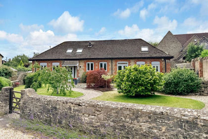
- Price
- Guide Price£625,000
Littleworth, Faringdon, SN7, Littleworth, Oxfordshire SN7 England
Added on 02/07/2026Barn Conversion