Goose Lane, Thwaite Common, NR11
- Land size
- 6 acres
Key Features
- Approx. 6 Acres of Pastureland/Grazing Land
- Rural North Norfolk Location
- Pre-Application Enquiry for Eco-Friendly Equestrian Centre
- Ref: DE21|23/1358 (Registered 29 June 2023)
- Potential for Equestrian Use (STPP)
- Peaceful Countryside Setting
- Rare Land Opportunity
- Overage Covenant Applies (Further Details Available Upon Request)
- Chain free sale
Description
An incredible and rare opportunity to acquire approximately 6 acres of pastureland/grazing land situated at Thwaite Common, within the sought-after North Norfolk countryside.
The land offers an attractive parcel of open pasture, ideal for agricultural, grazing, recreational or equestrian interests, subject to any necessary consents. Enjoying a peaceful rural setting surrounded by open countryside, this versatile site presents a unique opportunity to secure a substantial acreage in a desirable location.
The current owners have held the land for over five years and, during their ownership, submitted a pre-application enquiry to North Norfolk District Council to explore the potential development of an eco-friendly equestrian centre. The proposal included stabling, an arena/school, paddocks and an on-site caravan. The enquiry was registered on 29th June 2023 under reference DE21|23/1358.
Since submitting the enquiry, the owners have purchased an alternative property and no longer intend to pursue the project, creating an exciting opportunity for a new owner to investigate and potentially progress their own plans, subject to obtaining all necessary consents and approvals. Interested parties are advised to make their own enquiries with North Norfolk District Council regarding planning and development potential.
Opportunities of this nature are becoming increasingly scarce in North Norfolk, making this a particularly appealing proposition for those seeking land with both immediate use and future potential.
Additional Information
We understand that upon the current owners' purchase of the land, the property became subject to a Deed of Covenant dated 2019. This includes an overage provision whereby 50% of any net development value may become payable for a period of 50 years from July 2003, triggered upon the implementation or sale of a development. Interested parties are advised to seek independent legal advice and satisfy themselves as to the terms and implications of the covenant.
OUTSIDE
Extending to approximately 6 acres (subject to survey), the land comprises a delightful parcel of pasture and grazing land, enjoying a tranquil and picturesque setting amidst the unspoilt North Norfolk countryside.
Predominantly laid to grass, the acreage benefits from open rural views and a peaceful natural environment, creating an ideal setting for agricultural, grazing or equestrian interests, as well as those simply seeking to own a unique slice of the Norfolk countryside. The gently undulating landscape and established boundaries provide both character and versatility, offering a range of potential uses, subject to any necessary consents.
Access is provided via a gated entrance from Goose Lane, allowing convenient access to the land whilst retaining a sense of privacy and seclusion. The substantial acreage presents an increasingly rare opportunity to acquire a well-positioned parcel of countryside with both immediate enjoyment and future potential.
The land's attractive rural setting, combined with its scale, accessibility and previously explored equestrian potential, makes this a truly unique offering within the North Norfolk market.
LOCATION
The land is situated at Thwaite Common, a peaceful rural location nestled within the attractive North Norfolk countryside. Renowned for its open farmland, picturesque villages and unspoilt landscapes, the area offers an appealing balance of tranquillity and accessibility.
The nearby market town of Aylsham provides a comprehensive range of everyday amenities, including supermarkets, independent shops, cafés, schools and healthcare facilities, whilst the historic city of Norwich lies within convenient driving distance and offers an extensive selection of retail, leisure and cultural amenities. Norwich also benefits from a mainline rail service to London Liverpool Street and an international airport.
The stunning North Norfolk coastline, designated as an Area of Outstanding Natural Beauty, is easily accessible and home to some of the county's most celebrated beaches, nature reserves and coastal destinations, including Cromer, Sheringham, Blakeney and Wells-next-the-Sea.
The property's rural setting, combined with excellent access to both the coast and the city, makes it an ideal opportunity for those seeking land in one of Norfolk's most desirable and well-connected countryside locations.
SERVICES CONNECTED
Please note there are no services connected to the site. Our client intended to install a solar system for power and private drainage. They were looking at water options - Anglian Water can run water down the road, through the neighbours field but that was rather costly. As they were planning to use is as an equestrian centre they were planning on storing fresh water on site.
WHATTHREEWORDS
///grouping.barn.carbonate
Please note the postcode does not direct you to the location of the entrance. Please use what three words to locate the gated entrance on Goose Lane.
Disclaimer
Websters is a member of Propertymark and The Property Ombudsman Service. Neither Websters nor its representatives provide any warranty or representation regarding the property on behalf of ourselves or the seller. These particulars are for guidance only and do not form part of any offer or contract.
Leasehold details, including service charges and ground rent, should be confirmed by your legal adviser. Measurements, plans, photographs and descriptions are approximate and for illustration only. It should not be assumed the property has all required planning permissions, building regulation approvals or other consents. Services, fixtures and fittings have not been tested and buyers should verify these independently.
Anti-money laundering checks are required for all buyers and sellers and are carried out by our partner Coadjute via a secure link once an offer is accepted (subject to contract). A non-refundable fee of £45 + VAT per person applies.
Map Location
Property details
- Tenure
- Freehold
- Council Tax Band
- G
- Date Posted
- 2026-06-30
Market Value Analysis
Compared with 37 Bare & Undeveloped Land listings in East Anglia (5+ acres).
Utilities & Restrictions
Utilities
- Electricity
- Ask Agent
- Water
- Ask Agent
- Heating
- Ask Agent
- Broadband
- Ask Agent
- Sewerage
- Ask Agent
Rights & Restrictions
- Public Rights of Way
- Ask Agent
- Private Rights of Way
- Ask Agent
- Listed Property
- Ask Agent
- Restrictions
- Ask Agent
Listed status, conservation areas and planning constraints for this location are in the full report.
Property Features
- Accessibility
- Ask Agent
- Parking
- Ask Agent
- Garden
- Garden
Beyond the particulars: planning activity, flood history, heritage and ground risks, checked for this exact spot.
Connectivity
Broadband
Fastest speed available at this postcode
72 Mbps
Superfast · available to 75% of premises
Suitable for
- HD streaming
- Video calls
- Web & social
Mobile signal
Predicted 4G and 5G signal; indoor signal depends on building materials.
Ofcom Connected Nations postcode-level predictions. Speeds and signal are modelled, not measured, and vary between addresses and providers.
Signal is the easy part. Planning activity, flood history and protected designations here are in the full report.
Nearest Schools
Primary
- Erpingham Voluntary Controlled Church of England Primary School0.8 milesOfsted report card · Mar 2026
- Ages
- 2 to 11
- Pupils
- 42
- Type
- Voluntary controlled school
- Faith
- Church of England
- Aldborough Primary School1.3 milesOfsted: Good *
- Ages
- 4 to 11
- Pupils
- 126
- Type
- Foundation school
- Colby Primary School2.7 milesOfsted report card · Jun 2026
- Ages
- 4 to 11
- Pupils
- 140
- Type
- Community school
- St Mary's Church of England Primary Academy3.1 milesNo Ofsted rating
- Ages
- 2 to 11
- Pupils
- 61
- Type
- Academy converter
- Faith
- Church of England
- St Michael's Church of England VA Primary and Nursery School3.4 milesOfsted: Good
- Ages
- 3 to 11
- Pupils
- 127
- Type
- Voluntary aided school
- Faith
- Church of England
Secondary
- Aylsham High School3.4 milesNo Ofsted rating
- Ages
- 11 to 16
- Pupils
- 1,138
- Type
- Foundation school
- Cromer Academy5.6 milesNo Ofsted rating
- Ages
- 11 to 16
- Pupils
- 665
- Type
- Academy converter
- North Walsham High School5.7 milesOfsted: Good
- Ages
- 11 to 16
- Pupils
- 641
- Type
- Academy converter
- Sheringham High School6.9 milesOfsted: Good
- Ages
- 11 to 18
- Pupils
- 630
- Type
- Academy converter
- Reepham High School and College8.9 milesOfsted: Good *
- Ages
- 11 to 18
- Pupils
- 959
- Type
- Academy converter
* Latest graded judgement covers quality of education only; no overall grade was issued under the 2024-25 inspection framework.
Distances are straight-line from the advertised location. Source: the national school registers (DfE, Welsh Government, Scottish Government) and Ofsted.
Schools are just the start: sold prices nearby, planning activity and any flood history are in the full report.
Amenities
Supermarket
GP surgery
Pharmacy
Hospital
Green space
Straight-line distances from the advertised location. Sources: NHS records, Geolytix supermarket locations, OS Open Greenspace and the national trails registers.
The area stacks up? Now check the location itself: planning nearby, protected designations and past flooding.
Getting Around
Nearest station
Nearest bus stop
Typical drive times
Straight-line distances from the advertised location; drive times are typical free-flow times over OpenStreetMap road data, so allow more at peak. Public transport locations from DfT NaPTAN.
Easy to reach matters. So do planning activity, flood history and ground risks: all in the full report.
Flood Risk
Environment Agency open data, checked around the advertised map pin for the listed acreage. Long-term risk counts flood defences; the planning map's flood zones do not. Provided by LandSale, not the listing agent, and not part of the agent's particulars. Risk varies across a holding, so verify before committing.
Rivers and the sea
Planning map: Flood Zone 1.
Surface water
Not at the pin: mapped about 20 metres away.
These bandings are the summary. Where this location sits on the flood maps, plus planning activity, heritage and ground risks, is in the full report.
Important notice: Information, maps and tags on this page are drawn from the advertising agent's marketing materials or generated automatically. LandSale has not verified them. Relying on these details is at your own risk, always carry out independent checks before committing to a purchase.
LandSale full disclaimer
Marketing information only - not formal particulars. The details on this website are provided for general guidance and do not constitute an offer or contract. Neither LandSale nor the advertising estate/land agent accepts responsibility for any inaccuracy.
1. Source of information
- Listing content: Core description, asking price, tenure, measurements, photographs and planning history originate from the marketing materials of the advertising estate or land agent. LandSale does not author this content and cannot guarantee its accuracy.
- Automated tags & categorisation: Property type, land-use class, acreage bands and similar labels may be applied by machine-learning models. They are intended as a helpful guide only and may not reflect the property's legal status or permitted use.
- Third-party & enriched data layers: Maps, boundary outlines, planning designations, soil reports, broadband coverage and other environmental or location-based insights are licensed from external suppliers. Such data are supplied “as is", may be incomplete or out of date and are subject to change without notice.
2. Verification required
Prospective purchasers must verify critical matters, including but not limited to planning permission, title boundaries, public rights of way, environmental constraints, acreage, services, access and VAT status, through their own inspections, specialist surveys, legal advisers and the selling agent before relying on the information or entering into any contract.
3. No warranty or liability
LandSale gives no warranty, express or implied, as to the accuracy, completeness or fitness for any particular purpose of the information displayed. LandSale shall not be liable for any loss, damage, cost or expense arising directly or indirectly from any use of or reliance on such information, save where liability may not be excluded by law.
4. Updates & feedback
If you believe any detail on this listing is inaccurate, please let us know. We will investigate and, where appropriate, update the listing or notify the agent.
© LandSale | Version 1.3 - August 2026
Similar properties for sale
- Price
- Guide Price£170,000
Land Off Heath Lane, Lenwade, Norwich, Norfolk, NR9, Great Witchingham, Norfolk NR9 England
Added on 15/09/2026Arable Land
- Price
- From£135,000
Added on 26/08/2026Arable Land
- Price
- From£90,000
- Size
- 6.75 acres
Added on 29/01/2026Vacant Land
- Price
- Guide Price£210,000
- Size
- 10.71 acres
Lot 1, Land at Wilby, Norfolk, Quidenham, Norfolk NR16 England
Added on 25/09/2026Redevelopment Land
- Price
- From£160,000
- Size
- 19.37 acres
Added on 14/06/2026Agricultural Land
- Price
- Guide Price£100,000
- Size
- 11.78 acres
Added on 29/01/2026Arable Land
- Price
- £140,000
- Size
- 11.86 acres
Added on 24/05/2026Grazing Land
- Price
- Offers in Region of£90,000
- Size
- 7.65 acres
7.65 Acres Of Land At Outwell, Outwell, Norfolk PE14 England
Added on 29/01/2026Farmland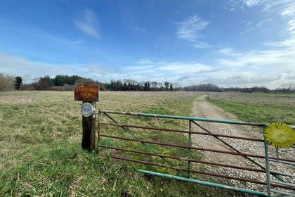
- Price
- Guide Price£105,000
- Size
- 7 acres
Added on 16/04/2026Undeveloped Land
- Price
- Offers in Region of£200,000
- Size
- 1.36 acres
Skegness Road, Chapel St. Leonards, Skegness, Ingoldmells, Lincolnshire PE25 England
Added on 29/01/2026Pasture