1.5-Acre Country Estate with Approved 1, 660 sq ft Holiday Let Development Plot and Existing Ancillary Hub, RH20
- Land size
- 1.5 acres
- Bedrooms
- 4
- Bathrooms
- 3
Key Features
- TRANQUIL SETTING IN 1.5 ACRES
- PEACEFUL, YET CONVENIENT LOCATION
- PLANNING PERMISSION FOR HOLIDAY LET IN GROUNDS
- WOODED OUTLOOK
- VARIOUS OUTBUILDINGS
- OUTSTANDING COUNTRY WALKS FROM THE GROUNDS
- OPEN PLAN KITCHEN/DINING/FAMILY ROOM
- GREAT INVESTMENT OPPORTUNITY
Description
Positioned centrally within a private woodland block bordering the South Downs National Park, this unique 1.5-acre country estate represents a premier multi-property residential and commercial venture. The estate features an exceptional four-bedroom main residence alongside a substantial, detached stone-fronted studio building, all within beautiful walking distance of West Chiltington, Pulborough, Amberley, and Storrington.
For the ambitious lifestyle entrepreneur or forward-thinking micro-hotelier, the acreage includes an independent building plot with active planning permission to construct a substantial 1,660 sq ft dwelling. Perfectly tailored to launch or expand a lucrative commercial staycation business, the development plot benefits from pre-installed, independent utility infrastructures, a dedicated electricity connection, and a separate sewage treatment system. This heavily de-risked asset offers an elite-tier West Sussex footprint, allowing an incoming buyer to seamlessly blend luxury country living with a high-yield hospitality brand or create a premium family compound.
The heart of the home is a stunning triple-aspect open-plan kitchen, dining and family room with vaulted ceilings, exposed beams and bi-fold doors opening onto the garden, creating a seamless connection between indoor and outdoor living. A cosy snug with a wood-burning stove provides the perfect retreat, while underfloor heating and a recently installed air source heat pump ensure year-round comfort and efficiency.
The principal bedroom is a luxurious sanctuary with a vaulted ceiling, mezzanine level, garden access and stylish en-suite. The remaining bedrooms offer flexible accommodation for family, guests or home working.
Outside, the south-westerly facing patio is perfect for entertaining, complete with a barbecue and pizza oven area, while the extensive gardens and woodland provide a wonderful setting to relax and unwind. A detached home office/gym with shower room, currently used as ancillary accommodation, and a powered summer house add further versatility.
The property also benefits from planning permission to extend, offering exciting scope to create additional living space and further enhance this exceptional countryside home.
Map Location
Property details
- Tenure
- Freehold
- Council Tax Band
- E
- Date Posted
- 2026-06-27
Market Value Analysis
Compared with 1,865 Homes with Land listings in South East England (1+ acres).
Energy Performance Certificate
Energy Efficiency Rating
Based on UK Energy Performance Certificate standards (EU Directive 2002/91/EC)
Utilities & Restrictions
Utilities
- Electricity
- Ask Agent
- Water
- Ask Agent
- Heating
- Ask Agent
- Broadband
- Ask Agent
- Sewerage
- Ask Agent
Rights & Restrictions
- Public Rights of Way
- Ask Agent
- Private Rights of Way
- Ask Agent
- Listed Property
- Ask Agent
- Restrictions
- Ask Agent
Property Features
- Accessibility
- Ask Agent
- Parking
- Ask Agent
- Garden
- Garden
Connectivity
Broadband
Fastest speed available at this postcode
1.8 Gbps
Gigabit full fibre
Suitable for
- 4K streaming on every screen
- Full-time home working
- Online gaming & big downloads
Mobile signal
Outdoor predictions; indoor signal depends on building materials.
Ofcom Connected Nations postcode-level predictions. Speeds and signal are modelled, not measured, and vary between addresses and providers.
Nearest Schools
Primary
- Storrington Primary School1.4 milesOfsted: Good
- Ages
- 4 to 11
- Pupils
- 361
- Type
- Community school
- St Mary's Church of England Primary School2 milesOfsted: Good
- Ages
- 4 to 11
- Pupils
- 295
- Type
- Voluntary aided school
- Faith
- Church of England
- West Chiltington Community Primary School2 milesOfsted: Good *
- Ages
- 4 to 11
- Pupils
- 192
- Type
- Community school
- Thakeham Primary School2.2 milesNo Ofsted rating
- Ages
- 4 to 11
- Pupils
- 104
- Type
- Community school
- St James' CofE Primary School, Coldwaltham2.8 milesOfsted: Good *
- Ages
- 4 to 11
- Pupils
- 44
- Type
- Voluntary controlled school
- Faith
- Church of England
Secondary
- Weald School, The5.8 milesOfsted: Good *
- Ages
- 11 to 18
- Pupils
- 1,800
- Type
- Community school
- Steyning Grammar School7.2 milesOfsted report card · Mar 2026
- Ages
- 11 to 18
- Pupils
- 1,775
- Type
- Academy converter
- Faith
- Church of England
- The Angmering School7.8 milesOfsted: Good
- Ages
- 11 to 19
- Pupils
- 1,360
- Type
- Community school
- Durrington High School8.1 milesOfsted: Good
- Ages
- 11 to 16
- Pupils
- 1,572
- Type
- Academy converter
- St Oscar Romero Catholic School8.5 milesOfsted: Outstanding *
- Ages
- 11 to 18
- Pupils
- 1,144
- Type
- Voluntary aided school
- Faith
- Roman Catholic
* Latest graded judgement covers quality of education only; no overall grade was issued under the 2024-25 inspection framework.
Distances are straight-line from the advertised location. Source: the national school registers (DfE, Welsh Government, Scottish Government) and Ofsted.
Amenities
Supermarket
GP surgery
Pharmacy
Hospital
Green space
Straight-line distances from the advertised location. Sources: NHS records, Geolytix supermarket locations, OS Open Greenspace and the national trails registers.
Getting Around
Nearest station
Nearest bus stop
Typical drive times
Straight-line distances from the advertised location; drive times are typical free-flow times over OpenStreetMap road data, so allow more at peak. Public transport locations from DfT NaPTAN.
Flood Risk
From Environment Agency flood map open data, checked around the advertised map pin and allowing for the listed acreage where known. This summary comes from LandSale, the advertising platform, not from the listing agent, and is not part of the agent's particulars. Risk can vary across a single holding, so verify anything critical through your own searches before committing.
Rivers and the sea
Surface water
The detail behind these bandings, including exact zones and annual chances, any recorded past flooding, plus planning, heritage, nature and ground checks, is in the .
Important notice: Information, maps and tags on this page are supplied by the advertising agent or generated automatically. LandSale has not verified them. Relying on these details is at your own risk, always carry out independent checks before committing to a purchase.
LandSale full disclaimer
Marketing information only - not formal particulars. The details on this website are provided for general guidance and do not constitute an offer or contract. Neither LandSale nor the advertising estate/land agent accepts responsibility for any inaccuracy.
1. Source of information
- Agent-supplied content: Core description, asking price, tenure, measurements, photographs and planning history are uploaded by the appointed agent, who remains solely responsible for their accuracy.
- Automated tags & categorisation: Property type, land-use class, acreage bands and similar labels may be applied by machine-learning models. They are intended as a helpful guide only and may not reflect the property's legal status or permitted use.
- Third-party & enriched data layers: Maps, boundary outlines, planning designations, soil reports, broadband coverage and other environmental or location-based insights are licensed from external suppliers. Such data are supplied “as is", may be incomplete or out of date and are subject to change without notice.
2. Verification required
Prospective purchasers must verify critical matters, including but not limited to planning permission, title boundaries, public rights of way, environmental constraints, acreage, services, access and VAT status, through their own inspections, specialist surveys, legal advisers and the selling agent before relying on the information or entering into any contract.
3. No warranty or liability
LandSale gives no warranty, express or implied, as to the accuracy, completeness or fitness for any particular purpose of the information displayed. LandSale shall not be liable for any loss, damage, cost or expense arising directly or indirectly from any use of or reliance on such information, save where liability may not be excluded by law.
4. Updates & feedback
If you believe any detail on this listing is inaccurate, please let us know. We will investigate and, where appropriate, update the listing or notify the agent.
© LandSale | Version 1.2 - January 2026
Listing agent
TAUK, Covering Nationwide
Covering Nationwide
Similar properties for sale
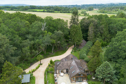
- Price
- £1,350,000
- Size
- 1.5 acres
Wiggonholt, Pulborough, RH20, Storrington and Sullington, West Sussex RH20 England
Added on 15/07/2026House with Land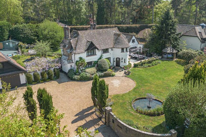
- Price
- Guide Price£1,575,000
- Size
- 1 acres
Added on 12/06/2026Country Home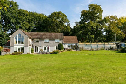
- Price
- Guide Price£1,500,000
- Size
- 6.75 acres
Nutbourne Road, Pulborough, Pulborough, West Sussex RH20 England
Added on 29/01/2026House with Land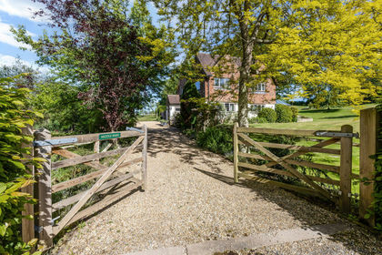
- Price
- Guide Price£1,650,000
- Size
- 3.5 acres
West Mare Lane, Pulborough, RH20, Pulborough, West Sussex RH20 England
Added on 28/05/2026House with Land
- Price
- £1,100,000
- Size
- 1.5 acres
London Road, Hardham, Pulborough, RH20, Coldwaltham, West Sussex RH20 England
Added on 12/08/2026House with Land
- Price
- Guide Price£1,100,000
- Size
- 4.44 acres
Added on 03/06/2026Equestrian property
- Price
- Guide Price£1,500,000
- Size
- 9.32 acres
Rock Road, Storrington, Washington, West Sussex RH20 England
Added on 26/06/2026House with Land
- Price
- Guide Price£1,100,000
- Size
- 4.19 acres
Added on 31/07/2026House with Land
- Price
- Offers Over£1,400,000
- Size
- 1.7 acres
Stane Street, North Heath, Pulborough, West Sussex, RH20, Pulborough, West Sussex RH20 England
Added on 14/05/2026Country Home
- Price
- £1,375,000
- Size
- 2.3 acres
Added on 10/03/2026Residential Land