Detached House with Land & Building For Sale – Starkie Heaton Farm, Ickornshaw, Cowling, BD22
- Land size
- 2.55 acres
- Bedrooms
- 4
Key Features
- A fabulous detached family house offering beautifully presented four bedroom accommodation
- With a delightful sheltered courtyard enclosed by an attractive range of traditional buildings
- Beyond which are terraced gardens, a stable and a new farm building
- Together with about 2.55 acres of land
- Convenient setting within the popular hamlet of Ickornshaw
- Within reach of the larger local centres of West Yorkshire and east Lancashire
Description
A fabulous detached family house offering beautifully presented four bedroom accommodation with a delightful sheltered courtyard enclosed by an attractive range of traditional buildings beyond which are terraced gardens, a stable and a new farm building, together with about 2.55 acres of land.
Convenient setting within the popular hamlet of Ickornshaw within reach of the larger local centres of West Yorkshire and east Lancashire.
Location
The property is situated in North Yorkshire within the hamlet of Ickornshaw, a short distance from the thriving village of Cowling, having shops, a primary school and a village hall. The nearby villages of Sutton, Glusburn and Cross Hills offer a good range of services including Co-op supermarket, bars and eateries, primary schools and a secondary school. The popular market town of Skipton lies 6 miles to the north providing a wider range of services, including shops, bars and restaurants, a leisure centre with swimming pool and highly regarded secondary schooling. Transport links are excellent with rail services to both Leeds and Bradford from either Skipton, Cononley or Steeton & Silsden and the A629 and A6068 providing access to the centres of West Yorkshire and east Lancashire.
Description
This delightful property enjoys a pleasant backwater position within the small hamlet of Ickornshaw and comprises a traditional detached family home with thoughtfully laid out and beautifully presented four bedroom accommodation which retains much of its original charm and character including exposed beams and trusses. At the back of the house is a charming sheltered courtyard enclosed by a most attractive range of traditional stone buildings including open fronted cart sheds (4.77m Average x 3.27m) and (2.36m x 3.24m) and fuel stores. The buildings benefit from Householder permission to convert to a one bedroom annexe(Ref: ZA25/27230/HH - 03 Oct 2025), perfect for additional guest accommodation or perhaps extended family. Beyond the access lane are cleverly landscaped, terraced gardens with seating areas and a summerhouse. A separate access track leads up to approximately 2.55 acres of land, the majority of which is relatively level and includes stables and a new steel portal frame mixed use building (45` x 25`) that requires finishing. NOTE: on completion of the new building the existing stables must be demolished and removed.
The house is entered from the courtyard into a welcoming hall with fitted storage for coats and boots, incorporating bench seating. There is half height wall boarding, tiled floor and a built-in concealing the gas central heating boiler. The hallway gives access to both the living room and the beautifully appointed family kitchen incorporating a range of painted base and wall units with granite work surfaces and splash back and a ‘Belfast' style sink with mixer tap. There is plumbing for a dishwasher, plumbing for an American style fridge/freezer and a gas/electric cooker point with extractor hood over set within a recess having exposed stone features and mantlepiece. Tiled floor, beamed ceiling and windows to three sides with plantation shutters. Enclosed staircase to first floor. Accessed from the kitchen is a cosy snug with woodburning stove set in a stone surround with flag hearth, oak boarded floor, fitted base and wall units and plantation shutters to the window. As well as from the hallway there is access from the snug into the stylish through living room with oak boarded floor and windows to two sides creating a lovely light space. The focal point of the room is a wood burning stove set in an opening with stone flag hearth and feature beam mantlepiece. Off the living room is a well planned utility room with base and wall units, laminate surfaces and a sink with drainer and oak boarded floor. Separate w.c. with hand wash basin and oak boarded floor. Accessed separately from the living room is a spacious office/games room with oak boarded floor.
The generous first floor landing gives way to a stunning master suite with impressive exposed roof truss and full height ceiling. There is a separate walk in wardrobe and well appointed en suite shower room. There are three further double bedrooms, one with a mezzanine level, and a beautifully appointed house bathroom with panelled bath and shower over, pedestal basin and w.c. Airing cupboard with hot water cylinder and fully tiled walls.
Starkie Heaton Farm is the perfect property for those with a love of the outdoors providing a wonderful family house with land and buildings to enjoy hobby farming and equestrian interests. There is also the potential to create additional annexe accommodation from the traditional buildings within the courtyard, which already benefit from planning permission.
Services
Mains electricity, gas, water and drainage.
Gas central heating.
Partial electric underfloor heating.
Stove with back boiler contributing to domestic hot water.
Solar panels.
Double glazing throughout.
Energy Rating
C - 74
Tenure
Freehold. Vacant possession on completion.
Council Tax
Band D (North Yorkshire Council)
Viewings
Strictly by appointment with the selling agent.
Wayleaves, Easements and Rights of Way
The land is sold subject to all wayleaves, easements and rights of way both public and private which might affect the land.
Directions
From Skipton head south on Keighley Road (A629) to the roundabout at Kildwick and the start of the dual carriageway section of the Aire Valley Trunk Road. Take the fourth exit onto Station Road (B6172) and continue to the T junction, turning right onto Keighley Road (A6068). Follow the road through Cross Hills and Glusburn for about 2 miles to Cowling. As you leave the village turn right onto Gill Lane and drop down into the bottom turning left onto Nan Scar. Starkie Heaton Farm can be found on the right after about 260 metres. A David Hill for sale sign has been erected.
Map Location
Property details
- Tenure
- Freehold
- Council Tax Band
- Ask Agent
- Date Posted
- 2026-06-18
Market Value Analysis
Compared with 670 Homes with Land listings in Yorkshire and The Humber (1+ acres).
Utilities & Restrictions
Utilities
- Electricity
- Ask Agent
- Water
- Ask Agent
- Heating
- Ask Agent
- Broadband
- Ask Agent
- Sewerage
- Ask Agent
Rights & Restrictions
- Public Rights of Way
- Ask Agent
- Private Rights of Way
- Ask Agent
- Listed Property
- Ask Agent
- Restrictions
- Ask Agent
Listed status, conservation areas and planning constraints for this location are in the full report.
Property Features
- Accessibility
- Ask Agent
- Parking
- Ask Agent
- Garden
- Garden
Beyond the particulars: planning activity, flood history, heritage and ground risks, checked for this exact spot.
Connectivity
Broadband
Fastest speed available at this postcode
1.8 Gbps
Gigabit full fibre
Suitable for
- 4K streaming on every screen
- Full-time home working
- Online gaming & big downloads
Mobile signal
Predicted 4G and 5G signal; indoor signal depends on building materials.
Ofcom Connected Nations postcode-level predictions. Speeds and signal are modelled, not measured, and vary between addresses and providers.
Signal is the easy part. Planning activity, flood history and protected designations here are in the full report.
Nearest Schools
Primary
- Cowling Community Primary School284 metresNo Ofsted rating
- Ages
- 4 to 11
- Pupils
- 118
- Type
- Community school
- Lothersdale Primary School2.1 milesOfsted: Outstanding *
- Ages
- 4 to 11
- Pupils
- 100
- Type
- Academy converter
- Glusburn Community Primary School2.6 milesOfsted: Good
- Ages
- 3 to 11
- Pupils
- 381
- Type
- Community school
- Sutton-in-Craven Community Primary School2.7 milesNo Ofsted rating
- Ages
- 4 to 11
- Pupils
- 194
- Type
- Community school
- Sutton CofE Primary and Nursery School2.7 milesNo Ofsted rating
- Ages
- 4 to 11
- Pupils
- 105
- Type
- Academy converter
- Faith
- Church of England
Secondary
- South Craven School2.9 milesOfsted: Good
- Ages
- 11 to 18
- Pupils
- 1,936
- Type
- Academy converter
- Colne Park High School4.3 milesOfsted report card · Apr 2026
- Ages
- 11 to 16
- Pupils
- 989
- Type
- Academy converter
- Beckfoot Oakbank5.5 milesOfsted: Requires improvement *
- Ages
- 11 to 18
- Pupils
- 1,394
- Type
- Academy sponsor led
- West Craven High School5.6 milesOfsted: Requires improvement
- Ages
- 11 to 16
- Pupils
- 528
- Type
- Academy converter
- Carlton Keighley5.6 milesOfsted: Good
- Ages
- 11 to 16
- Pupils
- 809
- Type
- Academy sponsor led
* Latest graded judgement covers quality of education only; no overall grade was issued under the 2024-25 inspection framework.
Distances are straight-line from the advertised location. Source: the national school registers (DfE, Welsh Government, Scottish Government) and Ofsted.
Schools are just the start: sold prices nearby, planning activity and any flood history are in the full report.
Amenities
Supermarket
GP surgery
Pharmacy
Hospital
Green space
Walking trail
Straight-line distances from the advertised location. Sources: NHS records, Geolytix supermarket locations, OS Open Greenspace and the national trails registers.
The area stacks up? Now check the location itself: planning nearby, protected designations and past flooding.
Getting Around
Nearest station
Nearest bus stop
Typical drive times
Straight-line distances from the advertised location; drive times are typical free-flow times over OpenStreetMap road data, so allow more at peak. Public transport locations from DfT NaPTAN.
Easy to reach matters. So do planning activity, flood history and ground risks: all in the full report.
Flood Risk
Environment Agency open data, checked around the advertised map pin for the listed acreage. Long-term risk counts flood defences; the planning map's flood zones do not. The map pin for this listing marks the postcode area rather than the exact location, so these readings describe the surrounding area. Provided by LandSale, not the listing agent, and not part of the agent's particulars. Risk varies across a holding, so verify before committing.
Rivers and the sea
Not at the pin: mapped about 20 metres away.
Planning map: Flood Zone 3, about 10 metres away.
Surface water
Not at the pin: mapped about 40 metres away.
These bandings are the summary. Where this location sits on the flood maps, plus planning activity, heritage and ground risks, is in the full report.
Important notice: Information, maps and tags on this page are drawn from the advertising agent's marketing materials or generated automatically. LandSale has not verified them. Relying on these details is at your own risk, always carry out independent checks before committing to a purchase.
LandSale full disclaimer
Marketing information only - not formal particulars. The details on this website are provided for general guidance and do not constitute an offer or contract. Neither LandSale nor the advertising estate/land agent accepts responsibility for any inaccuracy.
1. Source of information
- Listing content: Core description, asking price, tenure, measurements, photographs and planning history originate from the marketing materials of the advertising estate or land agent. LandSale does not author this content and cannot guarantee its accuracy.
- Automated tags & categorisation: Property type, land-use class, acreage bands and similar labels may be applied by machine-learning models. They are intended as a helpful guide only and may not reflect the property's legal status or permitted use.
- Third-party & enriched data layers: Maps, boundary outlines, planning designations, soil reports, broadband coverage and other environmental or location-based insights are licensed from external suppliers. Such data are supplied “as is", may be incomplete or out of date and are subject to change without notice.
2. Verification required
Prospective purchasers must verify critical matters, including but not limited to planning permission, title boundaries, public rights of way, environmental constraints, acreage, services, access and VAT status, through their own inspections, specialist surveys, legal advisers and the selling agent before relying on the information or entering into any contract.
3. No warranty or liability
LandSale gives no warranty, express or implied, as to the accuracy, completeness or fitness for any particular purpose of the information displayed. LandSale shall not be liable for any loss, damage, cost or expense arising directly or indirectly from any use of or reliance on such information, save where liability may not be excluded by law.
4. Updates & feedback
If you believe any detail on this listing is inaccurate, please let us know. We will investigate and, where appropriate, update the listing or notify the agent.
© LandSale | Version 1.3 - August 2026
Similar properties for sale
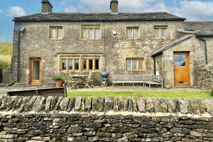
- Price
- Guide Price£679,000
- Size
- 1.3 acres
Cowling Hill, Cowling, Lothersdale, North Yorkshire BD22 England
Added on 17/02/2026Farmhouse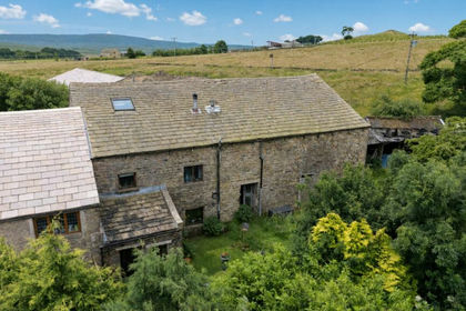
- Price
- £575,000
- Size
- 4 acres
Warley Wise Lane, Laneshawbridge, Colne, Lancashire, BB8, Laneshaw Bridge, Lancashire BB8 England
Added on 20/07/2026House with Land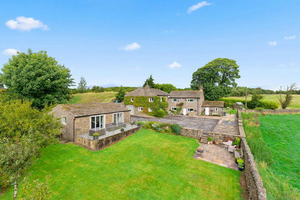
- Price
- Offers in Region of£875,000
- Size
- 2.7 acres
The Nook, Broadhead Lane, Oakworth, BD22, Keighley, Bradford BD22 England
Added on 12/08/2026House with Land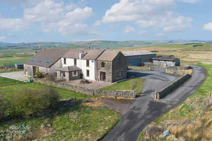
- Price
- £675,000
- Size
- 4.15 acres
New Laithe Farm, Hollin Hall, Trawden, Trawden Forest, Lancashire BB8 England
Added on 31/03/2026FarmhouseLeasehold
- Price
- Guide Price£950,000
- Size
- 1 acres
Croft House Farm, Kildwick Grange, Kildwick, BD20, Kildwick, North Yorkshire BD20 England
Added on 02/04/2026House with Land
- Price
- Guide Price£650,000
- Size
- 1.4 acres
Brow End Farm, Goose Eye, Oakworth, Keighley, BD22, Keighley, Bradford BD22 England
Added on 25/07/2026House with Land
- Price
- £950,000
- Size
- 4.5 acres
Skipton Road, Earby, Barnoldswick, Lancashire, BB18, Earby, Lancashire BB18 England
Added on 11/03/2026House with Land
- Price
- Guide Price£900,000
- Size
- 3 acres
Added on 28/04/2026House with Land
- Price
- Guide Price£875,000
- Size
- 1.82 acres
Hollins Bank Lane, Steeton, West Yorkshire, BD20, Steeton with Eastburn, Bradford BD20 England
Added on 05/03/2026House with Land
- Price
- Offers in Region of£595,000
- Size
- 1 acres
Brook View Barn, Skipton Road, Foulridge, Foulridge, Lancashire BB8 England
Added on 08/09/2026Barn Conversion