Lot 3: Gospel Farm, Bramley Lane, Hassop, Bakewell
- Land size
- 13.9 acres
Key Features
- 13.9 acres of Woodland
- attractive views
- sought after location
Description
Gospel Farm offers a rare opportunity to purchase a significant, ring fenced farm in a spectacular location, in the heart of the Peak District National Park. It occupies an elevated position with far reaching views and comprises two substantial modern portal framed agricultural buildings and concrete yard, together with 255 acres of agricultural land and just under 14 acres of woodland all over limestone. The farm is available as a whole or in three lots
The farm has potential for further expansion, the prospect of a farm workers dwelling and additional buildings (all subject to planning), making Gospel Farm a wonderful opportunity.
Lot 3 (c. 13.9 acres) - £85,000
Gospel Farm -
Summary - Gospel Farm offers the purchaser a wonderful farm located right in the heart of the Peak District National Park, with far reaching views of some of the most prominent landscapes in the area.
The farm is based around two substantial galvanised six bay steel portal frame buildings set on a spacious concrete yard, surrounded by 269 acres of land, all lying over limestone.
The farm has potential for further development offering the prospect of a farmhouse, and additional buildings (all subject to planning), making Gospel Farm a wonderful, unique opportunity.
Location - Gospel Farm occupies a special elevated position, with far reaching views over much of the surrounding area, encompassing Bretton, Curbar, Froggatt and Baslow Edge and Chatsworth Estate.
The farm is located off Bramley Lane, a minor adopted highway that leads to the B6001 (Hassop Calver Road). The farm benefits from two other primary access points, from Rowland (over Hassop Common) and from Moor Road, Longstone Edge (past High Rake).
The property lies a short distance from the popular market town of Bakewell (4.5 miles), Hathersage is just 5.6 miles away, with Sheffield City Centre only 14.5 miles from the farm.
Lot 2 - Accessed from Bramley Lane, and also directly off the B6001, with a good stone track passing through it. The Lot comprises a good block of 58.8 acres of sloping grazing land over limestone, with an easterly aspect overlooking Calver, and with views to Curbar Edge and beyond.
The ground offers good grazing pasture over limestone, but may offer scope for afforestation, recreational or less intensive environmental applications if so desired subject to any necessary consents.
The soils are loamy shallow lime rich soils (Soilscapes 3) and is classified as Grade 4 under the Agricultural Land Classification scheme
Viewing - Strictly by appointment only through the sole agents Bakewell office on or .
Services - Lots 1 and 2 benefit from mains water supplied by the Vendor from their retained property.
The Vendor undertakes to provide the existing supply of mains water from their retained property for 18 months following completion, billed according to usage. Thereafter the successful purchaser(s) will need to make their own provision.
In the event of Lot 1 and 2 being separately sold, it will be the responsibility of the purchaser of Lot 1 to install a sub meter for the water supplied to Lot 2 within 28 days of completion.
Rights Of Way, Wayleaves & Easements - The property is sold subject to and with the benefit of all rights of way, wayleaves and easements that may exist, whether or not they are defined in these particulars.
Timber electricity poles and oversailing lines cross the holding, held on a typical wayleave.
Bramley Lane is an adopted highway.
The track running past the farmstead to High Rake is a Restricted Byway (Great Longstone RB22, Calver RB11). A bridleway follows one of the tracks on the holding (Calver BW30) and public footpaths cross some of the land.
Timber, Minerals & Sporting Rights - Included insofar as they exist. Typical of the locality, parts of the farm have been subject to historic mineral workings.
Schemes & Designations - Whilst the Holding is currently within an Entry Level and Higher Level Stewardship Scheme, this is not to be transferred to the purchaser who will have no obligations to adhere to it. However, it does serve to illustrate the potential for the Holding to benefit from agri-environment schemes. Further details are available from the selling agents
Coombs Dale is designated as a SSSI (reference 104557 and 101720).
Fixtures, Fittings & Plan - Only those referred to in these particulars are included in the sale.
Tenure And Possession - The property is sold freehold with vacant possession granted on completion.
Local Planning Authority - Peak District National Park
Aldern House
Baslow Road
Bakewell
Derbyshire
DE45 1AE
T|
E| customer.
Method Of Sale - The property is offered by private treaty.
Directions - For the purposes of viewing Lot 1, drive through the village of Rowland, and continue on Hassop Common. Remain on this road until reaching Bramley Lane. Turn left, and the farm buildings are located on the right. The entrance to the farm drive is at What3Words ///contoured.sailor.soonest
Lots 2 and 3 can be accessed off the Hassop Calver Road
Solicitor - Freeths LLP (Kevin Fox), Suite 2, 1st Floor, South Point, Cardinal Square, 10 Nottingham Road, DE1 3QT
E| janet.
T|
Map Location
Property details
- Tenure
- Freehold
- Council Tax Band
- Ask Agent
- Date Posted
- 2026-06-18
Market Value Analysis
Compared with 47 Farms & Smallholdings listings in East Midlands (10+ acres).
Utilities & Restrictions
Utilities
- Electricity
- Ask Agent
- Water
- Ask Agent
- Heating
- Ask Agent
- Broadband
- Ask Agent
- Sewerage
- Ask Agent
Rights & Restrictions
- Public Rights of Way
- Ask Agent
- Private Rights of Way
- Ask Agent
- Listed Property
- Ask Agent
- Restrictions
- Ask Agent
Listed status, conservation areas and planning constraints for this location are in the full report.
Property Features
- Accessibility
- Ask Agent
- Parking
- Parking Available
- Garden
- Garden
Beyond the particulars: planning activity, flood history, heritage and ground risks, checked for this exact spot.
Connectivity
Broadband
Fastest speed available at this postcode
10 Mbps
Under 10 Mbps here
Suitable for
- Web & social
- Music streaming
- Standard video calls
Mobile signal
Predicted 4G and 5G signal; indoor signal depends on building materials.
Ofcom Connected Nations postcode-level predictions. Speeds and signal are modelled, not measured, and vary between addresses and providers.
Signal is the easy part. Planning activity, flood history and protected designations here are in the full report.
Nearest Schools
Primary
- Curbar Primary School1.1 milesOfsted: Good
- Ages
- 4 to 11
- Pupils
- 68
- Type
- Community school
- Stoney Middleton CofE (C) Primary School1.2 milesOfsted: Good
- Ages
- 3 to 11
- Pupils
- 20
- Type
- Voluntary controlled school
- Faith
- Church of England
- St Anne's CofE Primary School1.6 milesOfsted: Good
- Ages
- 4 to 11
- Pupils
- 129
- Type
- Voluntary controlled school
- Faith
- Church of England
- Pilsley CofE Primary School1.7 milesNo Ofsted rating
- Ages
- 3 to 11
- Pupils
- 64
- Type
- Voluntary aided school
- Faith
- Church of England
- Eyam CofE Primary School1.9 milesOfsted: Good *
- Ages
- 4 to 11
- Pupils
- 64
- Type
- Voluntary controlled school
- Faith
- Church of England
Secondary
- Lady Manners School3.9 milesOfsted: Good
- Ages
- 11 to 18
- Pupils
- 1,405
- Type
- Foundation school
- King Ecgbert School6.5 milesOfsted: Outstanding *
- Ages
- 11 to 18
- Pupils
- 1,575
- Type
- Academy converter
- Hope Valley College7.4 milesOfsted: Good
- Ages
- 11 to 18
- Pupils
- 518
- Type
- Academy sponsor led
- Brookfield Community School7.8 milesOfsted: Good
- Ages
- 11 to 18
- Pupils
- 1,156
- Type
- Academy converter
- Silverdale School8.2 milesOfsted: Good
- Ages
- 11 to 18
- Pupils
- 1,491
- Type
- Academy converter
* Latest graded judgement covers quality of education only; no overall grade was issued under the 2024-25 inspection framework.
Distances are straight-line from the advertised location. Source: the national school registers (DfE, Welsh Government, Scottish Government) and Ofsted.
Schools are just the start: sold prices nearby, planning activity and any flood history are in the full report.
Amenities
Supermarket
GP surgery
Pharmacy
Hospital
Straight-line distances from the advertised location. Sources: NHS records, Geolytix supermarket locations, OS Open Greenspace and the national trails registers.
The area stacks up? Now check the location itself: planning nearby, protected designations and past flooding.
Getting Around
Nearest station
Nearest bus stop
Typical drive times
Straight-line distances from the advertised location; drive times are typical free-flow times over OpenStreetMap road data, so allow more at peak. Public transport locations from DfT NaPTAN.
Easy to reach matters. So do planning activity, flood history and ground risks: all in the full report.
Flood Risk
Environment Agency open data, checked around the advertised map pin for the listed acreage. Long-term risk counts flood defences; the planning map's flood zones do not. Provided by LandSale, not the listing agent, and not part of the agent's particulars. Risk varies across a holding, so verify before committing.
Rivers and the sea
Planning map: Flood Zone 1.
Surface water
Not at the pin: mapped about 80 metres away.
These bandings are the summary. Where this location sits on the flood maps, plus planning activity, heritage and ground risks, is in the full report.
Important notice: Information, maps and tags on this page are drawn from the advertising agent's marketing materials or generated automatically. LandSale has not verified them. Relying on these details is at your own risk, always carry out independent checks before committing to a purchase.
LandSale full disclaimer
Marketing information only - not formal particulars. The details on this website are provided for general guidance and do not constitute an offer or contract. Neither LandSale nor the advertising estate/land agent accepts responsibility for any inaccuracy.
1. Source of information
- Listing content: Core description, asking price, tenure, measurements, photographs and planning history originate from the marketing materials of the advertising estate or land agent. LandSale does not author this content and cannot guarantee its accuracy.
- Automated tags & categorisation: Property type, land-use class, acreage bands and similar labels may be applied by machine-learning models. They are intended as a helpful guide only and may not reflect the property's legal status or permitted use.
- Third-party & enriched data layers: Maps, boundary outlines, planning designations, soil reports, broadband coverage and other environmental or location-based insights are licensed from external suppliers. Such data are supplied “as is", may be incomplete or out of date and are subject to change without notice.
2. Verification required
Prospective purchasers must verify critical matters, including but not limited to planning permission, title boundaries, public rights of way, environmental constraints, acreage, services, access and VAT status, through their own inspections, specialist surveys, legal advisers and the selling agent before relying on the information or entering into any contract.
3. No warranty or liability
LandSale gives no warranty, express or implied, as to the accuracy, completeness or fitness for any particular purpose of the information displayed. LandSale shall not be liable for any loss, damage, cost or expense arising directly or indirectly from any use of or reliance on such information, save where liability may not be excluded by law.
4. Updates & feedback
If you believe any detail on this listing is inaccurate, please let us know. We will investigate and, where appropriate, update the listing or notify the agent.
© LandSale | Version 1.3 - August 2026
Listing agent
Bagshaws, Bakewell
The Agricultural Business Centre, Agricultural Way, Bakewell, DE45 1AH
Contact Bagshaws, Bakewell
The Agricultural Business Centre, Agricultural Way, Bakewell, DE45 1AH
View agent profileSimilar properties for sale
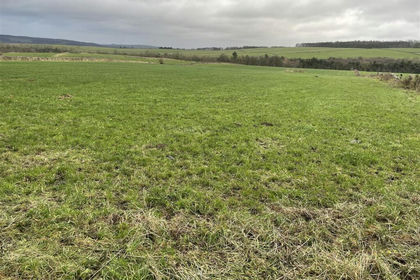
- Price
- Offers Over£125,000
- Size
- 12.59 acres
Added on 29/01/2026Grazing Land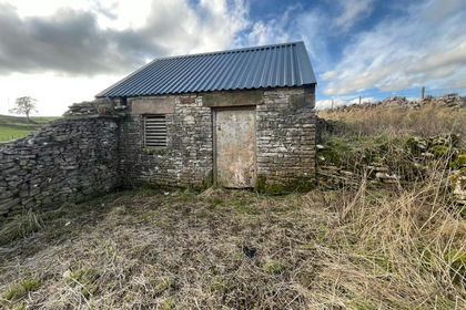
- Price
- Offers in Region of£70,000
- Size
- 6.1 acres
Land & Building at Pikehall, Matlock, Hartington Nether Quarter, Derbyshire DE4 England
Added on 07/06/2026Grazing Land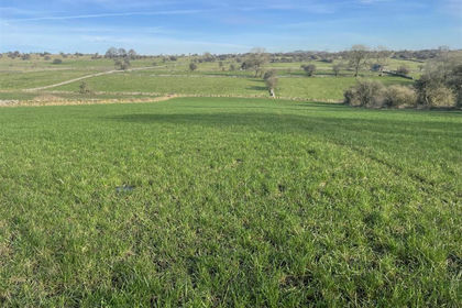
- Price
- Guide Price£60,000
- Size
- 8.24 acres
Added on 07/10/2026Agricultural Land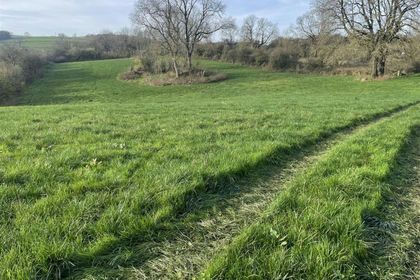
- Price
- Guide Price£90,000
- Size
- 12.39 acres
Added on 07/10/2026Grazing Land
- Price
- Guide Price£75,000
- Size
- 11.04 acres
Added on 07/10/2026Grazing Land
- Price
- Guide Price£60,000
- Size
- 8.32 acres
Hays Lane, Back O Th Brook, Waterfall, Waterhouses, Staffordshire ST10 England
Added on 02/10/2026Agricultural Land
- Price
- Guide Price£125,000
- Size
- 26.05 acres
Woodland at Hamps Valley, Waterfall, Waterhouses, Staffordshire ST10 England
Added on 05/06/2026Woodland
- Price
- Guide Price£85,000
- Size
- 12.57 acres
Retford, Nottinghamshire, Bassetlaw, Nottinghamshire DN22 England
Added on 11/07/2026Vacant Land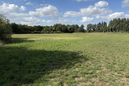
- Price
- £80,000
- Size
- 8.23 acres
Marsh Lane, Arksey, Doncaster, Doncaster, DN5, Doncaster North, Doncaster DN5 England
Added on 02/10/2026Grazing Land
- Price
- Guide Price£75,000
- Size
- 36.96 acres
Off Trent Lane, East Bridgford, Nottinghamshire, East Bridgford, Nottinghamshire NG13 England
Added on 05/04/2026Agricultural Land