Thurston, Suffolk
- Land size
- 3 acres
- Bedrooms
- 6
- Bathrooms
- 4
Description
A substantial extended modern house sitauted on the edge of this well-served village, in a mature 3-acre woodland and garden setting.
Situated in a small hamlet on the rural outskirts of this well-served village convenient for Bury St Edmunds, Hollybrook is an individual architect-designed house built of traditional construction of brick-and-block construction under a pantile roofline. The property has been cleverly designed to nestle within this mature garden setting whilst affording pleasant views from most windows, whilst ensuring a high degree of natural light throughout.
The house extends to just over 3,000ft2 with most of the accommodation on the ground floor, the property offers versatile living space, comprising large open reception hall with feature windows to the west and cloakroom, with glazed double doors leading to the living accommodation, comprising triple-aspect sitting room with open fire with wood mantel, together with bookshelves.
The dining/garden room has a large bay to the south and garden, with opening to a large kitchen/breakfast room, which is fitted with an extensive range of matching shaker-style base and eye level units with an expanse of solid wood preparation worktop with ceramic 1.5-sink unit with drainer, integrated oven and microwave, 4-ring electric hob, dishwasher, along with windows and doors to the south. There is a utility room fitted with a further range of base and eye level units, sink unit and door to the side of the house with covered porch.
The ground-floor ‘bedroom wing’ comprises a principal bedroom with dressing room with a wealth of fitted wardrobes and storage, along with an en suite shower room, whilst the two further ground-floor double bedrooms both with built in wardrobes, served by a modern bathroom, with white suite, painted tongue-and-groove panelling, low level WC, wash basin and panelled bath.
On the first floor via a spiral staircase is a large open landing/snug area and inner landing leading to a guest bedroom with en suite shower room with painted panelling, shower cubicle, WC with concealed cistern and vanity wash basin. There are two further double bedrooms served by a modern bathroom, with white suite comprising panelled bath, separate shower cubicle, WC with concealed cistern and wash basin.
Outside
Hollybrook is approached from The Planche onto a long-gravelled driveway leading to extensive parking, with double garage and workshop/store.
The formal garden wraps around the house, largely lawned along with well-stocked and landscaped beds, pond and terrace seating areas from the garden room and sitting room. There are a variety of native mature trees and shrubbery as well as a purpose-built garden studio/gym, with oak floors, power and light connected.
The remainder of the land is largely woodland and former vegetable gardens, and whilst these haven’t been tended to for some time, there is enormous scope for those looking for a small-holding or with equine interest. There are a collection of unused tin and timber sheds amongst these densely populated grassed and woodland areas.
Agents Note
The vendors will be implementing a development overage on the land, of 25% over 21 years.
Services
Mains water, drainage and electricity • Oil-fired heating • Council Tax Band ‘G’ • EPC-rating ‘D’ • Broadband: Ofcom suggest Superfast 72Mb available • Mobile: Ofcom suggest all providers likely.
Location
Hollybrook is situated about 1 mile from the village of Thurston and 6 miles east of Bury St Edmunds, the historic market, cathedral town known as the jewel in the crown of Suffolk. Bury St Edmunds is recognised for its history, beautiful outside spaces and great mix of independent and high street shops and for being Suffolk’s Foodie Town with its fantastic eateries.
The famous racing centre of Newmarket is approximately 20 miles away and the city of Cambridge is 34 miles via the A14, providing excellent shopping, recreational, cultural and educational facilities. London is easily accessible via the M11 and there is a fast train to King’s Cross (47 minutes) from Cambridge or to London Liverpool Street from Stowmarket (80 minutes).
Hollybrook is sitauted on the eastern fringes of the village, in a small hamlet identified as The Plance. From A14 east bound, taking the Beyton exit, take the left at the T-junction signposted Thurston. Around half-a-mile onwards take the next Right turn, before the village, signposted The Planche, following the road around the right and left bends, where the driveway can be found on the right hand side, signposted 'Hollybrook'.
ANTI-MONEY LAUNDERING (AML) AND ID CHECKS - In order to comply with current legislation, in the event that you make an acceptable offer and before solicitors are instructed, we must complete a number of checks for which you will be charged £30 including VAT per person (a company, trust, or similar will be charged a one-off fee of £75 including VAT).
Map Location
Property details
- Tenure
- Freehold
- Council Tax Band
- G
- Date Posted
- 2026-06-18
Market Value Analysis
Compared with 1,168 Homes with Land listings in East Anglia (1+ acres).
Utilities & Restrictions
Utilities
- Electricity
- Ask Agent
- Water
- Ask Agent
- Heating
- Ask Agent
- Broadband
- Ask Agent
- Sewerage
- Ask Agent
Rights & Restrictions
- Public Rights of Way
- Ask Agent
- Private Rights of Way
- Ask Agent
- Listed Property
- Ask Agent
- Restrictions
- Ask Agent
Listed status, conservation areas and planning constraints for this location are in the full report.
Property Features
- Accessibility
- Ask Agent
- Parking
- Parking Available
- Garden
- Garden
Beyond the particulars: planning activity, flood history, heritage and ground risks, checked for this exact spot.
Connectivity
Broadband
Fastest speed available at this postcode
80 Mbps
Superfast
Suitable for
- HD streaming
- Video calls
- Web & social
Mobile signal
Outdoor predictions; indoor signal depends on building materials.
Ofcom Connected Nations postcode-level predictions. Speeds and signal are modelled, not measured, and vary between addresses and providers.
Signal is the easy part. Planning activity, flood history and protected designations here are in the full report.
Nearest Schools
Primary
- Rougham Church of England Primary School1.5 milesOfsted: Good
- Ages
- 5 to 11
- Pupils
- 196
- Type
- Academy sponsor led
- Faith
- Church of England
- Thurston Church of England Primary Academy2 milesOfsted: Good *
- Ages
- 5 to 11
- Pupils
- 349
- Type
- Academy converter
- Faith
- Church of England
- Norton CEVC Primary School2 milesOfsted: Good *
- Ages
- 4 to 11
- Pupils
- 203
- Type
- Voluntary controlled school
- Faith
- Church of England
- Great Barton Church of England Primary Academy3 milesOfsted: Good
- Ages
- 5 to 11
- Pupils
- 188
- Type
- Academy converter
- Faith
- Church of England
- Abbots Green Primary Academy3.1 milesOfsted: Good
- Ages
- 2 to 11
- Pupils
- 608
- Type
- Academy sponsor led
Secondary
- Thurston Community College1 mileNo Ofsted rating
- Ages
- 11 to 18
- Pupils
- 1,512
- Type
- Community school
- Sybil Andrews Academy2.8 milesOfsted: Good
- Ages
- 11 to 16
- Pupils
- 657
- Type
- Academy sponsor led
- Ixworth High School4.1 milesOfsted: Good *
- Ages
- 11 to 16
- Pupils
- 512
- Type
- Free schools
- King Edward VI CEVC School5.2 milesNo Ofsted rating
- Ages
- 11 to 16
- Pupils
- 1,189
- Type
- Voluntary controlled school
- Faith
- Church of England
- Bury St Edmunds County High School5.3 milesOfsted report card · May 2026
- Ages
- 11 to 16
- Pupils
- 657
- Type
- Academy converter
* Latest graded judgement covers quality of education only; no overall grade was issued under the 2024-25 inspection framework.
Distances are straight-line from the advertised location. Source: the national school registers (DfE, Welsh Government, Scottish Government) and Ofsted.
Schools are just the start: sold prices nearby, planning activity and any flood history are in the full report.
Amenities
Supermarket
GP surgery
Pharmacy
Hospital
Green space
Straight-line distances from the advertised location. Sources: NHS records, Geolytix supermarket locations, OS Open Greenspace and the national trails registers.
The area stacks up? Now check the location itself: planning nearby, protected designations and past flooding.
Getting Around
Nearest station
Nearest bus stop
Typical drive times
Straight-line distances from the advertised location; drive times are typical free-flow times over OpenStreetMap road data, so allow more at peak. Public transport locations from DfT NaPTAN.
Easy to reach matters. So do planning activity, flood history and ground risks: all in the full report.
Flood Risk
From Environment Agency flood map open data, checked around the advertised map pin and allowing for the listed acreage where known. This summary comes from LandSale, the advertising platform, not from the listing agent, and is not part of the agent's particulars. Risk can vary across a single holding, so verify anything critical through your own searches before committing.
Rivers and the sea
Surface water
The detail behind these bandings
The full report pinpoints where this location sits on the flood maps, and runs the deeper checks that usually only surface after an offer.
- Exact flood zones & annual chances (included in the full report)
- Any recorded past flooding (included in the full report)
- Planning activity nearby (included in the full report)
- Heritage & conservation (included in the full report)
- Protected nature designations (included in the full report)
- Ground risks (included in the full report)
- Sold prices nearby (included in the full report)
£14.99 · one-off purchase
By LandSale, the platform. Not provided by the listing agent. Ready in about a minute.
Important notice: Information, maps and tags on this page are drawn from the advertising agent's marketing materials or generated automatically. LandSale has not verified them. Relying on these details is at your own risk, always carry out independent checks before committing to a purchase.
LandSale full disclaimer
Marketing information only - not formal particulars. The details on this website are provided for general guidance and do not constitute an offer or contract. Neither LandSale nor the advertising estate/land agent accepts responsibility for any inaccuracy.
1. Source of information
- Listing content: Core description, asking price, tenure, measurements, photographs and planning history originate from the marketing materials of the advertising estate or land agent. LandSale does not author this content and cannot guarantee its accuracy.
- Automated tags & categorisation: Property type, land-use class, acreage bands and similar labels may be applied by machine-learning models. They are intended as a helpful guide only and may not reflect the property's legal status or permitted use.
- Third-party & enriched data layers: Maps, boundary outlines, planning designations, soil reports, broadband coverage and other environmental or location-based insights are licensed from external suppliers. Such data are supplied “as is", may be incomplete or out of date and are subject to change without notice.
2. Verification required
Prospective purchasers must verify critical matters, including but not limited to planning permission, title boundaries, public rights of way, environmental constraints, acreage, services, access and VAT status, through their own inspections, specialist surveys, legal advisers and the selling agent before relying on the information or entering into any contract.
3. No warranty or liability
LandSale gives no warranty, express or implied, as to the accuracy, completeness or fitness for any particular purpose of the information displayed. LandSale shall not be liable for any loss, damage, cost or expense arising directly or indirectly from any use of or reliance on such information, save where liability may not be excluded by law.
4. Updates & feedback
If you believe any detail on this listing is inaccurate, please let us know. We will investigate and, where appropriate, update the listing or notify the agent.
© LandSale | Version 1.3 - August 2026
Listing agent
Bedfords, Bury St Edmunds
15 Guildhall Street, Bury St. Edmunds, IP33 1QD
View agent profileSimilar properties for sale
- Price
- Guide Price£995,000
- Size
- 1.25 acres
Added on 27/06/2026House with Land
- Price
- Guide Price£845,000
- Size
- 1.05 acres
The Park, Great Barton, Bury St. Edmunds, Great Barton, Suffolk IP31 England
Added on 05/07/2026House with Land
- Price
- £875,000
- Size
- 1.5 acres
Added on 01/08/2026House with Land
- Price
- Guide Price£995,000
- Size
- 1.5 acres
Cutlers Lane, Shelland, Stowmarket, Suffolk, IP14, Shelland, Suffolk IP14 England
Added on 11/06/2026Farmhouse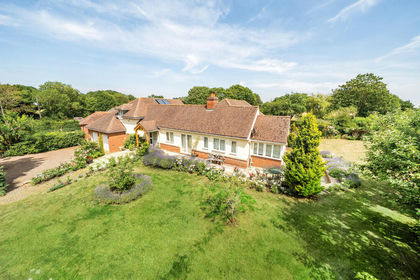
- Price
- Guide Price£975,000
- Size
- 1.8 acres
Whepstead, Bury St. Edmunds, Suffolk, Whepstead, Suffolk IP29 England
Added on 16/07/2026House with Land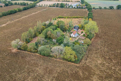
- Price
- £875,000
- Size
- 4 acres
Walsham-Le-Willows, Bury St. Edmunds, Walsham-le-Willows, Suffolk IP31 England
Added on 21/08/2026House with Land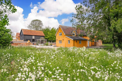
- Price
- Guide Price£975,000
- Size
- 1 acres
Added on 04/07/2026Cottage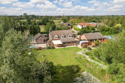
- Price
- Offers in Region of£900,000
- Size
- 1.52 acres
Walsham Road, Wattisfield, Diss, Wattisfield, Suffolk IP22 England
Added on 24/08/2026House with Land
- Price
- Guide Price£1,000,000
- Size
- 5.08 acres
Thorpe Morieux, Bury St. Edmunds, Suffolk, Thorpe Morieux, Suffolk IP30 England
Added on 24/07/2026Development Land
- Price
- Guide Price£1,100,000
- Size
- 1.02 acres
Bury Road, Hitcham, Ipswich, Suffolk, IP7, Hitcham, Suffolk IP7 England
Added on 29/01/2026House with Land