Tyr Y Mynach Barn, Clodock, Herefordshire
- Land size
- 1.44 acres
Description
SOUTH WEST HEREFORDSHIRE
Abergavenny 9 miles. Hereford 21 miles.
A HIGHLY ATTRACTIVE STONE BARN IN A GLORIOUS UNSPOILT RURAL LOCATION
TY’R Y MYNACH BARN
CLODOCK
HEREFORDSHIRE
HR2 0NZ
FOR SALE BY PRIVATE TREATY
PRICE GUIDE: £150,000
GENERAL REMARKS AND STIPULATIONS
(which where applicable shall be deemed part of the Conditions of Sale)
SITUATION
The property occupies a glorious rural location close to the village of Longtown in South West Herefordshire, close to the Monmouthshire border.
The town of Abergavenny is some 9 miles distant and the Cathedral City of Hereford some 21 miles distant.
DIRECTIONS
From Abergavenny take the A465 Hereford road for about 7 miles and in the village of Pandy turn left adjacent to the Pandy Inn, towards Longtown. Proceed along this road for about 3 miles and the property will be found on the left hand side of the road.
GRID REFERENCE
SO 377270.
WHAT THREE WORDS
salaried:forever:quietly
POST CODE
HR2 0NY.
TENURE
The property is presumed to be freehold and not subject to any restrictions of an onerous or unusual nature.
SERVICES
Mains Electricity and Water are available for connection.
Drainage will be to a private disposal system.
PLANNING CONSENT
No planning permission has been granted – the authority dealing with any applications is Herefordshire County Council
OUTGOINGS
Council Tax Banding – N/A
RIGHTS OF WAY
The property is sold subject to and with the benefit of all rights of way, wayleaves, access, water, light, drainage and other easements, quasi-easements, covenants, restrictions, orders etc, as may exist over the same or for the benefit of the same, whether mentioned in these particulars or not.
A right of way is to be grated over the vendors land via a stone track way leading off an unclassified council highway.
IMPORTANT NOTICE
These particulars are set out as a guideline only. They are intended to give a fair description of the property, but may not be relied upon as a statement or representation of fact. Photographs (and any artist’s impression) show only certain parts of the property at the time they were taken. Any areas, measurements, or distances are approximate only and should not be relied on as a statement of fact. Any reference to alterations to or use of any part of the property, is not a statement that any necessary planning, building regulations or other consent has been obtained. Descriptions of a property are inevitably subjective and those contained herein are made in good faith as an opinion and not by way of a statement of fact.
VIEWING
Viewing may be undertaken at any reasonable time.
AGENTS
RG and RB Williams, Ross Auction Centre, Overross, Ross on Wye, Tel: .
PRICE GUIDE
Offers invited based on £150,000.
PARTICULARS OF SALE
TIR Y MYNCAH BARN
CLODOCK
HEREFORDSHIRE
HR2 0NZ
AN ATTRACTIVE BARN WITH FAR REACHING VIEWS ACROSS SOUTH HEREFORDSHIRE AND SOUTH MONMOUTHSHIRE WITH PLANNING POTENTIAL
(Subject To Planning Consent)
Historically, Ty’r Mynach is understood to have close connections with Llanthony Priory and the wider ecclesiastical history of the Olchon Valley and Clodock area. Following repeated attacks on Llanthony Priory between the 12th and 15th centuries, it is believed that the monks temporarily abandoned the priory and utilised a number of nearby properties, including Ty’r Mynach and Olchon Court, as places of refuge and religious safe houses, in addition to relocating at times to Gloucester.
Local tradition suggests that the monks and friars travelled across the hills via the historic “Rhiw Cwrw” or “Beer Path” between Llanthony, Ty’r Mynach, and Longtown. The holding is also understood to have origins dating back to the Domesday period.
By the mid-19th century, records indicate that part of the farm was owned by Reverend Charles Probert, with the remaining section owned by John Jones. Given Llanthony Priory’s historical connection with Clodock Church, it is likely that the land and surrounding holdings were formerly associated with the priory estate.
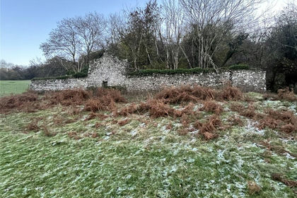
The barn itself displays a number of intriguing historic features. An oak beam within the centre of the building bears the hand-carved date “1639”, while the overall form and character of the structure, including the arrangement of windows and internal features, suggest the building may once have served a domestic or residential purpose rather than purely agricultural use. Local anecdotal history further suggests that the building may have been described historically as a barn to avoid taxation.
Evidence of a small pond adjacent to the building also remains visible, believed to have been used historically for the keeping of fish, an important dietary staple within monastic communities.
THE BUILDING
Ty’r Y Mynach barn is approached over a private entrance driveway leading off an unclassified council highway. The property is set at the foothills of Hattrall Hill, with far reaching views across South Herefordshire and Monmouthshire. Constructed of stone elevations under a corrugated iron roof, Ty’r Y Mynach Barn. The property offers opportunity for conversion subject to obtaining relevant planning consents.
Surrounding the property is approximately 1.44 acres of pasture land that compliments the property offering it leisure, equestrian and agricultural uses.
ADDITIONAL LAND
Additional land may be available by separate negotiation.
Map Location
Property details
- Tenure
- Ask Agent
- Council Tax Band
- Ask Agent
- Date Posted
- 2026-06-14
Market Value Analysis
Compared with 3 Barns listings in West Midlands (1+ acres).
Utilities & Restrictions
Utilities
- Electricity
- Ask Agent
- Water
- Ask Agent
- Heating
- Ask Agent
- Broadband
- Ask Agent
- Sewerage
- Ask Agent
Rights & Restrictions
- Public Rights of Way
- Ask Agent
- Private Rights of Way
- Ask Agent
- Listed Property
- Ask Agent
- Restrictions
- Ask Agent
Listed status, conservation areas and planning constraints for this location are in the full report.
Property Features
- Accessibility
- Ask Agent
- Parking
- Parking Available
- Garden
- Ask Agent
Beyond the particulars: planning activity, flood history, heritage and ground risks, checked for this exact spot.
Connectivity
Broadband
Fastest speed available at this postcode
17 Mbps
Standard (10-30 Mbps)
Suitable for
- Web & social
- Music streaming
- Standard video calls
Mobile signal
Outdoor predictions; indoor signal depends on building materials.
Ofcom Connected Nations postcode-level predictions. Speeds and signal are modelled, not measured, and vary between addresses and providers.
Signal is the easy part. Planning activity, flood history and protected designations here are in the full report.
Nearest Schools
Primary
- Longtown Community Primary School1.4 milesNo Ofsted rating
- Ages
- 4 to 11
- Pupils
- 48
- Type
- Community school
- Ewyas Harold Primary School4.4 milesOfsted: Requires improvement
- Ages
- 4 to 11
- Pupils
- 92
- Type
- Community school
- Michaelchurch Escley Primary School5.2 milesNo Ofsted rating
- Ages
- 4 to 11
- Pupils
- 63
- Type
- Community school
- Peterchurch Primary School7.3 milesOfsted: Good
- Ages
- 4 to 11
- Pupils
- 103
- Type
- Community school
- Kingstone and Thruxton Primary School8.5 milesNo Ofsted rating
- Ages
- 3 to 11
- Pupils
- 202
- Type
- Academy converter
Secondary
- Fairfield High School7.1 milesOfsted: Outstanding
- Ages
- 11 to 16
- Pupils
- 607
- Type
- Academy converter
- Kingstone High School8.5 milesNo Ofsted rating
- Ages
- 11 to 16
- Pupils
- 568
- Type
- Academy converter
- The Steiner Academy Hereford10 milesOfsted: Good
- Ages
- 3 to 16
- Pupils
- 345
- Type
- Academy sponsor led
- The Hereford Church of England Academy13 milesOfsted: Requires improvement
- Ages
- 11 to 16
- Pupils
- 647
- Type
- Academy sponsor led
- Faith
- Christian
- Whitecross Hereford14 milesOfsted: Good
- Ages
- 11 to 16
- Pupils
- 942
- Type
- Academy converter
Distances are straight-line from the advertised location. Source: the national school registers (DfE, Welsh Government, Scottish Government) and Ofsted.
Schools are just the start: sold prices nearby, planning activity and any flood history are in the full report.
Amenities
Supermarket
GP surgery
Pharmacy
Hospital
Walking trail
Straight-line distances from the advertised location. Sources: NHS records, Geolytix supermarket locations, OS Open Greenspace and the national trails registers.
The area stacks up? Now check the location itself: planning nearby, protected designations and past flooding.
Getting Around
Nearest station
Nearest bus stop
Typical drive times
Straight-line distances from the advertised location; drive times are typical free-flow times over OpenStreetMap road data, so allow more at peak. Public transport locations from DfT NaPTAN.
Easy to reach matters. So do planning activity, flood history and ground risks: all in the full report.
Flood Risk
From Environment Agency flood map open data, checked around the advertised map pin and allowing for the listed acreage where known. This summary comes from LandSale, the advertising platform, not from the listing agent, and is not part of the agent's particulars. Risk can vary across a single holding, so verify anything critical through your own searches before committing.
Rivers and the sea
Surface water
The detail behind these bandings
The full report pinpoints where this location sits on the flood maps, and runs the deeper checks that usually only surface after an offer.
- Exact flood zones & annual chances (included in the full report)
- Any recorded past flooding (included in the full report)
- Planning activity nearby (included in the full report)
- Heritage & conservation (included in the full report)
- Protected nature designations (included in the full report)
- Ground risks (included in the full report)
- Sold prices nearby (included in the full report)
£14.99 · one-off purchase
By LandSale, the platform. Not provided by the listing agent. Ready in about a minute.
Important notice: Information, maps and tags on this page are drawn from the advertising agent's marketing materials or generated automatically. LandSale has not verified them. Relying on these details is at your own risk, always carry out independent checks before committing to a purchase.
LandSale full disclaimer
Marketing information only - not formal particulars. The details on this website are provided for general guidance and do not constitute an offer or contract. Neither LandSale nor the advertising estate/land agent accepts responsibility for any inaccuracy.
1. Source of information
- Listing content: Core description, asking price, tenure, measurements, photographs and planning history originate from the marketing materials of the advertising estate or land agent. LandSale does not author this content and cannot guarantee its accuracy.
- Automated tags & categorisation: Property type, land-use class, acreage bands and similar labels may be applied by machine-learning models. They are intended as a helpful guide only and may not reflect the property's legal status or permitted use.
- Third-party & enriched data layers: Maps, boundary outlines, planning designations, soil reports, broadband coverage and other environmental or location-based insights are licensed from external suppliers. Such data are supplied “as is", may be incomplete or out of date and are subject to change without notice.
2. Verification required
Prospective purchasers must verify critical matters, including but not limited to planning permission, title boundaries, public rights of way, environmental constraints, acreage, services, access and VAT status, through their own inspections, specialist surveys, legal advisers and the selling agent before relying on the information or entering into any contract.
3. No warranty or liability
LandSale gives no warranty, express or implied, as to the accuracy, completeness or fitness for any particular purpose of the information displayed. LandSale shall not be liable for any loss, damage, cost or expense arising directly or indirectly from any use of or reliance on such information, save where liability may not be excluded by law.
4. Updates & feedback
If you believe any detail on this listing is inaccurate, please let us know. We will investigate and, where appropriate, update the listing or notify the agent.
© LandSale | Version 1.3 - August 2026
Listing agent
RG & RB Williams, Ross-On-Wye
Ross Auction Centre, Netherton Road, Overross, Ross-On-Wye, HR9 7QQ
View agent profileSimilar properties for sale
- Price
- £170,000
- Size
- 13 acres
Added on 29/01/2026Redevelopment Land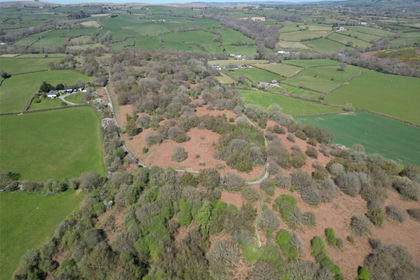
- Price
- Offers in Excess of£120,000
- Size
- 68.82 acres
Added on 29/01/2026Grazing Land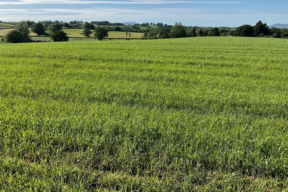
- Price
- Guide Price£120,000
- Size
- 9.19 acres
Lot 2: Land Formerly Part of Berllanderi, Raglan, Usk, Raglan, Monmouthshire NP15 Wales
Added on 22/06/2026Farmland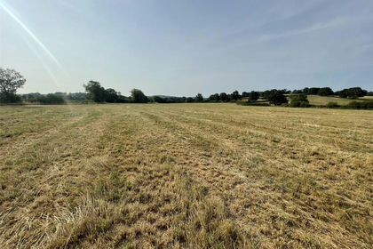
- Price
- Offers in Excess of£125,000
- Size
- 12.75 acres
Usk, Monmouthshire, NP15, Llantrisant Fawr, Monmouthshire NP15 Wales
Added on 29/07/2026Grazing Land
- Price
- Offers Over£170,000
- Size
- 23.88 acres
Gwernesney, Usk, Monmouthshire, NP15, Llantrisant Fawr, Monmouthshire NP15 Wales
Added on 21/05/2026Pasture
- Price
- Guide Price£130,000
- Size
- 11.27 acres
Proberts Barn Lane, Lydbrook, Gloucestershire, GL17, Lydbrook, Gloucestershire GL17 England
Added on 11/06/2026Grazing Land
- Price
- Offers Over£140,000
- Size
- 12.42 acres
Itton, Chepstow, Monmouthshire, NP16, Devauden, Monmouthshire NP16 Wales
Added on 18/08/2026Agricultural Land
- Price
- Guide Price£165,000
- Size
- 10.75 acres
Added on 18/03/2026PastureLeasehold
- Price
- Guide Price£160,000
- Size
- 21.3 acres
Added on 26/02/2026Pasture
- Price
- Offers in Region of£160,000
- Size
- 11.63 acres
Michaelston-Y-Fedw, Cefn Mably, Rudry, Caerphilly CF83 Wales
Added on 29/01/2026Grazing Land