Waters Upton, Shropshire, TF6
- Land size
- 168.02 acres
- Bedrooms
- 5
- Bathrooms
- 2
Key Features
- Approx. 168.02 acres of productive agricultural land
- A traditional five bedroom farmhouse, currently used as offices
- Horseshoe range of barns, converted to laboratories and research buildings, with courtyard garden
- Large secure yard area with a range of modern buildings
- Rural and accessible location
- For sale by private treaty, available as a whole or in lots as indicated
Description
A highly versatile and strategically located farm with a unique blend of residential, commercial and agricultural assets.
Description
Shray Hill Farm comprises a productive arable farm extending to 170.72 acres (68.87 hectares). The farm has been operated as a specialist agricultural research and development facility and has undergone significant investment in the last six years.
Situation
Shray Hill Farm is situated in an excellent location to the east of Shropshire in a prominent agricultural area and in close proximity to the sought after villages of Waters Upton and Tibberton which both have a small range of local amenities, including a public house, village shop and butchers. The A442 connecting Waters Upton to Telford is only 2 miles from the farm, 7 miles from the M54, heading to the West Midlands and the wider road network. Newport is the closest town, located 6 miles to the east of the farm, with a range of independent and high street shops, doctors surgeries as well as cafes, restaurants and other amenities. Newport Show is hosted yearly at Chetwynd Deer Park and is the major annual event in the town. There are a number of primary schools in the locality including both Crudgington Primary and Tibberton C of E Primary School, as well as Castle House School, an independent preparatory school.
The Farmhouse
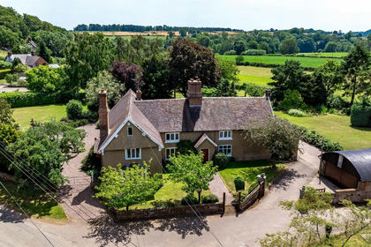
Shray Hill Farmhouse is a late Victorian country residence with large mature gardens occupying spectacular views of the Wrekin and Shropshire countryside. The house is approached from the sweeping driveway to the west with additional access adjacent to the barns, currently operated as a one-way system. Internally, the farmhouse has been converted to office accommodation (planning reference TWC/2020/0798). The building has undergone extensive internal refurbishment, whilst retaining the original layout and its traditional character. The farmhouse offers spacious accommodation arranged over two floors. The impressive entrance hall with seating area provides access to what was formerly the dining room, the grand drawing room with two open fireplaces and formal study with oak panelled walls. Off the dining room is a modern fitted kitchen, through to a shower room, W.C and snug. To the first floor, there are five large bedrooms, currently used as offices.
Horseshoe Barns
The traditional courtyard range of former agricultural buildings has been converted into a comprehensive laboratory and research complex (TWC/2021/0237 and TWC/2021/0761). The buildings have undergone extensive refurbishment, including significant structural works and underpinning. The conversion has retained the character of the traditional buildings whilst delivering modern, high-quality internal accommodation. The barns offer scope and flexibility for continued commercial and research use and, subject to the necessary planning consents, may also be well suited to future conversion to residential accommodation. There is a range of general-purpose modern buildings to the south of the barns, extending to approximately 765sqm (8,230 sqft).
Land
The agricultural land extends to approximately 168.02 acres (67.99 hectares) of productive agricultural land and is divided by the B5062 into land to the north and south of the road. The land to the south of the road is the more traditional agricultural element of the holding extending to approximately 95.12 acres and has benefited from improved drainage. The land to the north of the road extends to approximately 75.48 acres and has benefited from significant infrastructure investment. A substantial internal access track runs through the holding, dividing the land into four operational quadrants. Approximately 4.12 acres accommodates the internal access track, reservoir and associated infrastructure. The land is of good quality, a combination of Grade 2 and Grade 3.
Reservoir
The reservoir has a capacity of approximately 13 million litres and is connected to underground irrigation pipework across the north field. The north-eastern parcel includes polytunnel structures. There is no water supply to this reservoir apart from the collection of water from the polytunnels and pumping it from nearby ponds. There is an area to the west of the polytunnels comprising a vineyard and orchard.
Method of Sale
Shray Hill Farm is offered for sale by private treaty as a whole or in 4 lots.
Lot 1
Lot 1: Farmhouse, garden, general purpose modern buildings and yard, together with paddocks extending to 21.85 acres (8.84 ha) in total (£1,295,000 guide)
Lot 2
Lot 2: Horseshoe range of converted barns, laboratories and research buildings extending to 0.47 acre (0.19 ha) (£650,000)
Lot 3
Lot 3: Agricultural land to the south of the B5062, extending to 72.92 acres (29.51 ha) (£945,000)
Lot 4
Lot 4: Arable land to the north of the B5062 including a reservoir, infrastructure and polytunnels, extending to 75.48 acres (30.55 ha) (£1,110,000)
Services
The property has the benefit of mains water and three phase electricity. The farmhouse has oil fired central heating and drainage via a private treatment plant.
Easements, Covenants and Rights of Way
The property is being sold subject to and with the benefit of all rights including, rights of way whether public or private, light, support, drainage, water and electricity supplied and other rights and obligations, easements and quasi-easements and restrictive covenants and all existing and proposed wayleaves for masts, pylons, stays, cables, drains, water and gas and other pipes whether referred to in these particulars or not.
Sporting, Timber and Mineral Rights
All sporting, timber and mineral rights are included in the freehold sale in so far as they are owned.
EPC and Taxation
Shray Hill Farmhouse: EPC rating Band E. Converted Barns: EPC rating Band C. The local authority is Telford and Wrekin Council. The property is currently subject to Business Rates, the current rateable value is £32,250.
Fixtures and Fittings
All fixtures, fittings and chattels whether referred to or not are specifically excluded from the sale including carpets, curtains, light fittings, free standing domestic and electric items, garden ornaments and machinery.
VAT
Any guide price quoted or discussed is exclusive of VAT. In the event that a sale of the property or any part of it, or any right attached to it, becomes a chargeable supply for the purposes of VAT, such tax will be payable in addition.
Purchaser Indentification
In accordance with Money Laundering Regulations, proof of identification for all purchasers will be required through Thirdfort.
Map Location
Property details
- Tenure
- Ask Agent
- Council Tax Band
- TBC
- Date Posted
- 2026-06-13
Market Value Analysis
Compared with 19 Farms & Smallholdings listings in West Midlands (100+ acres).
Utilities & Restrictions
Utilities
- Electricity
- Ask Agent
- Water
- Ask Agent
- Heating
- Ask Agent
- Broadband
- Ask Agent
- Sewerage
- Ask Agent
Rights & Restrictions
- Public Rights of Way
- Ask Agent
- Private Rights of Way
- Ask Agent
- Listed Property
- Ask Agent
- Restrictions
- Ask Agent
Listed status, conservation areas and planning constraints for this location are in the full report.
Property Features
- Accessibility
- Ask Agent
- Parking
- Parking Available
- Garden
- Garden
Beyond the particulars: planning activity, flood history, heritage and ground risks, checked for this exact spot.
Connectivity
Broadband
Fastest speed available at this postcode
1.8 Gbps
Gigabit full fibre
Suitable for
- 4K streaming on every screen
- Full-time home working
- Online gaming & big downloads
Mobile signal
Outdoor predictions; indoor signal depends on building materials.
Ofcom Connected Nations postcode-level predictions. Speeds and signal are modelled, not measured, and vary between addresses and providers.
Signal is the easy part. Planning activity, flood history and protected designations here are in the full report.
Nearest Schools
Primary
- Crudgington Primary School1.4 milesNo Ofsted rating
- Ages
- 4 to 11
- Pupils
- 132
- Type
- Academy converter
- Tibberton Church of England Primary School1.8 milesOfsted: Good
- Ages
- 3 to 11
- Type
- Academy converter
- Faith
- Church of England
- St Lawrence Church of England Voluntary Controlled Primary School3 milesOfsted: Good
- Ages
- 3 to 11
- Type
- Academy converter
- Faith
- Church of England
- St Peter's Bratton Church of England Academy3.6 milesOfsted: Requires improvement
- Ages
- 5 to 11
- Pupils
- 397
- Type
- Academy converter
- Faith
- Church of England
- Apley Wood Primary Academy3.9 milesNo Ofsted rating
- Ages
- 4 to 11
- Pupils
- 407
- Type
- Academy converter
Secondary
- Charlton School4.1 milesOfsted report card · Apr 2026
- Ages
- 11 to 16
- Pupils
- 1,218
- Type
- Academy sponsor led
- Hadley Learning Community - Secondary Phase4.8 milesNo Ofsted rating
- Ages
- 11 to 16
- Pupils
- 1,237
- Type
- Academy converter
- New Road Academy5.1 milesOfsted: Requires improvement
- Ages
- 11 to 16
- Pupils
- 1,073
- Type
- Academy sponsor led
- Ercall Wood Academy5.3 milesOfsted: Good *
- Ages
- 11 to 16
- Pupils
- 971
- Type
- Academy converter
- Haberdashers' Adams5.5 milesOfsted: Good
- Ages
- 11 to 18
- Pupils
- 1,090
- Type
- Academy converter
* Latest graded judgement covers quality of education only; no overall grade was issued under the 2024-25 inspection framework.
Distances are straight-line from the advertised location. Source: the national school registers (DfE, Welsh Government, Scottish Government) and Ofsted.
Schools are just the start: sold prices nearby, planning activity and any flood history are in the full report.
Amenities
Supermarket
GP surgery
Pharmacy
Hospital
Straight-line distances from the advertised location. Sources: NHS records, Geolytix supermarket locations, OS Open Greenspace and the national trails registers.
The area stacks up? Now check the location itself: planning nearby, protected designations and past flooding.
Getting Around
Nearest station
Nearest bus stop
Typical drive times
Straight-line distances from the advertised location; drive times are typical free-flow times over OpenStreetMap road data, so allow more at peak. Public transport locations from DfT NaPTAN.
Easy to reach matters. So do planning activity, flood history and ground risks: all in the full report.
Flood Risk
From Environment Agency flood map open data, checked around the advertised map pin and allowing for the listed acreage where known. This summary comes from LandSale, the advertising platform, not from the listing agent, and is not part of the agent's particulars. Risk can vary across a single holding, so verify anything critical through your own searches before committing.
Rivers and the sea
Mapped within the area searched, not at the advertised map pin itself.
Surface water
Mapped within the area searched, not at the advertised map pin itself.
These bandings are the summary. Where this location sits on the flood maps, plus planning activity, heritage and ground risks, is in the full report.
Important notice: Information, maps and tags on this page are drawn from the advertising agent's marketing materials or generated automatically. LandSale has not verified them. Relying on these details is at your own risk, always carry out independent checks before committing to a purchase.
LandSale full disclaimer
Marketing information only - not formal particulars. The details on this website are provided for general guidance and do not constitute an offer or contract. Neither LandSale nor the advertising estate/land agent accepts responsibility for any inaccuracy.
1. Source of information
- Listing content: Core description, asking price, tenure, measurements, photographs and planning history originate from the marketing materials of the advertising estate or land agent. LandSale does not author this content and cannot guarantee its accuracy.
- Automated tags & categorisation: Property type, land-use class, acreage bands and similar labels may be applied by machine-learning models. They are intended as a helpful guide only and may not reflect the property's legal status or permitted use.
- Third-party & enriched data layers: Maps, boundary outlines, planning designations, soil reports, broadband coverage and other environmental or location-based insights are licensed from external suppliers. Such data are supplied “as is", may be incomplete or out of date and are subject to change without notice.
2. Verification required
Prospective purchasers must verify critical matters, including but not limited to planning permission, title boundaries, public rights of way, environmental constraints, acreage, services, access and VAT status, through their own inspections, specialist surveys, legal advisers and the selling agent before relying on the information or entering into any contract.
3. No warranty or liability
LandSale gives no warranty, express or implied, as to the accuracy, completeness or fitness for any particular purpose of the information displayed. LandSale shall not be liable for any loss, damage, cost or expense arising directly or indirectly from any use of or reliance on such information, save where liability may not be excluded by law.
4. Updates & feedback
If you believe any detail on this listing is inaccurate, please let us know. We will investigate and, where appropriate, update the listing or notify the agent.
© LandSale | Version 1.3 - August 2026
Similar properties for sale
- Price
- Guide Price£3,250,000
- Size
- 214.51 acres
Lee Hall Farm, Lee Brockhurst, Shrewsbury, Moreton Corbet and Lee Brockhurst, Shropshire SY4 England
Added on 15/09/2026Farm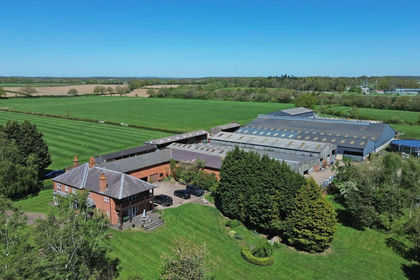
- Price
- Offers Over£5,000,000
- Size
- 172 acres
Lower Lynbrook Farm, Newchurch, Hoar Cross, DE13, Yoxall, Staffordshire DE13 England
Added on 10/05/2026Country Estate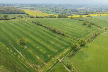
- Price
- £3,145,000
- Size
- 241.52 acres
Parsonage Farm, Kyre, Tenbury Wells, Worcestershire, Kyre, Worcestershire WR15 England
Added on 14/05/2026Farm
- Price
- Offers in Excess of£5,000,000
- Size
- 125 acres
Plumley, Knutsford, Cheshire, Plumley, Cheshire East WA16 England
Added on 29/01/2026Country Estate
- Price
- Offers in Excess of£3,750,000
- Size
- 121.66 acres
Plumley, Knutsford, Cheshire, Plumley, Cheshire East WA16 England
Added on 29/01/2026Country Estate
- Price
- Guide Price£3,000,000
- Size
- 144.5 acres
Sinton Green, Hallow, WR2, Grimley, Worcestershire WR2 England
Added on 16/06/2026Farm