Abberley, Worcester, Worcestershire
- Land size
- 226 acres
- Bedrooms
- 6
Key Features
- Ring-fenced farm extending to about 226 acres
- Flexible six-bedroom accommodation arranged as two dwellings
- Useful range of traditional and modern farm buildings
- Planning permission for two new grain stores
- Predominantly productive arable land
- Private setting at the end of a long driveway
- Orchard, pastureland and picturesque pools
- Superb farming or lifestyle opportunity
Description
A ringfenced arable farm with a period farmhouse, traditional barn and courtyard of modern barns. Planning permission for two new grain stores. Mainly arable land. In all about 226 acres.
As a whole about 226.00 acres (91.46 ha)
Description
• Lower Sneads Farm comprises of a Grade II listed farmhouse that is currently occupied as two dwellings.
• There is a traditional red brick granary barn that is incorporated within the range of modern farm buildings.
• The farmstead is situated at the end of a long private drive towards the centre of its farmland.
• The farmland is mainly arable with some permanent grassland.
• The fields are gently rolling and of a good size with excellent access.
• Planning permission has been recently approved for the erection of two new grain stores.
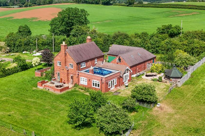
Lower Snead Farmhouse
Lower Snead Farmhouse is a timber framed property that is Grade II listed, it dates back to the early 17th century.
The accommodation is currently divided into two separate dwellings but could be very easily adapted to live as one large home.
The accommodation comprises: porch, 2 reception rooms, 2 kitchens, boot room, pantry and wood store with 6 bedrooms and 2 bathrooms on the first floor, extending in total to 3,289 sq ft.
Outside are level gardens and an orchard.
Planning Permission
• In February 2026 planning permission was granted for two 60 x 90 ft (14 ft to eaves) agricultural buildings under application number 26/0047/AG.
• There was another application (ref. 26/0585/FUL) which was refused in October 2026. This application was for a further agricultural building, plus a three bedroom rural workers’ dwelling.
• The approved new buildings sit in an elevated position with outstanding and far-reaching views.
• There is an existing double gated access from the B4202 Abberley to Clows Top Road, the approach would be along a private drive.
• This is an excellent opportunity to create a modern farmyard in a ring fenced block of land.
The Farmland
In total the property comprises about 226.00 acres (91.46 hectares) in a ring-fenced unit, bounded by brooks and streams. The farmland is gently rolling and split into well apportioned parcels dived by mature, well maintained hedgerows.
The land is mainly arable and has been farmed in a typical arable rotation with some SFI options in recent years the details of which can be made available on request. The arable land accounts for about 183.87 acres (74.41 hectares). There are three parcels of permanent grassland which is used for grazing and hay production. The grassland accounts for about 28.09 acres (11.37 hectares) and is fenced with access to water. The balance of the acreage is made up wooded shelter belts following the boundaries of the holding, the pools, tracks and the farmyard.
The pools are located on the northern boundary and are naturally filled by the brook. They are well maintained and currently provide a haven for wildlife but could offer potential alternate uses for fishing or water abstraction subject to the necessary consents.
The Predictive Agricultural Land Classification Map for England classifies the soils as:
• Grade 1 - 33.21%
• Grade 2 - 24.75%
• Grade 3a - 35.90%
• Grade 3b - 5.68%
The National Soil Map describes about 65% of the soils to the north of the property belonging within the Bromyard Soil Series which consists of well-drained, reddish, medium silt clay loams or silt loams over Devonian siltstone and shale. The remaining 35% of soils belong to the Bardsey Soil Series which consists of slowly permeable, seasonally waterlogged loamy-over-clayey and fine silty soil lying over soft rock. These soils are reasonably flexible and well suited to grass production and autumn sown cereal crops.
Situation
Abberley is an attractive rural village in west Worcestershire, occupying a peaceful position between the valleys of the Rivers Severn and Teme.
The parish extends along the wooded ridge of Abberley Hill and has a pleasantly dispersed character, with houses, cottages and farmsteads grouped around the old village, The Common and surrounding greens.
The village has a rich architectural and landscape heritage, with landmarks including the historic Church of St Michael, Abberley Hall and its distinctive clock tower. Abberley Hill forms part of the wider Abberley and Malvern Hills Geopark, while the Worcestershire Way provides excellent walking through mature woodland and open countryside, with extensive views across the county.
Local facilities include a village shop and Post Office, a primary school and village hall. A broader range of shops, services and leisure amenities can be found in Great Witley, Stourport-on-Severn, Bewdley and Worcester.
The area is well placed for access to the county town, the Wyre Forest and the wider West Midlands road network, combining an appealing countryside setting with convenient links to regional centres.
Fixtures and fittings
The carpets, curtains and all other fixtures and fittings, garden ornaments and statuary are excluded. Some may be available by separate negotiation. The inclusion or exclusion of any agricultural fixtures and fittings is to be discussed and agreed.
Services
The farmhouse and the cottage are connected to mains water and electricity with separate private septic tank drainage systems. Heating for each dwelling is an via oil-fired central heating system with Rayburns and additional secondary heating by way of a log burner in each.
The farm buildings benefit from mains water and a single phase electricity supply.
None of the services or appliances, heating installations, plumbing or electrical systems have been tested by the selling agents.
If the private drainage system requires updating/replacement, it is assumed that prior to offers being made, associated costs have been considered and are the responsibility of the purchaser. Interested parties are advised to make their own investigations, no further information will be provided by the selling agents.
The estimated fastest download speed currently achievable for the property postcode area is around 1800 Mbps (data taken from checker.ofcom.org.uk on 13/10/2026). Actual service availability at the property or speeds received may be different.
We understand that the property is likely to have current mobile coverage (data taken from checker.ofcom.org.uk on 13/10/2026). Please note that actual services available may be different depending on the particular circumstances, precise location and network outages.
Tenure
The land is sold freehold and vacant possession will be available on completion.
The property is registered under title numbers: WR47544, HW200630 and WR73565. Part of the farm is currently unregistered but first registration is underway.
Method of sale
The property is offered for sale by Private Treaty method. However, the vendor reserves the right to conclude the sale by an alternative method if required.
Value Added Tax (VAT)
We understand the property has not been opted to tax and therefore VAT will not be chargeable in addition to the purchase price. In the event that a sale of the property or any part thereof or any right to it becomes a chargeable supply for the purposes of VAT, such tax will be payable in addition to the sale price.
Sporting, Timber and Mineral Rights
The sporting, timber and mineral rights will be transferred with the freehold title where owned.
Nitrate Vulnerable Zone (NVZ)
The Property lies within a Surface Water Nitrate Vulnerable Zone (NVZ) Area and is subject to the usual restrictions.
Local Authority
Wyre Forest District Council
Public rights of way, wayleaves and easements
The Property is sold subject to and with the benefit of all easements, quasi easements, wayleaves and rights of way both declared and undeclared.
Environmental Schemes
The farmland is entered into an SFI agreement running September 2024 to 2027. Options include SAM1, LIG1, AHL4 and SAM3. Further details available on request.
Planning
The selling agents will not provide advice/guidance on the planning history for the property/land. Interested parties are advised to make their own investigations. It is assumed that enquiries have been satisfied, prior to an offer being made.
Anti Money Laundering Regulations (AML)
In accordance with Anti Money Laundering Regulations (AML), we are required to request forms of identification and carry out due diligence on any parties connected to a successful offer. Should an offer be made on behalf of a business/company, AML due diligence will also be necessary. Proof/source of funding must be supplied, prior to offer acceptance.
Plans and boundaries
The plans within these particulars are based on Ordnance Survey data and provided for reference only. They are believed to be correct but accuracy is not guaranteed. The purchaser shall be deemed to have full knowledge of all boundaries and the extent of ownership. Neither the vendor nor the vendor’s agents will be responsible for defining the boundaries or the ownership thereof. More detailed boundary plans of the property are available on request.
Holdover and ingoing valuation
If required, provision may need to be made for holdover and ingoing valuation of the growing crops.
Listed Buildings
There are two Grade II listed buildings being, Lower Snead Farmhouse (List Entry No. 1139028) and the Cow House and Barn approximately 25 metres south of the farmhouse (List Entry No. 1100729).
Viewings
Strictly by appointment through Fisher German LLP.
Directions
Postcode – WR6 6AF
what3words - ///rocked.appoints.rollover
Map Location
Property details
- Tenure
- Ask Agent
- Council Tax Band
- TBC
- Date Posted
- 2026-10-30
Market Value Analysis
Compared with 21 Farms & Smallholdings listings in West Midlands (100+ acres).
Energy Performance Certificate
Energy Efficiency Rating
Based on UK Energy Performance Certificate standards (EU Directive 2002/91/EC)
Running costs are one side. Planning activity, flood history and ground risks for this location are in the full report.
Utilities & Restrictions
Utilities
- Electricity
- Ask Agent
- Water
- Ask Agent
- Heating
- Ask Agent
- Broadband
- Ask Agent
- Sewerage
- Ask Agent
Rights & Restrictions
- Public Rights of Way
- Ask Agent
- Private Rights of Way
- Ask Agent
- Listed Property
- Ask Agent
- Restrictions
- Ask Agent
Listed status, conservation areas and planning constraints for this location are in the full report.
Property Features
- Accessibility
- Ask Agent
- Parking
- Parking Available
- Garden
- Garden
Beyond the particulars: planning activity, flood history, heritage and ground risks, checked for this exact spot.
Connectivity
Broadband
Fastest speed available at this postcode
1.8 Gbps
Gigabit full fibre · available to 65% of premises
Suitable for
- 4K streaming on every screen
- Full-time home working
- Online gaming & big downloads
Fixed wireless access may also be an option here.
Mobile signal
Predicted 4G and 5G signal; indoor signal depends on building materials.
Ofcom Connected Nations postcode-level predictions. Speeds and signal are modelled, not measured, and vary between addresses and providers.
Signal is the easy part. Planning activity, flood history and protected designations here are in the full report.
Nearest Schools
Primary
- Abberley Parochial VC Primary School1.2 milesOfsted: Good *
- Ages
- 4 to 11
- Pupils
- 102
- Type
- Voluntary controlled school
- Faith
- Church of England
- Great Witley CofE Primary School2.6 milesNo Ofsted rating
- Ages
- 5 to 11
- Pupils
- 187
- Type
- Academy converter
- Faith
- Church of England
- Far Forest Lea Memorial CofE Primary School3.2 milesOfsted: Good *
- Ages
- 2 to 11
- Pupils
- 86
- Type
- Academy converter
- Faith
- Church of England
- Bayton CofE Primary School3.5 milesOfsted: Good *
- Ages
- 3 to 11
- Pupils
- 95
- Type
- Voluntary controlled school
- Faith
- Church of England
- Astley CofE Primary School3.6 milesOfsted report card · May 2026
- Ages
- 4 to 11
- Pupils
- 91
- Type
- Voluntary aided school
- Faith
- Church of England
Secondary
- The Bewdley School4.8 milesOfsted: Good *
- Ages
- 11 to 18
- Pupils
- 970
- Type
- Foundation school
- The Stourport High School and Sixth Form College5 milesOfsted: Good
- Ages
- 11 to 18
- Pupils
- 1,039
- Type
- Academy converter
- The Lacon Childe School5.7 milesOfsted: Requires improvement
- Ages
- 11 to 16
- Pupils
- 563
- Type
- Academy converter
- The Chantry School6 milesOfsted: Good
- Ages
- 11 to 16
- Pupils
- 881
- Type
- Academy converter
- Baxter College6.7 milesOfsted: Requires improvement *
- Ages
- 11 to 18
- Pupils
- 766
- Type
- Academy converter
* Latest graded judgement covers quality of education only; no overall grade was issued under the 2024-25 inspection framework.
Distances are straight-line from the advertised location. Source: the national school registers (DfE, Welsh Government, Scottish Government) and Ofsted.
Schools are just the start: sold prices nearby, planning activity and any flood history are in the full report.
Amenities
Supermarket
GP surgery
Pharmacy
Hospital
Straight-line distances from the advertised location. Sources: NHS records, Geolytix supermarket locations, OS Open Greenspace and the national trails registers.
The area stacks up? Now check the location itself: planning nearby, protected designations and past flooding.
Getting Around
Nearest station
Nearest bus stop
Typical drive times
Straight-line distances from the advertised location; drive times are typical free-flow times over OpenStreetMap road data, so allow more at peak. Public transport locations from DfT NaPTAN.
Easy to reach matters. So do planning activity, flood history and ground risks: all in the full report.
Flood Risk
Environment Agency open data, checked around the advertised map pin for the listed acreage. Long-term risk counts flood defences; the planning map's flood zones do not. Provided by LandSale, not the listing agent, and not part of the agent's particulars. Risk varies across a holding, so verify before committing.
Rivers and the sea
Planning map: Flood Zone 1.
Surface water
Not at the pin: mapped about 20 metres away.
These bandings are the summary. Where this location sits on the flood maps, plus planning activity, heritage and ground risks, is in the full report.
Important notice: Information, maps and tags on this page are drawn from the advertising agent's marketing materials or generated automatically. LandSale has not verified them. Relying on these details is at your own risk, always carry out independent checks before committing to a purchase.
LandSale full disclaimer
Marketing information only - not formal particulars. The details on this website are provided for general guidance and do not constitute an offer or contract. Neither LandSale nor the advertising estate/land agent accepts responsibility for any inaccuracy.
1. Source of information
- Listing content: Core description, asking price, tenure, measurements, photographs and planning history originate from the marketing materials of the advertising estate or land agent. LandSale does not author this content and cannot guarantee its accuracy.
- Automated tags & categorisation: Property type, land-use class, acreage bands and similar labels may be applied by machine-learning models. They are intended as a helpful guide only and may not reflect the property's legal status or permitted use.
- Third-party & enriched data layers: Maps, boundary outlines, planning designations, soil reports, broadband coverage and other environmental or location-based insights are licensed from external suppliers. Such data are supplied “as is", may be incomplete or out of date and are subject to change without notice.
2. Verification required
Prospective purchasers must verify critical matters, including but not limited to planning permission, title boundaries, public rights of way, environmental constraints, acreage, services, access and VAT status, through their own inspections, specialist surveys, legal advisers and the selling agent before relying on the information or entering into any contract.
3. No warranty or liability
LandSale gives no warranty, express or implied, as to the accuracy, completeness or fitness for any particular purpose of the information displayed. LandSale shall not be liable for any loss, damage, cost or expense arising directly or indirectly from any use of or reliance on such information, save where liability may not be excluded by law.
4. Updates & feedback
If you believe any detail on this listing is inaccurate, please let us know. We will investigate and, where appropriate, update the listing or notify the agent.
© LandSale | Version 1.3 - August 2026
Similar properties for sale
- Price
- Guide Price£3,000,000
- Size
- 144.5 acres
Sinton Green, Hallow, WR2, Grimley, Worcestershire WR2 England
Added on 16/06/2026Farm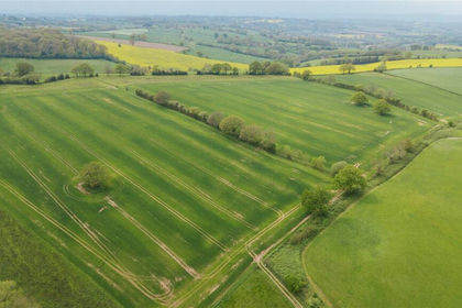
- Price
- £3,145,000
- Size
- 241.52 acres
Parsonage Farm, Kyre, Tenbury Wells, Worcestershire, Kyre, Worcestershire WR15 England
Added on 14/05/2026Farm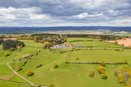
- Price
- Guide Price£3,700,000
- Size
- 286.32 acres
Pervin Farm, Hope under Dinmore, Leominster, Leominster, Herefordshire, County of HR6 England
Added on 29/01/2026Farm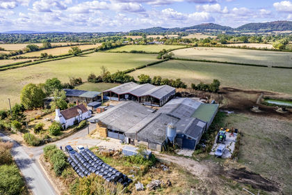
- Price
- Offers in Region of£2,740,000
- Size
- 219.64 acres
Added on 19/10/2026Farm
- Price
- £3,000,000
- Size
- 215.91 acres
Willey Presteigne LD8, Willey, Herefordshire, County of LD8 England
Added on 02/10/2026Farm
- Price
- Guide Price£3,250,000
- Size
- 214.51 acres
Lee Hall Farm, Lee Brockhurst, Shrewsbury, Moreton Corbet and Lee Brockhurst, Shropshire SY4 England
Added on 15/09/2026Farm