Hornbeam Lane, Lancaster
- Land size
- 0.19 acres
Description
LOCATION
The property is set within the medieval city of Lancaster, in the northwest of England. Lancaster is a historic city with Roman ruins and the infamous Lancaster Castle, synonymous with the trial for the Pendle Witches and the War of the Roses.
Lancaster has direct access to the M6 motorway at J33 and J34 and is approximately 25miles south of the English Lake District and 17miles west of the Yorkshire Dales National Park.
Lancaster is positioned on the west coast mainline, approximately 20miles north of Preston, and with 2hrs 35mins of London Euston. Manchester and Manchester International Airport are within 1hrs 20mins and connected by hourly rail services.
Drive times to Preston, Kendal, Carlisle, Blackburn, Bolton, Manchester and Liverpool are within approximately 1hr15m.
The District of Lancaster has a ONS recorded GDP of £4.4billion per annum and a population of 145,006 and a population growth change for 2019-2024 of 3.7%.
The district comprises the urban centres of Lancaster itself, but also Morecambe, Heysham and Carnforth along with those outlying locations such as Warton, Galgate, Caton and Hornby (which is famous for its Castle´s connection to the War of the Roses).
The city has two universities and a busy festival calendar operated and promoted by BID Lancaster, and will be the future home of Eden Project North which is assessed by Lancaster University Business School to deliver >£200m annual boost to the local economy and deliver 400 direct employed roles and a support sector gain of approximately 1,400 jobs.
DESCRIPTION
Willow Business Park offers a well-defined property which is home to a variety of construction industry occupiers. The business park is easily accessible off Hornbeam Road, this being easily accessed by vans, fixed axle and articulated vehicles.
The scheme has 7 brick / block constructed industrial units with modern metal insulated clad roofs and 5no. shipping containers used for storage (being 4no. 20ft containers and 1no. 40ft container). The whole is set around a central shared courtyard being available shared access.
There is external storage and carparking spaces to the front of the units. The site is enclosed by palisade fencing and offers hard concrete standing to all areas, including entrances and enclosed yard parts.
ACCOMMODATION
The site is held on HM Land Registry title number LA921939 (edged red on the above plan) and is noted to extend to an approximate area of 0.67 acres.
The units extend to a gross internal areas (as follows):
Unit 1 (with external area) 073.32 m2 0,789 ft2
Unit 2 (with external area) 138.85 m2 1,495 ft2
Unit 3 (with large enclosed yard) 094.62 m2 1,018 ft2
Unit 4 (with external area) 051.51 m2 0,555 ft2
Unit 5 (with external area) 051.52 m2 0,555 ft2
Unit 6a (with external area) 122.27 m2 1,316 ft2
Unit 6 (with external area) 218.91 m2 2,356 ft2
Container 1 20ft Container 2 20ft Container 3 20ft
Container 4 20ft Container 5 40ft
AMENITIES
The property is situated on the west side of the city centre, positioned on the edge of Lune Business Park or formerly Lune Industrial Estate, which is currently undergoing a significant level of inward investment by the owner; new build accommodation, refurbishments and redevelopments are being implemented - this will reinforce the commercial location and cement demand within the vicinity.
The Marsh area of Lancaster, though widely made up of housing does host the presence of Lune Business Park; this offers a variety of accommodation from 500ft2 - 15,000ft2 which offers offices, industrial workshop units, storage and distribution spaces, as well as manufacturing premises. A new creche / nursery and supermarket are anticipated, with a gym having already been implemented.
The units constructed as part of a phase one introduction have been let up and demand has been consistent since the redevelopment proposal was commenced. A phase two implementation is planned for fall of 2027. Existing occupiers to the development comprises Howdens Joinery, First Sub Sea, MP Haulage, Normesh, STS Manufacturing, Fireus and White & Company Removals.
The site is reasonably accessible via Willow Lane and its links with St Georges Quay. The city centre is 10min walk from the premises, the bus stops to Willow Lane are within a 1 and 3min walk respectively.
A Spar convenience store is within 150m of the subject premises.
The M6 is accessible via Caton Road (A589) 2.5miles northeast of site; Morecambe is easily accessible via Morecambe Road which in turn links with Bay Gateway and the Port of Heysham.
TERMS
The Freehold interest is available by way of a private treaty sale.
VAT
The agent understands the property is not elected to waive value added tax. Values noted in these details may be subject to VAT being applied at the prevailing rate.
LEGAL COSTS
Each party is responsible for their own costs. Figures are quoted exclusive of VAT.
VIEWING
Viewing is strictly by way of appointment with our joint agent, Richard P Taylor Chartered Surveyors.
Map Location
Property details
- Tenure
- Freehold
- Council Tax Band
- Ask Agent
- Date Posted
- 2026-06-12
Utilities & Restrictions
Utilities
- Electricity
- Ask Agent
- Water
- Ask Agent
- Heating
- Ask Agent
- Broadband
- Ask Agent
- Sewerage
- Ask Agent
Rights & Restrictions
- Public Rights of Way
- Ask Agent
- Private Rights of Way
- Ask Agent
- Listed Property
- Ask Agent
- Restrictions
- Ask Agent
Listed status, conservation areas and planning constraints for this location are in the full report.
Property Features
- Accessibility
- Ask Agent
- Parking
- Parking Available
- Garden
- Garden
Beyond the particulars: planning activity, flood history, heritage and ground risks, checked for this exact spot.
Connectivity
Broadband
Fastest speed available at this postcode
10 Gbps
Gigabit full fibre · available to 40% of premises
Suitable for
- 4K streaming on every screen
- Full-time home working
- Online gaming & big downloads
Mobile signal
Outdoor predictions; indoor signal depends on building materials.
Ofcom Connected Nations postcode-level predictions. Speeds and signal are modelled, not measured, and vary between addresses and providers.
Signal is the easy part. Planning activity, flood history and protected designations here are in the full report.
Nearest Schools
Primary
- Willow Lane Community Primary School359 metresOfsted: Requires improvement *
- Ages
- 4 to 11
- Pupils
- 199
- Type
- Community school
- Lancaster Dallas Road Community Primary School0.6 milesOfsted: Good
- Ages
- 4 to 11
- Pupils
- 372
- Type
- Community school
- Lancaster Ryelands Primary School0.9 milesOfsted report card · Apr 2026
- Ages
- 4 to 11
- Pupils
- 362
- Type
- Community school
- Morecambe and Heysham Grosvenor Park Primary School0.9 milesNo Ofsted rating
- Ages
- 4 to 11
- Pupils
- 320
- Type
- Community school
- The Cathedral Catholic Primary School, Lancaster1.1 milesNo Ofsted rating
- Ages
- 4 to 11
- Pupils
- 195
- Type
- Voluntary aided school
- Faith
- Roman Catholic
Secondary
- Lancaster Girls' Grammar School0.7 milesOfsted: Good
- Ages
- 11 to 18
- Pupils
- 1,038
- Type
- Academy converter
- Gender
- Girls
- Ripley St Thomas Church of England Academy0.9 milesOfsted: Outstanding
- Ages
- 11 to 18
- Pupils
- 1,755
- Type
- Academy converter
- Faith
- Church of England
- Our Lady's Catholic College0.9 milesOfsted: Requires improvement
- Ages
- 11 to 18
- Pupils
- 981
- Type
- Voluntary aided school
- Faith
- Roman Catholic
- Lancaster Royal Grammar School1.2 milesOfsted: Good
- Ages
- 11 to 18
- Pupils
- 1,294
- Type
- Academy converter
- Faith
- Christian
- Lancaster High School1.6 milesOfsted: Good
- Ages
- 11 to 16
- Pupils
- 567
- Type
- Academy converter
* Latest graded judgement covers quality of education only; no overall grade was issued under the 2024-25 inspection framework.
Distances are straight-line from the advertised location. Source: the national school registers (DfE, Welsh Government, Scottish Government) and Ofsted.
Schools are just the start: sold prices nearby, planning activity and any flood history are in the full report.
Amenities
Supermarket
GP surgery
Pharmacy
Hospital
Green space
Straight-line distances from the advertised location. Sources: NHS records, Geolytix supermarket locations, OS Open Greenspace and the national trails registers.
The area stacks up? Now check the location itself: planning nearby, protected designations and past flooding.
Getting Around
Nearest station
Nearest bus stop
Typical drive times
Straight-line distances from the advertised location; drive times are typical free-flow times over OpenStreetMap road data, so allow more at peak. Public transport locations from DfT NaPTAN.
Easy to reach matters. So do planning activity, flood history and ground risks: all in the full report.
Flood Risk
From Environment Agency flood map open data, checked around the advertised map pin and allowing for the listed acreage where known. This summary comes from LandSale, the advertising platform, not from the listing agent, and is not part of the agent's particulars. Risk can vary across a single holding, so verify anything critical through your own searches before committing.
Rivers and the sea
Surface water
Mapped within the area searched, not at the advertised map pin itself.
These bandings are the summary. Where this location sits on the flood maps, plus planning activity, heritage and ground risks, is in the full report.
Important notice: Information, maps and tags on this page are drawn from the advertising agent's marketing materials or generated automatically. LandSale has not verified them. Relying on these details is at your own risk, always carry out independent checks before committing to a purchase.
LandSale full disclaimer
Marketing information only - not formal particulars. The details on this website are provided for general guidance and do not constitute an offer or contract. Neither LandSale nor the advertising estate/land agent accepts responsibility for any inaccuracy.
1. Source of information
- Listing content: Core description, asking price, tenure, measurements, photographs and planning history originate from the marketing materials of the advertising estate or land agent. LandSale does not author this content and cannot guarantee its accuracy.
- Automated tags & categorisation: Property type, land-use class, acreage bands and similar labels may be applied by machine-learning models. They are intended as a helpful guide only and may not reflect the property's legal status or permitted use.
- Third-party & enriched data layers: Maps, boundary outlines, planning designations, soil reports, broadband coverage and other environmental or location-based insights are licensed from external suppliers. Such data are supplied “as is", may be incomplete or out of date and are subject to change without notice.
2. Verification required
Prospective purchasers must verify critical matters, including but not limited to planning permission, title boundaries, public rights of way, environmental constraints, acreage, services, access and VAT status, through their own inspections, specialist surveys, legal advisers and the selling agent before relying on the information or entering into any contract.
3. No warranty or liability
LandSale gives no warranty, express or implied, as to the accuracy, completeness or fitness for any particular purpose of the information displayed. LandSale shall not be liable for any loss, damage, cost or expense arising directly or indirectly from any use of or reliance on such information, save where liability may not be excluded by law.
4. Updates & feedback
If you believe any detail on this listing is inaccurate, please let us know. We will investigate and, where appropriate, update the listing or notify the agent.
© LandSale | Version 1.3 - August 2026
Listing agent
Tiger Sales & Lettings, Blackpool
56 Highfield Road, Blackpool, FY4 2JA
Similar properties for sale
 Added on 19/02/2026Commercial Land
- Price
- Offers in Region of£395,000
New Inn 59 Main Road, Galgate, LA2, Ellel, Lancashire LA2 England
Added on 22/06/2026Pub Added on 17/07/2026Pub
- Price
- £425,000
Added on 08/08/2026Pub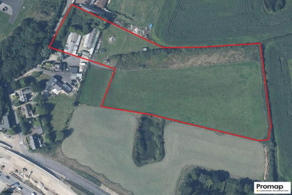
- Price
- £475,000
- Size
- 4.85 acres
Property Development, Lancashire, Singleton, Lancashire FY6 England
Added on 16/05/2026Development Land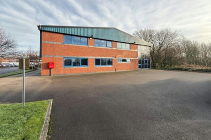
- Price
- Offers in Region of£550,000
- Size
- 0.15 acres
Added on 18/06/2026Warehouse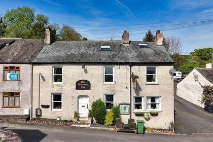
- Price
- Offers in Region of£450,000
Penny Bridge, Ulverston, Egton with Newland, Westmorland and Furness LA12 England
Added on 29/01/2026Pub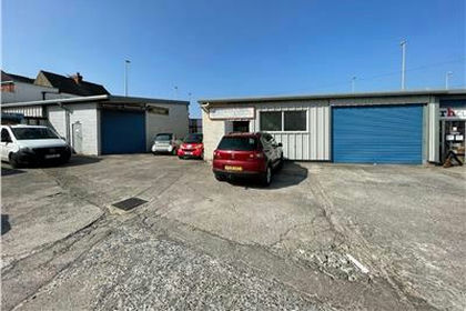
- Price
- Offers in Excess of£399,950
Added on 03/06/2026Commercial Land
- Price
- Offers in Region of£425,000
- Size
- 0.28 acres
Swan Hotel 115 Poulton Street, Kirkham, PR4, Kirkham, Lancashire PR4 England
Added on 03/07/2026Pub
- Price
- Offers Invited
Added on 29/01/2026Pub