
Building and Land North Of Summerhill Cross, Ashburton, Newton Abbot, TQ13
- Land size
- 7.56 acres
Key Features
- Building and Land extending to 7.56 acres
- Set in a secluded location with excellent access
- Natural water supply
Description
Building and Land extending to 7.56 acres set in a secluded location with excellent access and within the fringes of the charming Dartmoor National Park.
For Sale by Private Treaty
DESCRIPTION
The sale offers a rare opportunity for prospective purchasers to acquire a useful building and land in a secluded location with excellent access and within the fringes of the charming Dartmoor National Park.
The land benefits from a natural water supply from springs rise on the land feeding ponds and wildlife habitat areas.
BUILDINGS
MAIN BUILDING: 60’0 30’0
Modern barn of metal frame construction under a fibre cement roof with eight clear panels providing natural light and with concrete block walls to approx. 6’0 height and Yorkshire boarding/cladding above. The building has a part concrete part hardcore floor.
LEAN-TO: 45’0X 40’0
Adjoining the western side of main building is a metal frame lean-to 45’0 x 40’0 with further 15’0 x 30’0 lean-to of metal frame under a Galvaprime sheet roof with similar part cladding open to west.
There is a stoned yard area to the south and east of the buildings providing a good storage area for machinery and equipment.
THE LAND
The land is an attractive parcel of primarily grassland with pond areas
with some semi-mature tree growth to the south-western side of the land which are fed by a spring which raises in that section and which also provides a natural water supply to the land.
The land is gently south and west facing, free draining, productive pasture which is bordered by solid Devon hedge banks to the eastern side and by semi mature hedge and tree growth which has been faced up along the western boundary which provides a screen to that side of the land.
The land is well fenced throughout the majority with sheep netting and single strand barbed and the land is of character with idyllic views southwards over the River Dart valley and the southern slopes of Dartmoor.
Access to the land is a short section of track from the public highway leading up from Summerhill Cross to an approx. 10’0 gateway to the south-east of the building and yard area. There is also an approx. 11’0 wooden gateway to the north-eastern side of the land which although not having been utilised recently exists giving access from the Lavender House road adjoining.
The buildings and land offer potential for continued agricultural use as well as equestrian, hobby farming, amenity and habitat uses, subject to necessary consents and permissions that may be required.
SITUATION
The land is situated on the very edge of the scenic Dartmoor National Park lying less than a mile to the south-west of the popular ancient stannary town of Ashburton and also the A38 Devon Expressway. The market town of Newton Abbot lies approximately 8 miles to the north-west with active community and range of amenities to include primary and secondary schools, traditional bustling high street and mainline railway service to London. The city of Exeter lies approximately 15 miles to the north and affords a larger range of commercial and recreational services.
DIRECTIONS
From the A38 Devon Expressway turn off at the Pear Tree Cross junction just to the south of Ashburton following the signs to Dartmeet, Two Bridges, Princetown and Holne passing Ashburton Motor Works and Garage on your left hand side, staying on this road passing the Bowden Hill/Lavender House turning on your right staying on the Holne road and after a further approx. 200 yards at Summerhill Cross turn right and after approximately 50 yards the building/land will be found on your left hand side.
TOWN AND COUNTRY PLANNING
The property, notwithstanding any description contained in these particulars, is sold subject to any Development Plan, Tree Preservation Order, Town Planning Scheme, Resolution Notice, which may be or may come to be in force an also subject to any statutory provision or by-laws without any obligation on the part of the vendor to specify them.
OUTGOINGS
The agents are of the understanding there are no outgoings.
TENURE
The land is of Freehold tenure offering vacant possession at the completion of the sale.
BASIC PAYMENT SCHEME/ AGRI– ENVIRONMENT SCHEMES
The land is being sold without any entitlements to the Basic Payments Scheme or any de-linked payments. The land area is not subject to any agri-environmental schemes.
ACCESS, RIGHTS OF WAY, EASEMENTS
Access to the land is via an approx. 10’0 gateway to the south-east from a stone track leading a short distance up from Summerhill Cross to the south. There is also an approx. 11’0 wooden gateway to the north-east of the land from the Lavender House road.
SERVICES
The land benefits from a natural water supply from a spring that rises to the south-western corner of the land which feeds ponds and provides a water supply to livestock. There is no mains water or electric although the main building is currently served by a generator which may be available by separate negotiation.
LOCAL AUTHORITY
Dartmoor National Park, Parke, Bovey Tracey, Newton Abbot, Devon, TQ13 9JQ Tel: 01626 832093
METHOD OF SALE
We are offering the land freehold for sale via Private Treaty, as a whole with the invitation for bids in excess of £155,000. All bids submitted will be disclosed to existing bidders but no information regarding bidder. Bidders will be given the opportunity of revising their bids if exceeded by bids received from third parties.
STATUS
Bidders will be required to confirm their status when submitting offers and would need to advise us if their purchase is subject to any other sales or funding.
ACCEPTANCE OF BIDS
On submitting the final highest bid, prospective purchasers will be advised that this is accepted subject to contract and will be expected to sign a contract within four weeks of the receipt of the contract. Failure to do so may result in a contract being offered to an underbidder. The vendor reserves the right not to accept the highest or any bids.
IMPORTANT NOTICE
For clarification we wish to inform any prospective purchasers that we have prepared these sales particulars as a general guide. They must not be relied upon as statements of fact. We have not carried out a detailed survey. If there are points which are of particular importance to you please contact the office prior to viewing the property.
Map Location
Property details
- Tenure
- Ask Agent
- Council Tax Band
- TBC
- Date Posted
- 2026-05-23
Market Value Analysis
Compared with 215 Farmland & Pasture listings in South West England (5+ acres).
Property Brochure
Seen the details? The full report adds the independent checks: planning activity, flood history, heritage and ground.
Utilities & Restrictions
Utilities
- Electricity
- Ask Agent
- Water
- Ask Agent
- Heating
- Ask Agent
- Broadband
- Ask Agent
- Sewerage
- Ask Agent
Rights & Restrictions
- Public Rights of Way
- Ask Agent
- Private Rights of Way
- Ask Agent
- Listed Property
- Ask Agent
- Restrictions
- Ask Agent
Listed status, conservation areas and planning constraints for this location are in the full report.
Property Features
- Accessibility
- Ask Agent
- Parking
- Parking Available
- Garden
- Garden
Beyond the particulars: planning activity, flood history, heritage and ground risks, checked for this exact spot.
Connectivity
Broadband
Fastest speed available at this postcode
1 Gbps
Gigabit full fibre
Suitable for
- 4K streaming on every screen
- Full-time home working
- Online gaming & big downloads
Mobile signal
Predicted 4G and 5G signal; indoor signal depends on building materials.
Ofcom Connected Nations postcode-level predictions. Speeds and signal are modelled, not measured, and vary between addresses and providers.
Signal is the easy part. Planning activity, flood history and protected designations here are in the full report.
Nearest Schools
Primary
- Ashburton Primary School0.9 milesOfsted: Good
- Ages
- 4 to 11
- Pupils
- 161
- Type
- Academy converter
- St Mary's Catholic Primary School, Buckfast1.5 milesOfsted report card · Feb 2026
- Ages
- 3 to 11
- Pupils
- 168
- Type
- Academy converter
- Faith
- Roman Catholic
- Buckfastleigh Primary School2.3 milesOfsted: Good
- Ages
- 4 to 11
- Pupils
- 112
- Type
- Academy converter
- Landscove Church of England Primary School2.8 milesOfsted: Good
- Ages
- 4 to 11
- Pupils
- 91
- Type
- Academy converter
- Faith
- Church of England
- Broadhempston Village Primary School4.1 milesOfsted: Good *
- Ages
- 4 to 11
- Pupils
- 43
- Type
- Academy converter
Secondary
- South Dartmoor Community College1.4 milesOfsted: Good *
- Ages
- 11 to 18
- Pupils
- 801
- Type
- Academy converter
- King Edward VI Community College6.2 milesNo Ofsted rating
- Ages
- 11 to 18
- Pupils
- 940
- Type
- Academy converter
- Coombeshead Academy6.9 milesOfsted: Good
- Ages
- 11 to 18
- Pupils
- 870
- Type
- Academy converter
- Newton Abbot College7.1 milesOfsted: Good *
- Ages
- 11 to 18
- Pupils
- 1,108
- Type
- Academy converter
- South Devon UTC7.5 milesOfsted report card · Feb 2026
- Ages
- 14 to 19
- Pupils
- 184
- Type
- University technical college
* Latest graded judgement covers quality of education only; no overall grade was issued under the 2024-25 inspection framework.
Distances are straight-line from the advertised location. Source: the national school registers (DfE, Welsh Government, Scottish Government) and Ofsted.
Schools are just the start: sold prices nearby, planning activity and any flood history are in the full report.
Amenities
Supermarket
GP surgery
Pharmacy
Hospital
Green space
Straight-line distances from the advertised location. Sources: NHS records, Geolytix supermarket locations, OS Open Greenspace and the national trails registers.
The area stacks up? Now check the location itself: planning nearby, protected designations and past flooding.
Getting Around
Nearest station
Nearest bus stop
Typical drive times
Straight-line distances from the advertised location; drive times are typical free-flow times over OpenStreetMap road data, so allow more at peak. Public transport locations from DfT NaPTAN.
Easy to reach matters. So do planning activity, flood history and ground risks: all in the full report.
Flood Risk
Environment Agency open data, checked around the advertised map pin for the listed acreage. Long-term risk counts flood defences; the planning map's flood zones do not. Provided by LandSale, not the listing agent, and not part of the agent's particulars. Risk varies across a holding, so verify before committing.
Rivers and the sea
Planning map: Flood Zone 1.
Surface water
Not at the pin: mapped about 10 metres away.
These bandings are the summary. Where this location sits on the flood maps, plus planning activity, heritage and ground risks, is in the full report.
Important notice: Information, maps and tags on this page are drawn from the advertising agent's marketing materials or generated automatically. LandSale has not verified them. Relying on these details is at your own risk, always carry out independent checks before committing to a purchase.
LandSale full disclaimer
Marketing information only - not formal particulars. The details on this website are provided for general guidance and do not constitute an offer or contract. Neither LandSale nor the advertising estate/land agent accepts responsibility for any inaccuracy.
1. Source of information
- Listing content: Core description, asking price, tenure, measurements, photographs and planning history originate from the marketing materials of the advertising estate or land agent. LandSale does not author this content and cannot guarantee its accuracy.
- Automated tags & categorisation: Property type, land-use class, acreage bands and similar labels may be applied by machine-learning models. They are intended as a helpful guide only and may not reflect the property's legal status or permitted use.
- Third-party & enriched data layers: Maps, boundary outlines, planning designations, soil reports, broadband coverage and other environmental or location-based insights are licensed from external suppliers. Such data are supplied “as is", may be incomplete or out of date and are subject to change without notice.
2. Verification required
Prospective purchasers must verify critical matters, including but not limited to planning permission, title boundaries, public rights of way, environmental constraints, acreage, services, access and VAT status, through their own inspections, specialist surveys, legal advisers and the selling agent before relying on the information or entering into any contract.
3. No warranty or liability
LandSale gives no warranty, express or implied, as to the accuracy, completeness or fitness for any particular purpose of the information displayed. LandSale shall not be liable for any loss, damage, cost or expense arising directly or indirectly from any use of or reliance on such information, save where liability may not be excluded by law.
4. Updates & feedback
If you believe any detail on this listing is inaccurate, please let us know. We will investigate and, where appropriate, update the listing or notify the agent.
© LandSale | Version 1.3 - August 2026
Listing agent
Greenslade Taylor Hunt, Ivybridge
8 Erme Ct Leonards Road, Ivybridge, PL21 0SZ
View agent profileSimilar properties for sale
- Price
- Guide Price£175,000
- Size
- 4.7 acres
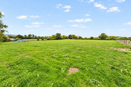
4.7 Acres at Broadhempston, Totnes, Broadhempston, Devon TQ9 England
Added on 23/09/2026Agricultural Land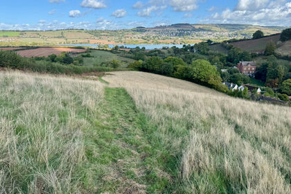
- Price
- Guide Price£140,000
- Size
- 13.69 acres
Combeinteignhead, Newton Abbot, TQ12, Newton Abbot, Devon TQ12 England
Added on 15/10/2026Agricultural Land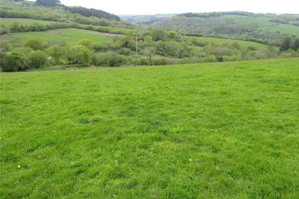
- Price
- Guide Price£160,000
- Size
- 19.62 acres
Wigford Meadows - 19.62 Acres, Loddiswell, Kingsbidge, TQ7, Kingsbidge, Devon TQ7 England
Added on 20/05/2026Undeveloped Land
- Price
- Guide Price£175,000
- Size
- 28.28 acres
Added on 17/03/2026Grazing Land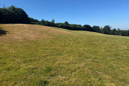
- Price
- Guide Price£150,000
- Size
- 16.83 acres
Chillington, Kingsbridge - Lot 1, TQ7, Kingsbridge, Devon TQ7 England
Added on 02/10/2026Undeveloped Land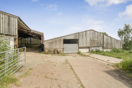
- Price
- Guide Price£150,000
- Size
- 4.29 acres
Added on 03/07/2026Small Farm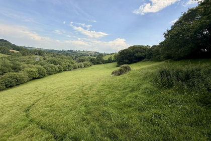
- Price
- Guide Price£130,000
- Size
- 13 acres
Land at Trewidland, Liskeard, St. Keyne and Trewidland, Cornwall PL14 England
Added on 21/09/2026Undeveloped Land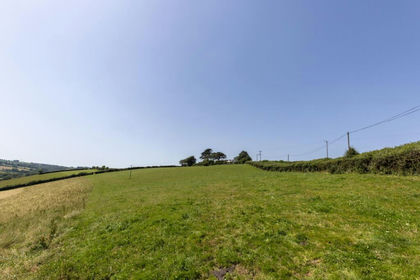
- Price
- Guide Price£150,000
- Size
- 16.04 acres
Milton Damerel, Holsworthy, EX22, Milton Damerel, Devon EX22 England
Added on 07/07/2026Vacant Land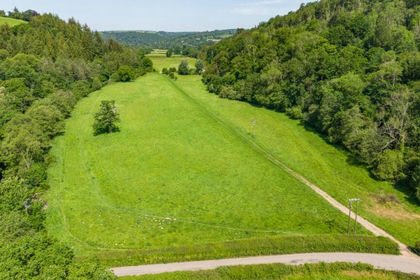
- Price
- Guide Price£120,000
- Size
- 10.28 acres
Lot 5: Land At Perry Farm, Dulverton, Somerset, TA22, Brushford, Somerset TA22 England
Added on 17/09/2026Pasture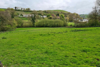
- Price
- Offers in Region of£129,950
- Size
- 3.25 acres
Added on 27/06/2026Equestrian property