Snelland, Market Rasen
- Land size
- 16.5 acres
- Bedrooms
- 4
- Bathrooms
- 1
Key Features
- Detached 4-bedroom farmhouse
- Extensive range of modern and traditional farm buildings
- Productive arable and grassland
- Rural location but good access to A46 (Lincoln/Market Rasen)
- Potential for wide range of uses (Subject to planning)
- For Sale as a Whole by Informal Tender
- Deadline – Friday 3rd July 2026 at 12 noon
- Viewing by appointment
Description
PGM&CO. are pleased to bring to the market a rarely available, small residential farm, lying in the in open countryside north-east of Lincoln and extending to nearly 16.50 Acres.
For Sale by Informal Tender as a Whole.
Tender Deadline – Friday 3rd July 2026 at 12 noon.
Introduction - Swinthorpe House Farm presents a rare opportunity to acquire an attractive and highly versatile, residential holding with main farmhouse and good range of outbuildings enjoying a peaceful rural setting in the Lincolnshire countryside.
Approached via a quiet country lane and enjoying complete privacy with no immediate neighbouring properties, the farm combines the appeal of a traditional period farmhouse with an impressive range of agricultural and ancillary buildings together with productive arable and pastureland extending in all to about 16.50 Acres.
The property has remained within the same family ownership for many years and offers considerable scope for sympathetic modernisation and enhancement, whilst retaining its established agricultural character and charm.
The existing buildings and layout are considered suitable for a variety of future uses, subject to the necessary planning consents.
Location - Situated between Lincoln (9 miles) and Market Rasen (5.50 miles) and accessed via Swinthorpe Lane.
what3words: ///headliner.crusaders.shows
Postcode: LN8 3SN
Humber Bridge: 35 miles
Humberside Airport: 23 miles
Lincoln Train Station: 10 miles
Market Rasen Train Station: 6 miles
The surrounding area offers an excellent range of amenities, schooling, leisure facilities, restaurants and independent shops, whilst the nearby A46 provides convenient connections throughout Lincolnshire and beyond. The nearest livestock market is in Louth (20 miles).
Description - A small, mixed holding with detached, 4-bed farmhouse and extensive range of both modern and traditional farm buildings arranged around a central farmyard.
The surrounding land is relatively flat with open vistas providing good amenity and having the benefit of no immediate residential neighbours. The buildings are considered to offer scope for a variety of uses and have been well maintained.
Lying immediately to the south and east of the property, the farmland comprises a long-standing rig and furrow paddock together with a single enclosure of productive arable land. (15m. ODN). The Barlings Eau forms the western boundary.
The Farmhouse - An attractive, brick farmhouse with a tile roof with adjoining range of domestic outbuildings. The property was likely constructed in the mid to late 1800’s. The accommodation is extensive. Arranged over two-floors, the property comprises;
Ground Floor - Entrance Porch; Living Room; Sitting Room; Hall; Pantry; Kitchen; Dining Room; Utility; Conservatory.
First Floor - Landing; Bathroom; W/C; Bedrooms (x4).
Overall, it extends to about 2,600 square feet (241.6 square metres).
Services - Mains water and electricity are connected. There is a private drainage system. A comprehensive mains oil fired heating system has been installed.
Council Tax - West Lindsey District Council: Band E.
Epc - Rating F.
Farmyard - Situated adjacent to the farmhouse is a good range of general-purpose farm buildings including corn store, Dutch barn and open-crew yard with surrounding loose boxes and former granary. The yard area including the farmhouse and grounds extends to about 1.75 Acres in all.
Grain Store (40’ x 45’): Steel framed with lean-to, central drying tunnel, grain walling and fan. Concrete floor. Approx. 250t capacity.
Dutch Barn (60’ x 30’): Steel framed, open-sided with lean to (18’ x 30’) with part block walls and part corrugated sheet cladding with A/C sheet roof. Concrete floor.
…together with extensive range of traditional mainly brick and tile buildings comprising;
Barn/store (27’ x 15’)
Calf pens (27’ x 15’)
(x4) Loose boxes (37’6” x 15’)
Ex-dairy parlour (10’6” x15’)
Former milking parlour, incorporating pig pens (48’ x 22’)
Livestock accommodation (14’ x 22’)
Bull pen (20’ x 13’)
Garage/workshop (33’ x 30’) with lean-to (30’ x 15’)
Pig pens (30’ x 30’) with lean-to (30’ x 15’)
Pig pens (30’ x 33’) with lean-to (30’ x 8’)
Open crew yard (60’ x 28’6”)
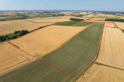
The Land - Lying in a ring fence and adjoining the farmyard, it comprises two small paddocks of old grass (4.38 Acres) and arable land (10.34 Acres).
The land is classified Grade 3 by reference to the Agricultural Land Classification Map for the East Midlands Region (ACC005). LandIS Soilscapes refer to the land as very productive, mainly loamy and clayey soils.
General Stipulations -
Method Of Sale - All offers are subject to the tender conditions as set out on the Tender Form and must reach the Market Rasen office of the Selling Agent by not later than; Friday 3rd July 2026, 12 noon.
Tenure And Possession - The property is Freehold. Vacant possession will be granted on completion.
Tenantright/Dilapidations - Should the sale give rise to a claim for tenantright, successful purchaser(s) will be required to pay for any seeds, fertiliser, cultivations, sprays and acts of husbandry relating to any growing crops on the land based on CAAV costings and actual costs. This will be at the discretion of the Selling Agent. Dilapidations will not be allowed.
Holdover/Early Entry - Possession is available subject to holdover at no additional charge (where applicable). Early entry may be available by prior agreement.
Rights Of Way, Easements & Wayleaves - The land is offered for sale subject to all existing rights and with the benefit of existing rights of way whether public or private, light, support, drainage, water, and electricity supplies and other rights, easements and wayleaves whether referred to or not in these particulars.
Sporting, Timber & Mineral Rights - The timber, mineral & sporting rights are included in the sale in so far as they are owned. They are in hand.
Vat - It is understood that none of the land is elected for VAT.
Rural Payments/Subsidy Schemes - There are no Entitlements included in the sale. Any delinked payments will be retained by the Seller.
Environmental Land Management Schemes - There are no ELMS Schemes in existence on the land.
Outgoings - Annual drainage charges are due payable to the Environment Agency and local IDB.
Drainage - The arable land is believed to be under drained but no plans are available.
Nitrate Vulnerable Zone - The land is in a Nitrate Vulnerable Zone.
Boundaries - The purchaser shall be deemed to have full knowledge of the boundaries and neither the Seller nor the Selling Agent will be responsible for defining the boundaries or their ownership.
Plans & Areas - These have been prepared as carefully as possible. They are for identification purposes only and although are believed to be correct their accuracy cannot be guaranteed.
Fixtures & Fittings - All fixtures and fittings are excluded from the sale, unless mentioned in these particulars of sale.
Buyer Identity Check - Purchasers will be required to provide the necessary identification for the purposes of the Anti-Money Laundering Regulations.
Viewing - Strictly by appointment via the Selling Agent.
Nicholas Sharp
T: or M:
Molly Williams
T: or M:
Solicitors - Bridge McFarland, 26 Market Place, Market Rasen,
Lincolnshire LN8 3HL
Ref. David Harvey
E:
T:
Map Location
Property details
- Tenure
- Freehold
- Council Tax Band
- E
- Date Posted
- 2026-05-23
Market Value Analysis
Compared with 43 Farms & Smallholdings listings in East Midlands (10+ acres).
Energy Performance Certificate
Energy Efficiency Rating
Based on UK Energy Performance Certificate standards (EU Directive 2002/91/EC)
Running costs are one side. Planning activity, flood history and ground risks for this location are in the full report.
Utilities & Restrictions
Utilities
- Electricity
- Ask Agent
- Water
- Ask Agent
- Heating
- Ask Agent
- Broadband
- Ask Agent
- Sewerage
- Ask Agent
Rights & Restrictions
- Public Rights of Way
- Ask Agent
- Private Rights of Way
- Ask Agent
- Listed Property
- Ask Agent
- Restrictions
- Ask Agent
Listed status, conservation areas and planning constraints for this location are in the full report.
Property Features
- Accessibility
- Ask Agent
- Parking
- Parking Available
- Garden
- Garden
Beyond the particulars: planning activity, flood history, heritage and ground risks, checked for this exact spot.
Connectivity
Broadband
Fastest speed available at this postcode
2 Mbps
Under 10 Mbps here
Suitable for
- Basic browsing & email
Fixed wireless access may also be an option here.
Mobile signal
Predicted 4G and 5G signal; indoor signal depends on building materials.
Ofcom Connected Nations postcode-level predictions. Speeds and signal are modelled, not measured, and vary between addresses and providers.
Signal is the easy part. Planning activity, flood history and protected designations here are in the full report.
Nearest Schools
Primary
- Dunholme St Chad's Church of England Primary School2.3 milesOfsted: Good *
- Ages
- 4 to 11
- Pupils
- 196
- Type
- Voluntary controlled school
- Faith
- Church of England
- Faldingworth Community Primary School2.3 milesNo Ofsted rating
- Ages
- 4 to 11
- Pupils
- 51
- Type
- Community school
- Ellison Boulters Church of England Primary School2.8 milesOfsted: Good
- Ages
- 4 to 11
- Pupils
- 291
- Type
- Academy converter
- Faith
- Church of England
- Welton St Mary's Church of England Primary Academy2.9 milesNo Ofsted rating
- Ages
- 4 to 11
- Pupils
- 389
- Type
- Academy converter
- Faith
- Church of England
- The Hackthorn Church of England Primary School3.6 milesOfsted: Good *
- Ages
- 4 to 11
- Pupils
- 58
- Type
- Voluntary controlled school
- Faith
- Church of England
Secondary
- William Farr CofE Comprehensive School2.8 milesOfsted: Good
- Ages
- 11 to 18
- Pupils
- 1,488
- Type
- Academy converter
- Faith
- Church of England
- The Priory Pembroke Academy5.2 milesOfsted: Good
- Ages
- 11 to 16
- Pupils
- 590
- Type
- Academy sponsor led
- De Aston School6 milesNo Ofsted rating
- Ages
- 11 to 18
- Pupils
- 939
- Type
- Academy converter
- Faith
- Christian
- Lincoln Christ's Hospital School6.9 milesOfsted: Good *
- Ages
- 11 to 18
- Pupils
- 1,275
- Type
- Academy converter
- Faith
- Christian
- Lincoln Castle Academy7 milesOfsted: Inadequate
- Ages
- 11 to 16
- Pupils
- 744
- Type
- Academy converter
* Latest graded judgement covers quality of education only; no overall grade was issued under the 2024-25 inspection framework.
Distances are straight-line from the advertised location. Source: the national school registers (DfE, Welsh Government, Scottish Government) and Ofsted.
Schools are just the start: sold prices nearby, planning activity and any flood history are in the full report.
Amenities
Supermarket
GP surgery
Pharmacy
Hospital
Straight-line distances from the advertised location. Sources: NHS records, Geolytix supermarket locations, OS Open Greenspace and the national trails registers.
The area stacks up? Now check the location itself: planning nearby, protected designations and past flooding.
Getting Around
Nearest station
Nearest bus stop
Typical drive times
Straight-line distances from the advertised location; drive times are typical free-flow times over OpenStreetMap road data, so allow more at peak. Public transport locations from DfT NaPTAN.
Easy to reach matters. So do planning activity, flood history and ground risks: all in the full report.
Flood Risk
Environment Agency open data, checked around the advertised map pin for the listed acreage. Long-term risk counts flood defences; the planning map's flood zones do not. Provided by LandSale, not the listing agent, and not part of the agent's particulars. Risk varies across a holding, so verify before committing.
Rivers and the sea
Not at the pin: mapped about 70 metres away.
Planning map: Flood Zone 3, about 120 metres away.
Surface water
Not at the pin: mapped about 40 metres away.
These bandings are the summary. Where this location sits on the flood maps, plus planning activity, heritage and ground risks, is in the full report.
Important notice: Information, maps and tags on this page are drawn from the advertising agent's marketing materials or generated automatically. LandSale has not verified them. Relying on these details is at your own risk, always carry out independent checks before committing to a purchase.
LandSale full disclaimer
Marketing information only - not formal particulars. The details on this website are provided for general guidance and do not constitute an offer or contract. Neither LandSale nor the advertising estate/land agent accepts responsibility for any inaccuracy.
1. Source of information
- Listing content: Core description, asking price, tenure, measurements, photographs and planning history originate from the marketing materials of the advertising estate or land agent. LandSale does not author this content and cannot guarantee its accuracy.
- Automated tags & categorisation: Property type, land-use class, acreage bands and similar labels may be applied by machine-learning models. They are intended as a helpful guide only and may not reflect the property's legal status or permitted use.
- Third-party & enriched data layers: Maps, boundary outlines, planning designations, soil reports, broadband coverage and other environmental or location-based insights are licensed from external suppliers. Such data are supplied “as is", may be incomplete or out of date and are subject to change without notice.
2. Verification required
Prospective purchasers must verify critical matters, including but not limited to planning permission, title boundaries, public rights of way, environmental constraints, acreage, services, access and VAT status, through their own inspections, specialist surveys, legal advisers and the selling agent before relying on the information or entering into any contract.
3. No warranty or liability
LandSale gives no warranty, express or implied, as to the accuracy, completeness or fitness for any particular purpose of the information displayed. LandSale shall not be liable for any loss, damage, cost or expense arising directly or indirectly from any use of or reliance on such information, save where liability may not be excluded by law.
4. Updates & feedback
If you believe any detail on this listing is inaccurate, please let us know. We will investigate and, where appropriate, update the listing or notify the agent.
© LandSale | Version 1.3 - August 2026
Listing agent
Perkins George Mawer & Co., Market Rasen
Corn Exchange Chambers, Queen Street, Market Rasen, LN8 3EH
View agent profileSimilar properties for sale
- Price
- Guide Price£995,000
- Size
- 116.99 acres
Added on 08/08/2026Agricultural Land
- Price
- Guide Price£875,000
- Size
- 8 acres
Spilsby LINCOLNSHIRE, Halton Holegate, Lincolnshire PE23 England
Added on 08/10/2026Smallholding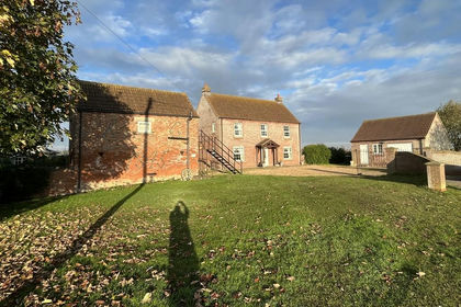
- Price
- Guide Price£720,000
- Size
- 16.46 acres
Browns Drove, Swineshead Bridge, Holland Fen with Brothertoft, Lincolnshire PE20 England
Added on 29/01/2026Small Farm
- Price
- Guide Price£720,000
- Size
- 15.86 acres
Catlins Farm, Swineshead Bridge, Swineshead, Lincolnshire PE20 England
Added on 11/02/2026Agricultural Land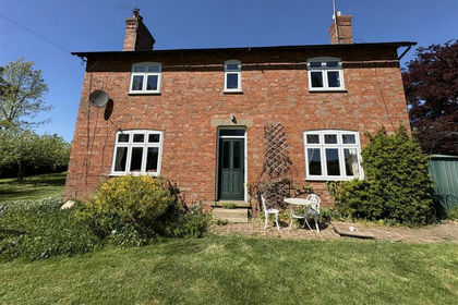
- Price
- Guide Price£850,000
- Size
- 32.49 acres
Honey Pot Lane, Colsterworth, Grantham, Colsterworth, Lincolnshire NG33 England
Added on 24/05/2026Farm