The Old Barns, West Handley, S21
- Bedrooms
- 5
- Bathrooms
- 3
Key Features
- A very special home located within West Handley with over 3150 feet of excellent accommodation
- Outbuildings to include large double garage and further barn
- The house has five good bedrooms, three bathrooms, and two lovely living rooms
- Large vaulted breakfast kitchen with space for large dining table and super views
- Modernised and converted in the mid-80s with full planning permission and listing building consents
- Sun room overlooking the cobbled planted gardens
- Large corner plot with orchard, large lawns, lovely planting, in a beautiful setting
- Gas LPG heating, and all other mains services
- EPC Rating - C North East Derbyshire Council Tax Band - F
- What3Words///flames.honest.taken
Description
The property comprises two agricultural buildings converted to residential use and linked by a new-build single storey kitchen extension. Both of the original buildings are Listed on the Statutory List of Buildings of Special Architectural and Historic Interest at Grade Two dating back to the late 16th century and late 17th century. The buildings are also included in the West Handley Conservation Area which was designated by North East Derbyshire District Council.
The present owners undertook the conversion of the buildings in 1984/85. The conversion proposals were granted consent in 1984 – with both Planning Permission and Listed Building Consent.
Listed Building Consent (LBC) forms part of the planning system and is required when proposals to alter a listed building are being considered by the Planning Authority. LBC is not intended to prevent alterations being made to an historic building but to ensure that alterations do not harm its special architectural or historic interest.
Sometimes the Planning Authority will require modifications to proposals but it is important to note that well over 90% of LBC applications are approved. In the case of The Old Barns, the approved alterations included a new extension to link the two existing buildings, the total remodelling of the interiors of both buildings with new walls and door openings and new, sympathetically designed window openings in the external fabric all to achieve appropriate space and light for modern living.
The property has five bedrooms, two en-suite with a further family bathroom, there are two lovely living rooms, a sun room, and a wonderful vaulted dining kitchen at the heart of the home. Services include, mains electricity, water and sewage, and LPG heating.
The Old Barns, set in a fabulous garden within the village of West Handley, is truly a very special and unique home.
West Handley is a special hamlet in North East Derbyshire, south west of Eckington known historically for sickle smithing and farming. Surrounded by countryside, with wonderful walks to all directions, the hamlet features architecturally beautiful farmhouses and The Old Barns is located next door to a very special thatched cottage. West Handley has easy access to the M1 motorway, Dronfield and Chesterfield, both of which have a mainline railway station. Sheffield City Centre is approx. nine miles away, 25 minutes by car.
Listing data - PARISH OF UNSTONE ASH LANE SK 37 NE 6/180 (South Side) The Old Barns (formerly listed as Cowhouse to 2.12.81 south and adjacent to Ash Lane Farmhouse and outbuilding to south-east of Ash Lane Farmhouse, south of Cowhouse) GV II House, formerly two farm outbuildings. Late C16 and late C17, converted 1984. Coursed rubble coal measures sandstone with plain dressings, quoins, Welsh slated roofs with stone slate eaves, C20 metal flues. L-plan, formerly two separate buildings now linked by C20 extension. South range. Two storeys, three bays with central doorway beneath plain timber lintel, and enlarged ventilation slits to either side of the doorway, now a glazed door. Inserted interior partitions do not obscure exposed late C17 queen strut tie beam trusses with straight windbraces to one side of each truss, which support double purlins and a ridge purlin. Inserted C20 openings to south gable end. North range runs at right angles to main range. Late C16, single storey, three bays, with two complete cruck trusses, and the remains of a third in the west gable wall. The cruck trusses stand on projecting padstones on the south side; the north side wall is built into an earth bank. The trusses have tie beams and yokes, and some windbraces. Single purlin and ridge purlin. Three doorways to south wall, with plain lintels, one now blocked. C20 link with timber arcade to front.
Listing NGR: SK
Tenure - Freehold
Council Tax Band - F
EPC Rating - C
Map Location
Property details
- Tenure
- Freehold
- Council Tax Band
- F
- Date Posted
- 2026-05-19
Energy Performance Certificate
Energy Efficiency Rating
Based on UK Energy Performance Certificate standards (EU Directive 2002/91/EC)
Running costs are one side. Planning activity, flood history and ground risks for this location are in the full report.
Utilities & Restrictions
Utilities
- Electricity
- Mains
- Water
- Mains
- Heating
- Gas Heating
- Broadband
- Ask Agent
- Sewerage
- Mains
Rights & Restrictions
- Public Rights of Way
- Ask Agent
- Private Rights of Way
- Ask Agent
- Listed Property
- Yes
- Restrictions
- Yes
Listed status, conservation areas and planning constraints for this location are in the full report.
Property Features
- Accessibility
- Ask Agent
- Parking
- Garage
- Garden
- Garden
Beyond the particulars: planning activity, flood history, heritage and ground risks, checked for this exact spot.
Connectivity
Broadband
Fastest speed available at this postcode
1.8 Gbps
Gigabit full fibre · available to 3% of premises
Suitable for
- 4K streaming on every screen
- Full-time home working
- Online gaming & big downloads
Mobile signal
Outdoor predictions; indoor signal depends on building materials.
Ofcom Connected Nations postcode-level predictions. Speeds and signal are modelled, not measured, and vary between addresses and providers.
Signal is the easy part. Planning activity, flood history and protected designations here are in the full report.
Nearest Schools
Primary
- Marsh Lane Primary School0.9 milesNo Ofsted rating
- Ages
- 4 to 11
- Pupils
- 147
- Type
- Community school
- Unstone St Mary's Nursery & Infant School1.3 milesOfsted: Good
- Ages
- 3 to 7
- Pupils
- 50
- Type
- Community school
- Birk Hill Infant & Nursery School1.4 milesOfsted report card · May 2026
- Ages
- 3 to 7
- Pupils
- 63
- Type
- Community school
- New Whittington Community Primary School1.5 milesOfsted: Good
- Ages
- 3 to 11
- Pupils
- 236
- Type
- Academy sponsor led
- Unstone Junior School1.6 milesOfsted report card · Jan 2026
- Ages
- 7 to 11
- Pupils
- 49
- Type
- Community school
Secondary
- Eckington School1.4 milesOfsted report card · Mar 2026
- Ages
- 11 to 18
- Pupils
- 1,124
- Type
- Academy converter
- Whittington Green School1.7 milesOfsted: Good
- Ages
- 11 to 16
- Pupils
- 682
- Type
- Community school
- Dronfield Henry Fanshawe School2.6 milesOfsted: Good
- Ages
- 11 to 18
- Pupils
- 1,810
- Type
- Voluntary controlled school
- The Birley Academy3.1 milesOfsted: Good *
- Ages
- 11 to 16
- Pupils
- 1,061
- Type
- Academy converter
- Springwell Community College3.3 milesOfsted: Good *
- Ages
- 11 to 16
- Pupils
- 836
- Type
- Academy converter
* Latest graded judgement covers quality of education only; no overall grade was issued under the 2024-25 inspection framework.
Distances are straight-line from the advertised location. Source: the national school registers (DfE, Welsh Government, Scottish Government) and Ofsted.
Schools are just the start: sold prices nearby, planning activity and any flood history are in the full report.
Amenities
Supermarket
GP surgery
Pharmacy
Hospital
Straight-line distances from the advertised location. Sources: NHS records, Geolytix supermarket locations, OS Open Greenspace and the national trails registers.
The area stacks up? Now check the location itself: planning nearby, protected designations and past flooding.
Getting Around
Nearest station
Nearest bus stop
Typical drive times
Straight-line distances from the advertised location; drive times are typical free-flow times over OpenStreetMap road data, so allow more at peak. Public transport locations from DfT NaPTAN.
Easy to reach matters. So do planning activity, flood history and ground risks: all in the full report.
Flood Risk
From Environment Agency flood map open data, checked around the advertised map pin and allowing for the listed acreage where known. This summary comes from LandSale, the advertising platform, not from the listing agent, and is not part of the agent's particulars. Risk can vary across a single holding, so verify anything critical through your own searches before committing.
Rivers and the sea
Surface water
The detail behind these bandings
The full report pinpoints where this location sits on the flood maps, and runs the deeper checks that usually only surface after an offer.
- Exact flood zones & annual chances (included in the full report)
- Any recorded past flooding (included in the full report)
- Planning activity nearby (included in the full report)
- Heritage & conservation (included in the full report)
- Protected nature designations (included in the full report)
- Ground risks (included in the full report)
- Sold prices nearby (included in the full report)
£14.99 · one-off purchase
By LandSale, the platform. Not provided by the listing agent. Ready in about a minute.
Important notice: Information, maps and tags on this page are drawn from the advertising agent's marketing materials or generated automatically. LandSale has not verified them. Relying on these details is at your own risk, always carry out independent checks before committing to a purchase.
LandSale full disclaimer
Marketing information only - not formal particulars. The details on this website are provided for general guidance and do not constitute an offer or contract. Neither LandSale nor the advertising estate/land agent accepts responsibility for any inaccuracy.
1. Source of information
- Listing content: Core description, asking price, tenure, measurements, photographs and planning history originate from the marketing materials of the advertising estate or land agent. LandSale does not author this content and cannot guarantee its accuracy.
- Automated tags & categorisation: Property type, land-use class, acreage bands and similar labels may be applied by machine-learning models. They are intended as a helpful guide only and may not reflect the property's legal status or permitted use.
- Third-party & enriched data layers: Maps, boundary outlines, planning designations, soil reports, broadband coverage and other environmental or location-based insights are licensed from external suppliers. Such data are supplied “as is", may be incomplete or out of date and are subject to change without notice.
2. Verification required
Prospective purchasers must verify critical matters, including but not limited to planning permission, title boundaries, public rights of way, environmental constraints, acreage, services, access and VAT status, through their own inspections, specialist surveys, legal advisers and the selling agent before relying on the information or entering into any contract.
3. No warranty or liability
LandSale gives no warranty, express or implied, as to the accuracy, completeness or fitness for any particular purpose of the information displayed. LandSale shall not be liable for any loss, damage, cost or expense arising directly or indirectly from any use of or reliance on such information, save where liability may not be excluded by law.
4. Updates & feedback
If you believe any detail on this listing is inaccurate, please let us know. We will investigate and, where appropriate, update the listing or notify the agent.
© LandSale | Version 1.3 - August 2026
Listing agent
Spencer The Estate Agent, Sheffield
469 Ecclesall Road, Sheffield, S11 8PP
View agent profileSimilar properties for sale
- Price
- £849,000
- Size
- 4.5 acres
Added on 07/02/2026House with Land
- Price
- Fixed Price£790,000
- Size
- 1.46 acres
Added on 29/01/2026House with Land Added on 07/05/2026Multiple Dwelling Property
- Price
- Offers in Region of£750,000
The Byre, Barlow Lees Lane, Barlow, Dronfield S18, Dronfield, Derbyshire S18 England
Added on 29/01/2026Barn Conversion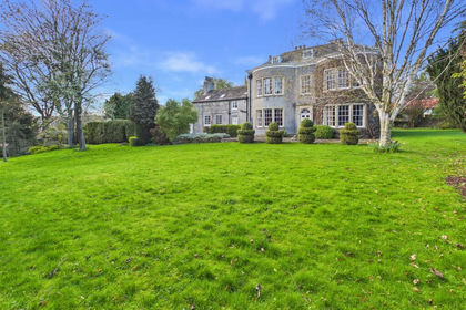
- Price
- Guide Price£850,000
- Size
- 1.28 acres
The Old Rectory, Church Street, Barlborough, Chesterfield, Barlborough, Derbyshire S43 England
Added on 19/04/2026Country Home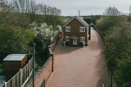
- Price
- Offers in Excess of£900,000
- Size
- 4 acres
John Hibbard Avenue, Sheffield, Sheffield South East, Sheffield S13 England
Added on 03/04/2026House with Land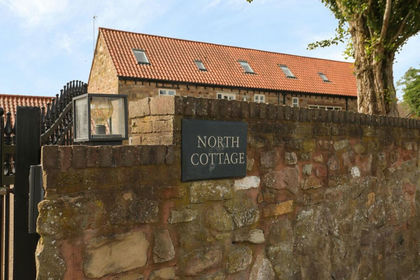
- Price
- Guide Price£750,000
Walseker Lane, Harthill, S26, Harthill with Woodall, Rotherham S26 England
Added on 14/02/2026Barn Conversion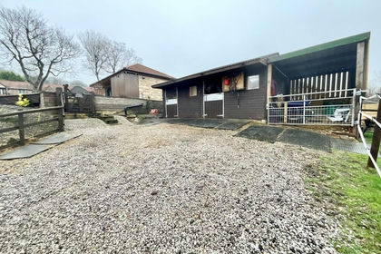
- Price
- Guide Price£685,000
Falconer Lane, Sheffield, Rotherham, S13, Aston cum Aughton, Rotherham S13 England
Added on 06/02/2026Residential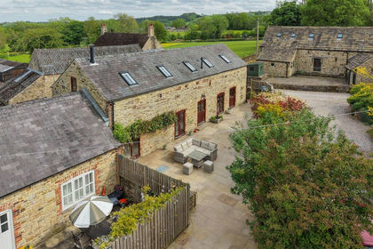
- Price
- Guide Price£800,000
- Size
- 1.7 acres
Pocknedge Lane, Holymoorside, S42, Holymoorside and Walton, Derbyshire S42 England
Added on 31/05/2026Barn Conversion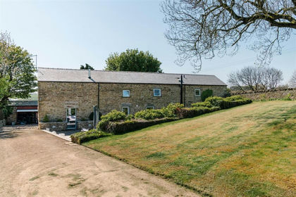
- Price
- £1,000,000
- Size
- 3.4 acres
Added on 16/05/2026House with Land