Wentworth Barn, 2 Patshull Gardens, Albrighton, Wolverhampton, WV7
- Bedrooms
- 3
- Bathrooms
- 2
Description
An outstanding, semi-detached two-storey barn standing in a beautiful, rural location
forming part of a small and select, gated, luxury scheme of just five properties
Location - Patshull Gardens stands in a beautiful, rural location set amidst glorious, rolling South Staffordshire countryside and stands adjacent to the Patshull Park Golf Course.
Despite its rural setting the development is conveniently situated within a few minutes drive of Albrighton with its wide range of shops, restaurants, bank, chemist, convenience stores, newsagents and doctors surgery, Wolverhampton City Centre, the historic market town of Bridgnorth and the former new town of Telford are all within easy reach.
Junction 3 of the M54 is easily accessible providing fast access to Birmingham and beyond, Albrighton Train Station has direct connections to Shrewsbury and Birmingham, regular bus and rail services run from Albrighton and there is a selection of both independent and maintained schools available.
Description - The property was converted in 2017 to a high standard with oak veneered doors throughout, double glazing and ceramic tiled flooring to the ground floor with underfloor heating. There is versatile living which can be adjusted to suit buyers needs. There is a bedroom suite to the ground floor which is currently being used as a dining room, the sitting room could be a dining room or study. The lounge is big enough to accommodate both seating and dining and the second bedroom upstairs could be a study for those wishing to work from home or a sitting room to go with the principal bedroom suite to create a teenage floor.
Unusually for a barn conversion there is a large plot and a private gated drive.
Accommodation - A wooden door opens into the HALL with tiled flooring, integrated ceiling lighting, a useful understairs store and a GUEST CLOAKROOM with WC, wall mounted wash basin with drawer beneath, tiled floor and walls and a double glazed window. There is a SITTING ROOM / DINING ROOM with tiled flooring, integrated ceiling lighting, wiring for wall mounted TV and a double glazed window to the rear. The LOUNGE has tiled flooring, a glazed door to the front along with glazed double doors to the rear, beamed ceiling, two ceiling roof lights and a cast iron log burning fire set in an Inglenook style recess, wiring for a wall mounted TV and sliding doors open into the KITCHEN with a contemporary range of wall and base mounted units with work surfaces over with under cupboard lighting, an undermounted sink with boiling water tap and a window over, space for a range style cooker with filtration unit above, integrated larder fridge and larder freezer, integrated dishwasher and an washing machine. The SECOND BEDROOM SUITE is currently being used as a dining room and has glazed double doors to the rear garden, tiled flooring, integrated ceiling lighting and an EN-SUITE SHOWER ROOM with shower cubicle with water fall head and separate hose, a wash basin with vanity drawers beneath, WC, heated ladder towel rail, tiled floor and walls and a window to the front.
Stairs from the hall rise to the first floor landing with beamed ceiling and a cupboard housing the Baxi boiler. The PRINCIPAL BEDROOM SUITE has beamed ceiling, wiring for a wall mounted TV, a roof light and an EN-SUITE SHOWER ROOM with tiled shower cubicle, vanity unit with wash basin with drawers beneath, WC, tiled floor and walls, beamed ceiling, heated ladder towel rail, roof light and integrated ceiling lighting. BEDROOM THREE has a beamed ceiling, two roof lights, integrated ceiling lighting and there is eaves storage to either side of the room.
Outside - Electric gates open onto a gravelled driveway serving the five barn conversions with a further set of electric gates opening onto a gravelled DRIVEWAY which provides off street parking for several vehicles which is unusual for a barn conversion. There is external lighting, a paved patio, cold water supply, electrical points and two areas of garden with lawn and shrubbed borders.
There is a large REAR GARDEN with a patio with a long lawn beyond with planted borders. there is a GARDEN ROOM with a paved patio and covered decking area. There is electric light and power, TV and Wi-Fi connection and a bar. This room could be used for a variety of different purposes such as a bar, gym or study. There are two storerooms to the rear of the garden room and a shed. The garden finishes with a three bar wooden gate with views over neighbouring fields.
Management Fees - The five barns all contribute to the maintenance and lighting of the communal areas and costs are usually between £400 - £500 per annum. The management of this is undertaken by one of the residents.
Directions - Using the What3words app ///craft.width.manage
We are informed by the Vendors that mains water and electricity are connected, the heating is LPG and the drainage is to a treatment plant shared by just three barns.
COUNCIL TAX BAND E – Shropshire
POSSESSION Vacant possession will be given on completion.
VIEWING - Please contact the Tettenhall Office.
The property is FREEHOLD.
Broadband – Ofcom checker shows Standard broadband is available
Mobile date coverage is constantly changing, please use the property postcode and this link for the most up to date information from Ofcom:
Ofcom provides an overview of what is available, potential purchasers should contact their preferred supplier to check availability and speeds.
The long term flood defences website shows very low
Map Location
Property details
- Tenure
- Freehold
- Council Tax Band
- E
- Date Posted
- 2026-05-16
Energy Performance Certificate
Energy Efficiency Rating
Based on UK Energy Performance Certificate standards (EU Directive 2002/91/EC)
Running costs are one side. Planning activity, flood history and ground risks for this location are in the full report.
Utilities & Restrictions
Utilities
- Electricity
- Mains
- Water
- Mains
- Heating
- Gas Heating
- Broadband
- Ask Agent
- Sewerage
- Septic Tank / Private
Rights & Restrictions
- Public Rights of Way
- Ask Agent
- Private Rights of Way
- Ask Agent
- Listed Property
- Ask Agent
- Restrictions
- Yes
Listed status, conservation areas and planning constraints for this location are in the full report.
Property Features
- Accessibility
- Ask Agent
- Parking
- Private Parking
- Garden
- Garden
Beyond the particulars: planning activity, flood history, heritage and ground risks, checked for this exact spot.
Connectivity
Broadband
Fastest speed available at this postcode
300 Mbps
Gigabit full fibre · available to 40% of premises
Suitable for
- 4K streaming
- Video calls
- Home working
Mobile signal
Predicted 4G and 5G signal; indoor signal depends on building materials.
Ofcom Connected Nations postcode-level predictions. Speeds and signal are modelled, not measured, and vary between addresses and providers.
Signal is the easy part. Planning activity, flood history and protected designations here are in the full report.
Nearest Schools
Primary
- St Chad's CofE (VC) First School1.6 milesOfsted report card · Mar 2026
- Ages
- 3 to 9
- Pupils
- 101
- Type
- Voluntary controlled school
- Faith
- Church of England
- Albrighton Primary School & Nursery1.6 milesNo Ofsted rating
- Ages
- 2 to 11
- Pupils
- 344
- Type
- Academy converter
- St Mary's CofE Primary School2 milesNo Ofsted rating
- Ages
- 5 to 11
- Pupils
- 195
- Type
- Voluntary controlled school
- Faith
- Church of England
- Beckbury Church of England Primary School and Nursery2.5 milesNo Ofsted rating
- Ages
- 2 to 11
- Pupils
- 51
- Type
- Academy converter
- Faith
- Church of England
- Perton First School3.5 milesNo Ofsted rating
- Ages
- 2 to 9
- Pupils
- 278
- Type
- Community school
Secondary
- Perton Middle School4.1 milesNo Ofsted rating
- Ages
- 9 to 13
- Pupils
- 399
- Type
- Community school
- Codsall Middle School4.2 milesOfsted: Good
- Ages
- 9 to 13
- Pupils
- 516
- Type
- Academy converter
- Codsall Community High School4.3 milesOfsted: Good
- Ages
- 13 to 18
- Pupils
- 1,046
- Type
- Community school
- St Regis Church of England Academy4.4 milesOfsted report card · Jan 2026
- Ages
- 11 to 18
- Pupils
- 798
- Type
- Academy sponsor led
- Faith
- Church of England
- Bilbrook CofE (VC) Middle School4.7 milesNo Ofsted rating
- Ages
- 9 to 13
- Pupils
- 150
- Type
- Voluntary controlled school
- Faith
- Church of England
Distances are straight-line from the advertised location. Source: the national school registers (DfE, Welsh Government, Scottish Government) and Ofsted.
Schools are just the start: sold prices nearby, planning activity and any flood history are in the full report.
Amenities
Supermarket
GP surgery
Pharmacy
Hospital
Straight-line distances from the advertised location. Sources: NHS records, Geolytix supermarket locations, OS Open Greenspace and the national trails registers.
The area stacks up? Now check the location itself: planning nearby, protected designations and past flooding.
Getting Around
Nearest station
Nearest bus stop
Typical drive times
Straight-line distances from the advertised location; drive times are typical free-flow times over OpenStreetMap road data, so allow more at peak. Public transport locations from DfT NaPTAN.
Easy to reach matters. So do planning activity, flood history and ground risks: all in the full report.
Flood Risk
Environment Agency open data, checked around the advertised map pin for the listed acreage. Long-term risk counts flood defences; the planning map's flood zones do not. Provided by LandSale, not the listing agent, and not part of the agent's particulars. Risk varies across a holding, so verify before committing.
Rivers and the sea
Planning map: Flood Zone 1.
Surface water
Not at the pin: mapped about 10 metres away.
These bandings are the summary. Where this location sits on the flood maps, plus planning activity, heritage and ground risks, is in the full report.
Important notice: Information, maps and tags on this page are drawn from the advertising agent's marketing materials or generated automatically. LandSale has not verified them. Relying on these details is at your own risk, always carry out independent checks before committing to a purchase.
LandSale full disclaimer
Marketing information only - not formal particulars. The details on this website are provided for general guidance and do not constitute an offer or contract. Neither LandSale nor the advertising estate/land agent accepts responsibility for any inaccuracy.
1. Source of information
- Listing content: Core description, asking price, tenure, measurements, photographs and planning history originate from the marketing materials of the advertising estate or land agent. LandSale does not author this content and cannot guarantee its accuracy.
- Automated tags & categorisation: Property type, land-use class, acreage bands and similar labels may be applied by machine-learning models. They are intended as a helpful guide only and may not reflect the property's legal status or permitted use.
- Third-party & enriched data layers: Maps, boundary outlines, planning designations, soil reports, broadband coverage and other environmental or location-based insights are licensed from external suppliers. Such data are supplied “as is", may be incomplete or out of date and are subject to change without notice.
2. Verification required
Prospective purchasers must verify critical matters, including but not limited to planning permission, title boundaries, public rights of way, environmental constraints, acreage, services, access and VAT status, through their own inspections, specialist surveys, legal advisers and the selling agent before relying on the information or entering into any contract.
3. No warranty or liability
LandSale gives no warranty, express or implied, as to the accuracy, completeness or fitness for any particular purpose of the information displayed. LandSale shall not be liable for any loss, damage, cost or expense arising directly or indirectly from any use of or reliance on such information, save where liability may not be excluded by law.
4. Updates & feedback
If you believe any detail on this listing is inaccurate, please let us know. We will investigate and, where appropriate, update the listing or notify the agent.
© LandSale | Version 1.3 - August 2026
Listing agent
Berriman Eaton, Tettenhall
15 High Street, Tettenhall, Wolverhampton, WV6 8QS
Contact Berriman Eaton, Tettenhall
15 High Street, Tettenhall, Wolverhampton, WV6 8QS
View agent profileSimilar properties for sale
- Price
- Offers in Region of£525,000
- Size
- 3 acres
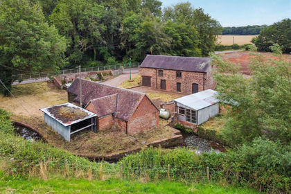
The Mill, Badger, Shropshire, WV6, Badger, Shropshire WV6 England
Added on 29/01/2026Development Land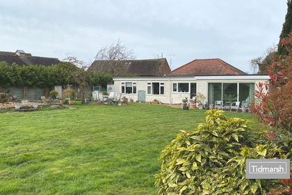
- Price
- Guide Price£650,000
- Size
- 1.6 acres
Stableford Road, Ackleton WV6, Worfield, Shropshire WV6 England
Added on 26/04/2026House with Land Added on 27/04/2026Barn Conversion
- Price
- Offers in Region of£485,000
THE WHEAT BARN, Chesterton Farm Barns, Chesterton, WV15, Worfield, Shropshire WV15 England
Added on 29/07/2026Barn Conversion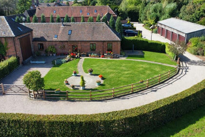
- Price
- Offers in Region of£575,000
Chesterton Farm Barns, Chesterton, Bridgnorth, Shropshire, WV15, Worfield, Shropshire WV15 England
Added on 21/09/2026Barn Conversion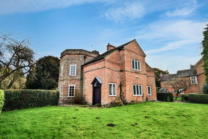
- Price
- Offers in Region of£595,000
- Size
- 1 acres
Old Post Office, Newport Road, Tong, Shifnal, Tong, Shropshire TF11 England
Added on 29/01/2026House with Land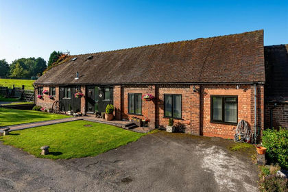
- Price
- Offers in Region of£465,000
Barn End, Codsall Road, Palmers Cross, Wolverhampton, Codsall, Staffordshire WV6 England
Added on 29/01/2026Barn Conversion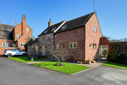
- Price
- Offers in Region of£500,000
Orton Hall Barns, Flash Lane, Wombourne, Wolverhampton, Wombourne, Staffordshire WV4 England
Added on 18/03/2026Barn Conversion
- Price
- Guide Price£500,000
- Size
- 1 acres
Shifnal Youth Centre, School Close, Shifnal, Shropshire, Shifnal, Shropshire TF11 England
Added on 23/09/2026Development Land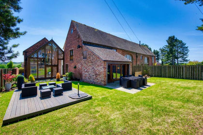
- Price
- Offers in Region of£649,000
Added on 29/01/2026Barn Conversion