Routs Green Farm, Routs Green, Bledlow Ridge, High Wycombe, Buckinghamshire
- Land size
- 17.43 acres
- Bedrooms
- 3
- Bathrooms
- 1
Key Features
- 3 Bedroom Detached Bungalow
- c17 Acre of Paddock Land
- Farm Buildings
- Substantial Plot
- Potential to Extend or Amend
- Triple Garage & Workshop
- Stunning Countryside Views
- Quiet No Through Road
Description
A fabulous opportunity to acquire this 17 acre small holding along with a 3 bedroom detached bungalow on a substantial plot of its own, offering great potential to extend or amend. Discretely situated at the end of a quiet country lane with stunning countryside views.
Uniquely positioned at the end of a no through road leading to a network of footpaths and bridleways.
The property, built in 1975 has been a much loved family home for over 35 years and occupies a plot of 0.43 acres with a triple garage and stunning views, providing the space to extend or amend as other neighbours have already done.
The property consists of: entrance hallway where all rooms lead from. There is a family kitchen/diner with ample eye and waist level storage with space to add more. From the kitchen is a useful boot room with plumbing for white goods, a sink, a door to the side of the house and garden and a cloakroom.
The spacious dual aspect reception room is a delightful room to use all year round, with views over the pretty garden, stunning views beyond and an open fireplace for cosy winter nights in. From the reception room there are sliding doors to the conservatory leading to the south facing garden.
The property offers three good size bedrooms, with the master bedroom boasting built in wardrobes and French doors leading to the garden.
There is also a family bathroom, with bath and overhead shower and additional hallway storage.
The loft is part boarded with a pull down ladder.
Outside
The south facing rear garden is mainly laid to lawn with a selection of trees including cherry, laburnum and lilac. At the end of the garden is a decked seating area, the perfect place to relax and admire the stunning views over The Chiltern Hills and surrounding farm land.
To the front of the property there is ample parking, a triple garage and workshop with power and lights.
The Land
Just a short stroll down the lane is the c17 acre smallholding along with two useful farm buildings, which could be adapted for horse or live stock accommodation.
The gently sloping land is divided into two large paddocks with a fenced off bridleway track running between the two, therefore to not interfere with your own livestock, but ideal access for direct off road hacking.
There is currently no electricity supply, but a pole and transformer are already in situ.
LOCATION
The sought after village of Bledlow Ridge is situated in an Area of Outstanding Natural Beauty within the Chiltern Hills. The village provides a local shop and The Boot, a popular Gastro pub.
Bledlow Ridge School provides excellent primary education in the village with Grammar schools nearby at High Wycombe. There are a good range of independent schools in the general area including Godstowe, Wycombe Abbey, St Teresa’s, Griffin House School and Pipers Corner.
The nearby towns of Princes Risborough, Chinnor and High Wycombe all offer an excellent range of shopping and leisure facilities whilst for the commuter there are mainline railway stations to London at both Saunderton and Princes Risborough(Marylebone – 35 minutes).
Junction 5 of the M40 is some 5 miles away.
We are required by law to conduct anti-money laundering checks and obtain verified ID from all purchasers. Whilst we retain responsibility for ensuring checks and any ongoing monitoring are carried out correctly, the initial checks are carried out using a third party, SmartSearch International Limited. The cost of these checks is £60 (incl. VAT) per person, which covers the cost of obtaining relevant data and any manual checks and monitoring which might be required. This fee will need to be paid before we can agree the sale and are able to issue a memorandum of sale and is non-refundable
Bonners & Babingtons Estate Agents endeavour to ensure our sales particulars produced are both accurate and reliable, however they do not constitute part of any offer or contract. All measurements supplied are for guidance only and are not precise. Additionally, any services, fixtures or fittings have not been tested by us and it is in the buyers interest to establish their condition or efficiency, and it is advised buyers obtain verification from their appointed solicitor as to the confirmed legal title of the property.
Map Location
Property details
- Tenure
- Freehold
- Council Tax Band
- Ask Agent
- Date Posted
- 2026-05-13
Market Value Analysis
Compared with 190 Homes with Land listings in South East England (10+ acres).
Energy Performance Certificate
Energy Efficiency Rating
Based on UK Energy Performance Certificate standards (EU Directive 2002/91/EC)
Running costs are one side. Planning activity, flood history and ground risks for this location are in the full report.
Utilities & Restrictions
Utilities
- Electricity
- Mains
- Water
- Mains
- Heating
- Gas Central Heating
- Broadband
- Full Fibre (FTTP)
- Sewerage
- Mains
Rights & Restrictions
- Public Rights of Way
- Ask Agent
- Private Rights of Way
- Ask Agent
- Listed Property
- Ask Agent
- Restrictions
- Ask Agent
Listed status, conservation areas and planning constraints for this location are in the full report.
Property Features
- Accessibility
- Ask Agent
- Parking
- Driveway
- Garden
- Front Garden, Rear Garden, Rear Garden
Beyond the particulars: planning activity, flood history, heritage and ground risks, checked for this exact spot.
Connectivity
Broadband
Fastest speed available at this postcode
80 Mbps
Superfast
Suitable for
- HD streaming
- Video calls
- Web & social
Mobile signal
Outdoor predictions; indoor signal depends on building materials.
Ofcom Connected Nations postcode-level predictions. Speeds and signal are modelled, not measured, and vary between addresses and providers.
Signal is the easy part. Planning activity, flood history and protected designations here are in the full report.
Nearest Schools
Primary
- Bledlow Ridge School0.9 milesOfsted: Good
- Ages
- 4 to 11
- Pupils
- 177
- Type
- Community school
- Radnage Church of England Primary School1.4 milesNo Ofsted rating
- Ages
- 4 to 11
- Pupils
- 83
- Type
- Voluntary aided school
- Faith
- Church of England
- Stokenchurch Primary School2.3 milesOfsted: Good *
- Ages
- 3 to 11
- Pupils
- 375
- Type
- Community school
- St John's Church of England Primary School, Lacey Green2.3 milesOfsted report card · Jun 2026
- Ages
- 4 to 11
- Pupils
- 215
- Type
- Academy converter
- Faith
- Church of England
- St Andrew's Church of England Primary School, Chinnor2.5 milesOfsted: Good *
- Ages
- 4 to 11
- Pupils
- 411
- Type
- Voluntary controlled school
- Faith
- Church of England
Secondary
- Princes Risborough School2.8 milesOfsted: Good
- Ages
- 11 to 18
- Pupils
- 1,083
- Type
- Academy converter
- Cressex Community School5.7 milesNo Ofsted rating
- Ages
- 11 to 18
- Pupils
- 766
- Type
- Foundation school
- The Royal Grammar School, High Wycombe6 milesOfsted: Good
- Ages
- 11 to 18
- Pupils
- 1,451
- Type
- Academy converter
- Gender
- Boys
- Wycombe High School6.1 milesOfsted: Outstanding
- Ages
- 11 to 18
- Pupils
- 1,371
- Type
- Academy converter
- Gender
- Girls
- John Hampden Grammar School6.1 milesOfsted: Outstanding
- Ages
- 11 to 18
- Pupils
- 1,281
- Type
- Academy converter
- Gender
- Boys
* Latest graded judgement covers quality of education only; no overall grade was issued under the 2024-25 inspection framework.
Distances are straight-line from the advertised location. Source: the national school registers (DfE, Welsh Government, Scottish Government) and Ofsted.
Schools are just the start: sold prices nearby, planning activity and any flood history are in the full report.
Amenities
Supermarket
GP surgery
Pharmacy
Hospital
Green space
Walking trail
Straight-line distances from the advertised location. Sources: NHS records, Geolytix supermarket locations, OS Open Greenspace and the national trails registers.
The area stacks up? Now check the location itself: planning nearby, protected designations and past flooding.
Getting Around
Nearest station
Nearest bus stop
Typical drive times
Straight-line distances from the advertised location; drive times are typical free-flow times over OpenStreetMap road data, so allow more at peak. Public transport locations from DfT NaPTAN.
Easy to reach matters. So do planning activity, flood history and ground risks: all in the full report.
Flood Risk
From Environment Agency flood map open data, checked around the advertised map pin and allowing for the listed acreage where known. This summary comes from LandSale, the advertising platform, not from the listing agent, and is not part of the agent's particulars. Risk can vary across a single holding, so verify anything critical through your own searches before committing.
Rivers and the sea
Surface water
The detail behind these bandings
The full report pinpoints where this location sits on the flood maps, and runs the deeper checks that usually only surface after an offer.
- Exact flood zones & annual chances (included in the full report)
- Any recorded past flooding (included in the full report)
- Planning activity nearby (included in the full report)
- Heritage & conservation (included in the full report)
- Protected nature designations (included in the full report)
- Ground risks (included in the full report)
- Sold prices nearby (included in the full report)
£14.99 · one-off purchase
By LandSale, the platform. Not provided by the listing agent. Ready in about a minute.
Important notice: Information, maps and tags on this page are drawn from the advertising agent's marketing materials or generated automatically. LandSale has not verified them. Relying on these details is at your own risk, always carry out independent checks before committing to a purchase.
LandSale full disclaimer
Marketing information only - not formal particulars. The details on this website are provided for general guidance and do not constitute an offer or contract. Neither LandSale nor the advertising estate/land agent accepts responsibility for any inaccuracy.
1. Source of information
- Listing content: Core description, asking price, tenure, measurements, photographs and planning history originate from the marketing materials of the advertising estate or land agent. LandSale does not author this content and cannot guarantee its accuracy.
- Automated tags & categorisation: Property type, land-use class, acreage bands and similar labels may be applied by machine-learning models. They are intended as a helpful guide only and may not reflect the property's legal status or permitted use.
- Third-party & enriched data layers: Maps, boundary outlines, planning designations, soil reports, broadband coverage and other environmental or location-based insights are licensed from external suppliers. Such data are supplied “as is", may be incomplete or out of date and are subject to change without notice.
2. Verification required
Prospective purchasers must verify critical matters, including but not limited to planning permission, title boundaries, public rights of way, environmental constraints, acreage, services, access and VAT status, through their own inspections, specialist surveys, legal advisers and the selling agent before relying on the information or entering into any contract.
3. No warranty or liability
LandSale gives no warranty, express or implied, as to the accuracy, completeness or fitness for any particular purpose of the information displayed. LandSale shall not be liable for any loss, damage, cost or expense arising directly or indirectly from any use of or reliance on such information, save where liability may not be excluded by law.
4. Updates & feedback
If you believe any detail on this listing is inaccurate, please let us know. We will investigate and, where appropriate, update the listing or notify the agent.
© LandSale | Version 1.3 - August 2026
Listing agent
Bonners & Babingtons, Chinnor
19 Station Road Chinnor Oxon OX39 4PU
Similar properties for sale
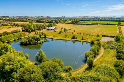
- Price
- £1,200,000
- Size
- 13 acres
Oakley Road, Worminghall, HP18, Oakley, Buckinghamshire HP18 England
Added on 08/08/2026House with Land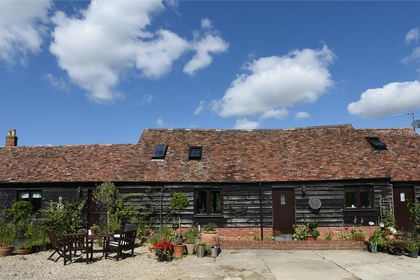
- Price
- Guide Price£1,300,000
- Size
- 14 acres
Thame Road, Piddington, Oxfordshire., Piddington, Oxfordshire OX25 England
Added on 10/05/2026Barn Conversion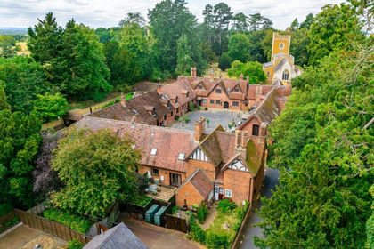
- Price
- £1,450,000
- Size
- 22 acres
Stable Yard, Mentmore, Buckinghamshire, LU7, Mentmore, Buckinghamshire LU7 England
Added on 14/08/2026Equestrian property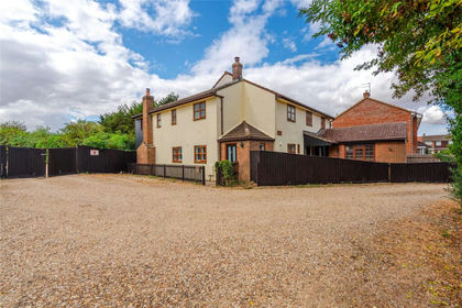
- Price
- £1,425,000
- Size
- 9.3 acres
Added on 28/08/2026House with Land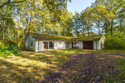
- Price
- Guide Price£1,500,000
- Size
- 8 acres
Honey Hill, Wokingham, RG40, Wokingham Without, Wokingham RG40 England
Added on 29/01/2026House with Land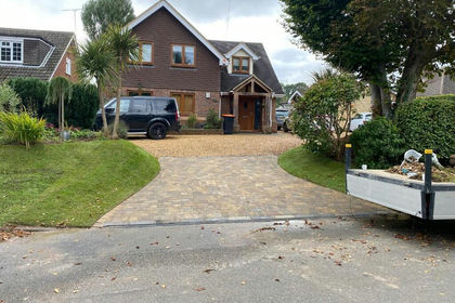
- Price
- £1,550,000
- Size
- 12 acres
Mancroft Road, Luton, Bedfordshire, LU1, Caddington, Central Bedfordshire LU1 England
Added on 18/08/2026House with Land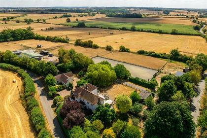
- Price
- £1,700,000
- Size
- 21 acres
Leckhampstead, Buckingham, Buckinghamshire, MK18, Leckhampstead, Buckinghamshire MK18 England
Added on 15/08/2026Equestrian property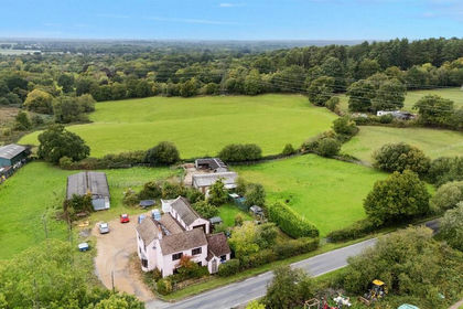
- Price
- Offers Over£1,400,000
- Size
- 15 acres
Doras Green Lane, Ewshot, Farnham, Crondall, Hampshire GU10 England
Added on 26/06/2026House with Land
- Price
- £1,750,000
- Size
- 10.5 acres
Church Lane, Weston, Hitchin, Hertfordshire, SG4, Weston, Hertfordshire SG4 England
Added on 05/08/2026House with Land
- Price
- £1,250,000
- Size
- 9.5 acres
Hinton Parva, Swindon, SN4, Bishopstone, Swindon SN4 England
Added on 11/04/2026House with Land