Consall, Wetley Rocks, Stoke-On-Trent
- Land size
- 26 acres
- Bedrooms
- 2
- Bathrooms
- 2
Key Features
- Idyllic Individual Barn sitting in a plot of 26 acres (not verified)
- Incorporating Fields, Paddock and Pond
- Rural Setting
- Two Bedrooms. En Suite Bathroom. Shower/Utility Room
- Open Plan Living Kitchen Diner with Bespoke units
Description
SUMMARY
Bagshaws Residential are proud to market this stunning modern open plan barn conversion set within approx 26 acres (not verified) nestled in peaceful rural surroundings offering countryside living with expansive views, privacy and versatile land suitable for a range of lifestyle or equestrian uses.
DESCRIPTION
Owls Hoot Barn is an exceptional modern barn conversion offering stylish open-plan living, set within approximately 26 acres of picturesque countryside in the sought-after rural setting of Wetley. This unique home has been thoughtfully designed to combine contemporary comfort with the character and charm of a rural property with the heart of the home in the spacious open plan living dining kitchen area creating a light-filled and versatile space. Large windows allow natural light while framing uninterrupted stunning views across the surrounding land and the modern design complements the barn's setting providing a perfect balance between rural tranquillity and modern convenience. Externally the property truly excels set being within approximately 26 acres (not verified) with private fish pond and the land offers significant potential for a variety of uses including equestrian pursuits, smallholding, or simply enjoying the privacy and space that comes with countryside living. Located in the charming rural area of Wetley Rocks, Owls Hoot Barn benefits from a peaceful setting while remaining within easy reach of local villages, transport links and everyday facilities.
This is a rare opportunity to acquire a distinctive modern barn with substantial land in a highly desirable countryside location.
Access to the property is gained via a long private expansive driveway leading to:
French Doors:
Leading into:
Open Plan Living Kitchen Diner 29' max x 15' 5" ( 8.84m max x 4.70m )
Having vaulted ceiling with exposed A frame beams; Oak flooring; two further sets of French doors; five feature arch shaped windows; central heating radiator; Rangemaster cooker with gas hob and cooker hood over; range of bespoke wall, base and drawer units; sink and drainer; island unit with cupboard and drawers; complementary wall and floor tiling; integrated fridge; plumbing for dishwasher; opening to:
Inner Hallway:
With step up and doors off to:
Utility / Shower Room: 11' 5" max x 8' max ( 3.48m max x 2.44m max )
Having shower cubicle with wall mounted shower; wash hand basin set in a vanity unit; low level wc; heated towel rail; tiled flooring; plumbing for washing machine; further appliance space; window; central heating boiler; spot lights.
Bedroom One: 16' 2" x 7' 10" ( 4.93m x 2.39m )
Having French doors leading out to the garden; window to the side elevation; central heating radiator; spot lights; door leading into:
En Suite Bathroom: 12' 2" max x 5' 9" ( 3.71m max x 1.75m )
Having Jacuzzi bath with wall mounted rain style shower over and side screen; wash hand basin set in a vanity unit; low level wc; complementary wall and floor tiling; heated towel rail; spot lights.
Bedroom Two: 15' 7" x 10' ( 4.75m x 3.05m )
Having window to the side elevation; door leading out to the side elevation; spot lights; central heating radiator.
Attached Barn: 22' 6" x 15' 2" ( 6.86m x 4.62m )
With door and window.
Cow Shed: 18' 4" x 15' 11" ( 5.59m x 4.85m )
With window.
Grounds:
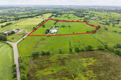
Set in 26 acres (not verified) of land which incorporates fields, paddock and pond.
Immediately surrounding the property are attractive Indian sandstone paved patio areas with timber fence boundaries having gravel borders and corner shrub planting area.
Tractor Shed: 27' x 20' ( 8.23m x 6.10m )
Please Note:
Photographs may have been taken using a wide angle lens.
Please note that an AML fee is chargeable to the buyer once an offer is accepted to cover the cost of carrying out the required identity and anti-money laundering checks. Once these checks have been completed, the fee cannot be refunded, even if the property purchase does not go ahead.
1. MONEY LAUNDERING REGULATIONS: Intending purchasers will be asked to produce identification documentation at a later stage and we would ask for your co-operation in order that there will be no delay in agreeing the sale.
2. General: While we endeavour to make our sales particulars fair, accurate and reliable, they are only a general guide to the property and, accordingly, if there is any point which is of particular importance to you, please contact the office and we will be pleased to check the position for you, especially if you are contemplating travelling some distance to view the property.
3. The measurements indicated are supplied for guidance only and as such must be considered incorrect.
4. Services: Please note we have not tested the services or any of the equipment or appliances in this property, accordingly we strongly advise prospective buyers to commission their own survey or service reports before finalising their offer to purchase.
5. THESE PARTICULARS ARE ISSUED IN GOOD FAITH BUT DO NOT CONSTITUTE REPRESENTATIONS OF FACT OR FORM PART OF ANY OFFER OR CONTRACT. THE MATTERS REFERRED TO IN THESE PARTICULARS SHOULD BE INDEPENDENTLY VERIFIED BY PROSPECTIVE BUYERS OR TENANTS. NEITHER SEQUENCE (UK) LIMITED NOR ANY OF ITS EMPLOYEES OR AGENTS HAS ANY AUTHORITY TO MAKE OR GIVE ANY REPRESENTATION OR WARRANTY WHATEVER IN RELATION TO THIS PROPERTY.
Map Location
Property details
- Tenure
- Freehold
- Council Tax Band
- D
- Date Posted
- 2026-05-10
Market Value Analysis
Compared with 29 Homes with Land listings in West Midlands (25+ acres).
Energy Performance Certificate
Energy Efficiency Rating
Based on UK Energy Performance Certificate standards (EU Directive 2002/91/EC)
Utilities & Restrictions
Utilities
- Electricity
- Mains
- Water
- Mains
- Heating
- Ask Agent
- Broadband
- No Internet Connection
- Sewerage
- Septic Tank / Private
Rights & Restrictions
- Public Rights of Way
- Ask Agent
- Private Rights of Way
- Ask Agent
- Listed Property
- Ask Agent
- Restrictions
- Ask Agent
Property Features
- Accessibility
- Ask Agent
- Parking
- Driveway
- Garden
- Garden
Connectivity
Broadband
Fastest speed available at this postcode
19 Mbps
Standard (10-30 Mbps)
Suitable for
- Web & social
- Music streaming
- Standard video calls
Mobile signal
Outdoor predictions; indoor signal depends on building materials.
Ofcom Connected Nations postcode-level predictions. Speeds and signal are modelled, not measured, and vary between addresses and providers.
Nearest Schools
Primary
- St John's CofE Primary School1.2 milesOfsted: Good
- Ages
- 3 to 11
- Pupils
- 198
- Type
- Academy converter
- Faith
- Church of England
- St Edward's CofE Academy Cheddleton2.4 milesNo Ofsted rating
- Ages
- 3 to 9
- Pupils
- 200
- Type
- Academy converter
- Faith
- Church of England
- St Werburgh's CE (A) Primary School2.5 milesOfsted: Good
- Ages
- 3 to 11
- Pupils
- 143
- Type
- Academy converter
- Faith
- Church of England
- Werrington Primary School2.7 milesNo Ofsted rating
- Ages
- 3 to 11
- Pupils
- 462
- Type
- Academy converter
- Dilhorne Endowed CofE Primary School2.8 milesOfsted report card · Jun 2026
- Ages
- 4 to 11
- Pupils
- 55
- Type
- Academy converter
- Faith
- Church of England
Secondary
- Moorside High School1.7 milesOfsted: Good
- Ages
- 11 to 16
- Pupils
- 766
- Type
- Academy converter
- Discovery Academy3.9 milesOfsted: Requires improvement
- Ages
- 11 to 16
- Pupils
- 1,435
- Type
- Academy sponsor led
- The Cheadle Academy4 milesNo Ofsted rating
- Ages
- 11 to 18
- Pupils
- 380
- Type
- Academy converter
- Painsley Catholic College4.1 milesOfsted: Good
- Ages
- 11 to 18
- Pupils
- 1,340
- Type
- Academy converter
- Faith
- Roman Catholic
- Endon High School4.4 milesOfsted: Good
- Ages
- 11 to 16
- Pupils
- 700
- Type
- Academy converter
Distances are straight-line from the advertised location. Source: the national school registers (DfE, Welsh Government, Scottish Government) and Ofsted.
Amenities
Supermarket
GP surgery
Pharmacy
Hospital
Green space
Straight-line distances from the advertised location. Sources: NHS records, Geolytix supermarket locations, OS Open Greenspace and the national trails registers.
Getting Around
Nearest station
Nearest bus stop
Typical drive times
Straight-line distances from the advertised location; drive times are typical free-flow times over OpenStreetMap road data, so allow more at peak. Public transport locations from DfT NaPTAN.
Flood Risk
From Environment Agency flood map open data, checked around the advertised map pin and allowing for the listed acreage where known. This summary comes from LandSale, the advertising platform, not from the listing agent, and is not part of the agent's particulars. Risk can vary across a single holding, so verify anything critical through your own searches before committing.
Rivers and the sea
Surface water
Mapped within the area searched, not at the advertised map pin itself.
The detail behind these bandings, including exact zones and annual chances, any recorded past flooding, plus planning, heritage, nature and ground checks, is in the .
Important notice: Information, maps and tags on this page are supplied by the advertising agent or generated automatically. LandSale has not verified them. Relying on these details is at your own risk, always carry out independent checks before committing to a purchase.
LandSale full disclaimer
Marketing information only - not formal particulars. The details on this website are provided for general guidance and do not constitute an offer or contract. Neither LandSale nor the advertising estate/land agent accepts responsibility for any inaccuracy.
1. Source of information
- Agent-supplied content: Core description, asking price, tenure, measurements, photographs and planning history are uploaded by the appointed agent, who remains solely responsible for their accuracy.
- Automated tags & categorisation: Property type, land-use class, acreage bands and similar labels may be applied by machine-learning models. They are intended as a helpful guide only and may not reflect the property's legal status or permitted use.
- Third-party & enriched data layers: Maps, boundary outlines, planning designations, soil reports, broadband coverage and other environmental or location-based insights are licensed from external suppliers. Such data are supplied “as is", may be incomplete or out of date and are subject to change without notice.
2. Verification required
Prospective purchasers must verify critical matters, including but not limited to planning permission, title boundaries, public rights of way, environmental constraints, acreage, services, access and VAT status, through their own inspections, specialist surveys, legal advisers and the selling agent before relying on the information or entering into any contract.
3. No warranty or liability
LandSale gives no warranty, express or implied, as to the accuracy, completeness or fitness for any particular purpose of the information displayed. LandSale shall not be liable for any loss, damage, cost or expense arising directly or indirectly from any use of or reliance on such information, save where liability may not be excluded by law.
4. Updates & feedback
If you believe any detail on this listing is inaccurate, please let us know. We will investigate and, where appropriate, update the listing or notify the agent.
© LandSale | Version 1.2 - January 2026
Listing agent
Bagshaws Residential, Uttoxeter
17 High Street, Uttoxeter, Staffordshire, ST14 7HP
Contact Bagshaws Residential, Uttoxeter
17 High Street, Uttoxeter, Staffordshire, ST14 7HP
View agent profileSimilar properties for sale
- Price
- Offers Over£750,000
- Size
- 20.83 acres
Tickhill Lane, Dilhorne, Stoke-On-Trent, Dilhorne, Staffordshire ST10 England
Added on 24/06/2026Farm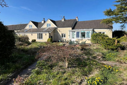
- Price
- Offers Over£750,000
- Size
- 20.31 acres
Wallmires Lane, Werrington, Stoke-On-Trent, Werrington, Staffordshire ST9 England
Added on 29/01/2026Farmhouse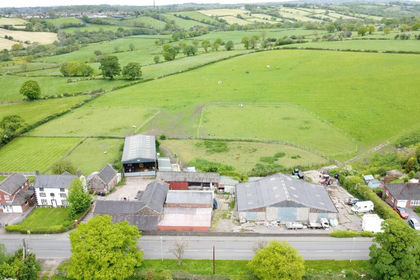
- Price
- Offers Over£700,000
- Size
- 53.04 acres
Annatts Farm, High Lane, Brown Edge, ST6, Stoke-on-Trent North, Stoke-on-Trent ST6 England
Added on 04/06/2026Farm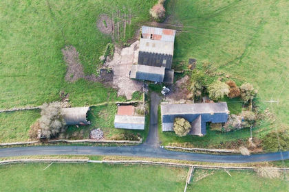
- Price
- Offers in Region of£745,000
- Size
- 22.24 acres
Bridge Flatts Farm, Winkhill, Leek, Waterhouses, Staffordshire ST13 England
Added on 21/02/2026Farmhouse
- Price
- £875,000
- Size
- 23.89 acres
Riddings Park Farm, Kniveton, Kniveton, Derbyshire DE6 England
Added on 12/08/2026House with Land
- Price
- £900,000
- Size
- 73.17 acres
Added on 17/07/2026Farm
- Price
- Guide Price£650,000
- Size
- 30.78 acres
LOT ONE - Buntingfields Nook Farm, Ashover, Chesterfield, Ashover, Derbyshire S45 England
Added on 25/07/2026Farm- Price
- Offers Over£930,000
- Size
- 64.75 acres
Buntingfields Nook Farm, Ashover, Chesterfield, Ashover, Derbyshire S45 England
Added on 24/07/2026Farm
- Price
- £600,000
- Size
- 13 acres
Sutton Spring Wood, Temple Normanton, S42, Sutton cum Duckmanton, Derbyshire S42 England
Added on 08/08/2026House with Land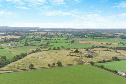
- Price
- Guide Price£800,000
- Size
- 15 acres
Highfield Hall, Worthenbury, Wrexham, Bangor Is-y-coed, Wrexham LL13 Wales
Added on 29/01/2026Redevelopment Land